These high quality PDF maps are provided to download and use at your leisure. Printing them and using a waterproof A4 map case, which can easily be folded into the smallest of pockets, is far more convenient than fumbling about with a large OS map; we always take a larger OS map with us, but it stays in the rucksack unless it is required.
Day 1
Ambleside to Threlkeld, The Hard Way
21 miles
14 Wainwrights
7300 ft
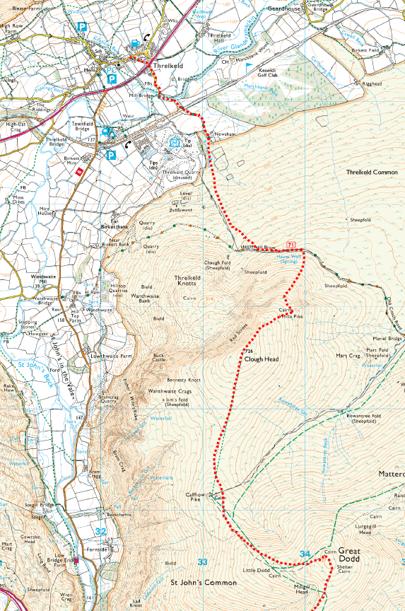
Map 4 – Ambleside to Threlkeld
Download
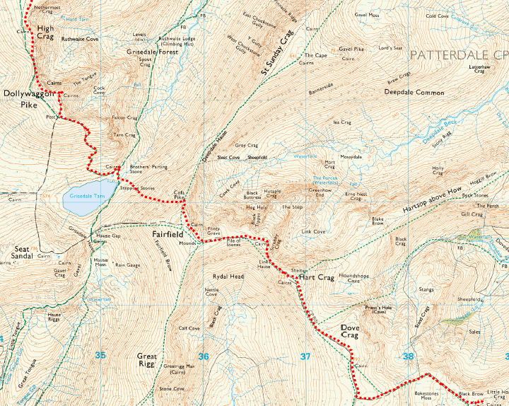
Map 3 – Ambleside to Threlkeld
Download
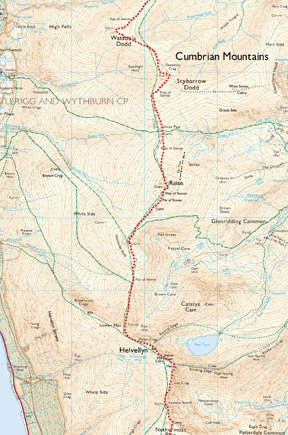
Map 2 – Ambleside to Threlkeld
Download
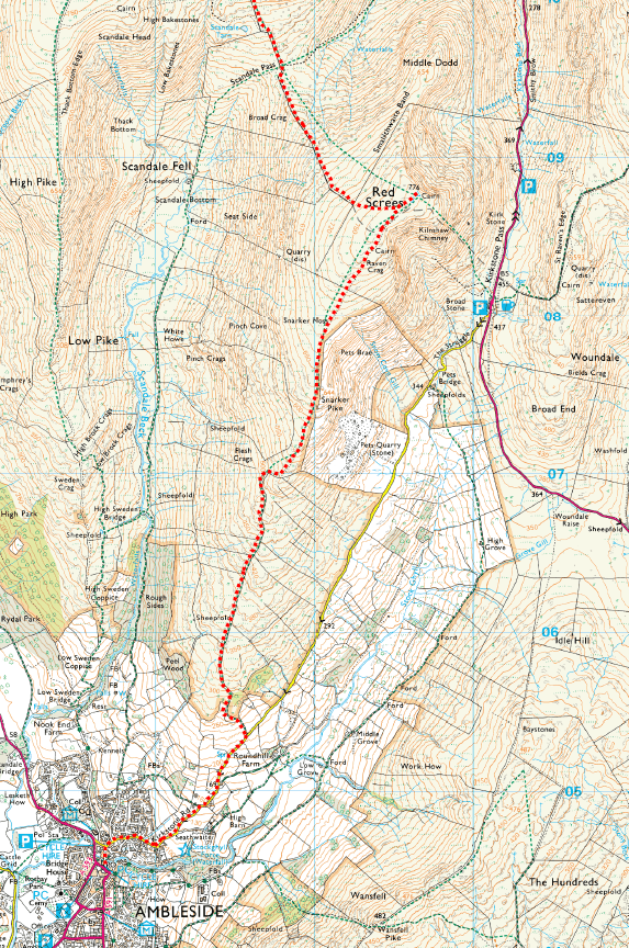
Map 1 – Ambleside to Threlkeld
Download