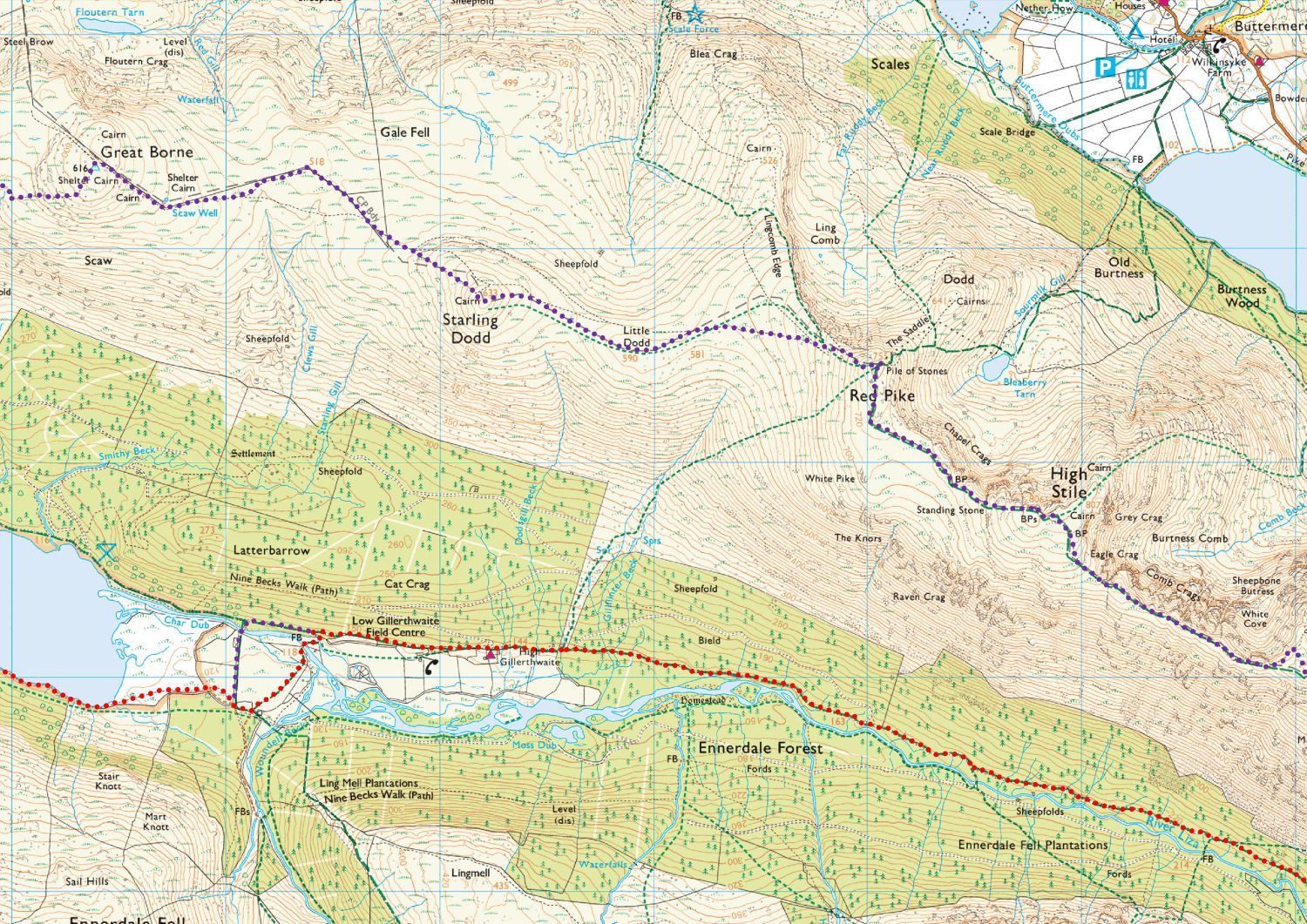
The red routes on the following maps are taken from the ‘Walkers Edition’ of the ‘Wainwright’s Coast to Coast Walk’ guide, which was revised by Chris Jesty and published in 2017. The purple routes over the Lake District section are what we recommend as a great alternative to Wainwright’s, however, these should not be attempted without prior knowledge of the routes, or without using Wainwright’s ‘A Pictorial Guide to the Lakeland Fells’.
These high quality PDF maps are provided to download and use at your leisure. Printing them and using a waterproof A4 map case, which can easily be folded into the smallest of pockets, is far more convenient than fumbling about with a large OS map; we always take a larger OS map with us, but it stays in the rucksack unless it is required.
<<>>
Day 1
St Bees to Ennerdale Bridge
15 miles
3500 ft
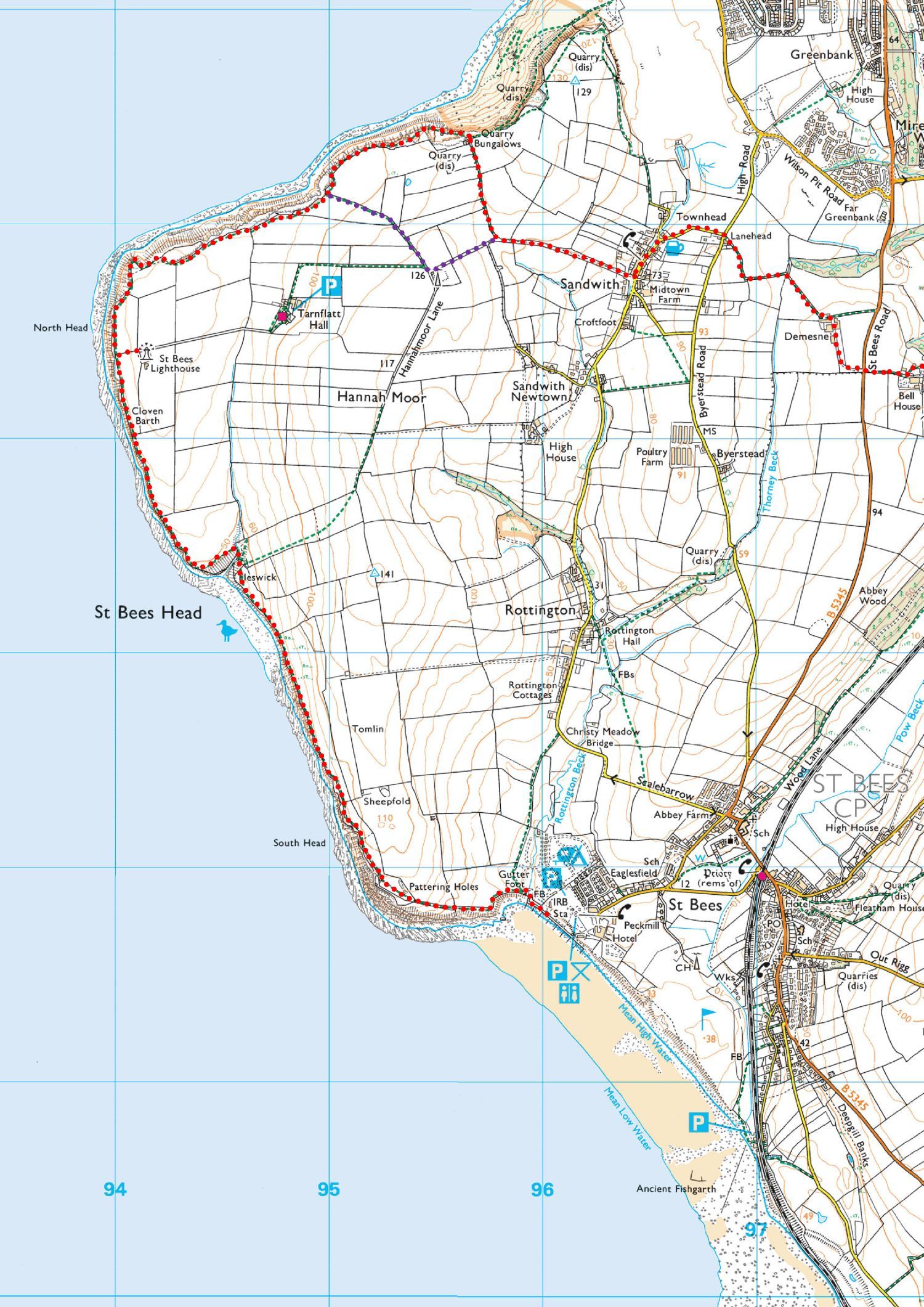 Map 1 – St Bees to Ennerdale Bridge
Download
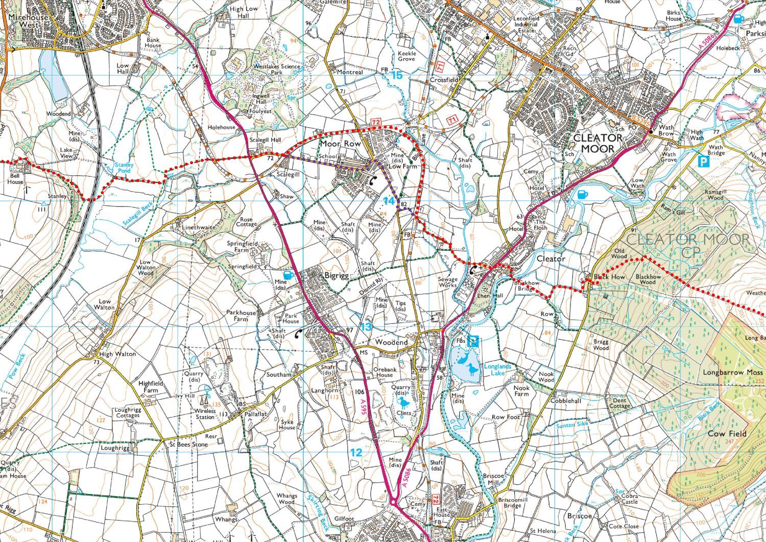 Map 2 – St Bees to Ennerdale Bridge
Download
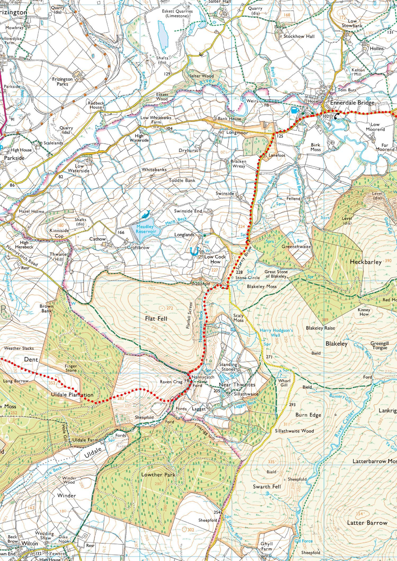 Map 3 – St Bees to Ennerdale Bridge
Download
<<>>
Day 2
Ennerdale Bridge to Honister Hause
12.5 miles
4300 ft
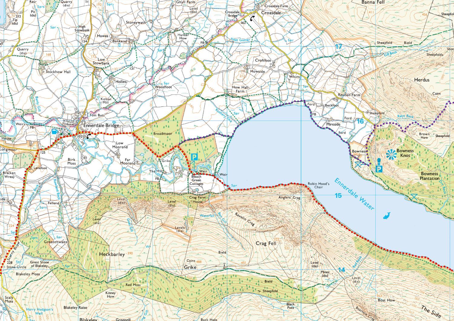 Map 4 – Ennerdale Bridge to Honister Hause
Download
 Map 5 – Ennerdale Bridge to Honister Hause
Download
 Map 6 – Ennerdale Bridge to Honister Hause
Download
<<>>
Day 3
Honister Hause to Grasmere
12 miles
3200 ft
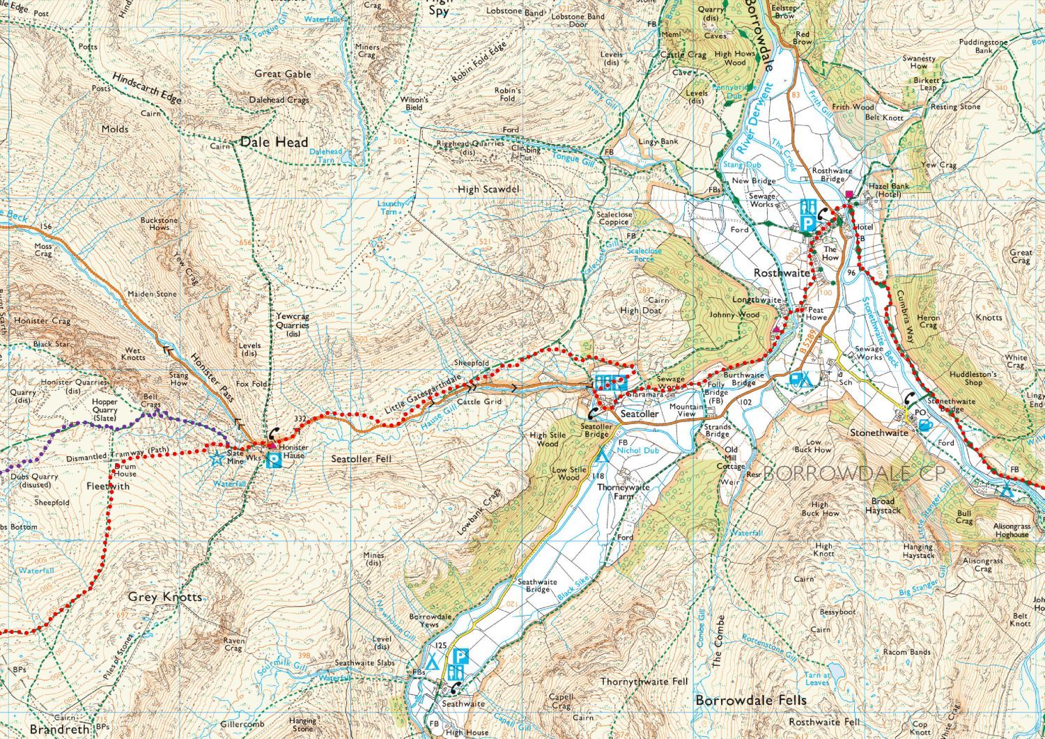 Map 7 – Honister Hause to Grasmere
Download
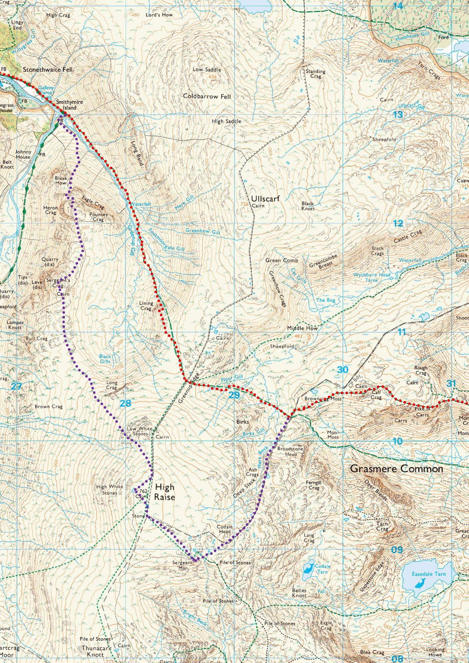 Map 8 – Honister Hause to Grasmere
Download
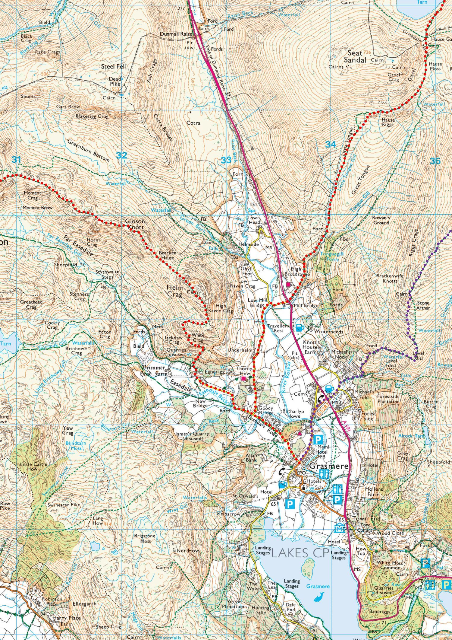 Map 9 – Honister Hause to Grasmere
Download
Back to the top