
A wonderful spring walk up to Sourmilk Gill and Easedale Tarn, followed by a steady climb to Sergeant Man and High Raise. Our return journey was down the valley of Far Easedale, but this walk can be extended by including the ridge of Helm Crag, or even by doing the full ‘Easedale Round’, which would then also take in Silver How and Blea Rigg. Whatever tops are added, any walk over Grasmere Common in late winter or early spring, when the weather is fine and clear, makes for a grand day out on the fells. Just remember to bring the camera!
Richard

The journey begins by leaving the car park at Broadgate Meadow and following the road to Butharlyp Howe.


After crossing the footbridge continue along the old packhorse track to Easedale Tarn in upper Easedale. Later we’ll return via Easedale Road seen here on the right.


The cairn on the left marks the start of the direct path to Blea Crag. However, continue straight ahead and deeper into upper Easedale.
“Black slime is experienced at its blackest and slimiest at frequent intervals on the path in this area, but this no longer poses problems for walkers because it is crossed by stepping stones.”
Sergeant Man 5
AW (revised by CJ)

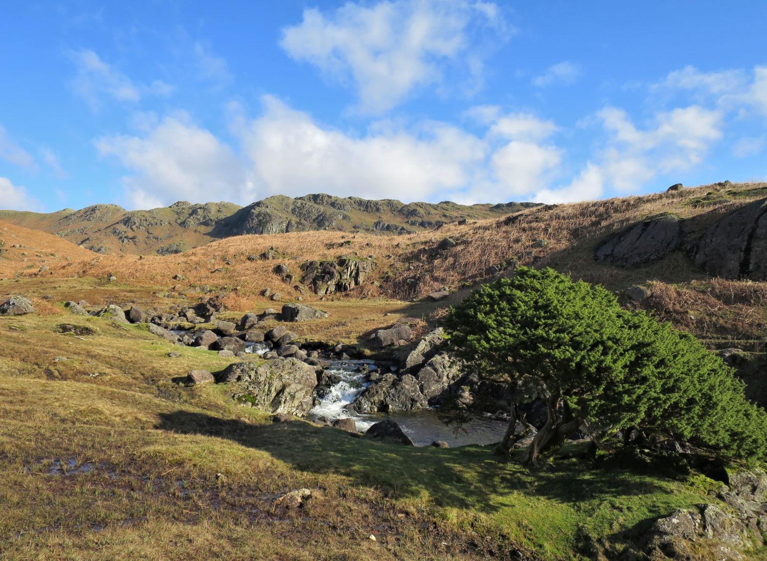
Greanhead Crag is part of Tarn Crag’s east ridge that rises from the outflow of Easedale Tarn.

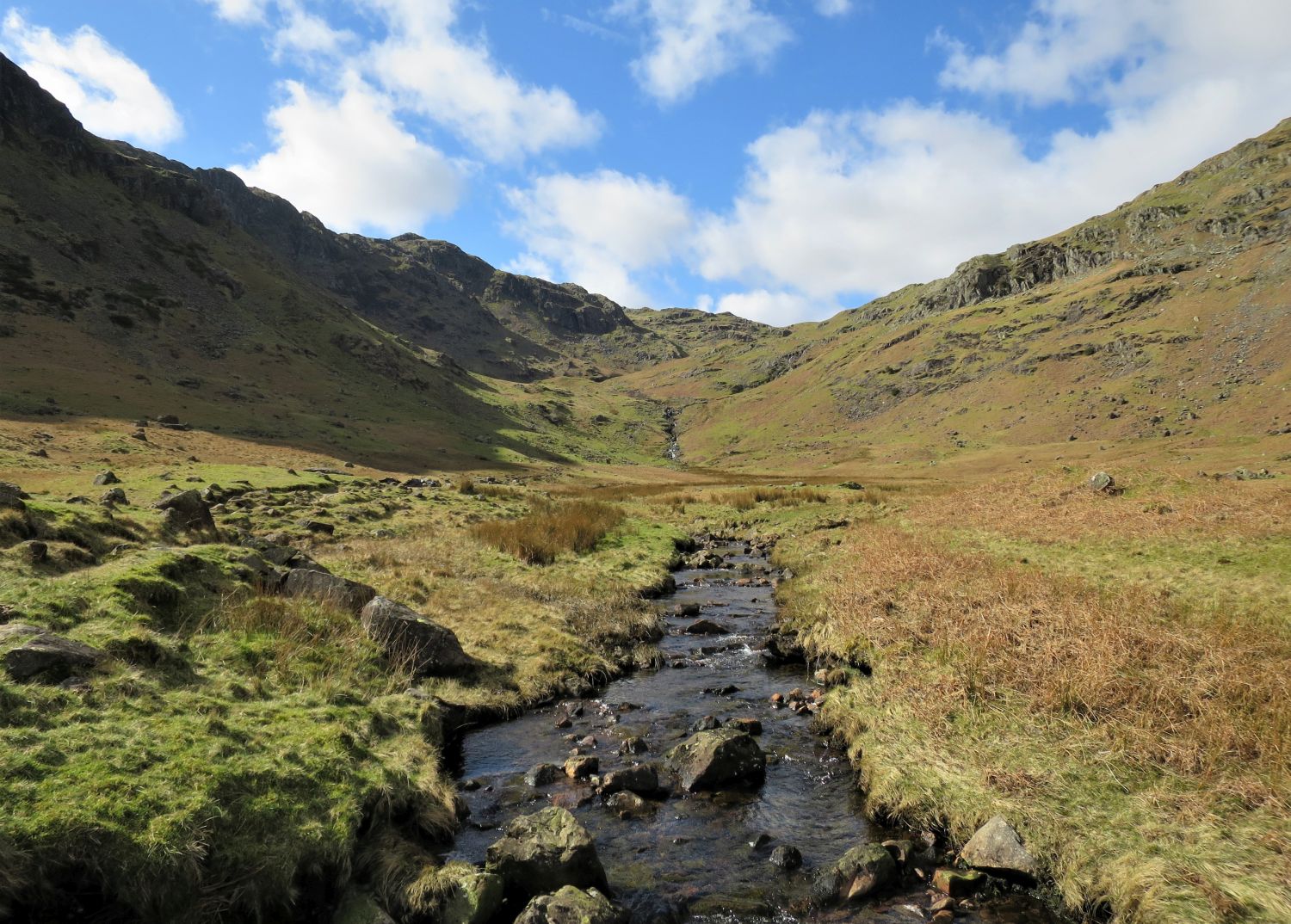
“Blea Crag and Eagle Crag form an imposing precipice on the left but the dominating feature on the march up the valley is the peak of Belles Knott, which assumes a striking appearance from the path as it is approached.”
Sergeant Man 5
AW


“This is the most direct and the quickest route. From Easedale Tarn the path follows the main feeder almost to its source before slanting up to the ridge. The route is too deeply enclosed to be attractive, although there are several interesting features.”
Sergeant Man 5
AW

“This sharp peak is a prominent feature in the early stages of the walk by the path from Easedale Tarn to Dungeon Ghyll.”
Sergeant Man 12
AW


Beyond the peak of Belles Knott, the final section includes some slimy rock terraces.


This large cairn marks the “crossroads” — a summit of a pass between the valleys of Easedale and Great Langdale, and a col between Blea Rigg and Sergeant Man. It’s rather surprising that such a major intersection has not been deemed worthy of an official title.
“Here the ridge is gained amid a profusion of cairns. This is a well-known ‘crossroads’. Routes from Dungeon Ghyll and Blea Rigg to Sergeant Man join in at this point.”
Sergeant Man 5
AW

Turn right at the cairn to start the ascent to Sergeant Man.


“Here the path passes a 50 foot rock slab with a cairn oddly set in the middle. Its easy gradient makes it climbable by walking.”
Sergeant Man 5
AW
The remnants of the cairn are seen on the right in the photo. Note the three walkers continuing along the main path to Sergeant Man.

A short detour to the top of the rock slab is well worth it for this grand view of the Langdale Pikes, and beyond to the Coniston Fells.


The view to the north east from the summit, with the eastern spine over Codale Head.
“The stones around the cairn have been scratched white by nailed boots of visitors, testifying to the popularity of this summit; one or more of these visitors are responsible for the shameful destruction of the beautiful cairn…now there is just a small heap of stones marking the highest point.”
Sergeant Man 8
AW (revised by CH)

The view to the south from the summit, looking down the cove of Bright Beck and towards Stickle Tarn.
“The most striking scene is that southwards, where Pavey Ark and Harrison Stickle rise starkly against a background formed by the Coniston Fells.”
Sergeant Man 9
AW

The view to the south west from the summit, with Crinkle Crags, Bowfell and Esk Pike.

The view to the north west of the summit, with the large expanse of High Raise, and the next objective.

This photo is taken from the north-west tarn, which I think is the most photogenic out of all the tarns dotted about on this plateau between Sergeant Man and Codale Head.


The view to the south west from High Raise Tarn, with Bowfell, the Scafells and Great Gable.

At the back we have Scafell Pike, Great End, Seatallan, Great Gable, Pillar and High Stile. Along the middle are Bowfell, Esk Pike, Allen Crags, Glaramara and Comb Head, while below, Lining Crag is seen at the end of the Rossett Pike ridge above the Langstrath Valley.

The view broadly to the south from the summit, with the Coniston Fells, Crinkle Crags and Bowfell.
“High Raise is often wrongly referred to as High White Stones. High Raise is the name of the fell, High White Stones the name of a small area of grey boulders which includes the summit….

….All else is grass, a vast sheepwalk in the form of a broad plateau little different from a valley pasture except that here drains and irrigation channels are absent and there is much marshy ground….

….The big cairn, and an adjacent survey column, stand at the top of the Langstrath slope, 150 yards left of a line of fence posts. Since it was illustrated, the summit cairn has been expanded into a wind shelter with two chambers. Walking across the top is everywhere very easy.”
High Raise 8
AW (revised by CJ)


Approaching the summit of the Rosthwaite–Grasmere mountain pass, commonly referred to as Greenup Edge. Strictly speaking, however, the “Edge” lies further down on the Borrowdale side, so a more accurate name for this route would be Greenup Pass.


“Far Easedale Bridleway – This is part of the Coast-to-Coast path. The work that is to be carried out here is to ensure that this is a sustainable path and is not further eroded by the increased level of use expected along a National Trail. The work to be carried out will include pitching, the installation of stepping stones, stone revetment, and causeway.“
Fix the Fells – 2024 Work Programme


These now redundant fence posts once divided the old counties of Cumberland and Westmorland. I think it’s rather nice to see that they haven’t been disturbed by the restoration work and the placing of these new flagstones.

A long view down the valley of Far Easedale with Deer Bields (crags) towering above on the right.

Looking back to the dark and formidable features of Ferngill Crag and Broadstone Head, from Far Easedale Beck.


Approaching the foot of the valley, with Helm crag towering over on the left and Loughrigg Fell seen in the distance.


(formerly Stythwaite Steps)


<<>>
Thanks, sources and further reading:
‘Book Three – The Central Fells’ by Alfred Wainwright
National Library of Scotland