

High on the North Ridge of Pavey Ark, around 2,000ft above sea level, are some unusual rock formations that record the violent volcanic activity that took place here around 460 million years ago. Small volcanic projectiles fell into the ancient Iapetus Ocean and became preserved in the seabed, leaving behind some fascinating formations that can still be seen today. On a beautiful day in Lakeland, we head out in search of these unique features.
Richard
Subaqueous Fallout Formations
Pyroclastic fallout consists of particles that have been ejected from volcanic vents and have travelled through the atmosphere before falling to Earth or into water. Pyroclastic material greater than 64mm in diameter is known as volcanic bombs when molten, or volcanic blocks when solid.
Particles in the range of 2 to 64mm in diameter are known as lapilli, and particles less than 2mm in diameter are referred to as volcanic ash. Lapilli (Latin for “little stones”) are spheroid, teardrop, dumb-bell or button-shaped droplets of molten or semi-molten lava, which are ejected during a volcanic eruption and then fall to Earth while still at least partially molten. Pyroclastic material that falls on land is “subaerial fallout”, while material falling into water is “subaqueous fallout”.

Pavey Ark
Facing south-east over Stickle Tarn, the cliff face of Pavey Ark is a little over 1⁄4 mile (400 metres) across and 120 metres high. Exposed rocks near the summit tell a story of ancient volcanic activity.
The rocks here were formed by a chain of island-arc volcanoes in the ancient Iapetus Ocean around 460 million years ago. This is indicative of the very violent volcanic activity which took place here during the Middle Ordovician Period.
When active, the volcanoes’ explosive nature produced pyroclastic flows that settled into the ocean. Close inspection of the rock surfaces reveals many angular fragments, volcanic bombs and andesitic lava spatter. The Iapetus Ocean gradually disappeared as its floor was pulled beneath the converging Laurentia, Baltica and Avalonia continental masses.

“Laurentia collides with the Grampian volcanic Arc causing the first stage of Caledonian mountain building, from 475 – 465 million years ago. Laurentia and Baltica both rotate anticlockwise as their tectonic plates move. Iapetus Ocean begins to close. England-Wales and southern Ireland, part of Avalonia micro-continent, arrive in the neighbourhood, heading north (blue arrow). Note that all the action takes place south of the Equator.”
— Brian Ricketts, Geological Digressions

Easy Gully is the dominant cleft which dissects the rising North Ridge. The first crag at the base of the ridge is Pavia’s Rock.


Just for a bit of fun, my wife and I decided to name the rock “Pavia’s Rock”. It’s believed that the name Pavey comes from the 13th-century female name “Pavia”, who had a milking shed (ark) in Mill Gill (now Stickle Ghyll). However, there are a few theories behind the name. One is that it’s named after a sheiling that was located high on the Langdale Pikes. Another is that the “ark” refers to a large chest used to store grain, which links with the corn mill that was located at Millbeck Farm (not to be confused with the fulling mill near the present-day Stickle Barn).
I prefer the milking shed theory because there was an influx of foreign farm workers in the 13th century who settled in the valley of Great Langdale. One thing is certain: the “ark” in the name Pavey Ark doesn’t refer to an arc of volcanoes; that is simply a coincidence.

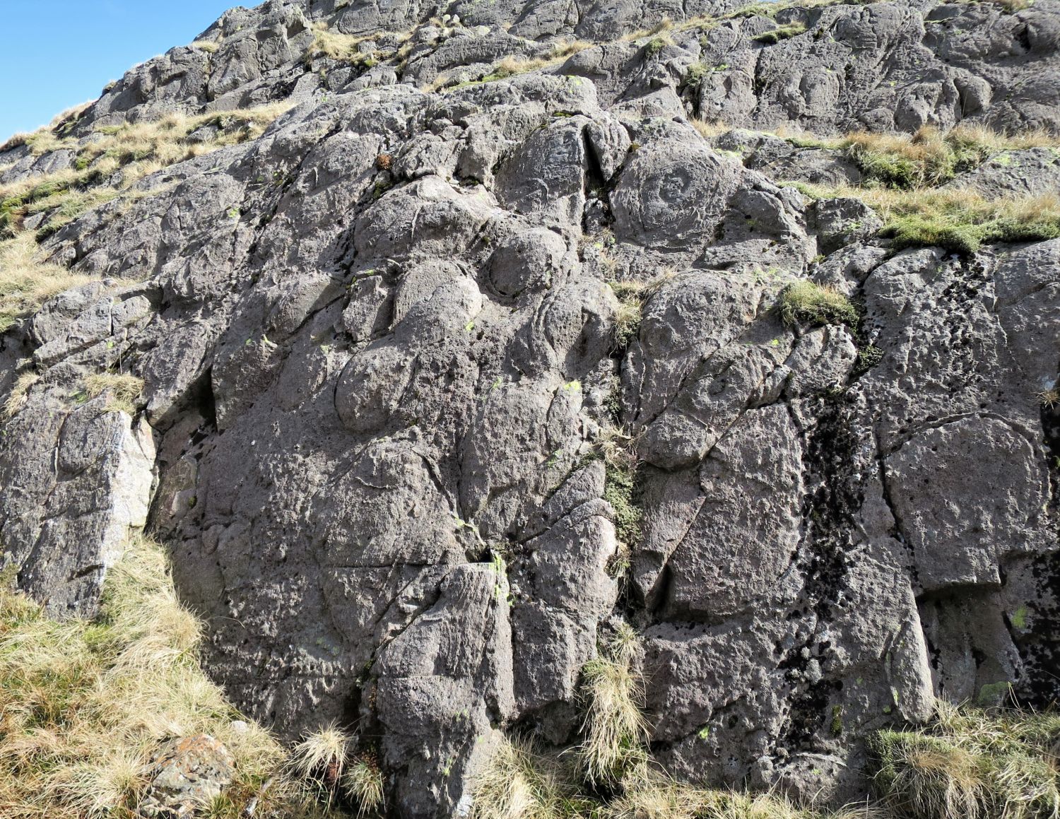


In this photo, you can see the squiggly line left by the projectile as it sank into the seabed.


This ring, located on the summit of the outcrop, was the largest one we found.

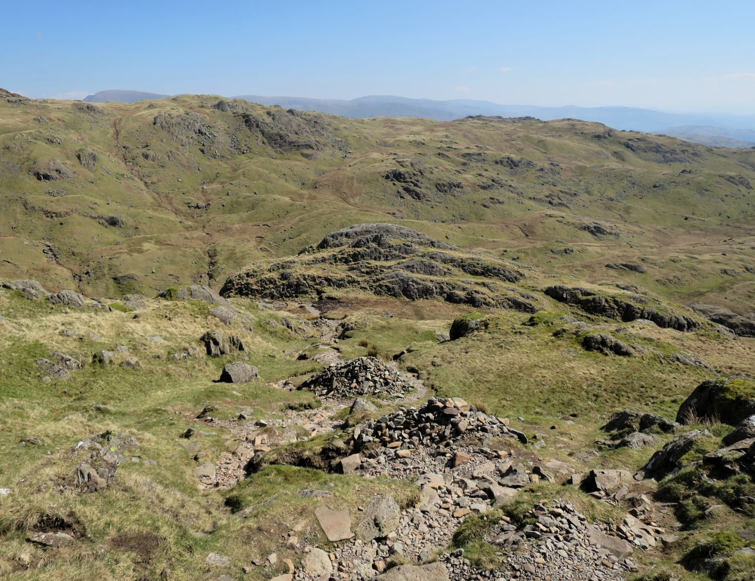

The narrow cleft of Jack’s Rake, a popular Grade 1 scramble, can be seen rising from the base of the cliff face in the centre.

<<>>
Thanks, sources and further reading:
Brian Ricketts of Geological Digressions