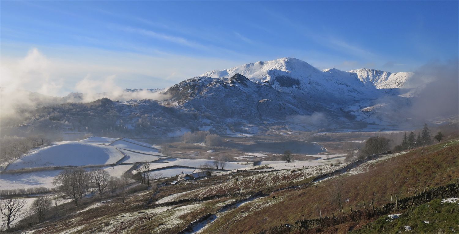
Lingmoor Fell is certainly one of my favourites, and it doesn’t seem to matter what time of year I walk it; each season rewards the eye with different visual characteristics of the surrounding fells. The Coniston Fells, Crinkle Crags, Bowfell and the Langdale Pikes dominate the skyline, while the valleys of Little and Great Langdale provide a beautiful expanse of contrasting colour. The snake-like ridge of Lingmoor Fell, or spine if you like, is a combination of unnamed subsidiary tops, the summit itself (Brown How), and two named tops of Bield Crag and Side Pike; the latter two being at either end of the fell’s long ridge. Lingmoor Tarn, the old quarry workings, Oakhowe Needle, and three more tops of Oakhowe Crag, Mart Crag and Busk Pike, are to be found on the northern and southern flanks, but detours to these are recommended outside of the winter months, when the paths are much easier to follow.
I make no apology for the amount of photos in this post (60)……well, go on then, I’m sorry!…..but Lingmoor Fell is very rewarding, and its long ridge provides superb views of the surrounding fells; I never put the camera away throughout the walk.
“The crescent-shaped ridge of high ground rises to the west from Elterwater’s pleasant pastures, climbs to a well-defined summit, a fine vantage point, and then curves northwards as it descends to valley-level near Dungeon Ghyll.” Lingmoor Fell 2
AW
GPX Route: Download
PDF Map: Download
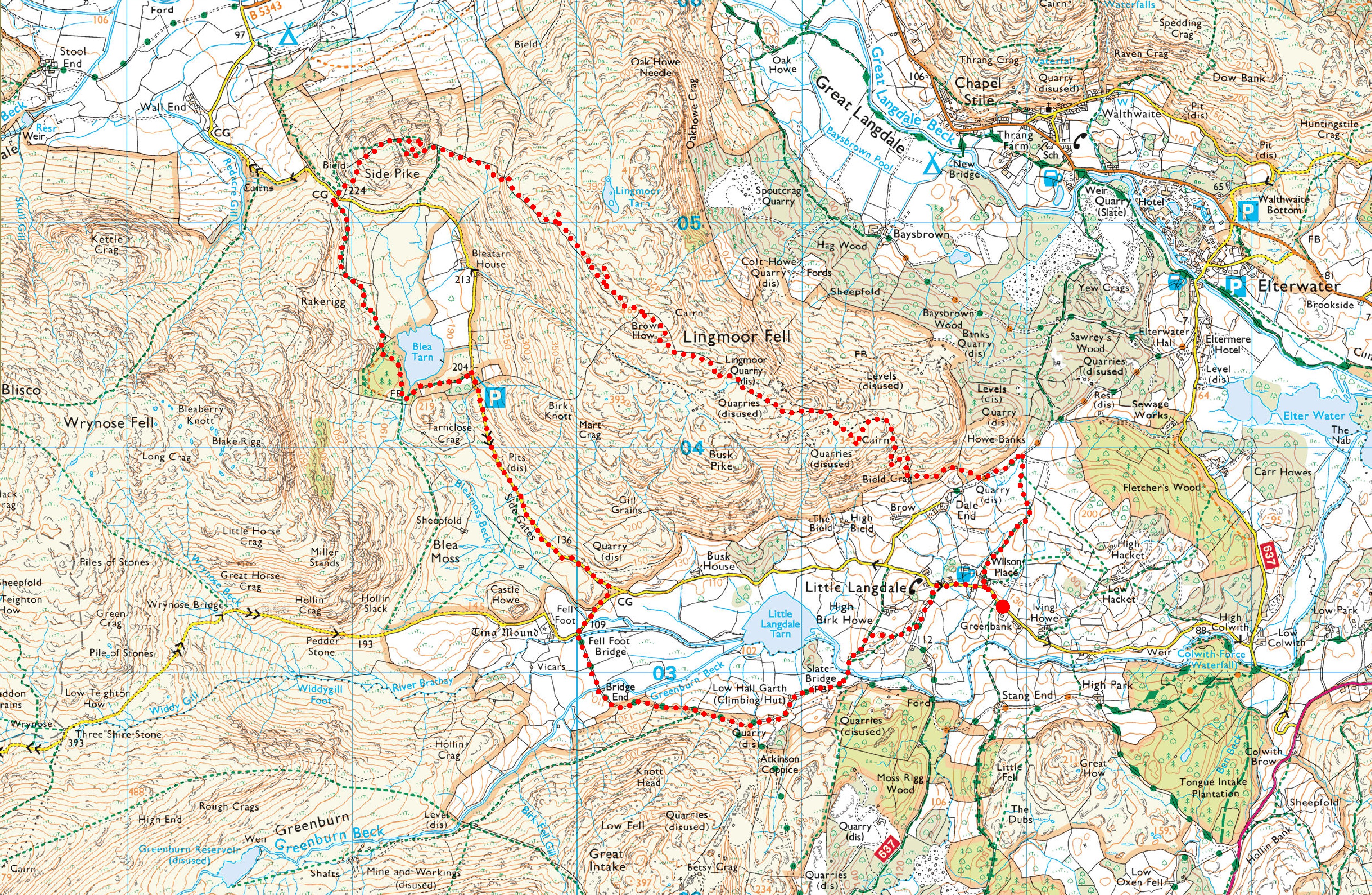
Greenbank > Wilson Place Farm > Bield Crag > Brown How > Side Pike > Blea Tarn > Fell Foot Bridge > Slater Bridge > Little Langdale > Greenbank
 Parking at Greenbank
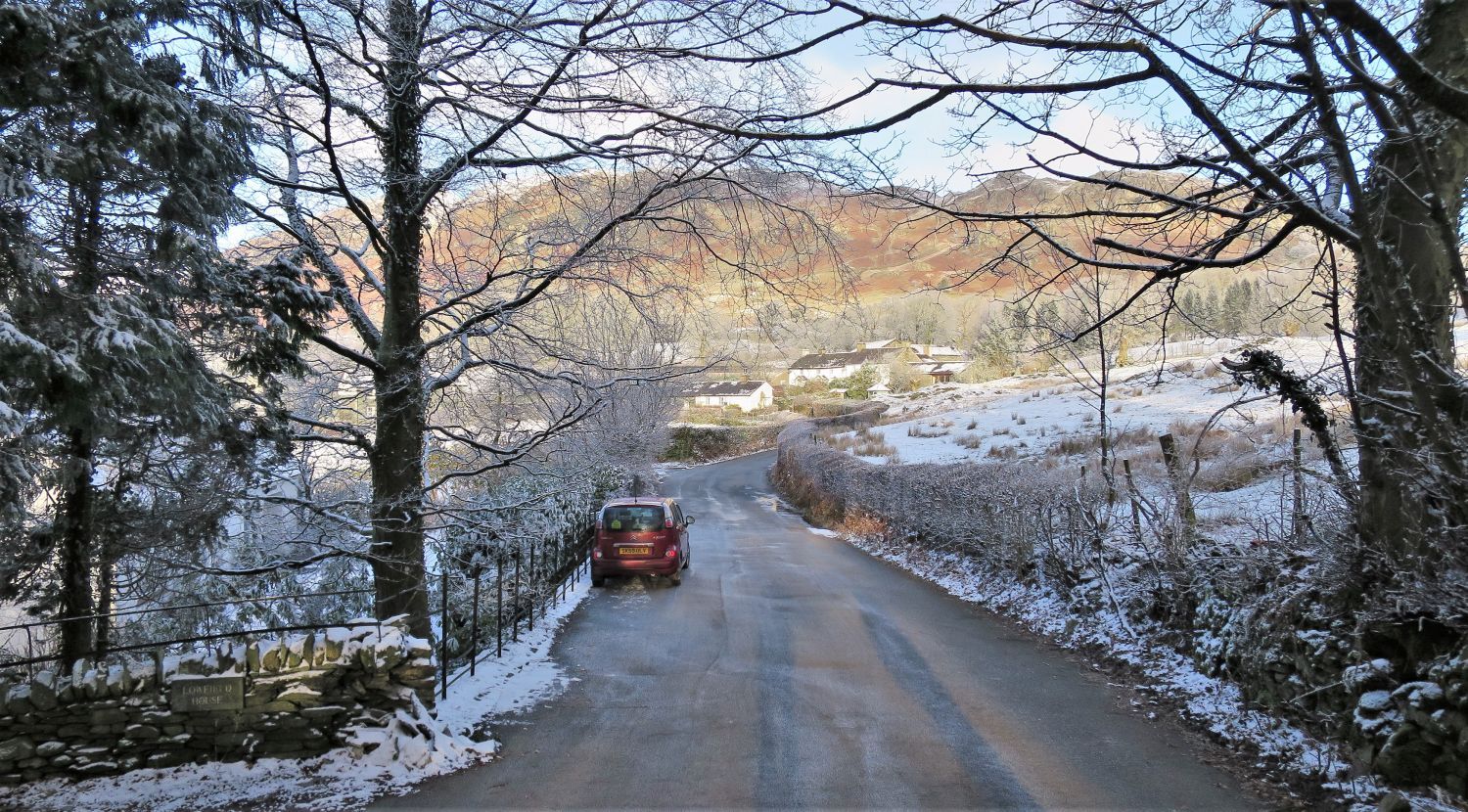
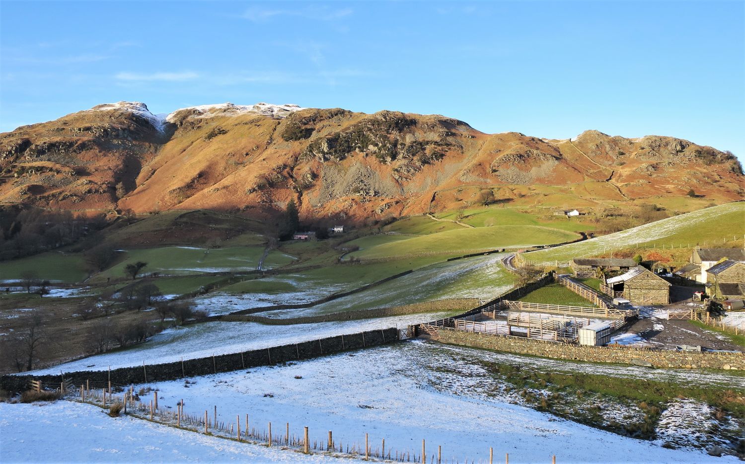
Parking is very limited in Little Langdale, however, at the small hamlet of Greenbank, the road widens allowing room for a few cars. Please note though, you are parking outside private homes so please respect the people that live there by keeping the noise to a minimum.
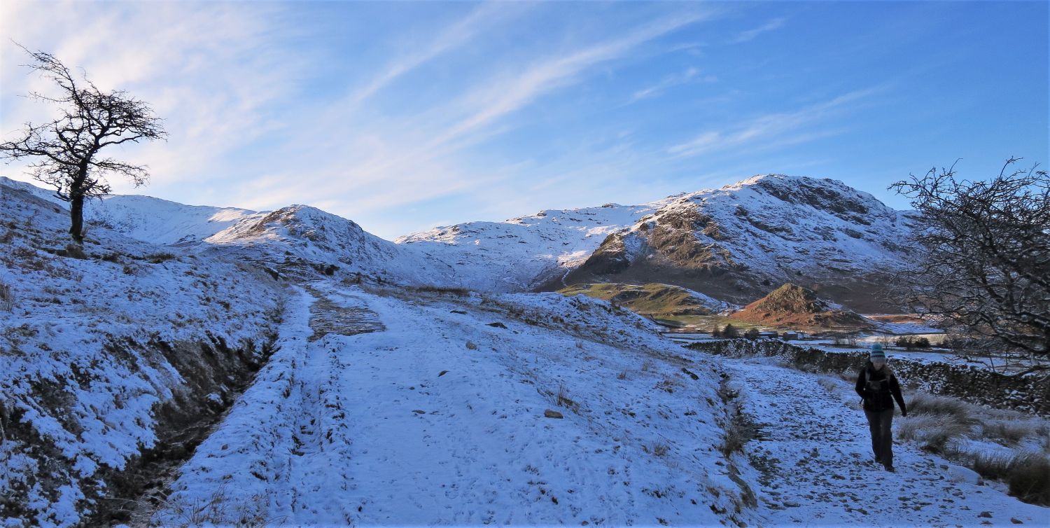
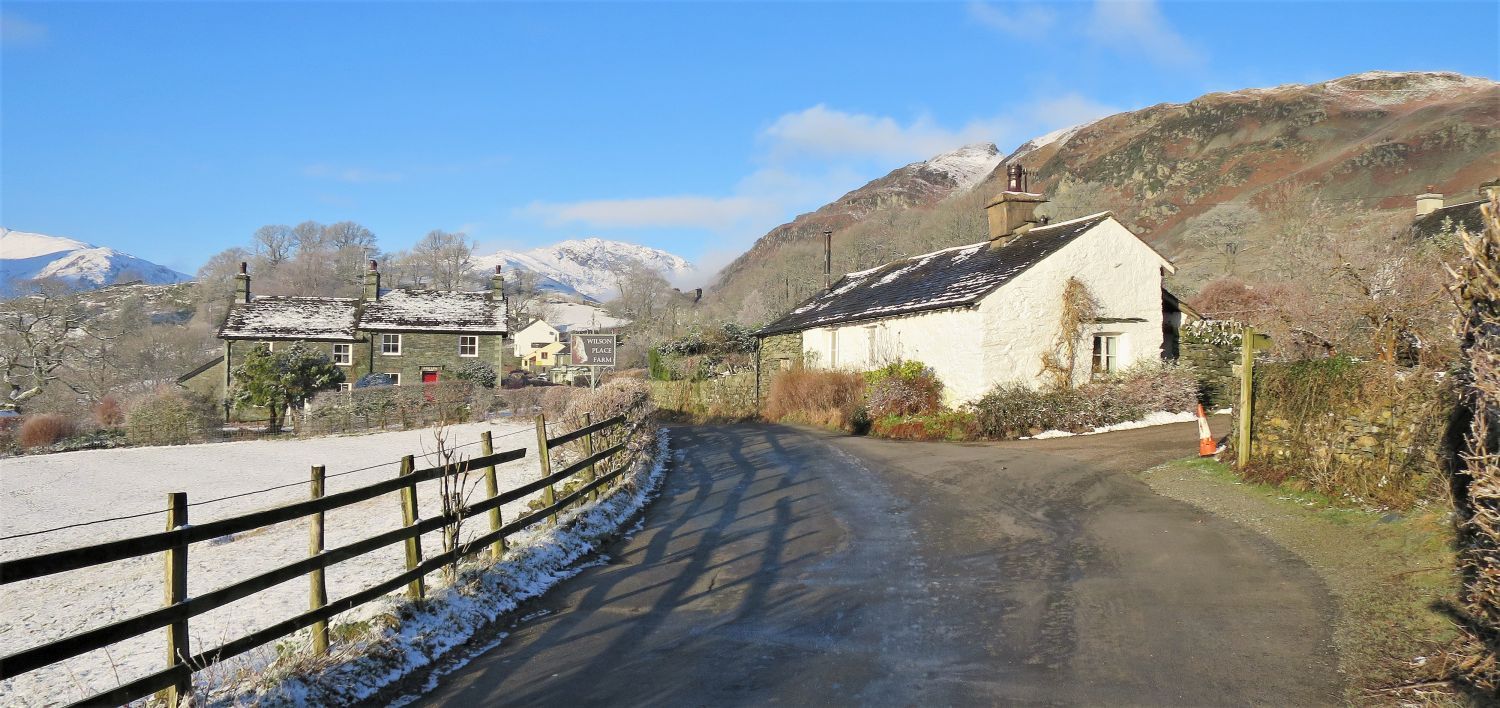 Lingmoor Fell from the approach to Wilson Place Farm
Wilson Place Farm is just a short walk away on the Side Gates road. Here, we turn right through the farm towards the east ridge of Lingmoor Fell.
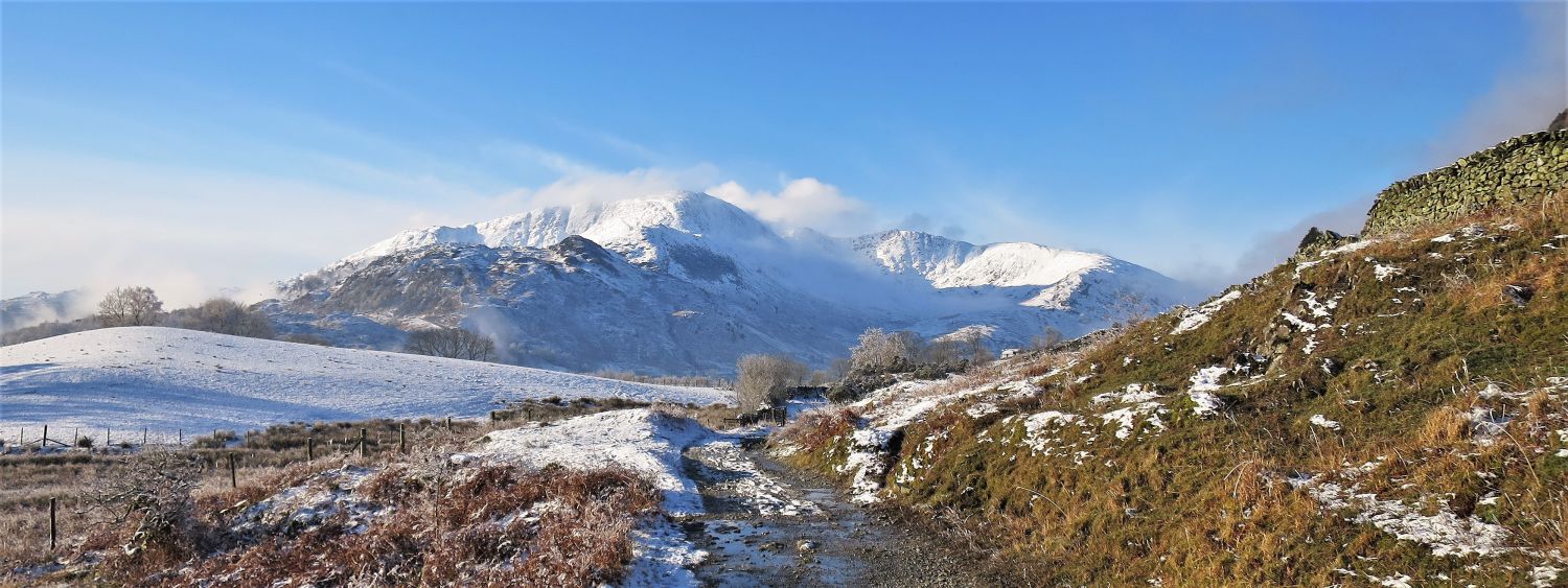
 Looking back to Wetherlam over Wilson Place Farm
Wetherlam dominates the scene from the ascent of Lingmoor Fell, but that’s not a bad thing.
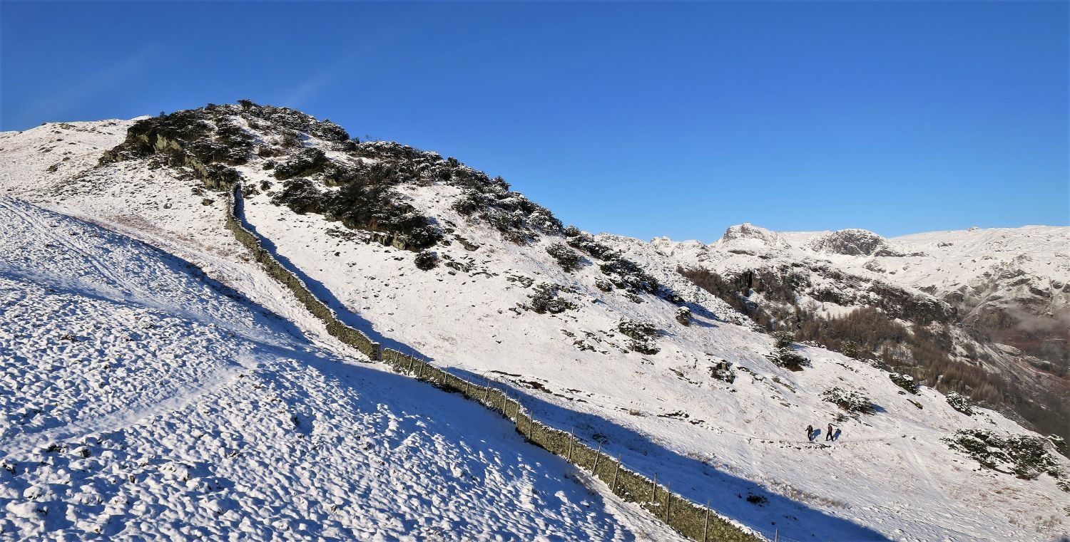
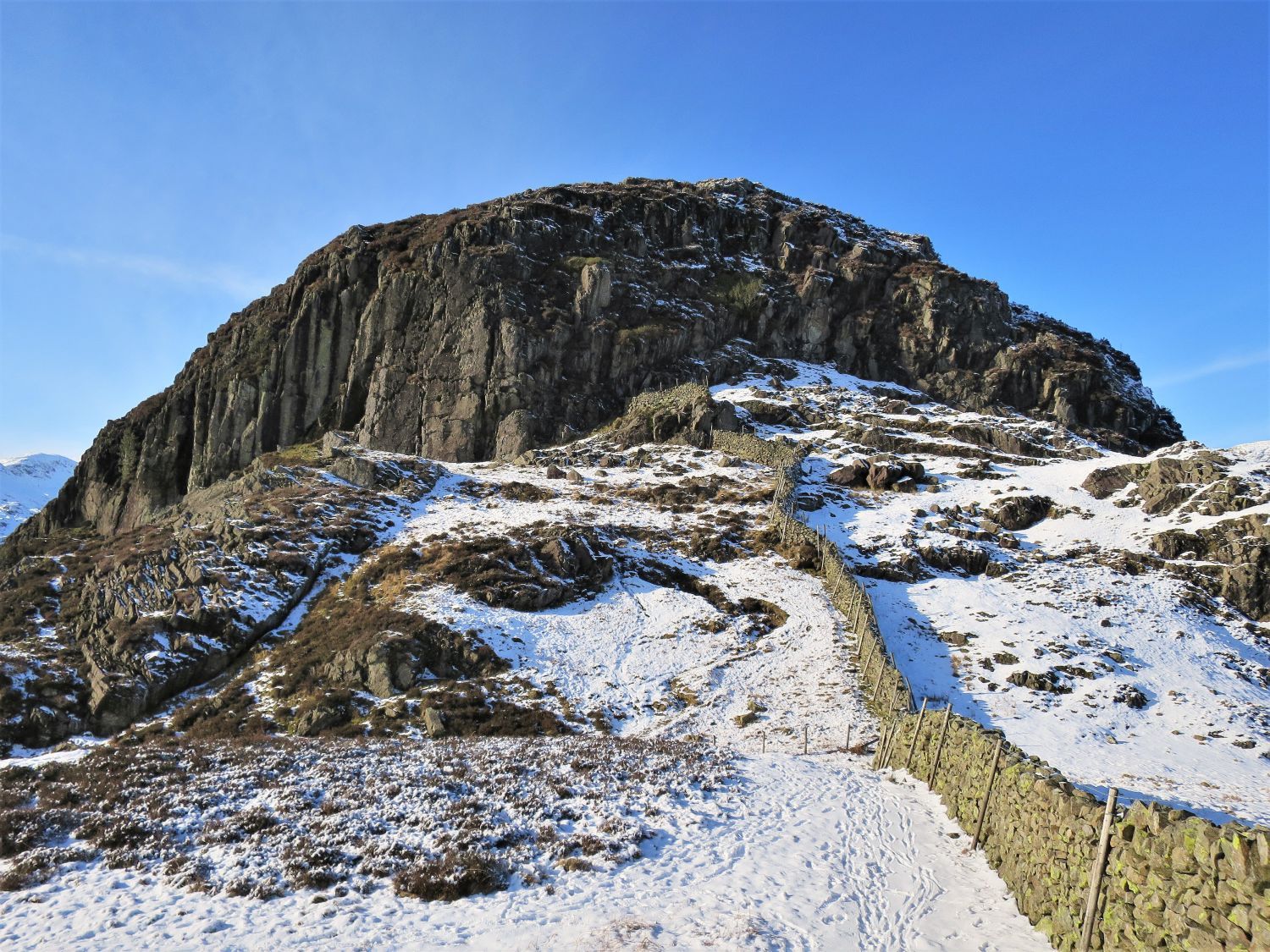
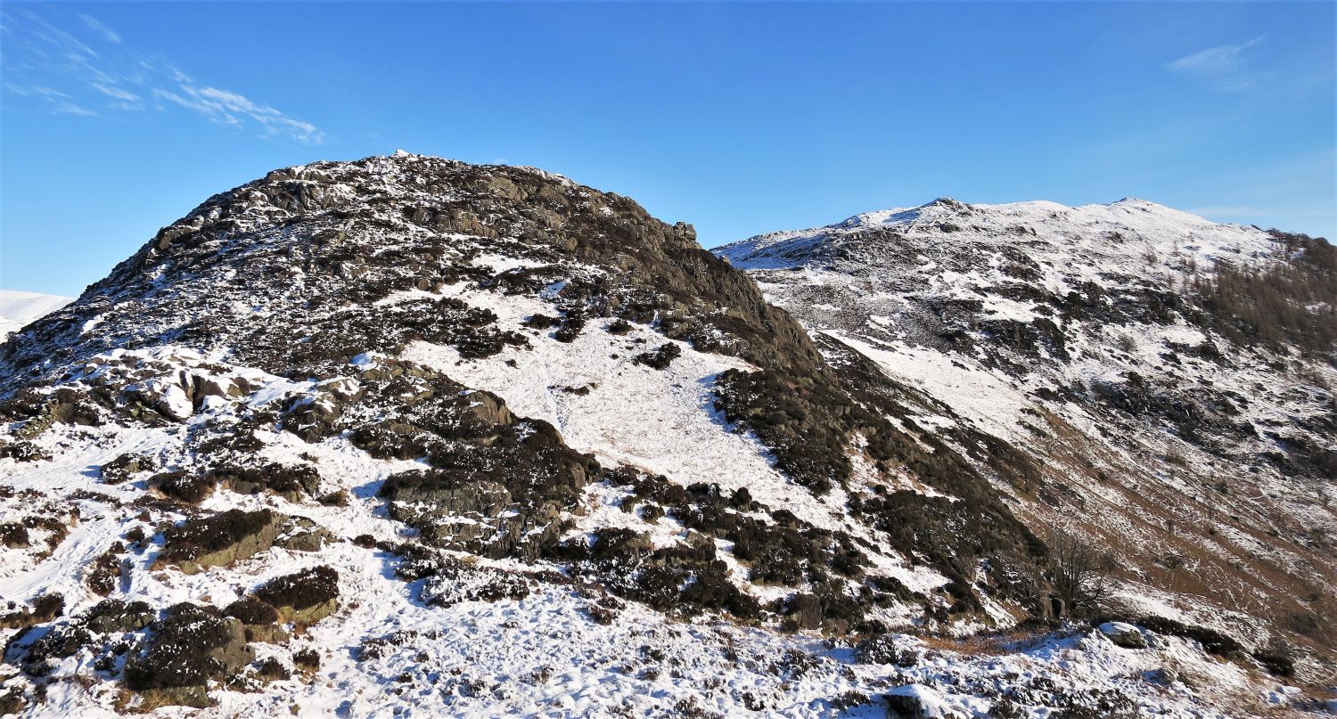
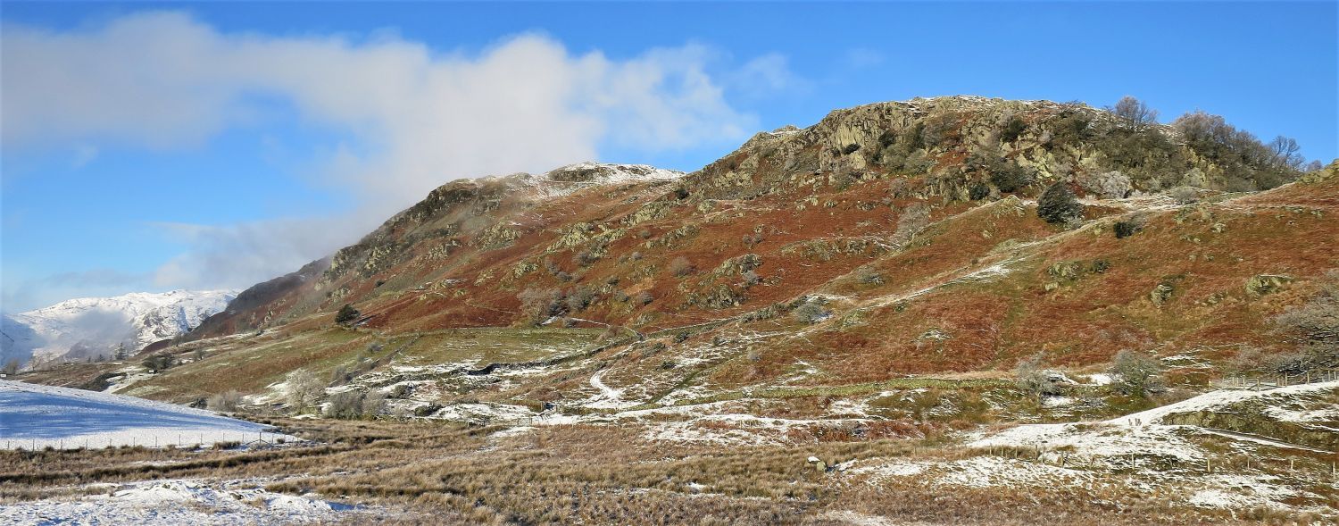 Lingmoor Fell’s Bield Crag and Howe Banks
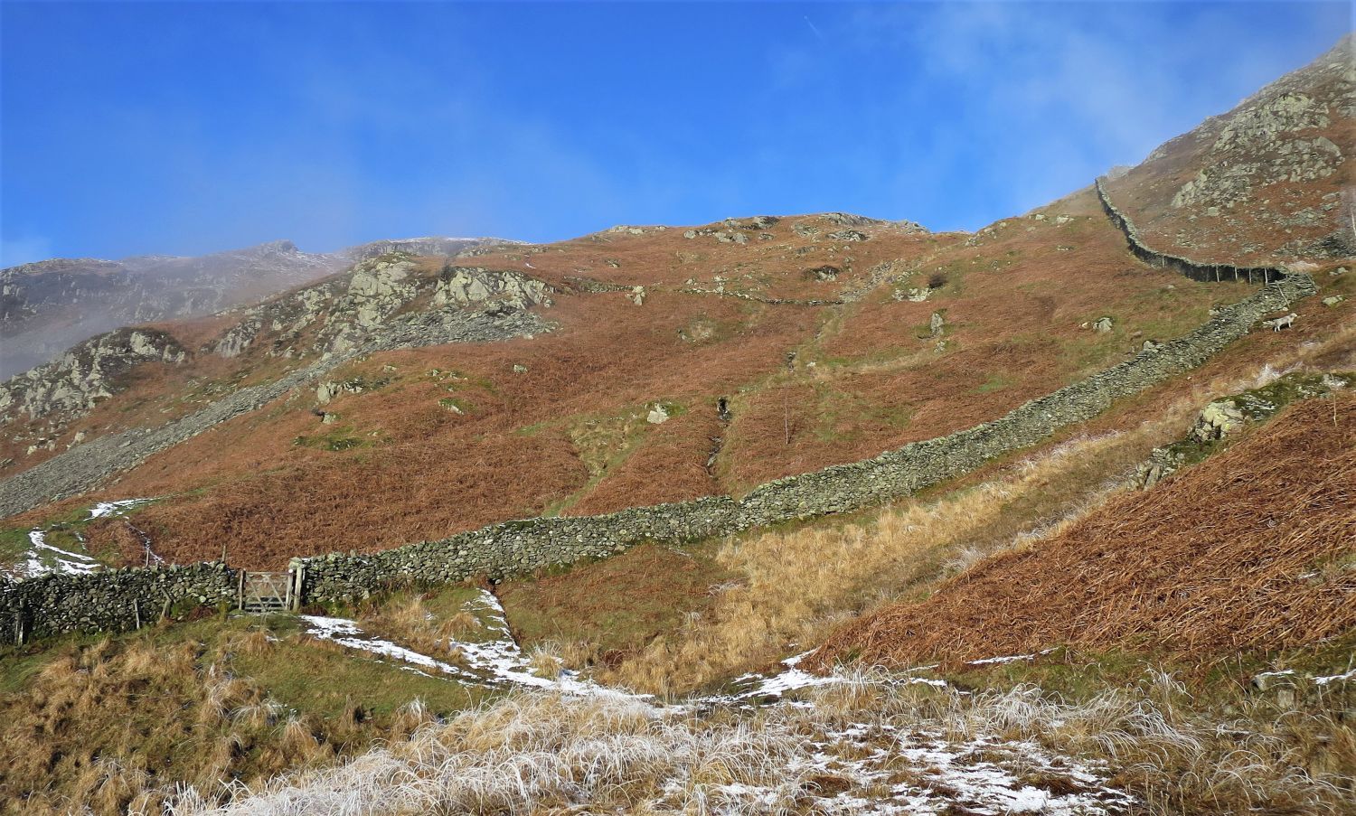
The col between these two crags is our gateway to Lingmoor Fell’s east ridge. The “quarry track” that leads to the col can be seen in the centre of the picture.
 Wetherlam from the ‘high road’ to Little Langdale
We now join the ‘high road’ for a short while before climbing towards the ridge. This old road, which is only suitable for off-road vehicles, is a more direct route between Elterwater and Little Langdale.
 The “quarry track” leaving the ‘high road’
This is the point where Wainwright’s route ‘Ascent from Little Langdale’ starts its journey on page: Lingmoor 8.
 The “quarry track” traversing Howe Banks
 Wetherlam over Little Langdale Tarn
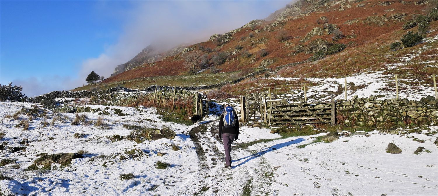
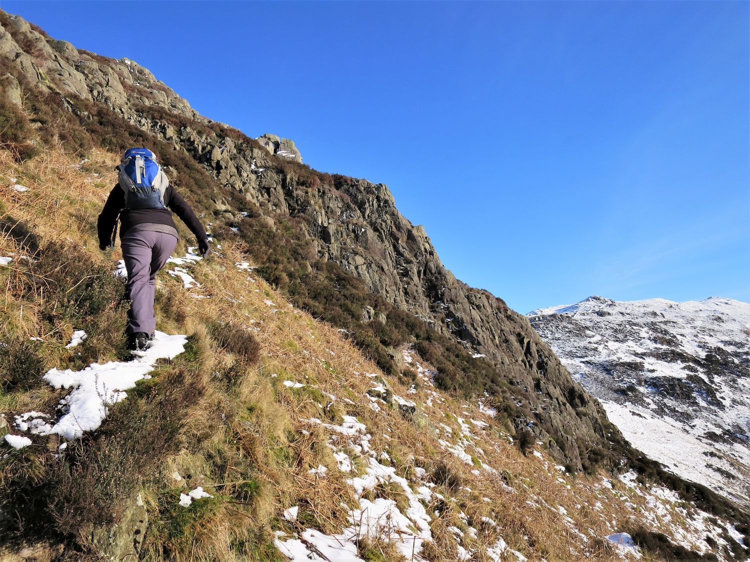
 Bield Crag (left) from the ascent towards the col
After the gate, the “quarry track” takes a zig-zag course up towards the col on the east ridge.
“A grassy quarry track serves excellently to point the way and ease the journey” Lingmoor Fell 8
AW
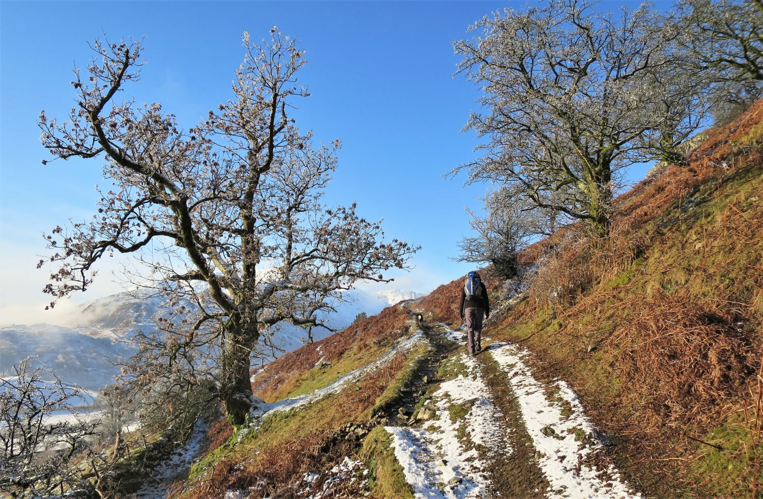
 Looking back towards a distant Wansfell Pike (left of centre)
 Wetherlam and Little Langdale Tarn from the ascent to Bield Crag
 Harrison Stickle and Pavey Ark from the east ridge
We now arrive onto the east ridge of Lingmoor Fell. The path rising up from the right is Wainwright’s ‘Ascent from Elterwater and Chapel Stile’.
 The eastern and central spines from the detour to Bield Crag
As soon as we arrive at the ridge wall, we take a small detour to the summit of Bield Crag. Looking back is a fine view of the Helvellyn and Fairfield groups.
 Wetherlam, Swirl How and Great Carrs from Bield Crag
The detour is well worth it!
 Wansfell Pike (above the cairn) and Black Fell (right) from Bield Crag
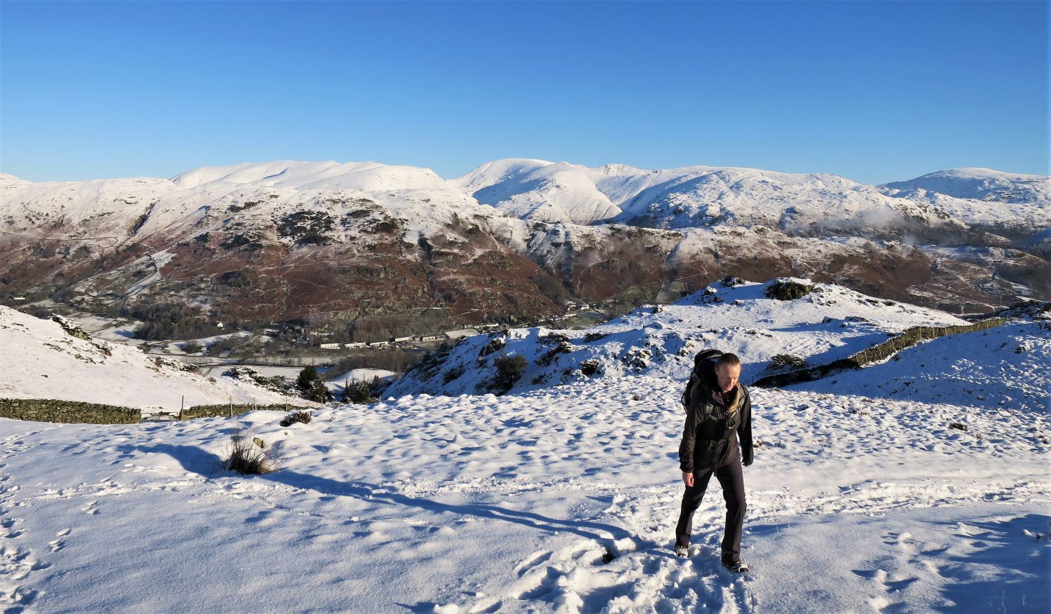
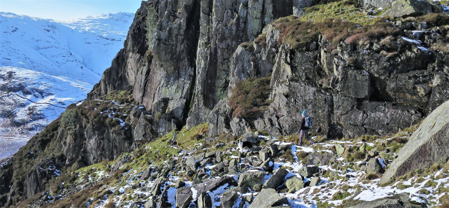
 Frankie ascending the lower subsidiary top (east ridge)
We are now back on the ridge, and this is the “junction” Wainwright mentions on page: Lingmoor Fell 8. The col to the left is the continuation of the “quarry track” that leads to the quarries and ruins, and straight ahead the path follows the ridge wall. This rise on the east ridge is the first of two subsidiary tops before reaching the main summit.
“The quarry track may be followed (easy walking) to its terminus at some ruins…..Or the track may be left when it turns towards the ridge-wall beyond the big cairn above Bield Crag, and the ridge then followed to the top. Watch for the junction or it will be missed.” Lingmoor Fell 8
AW
 Looking back from the ascent of the lower subsidiary top (east ridge)
 Looking across towards Wetherlam, Swirl How and Great Carrs
 Looking back towards the lower subsidiary top (east ridge)
On the northern face of the lower subsidiary (left of centre) is the site of the “top quarry”.
“The edge of the top quarry used to be unprotected and dangerous in mist, but a new wall has made this part of the route safe.” Lingmoor Fell 7
CH
 Looking across towards the Helvellyn and Fairfield groups
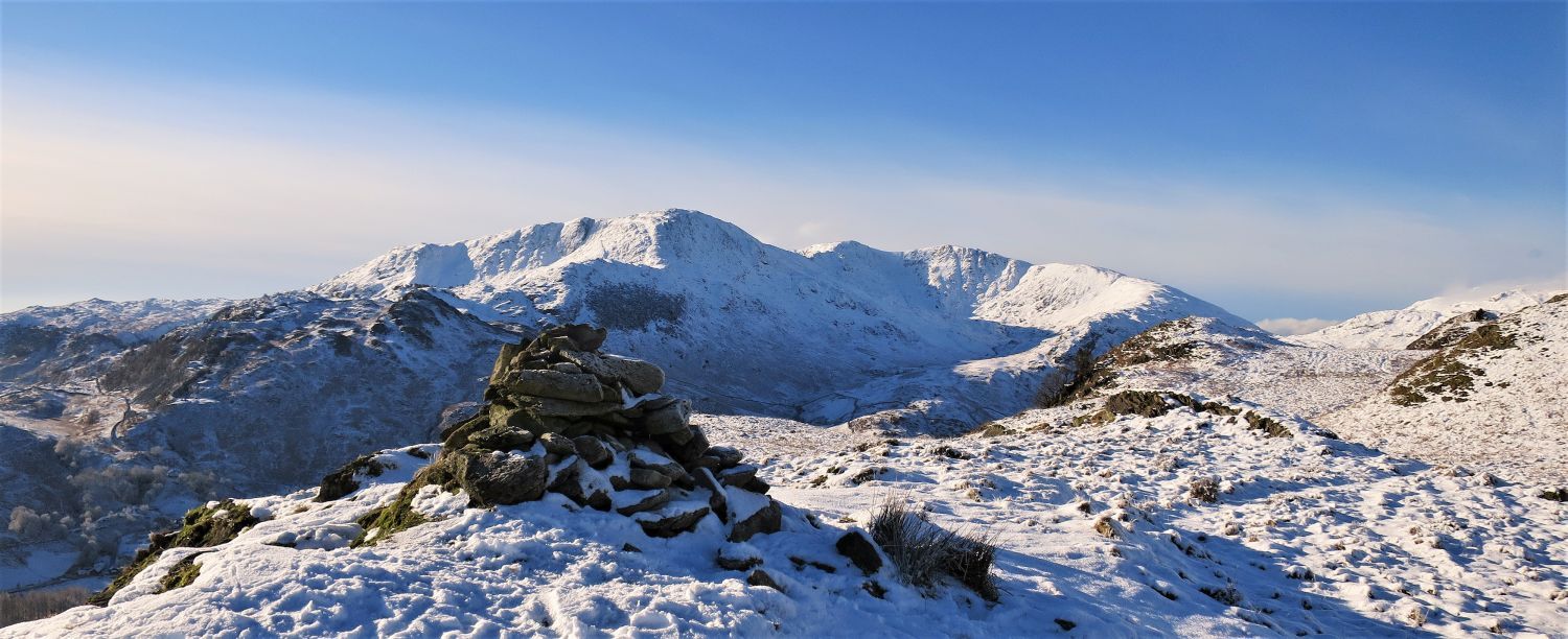
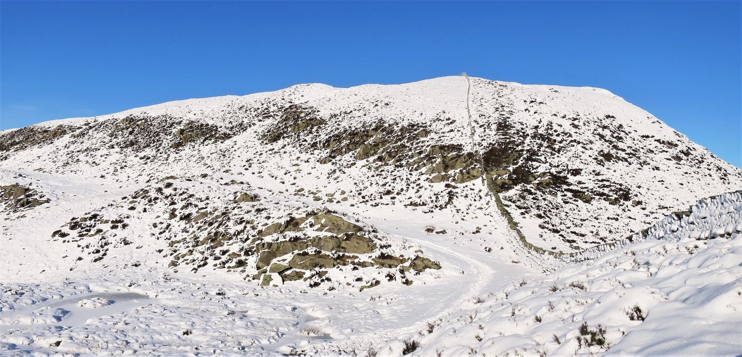
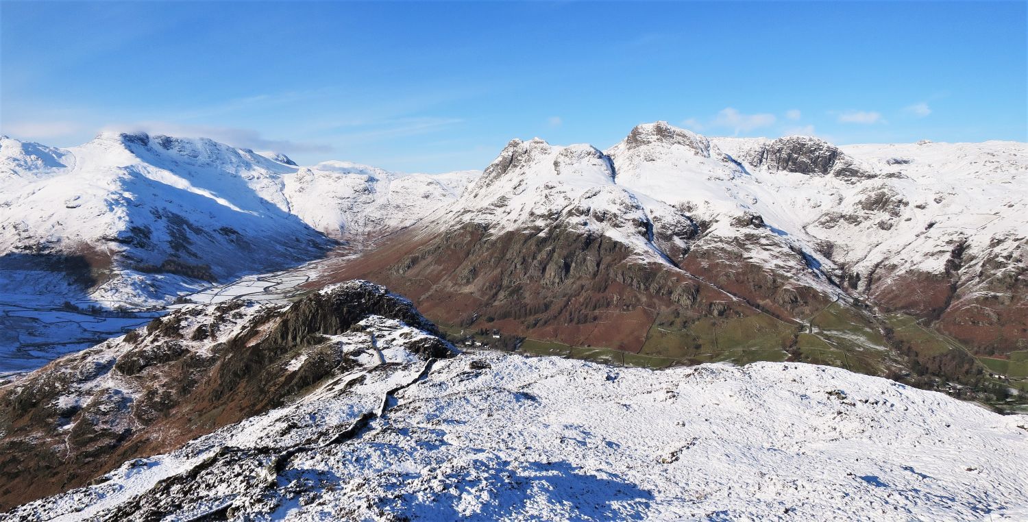
 Brown How from the upper subsidiary top (east ridge)
The true summit of Lingmoor Fell, Brown How, comes into view as we arrive at the second subsidiary top. Here, also, Pike o’ Blisco, Crinkle Crags and Bowfell look majestic on the left skyline.
 The approach to Brown How
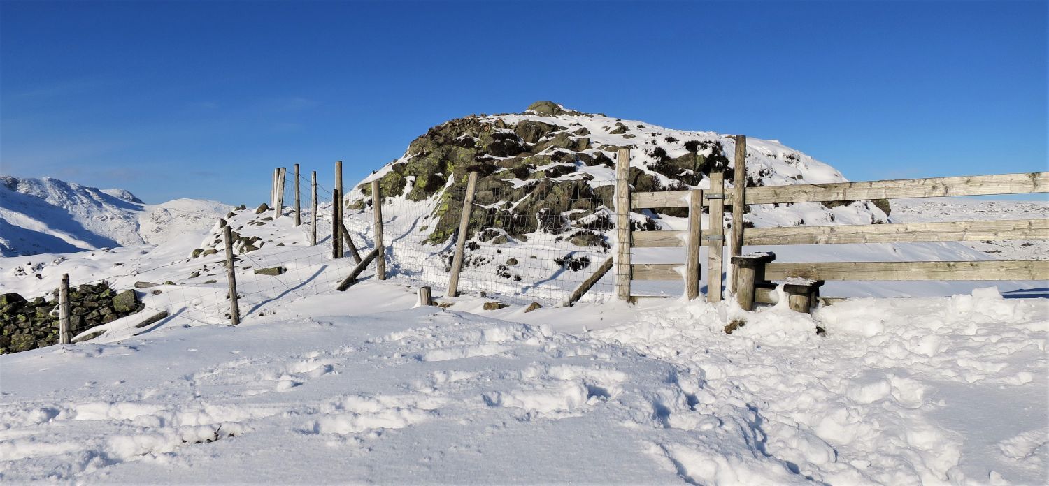 The summit of Lingmoor Fell (Brown How)
“The highest point, adjacent to an angle in the summit wall, is a stony mound superimposed on a dome dark with heather (Brown How)…..” Lingmoor Fell 8
AW
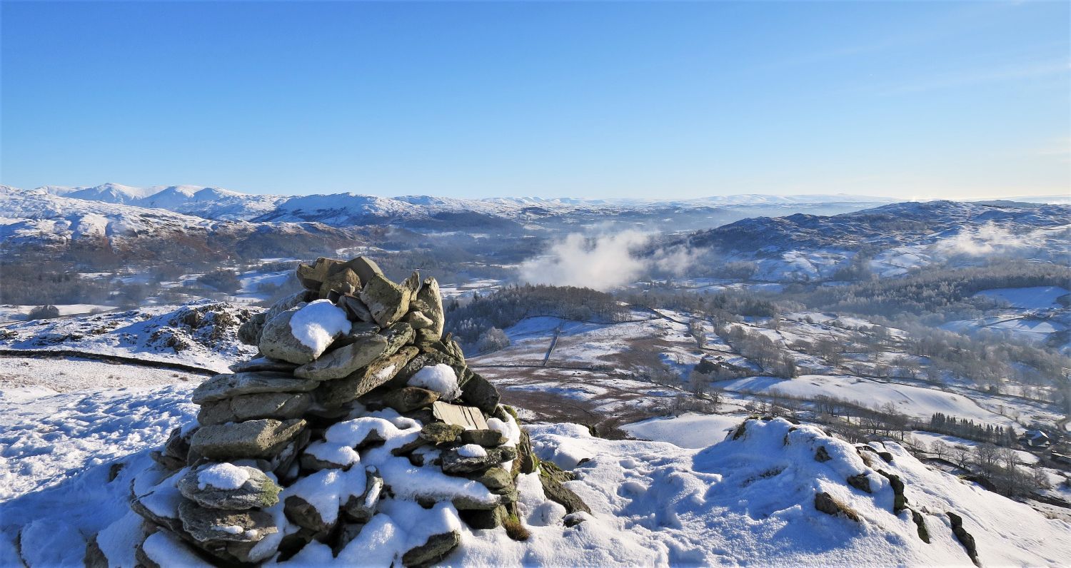
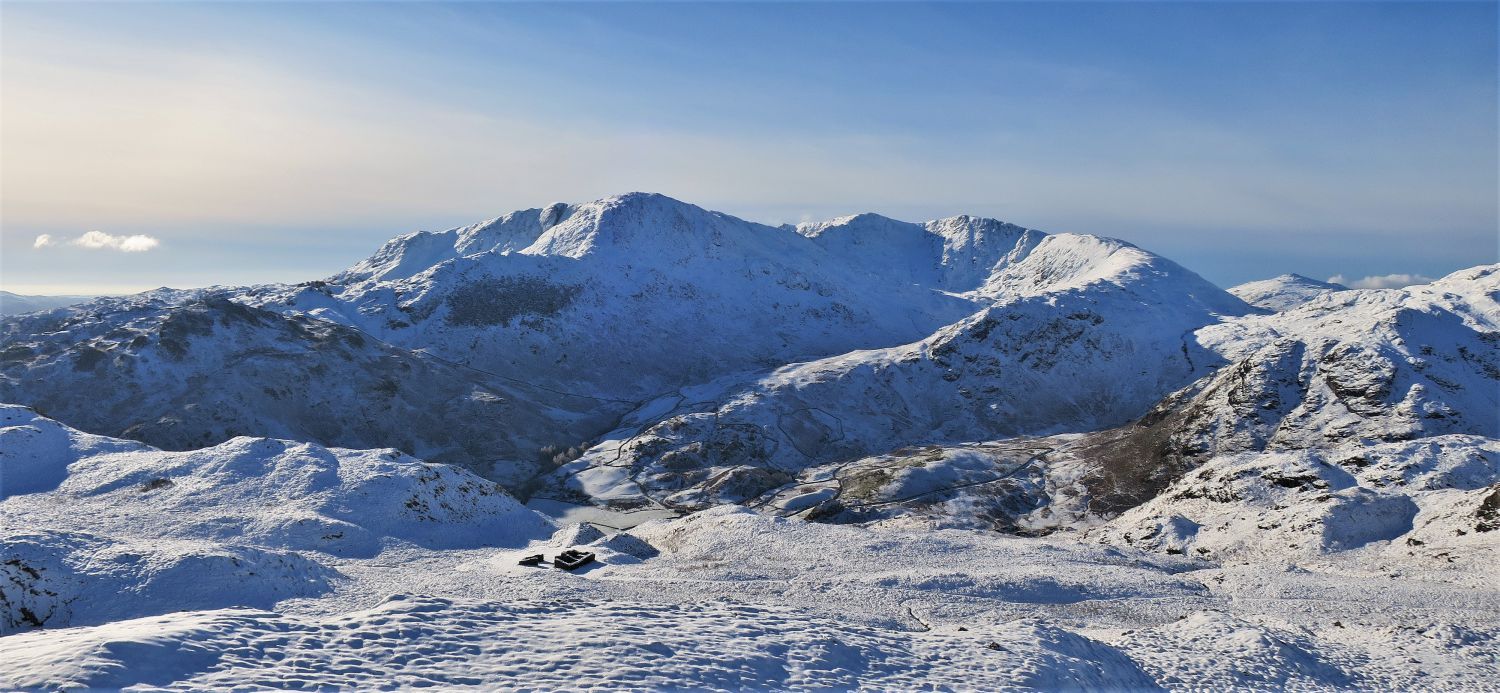
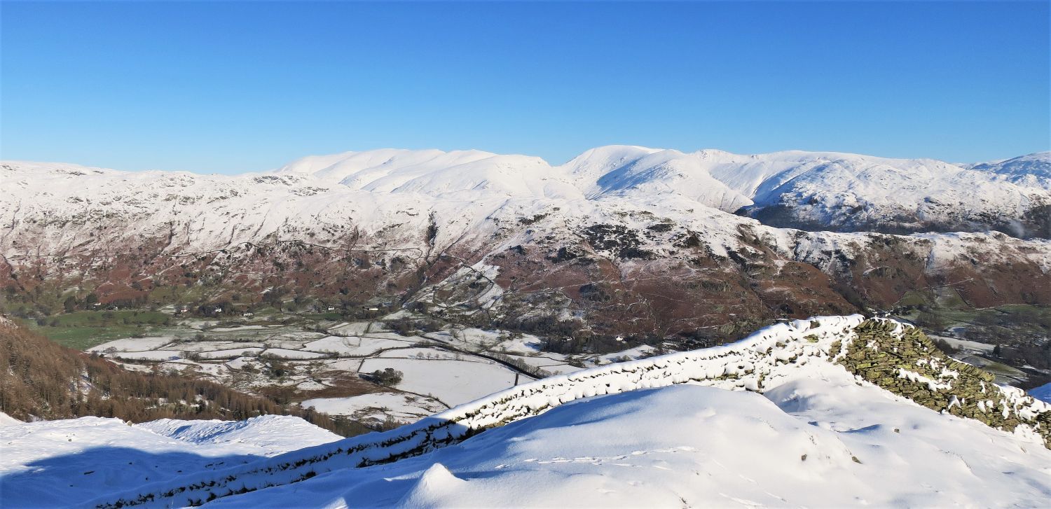
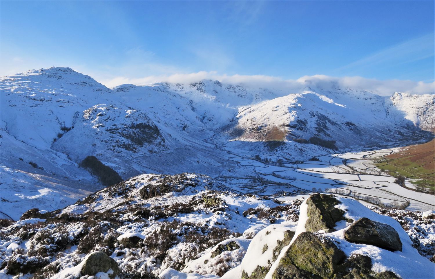
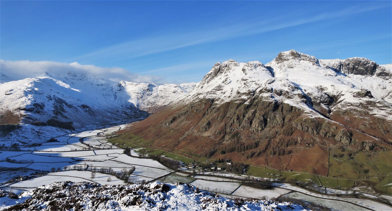
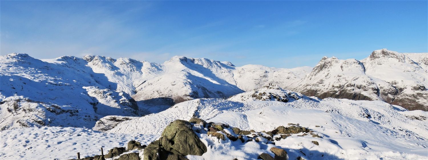 The surrounding fells of upper Great Langdale from Brown How
“There is no better place than the top of Lingmoor Fell for appraising the geography of the Langdale district. From this viewpoint the surround of rugged heights towering above the valley head of Great Langdale is most impressive…..”
 The Coniston Fells (left) from Brown How
“…..while across Little Langdale the Coniston Fells form a massive wall.” Lingmoor Fell 9
AW
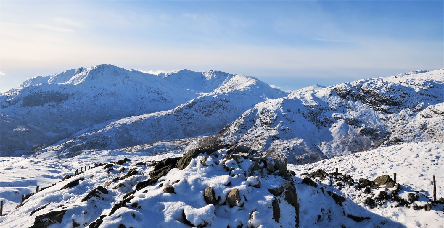
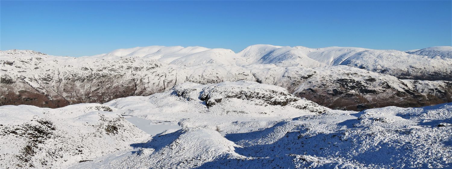
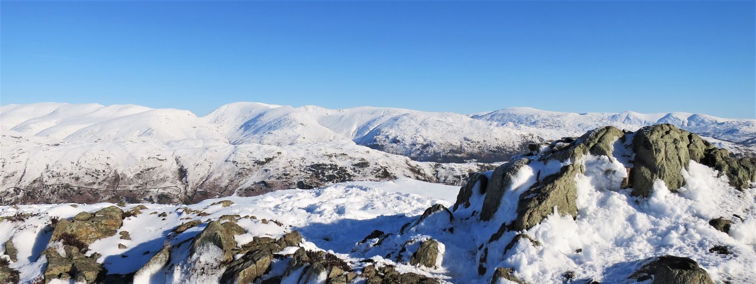 The Helvellyn, Fairfield, and Kentmere groups from Brown How
 Brown How from the upper subsidiary top (north-west ridge)
Just a short distance away from the main summit, the upper subsidiary top on the north-west side of the ridge provides splendid views.
 Bowfell and the Langdale Pikes from the upper subsidiary top (north-west ridge)
Certainly a contender for one of the best views in Lakeland, but just a bit further down, the lower subsidiary top provides an even better view.
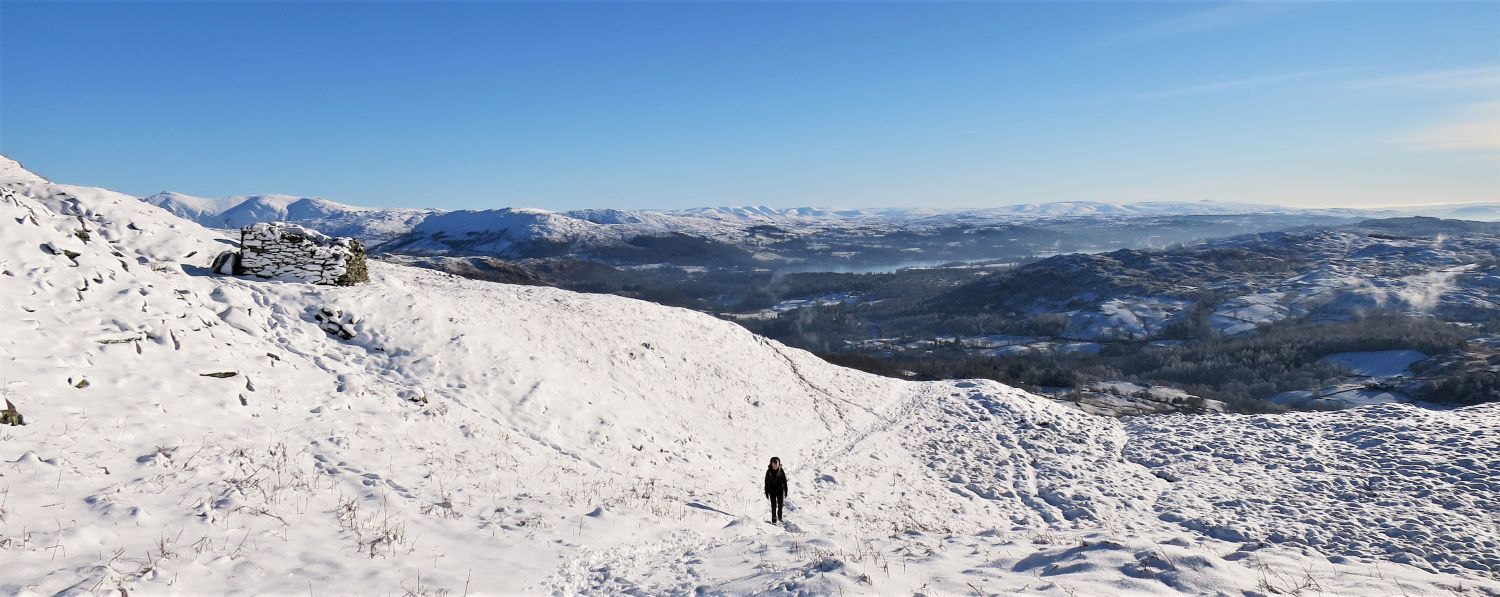
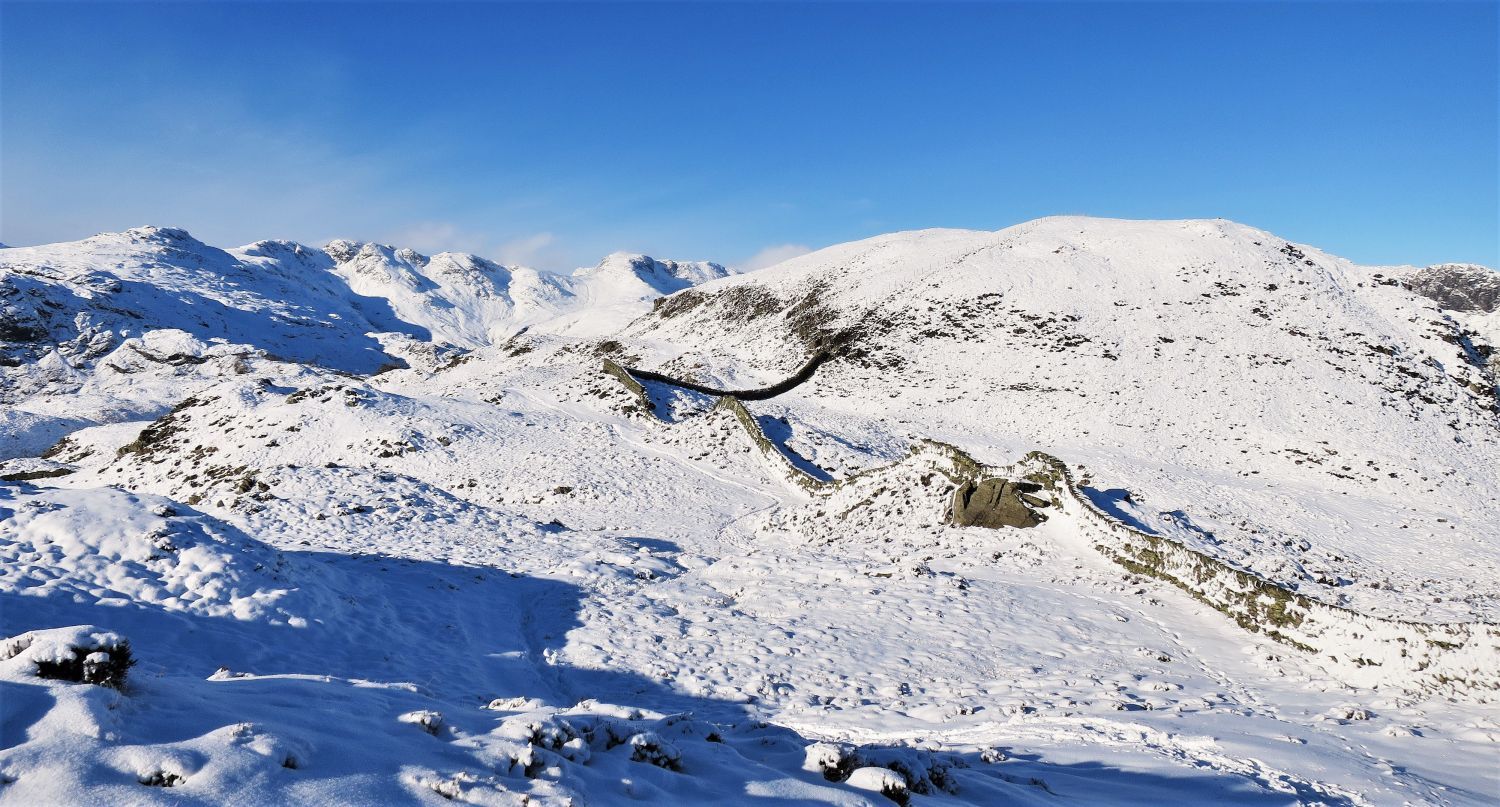
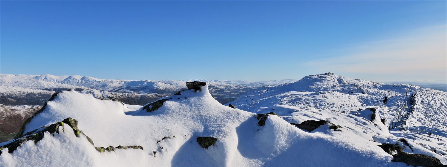
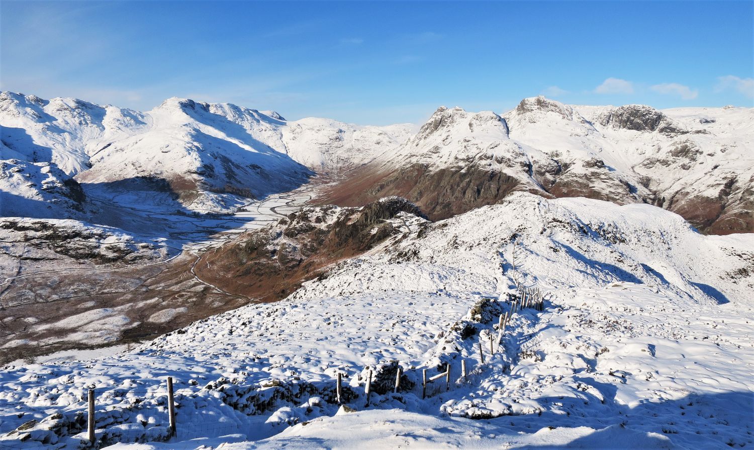
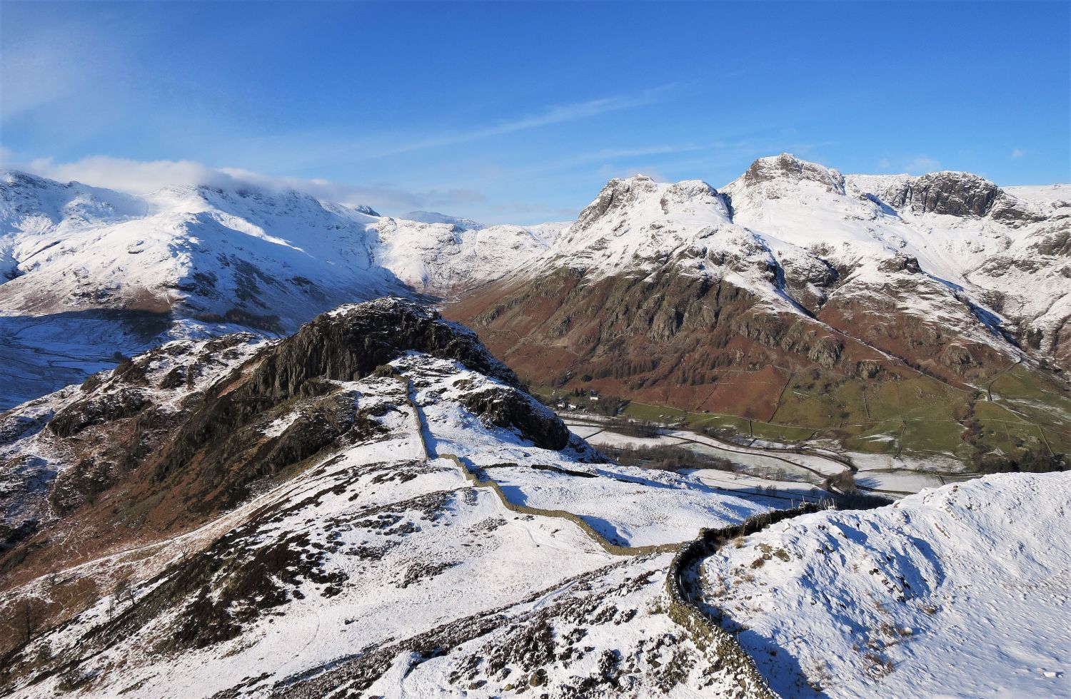
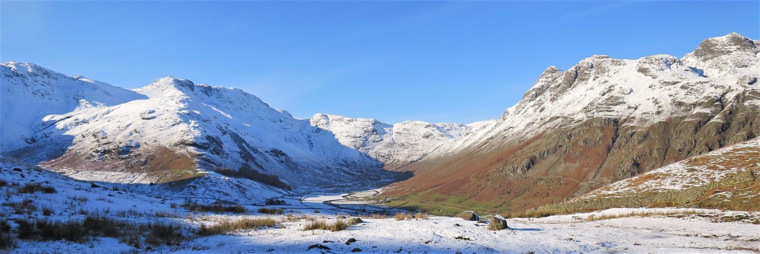
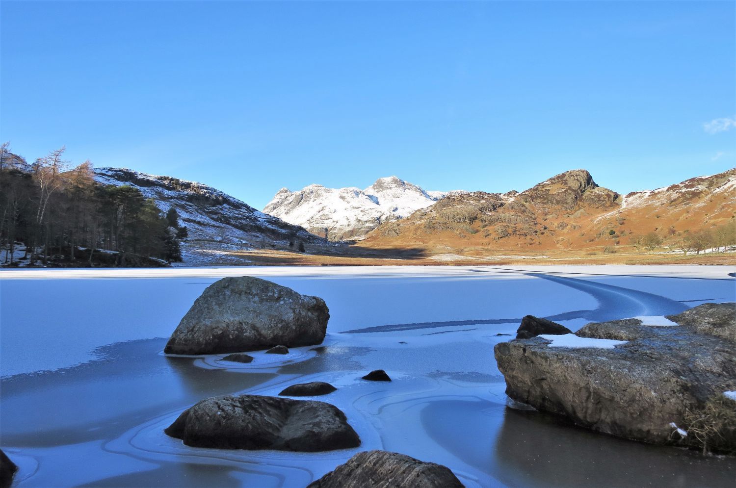
 The eastern and central spines over Oakhowe Crag and Lingmoor Tarn
A frozen Lingmoor Tarn is easily missed in this wonderful winter scene.
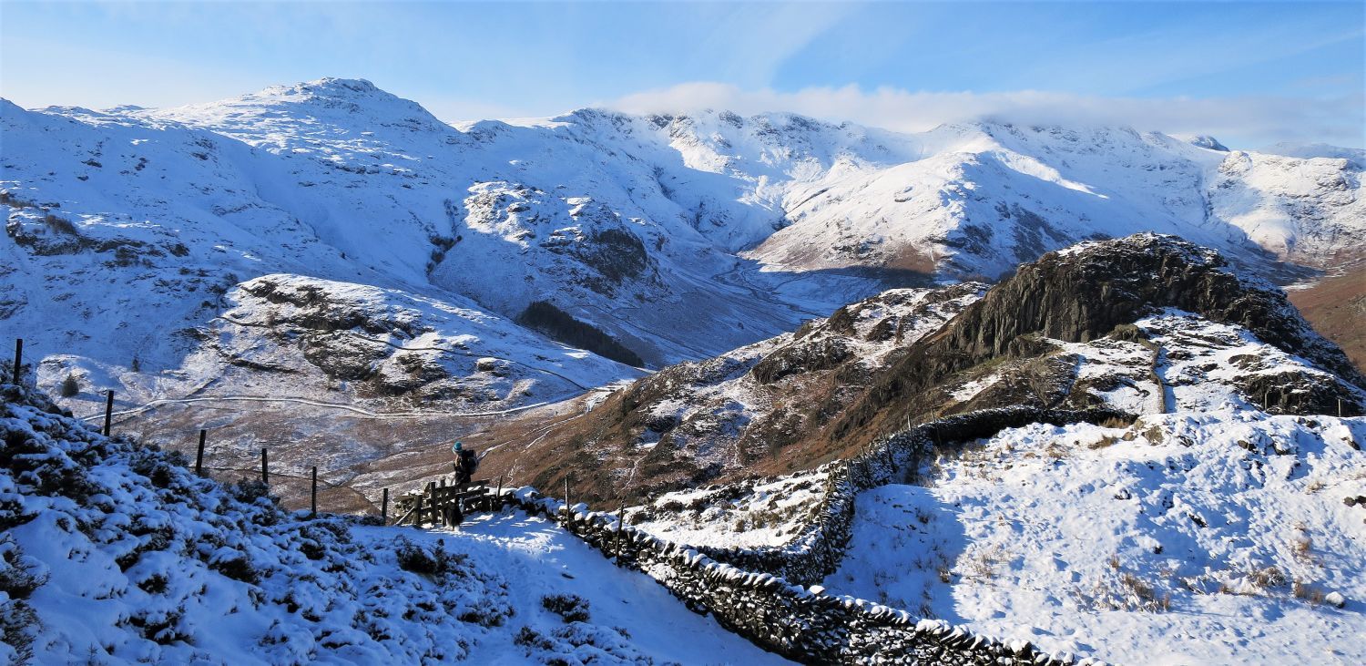
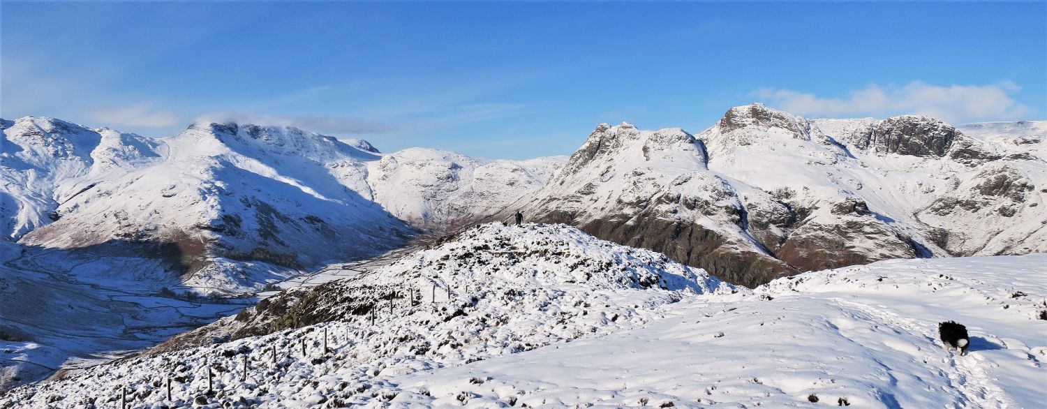 Approaching the lower subsidiary top (north-west ridge)
A visit to this top is not to be missed…..well, that’s what I said to the couple that are on there, who we had met on the main summit. The small dark head of a gully to the left is our line of descent to get back onto the ridge.
Personally, these next two photos, if stitched together, are of the finest view in Lakeland. In September, when the heather is in full bloom, the scene is even better!
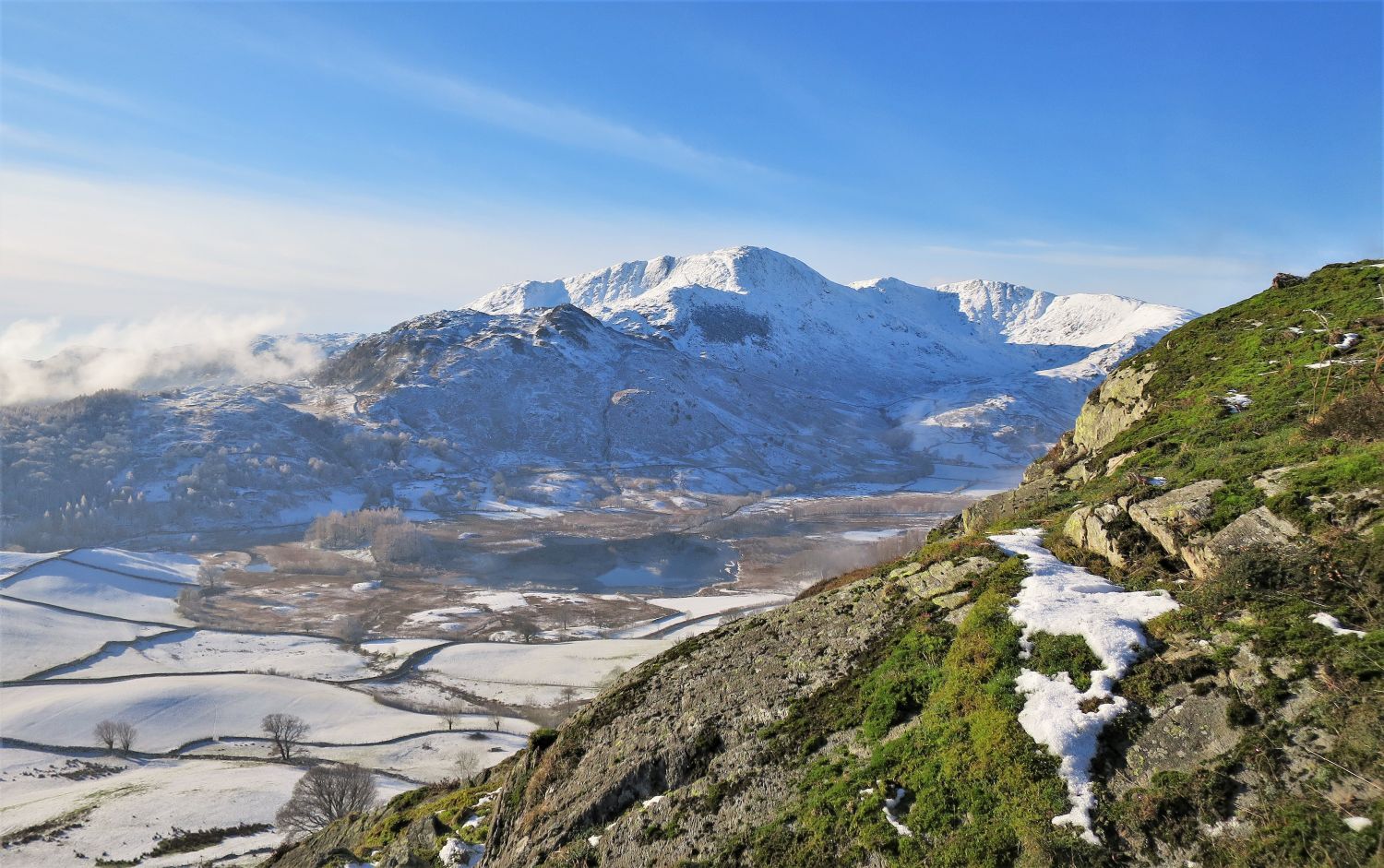
 Pike o’ Blisco, Crinkle Crags and Bowfell from the lower subsidiary top (north-west ridge)
 Bowfell and the Langdale Pikes from the lower subsidiary top (north-west ridge)
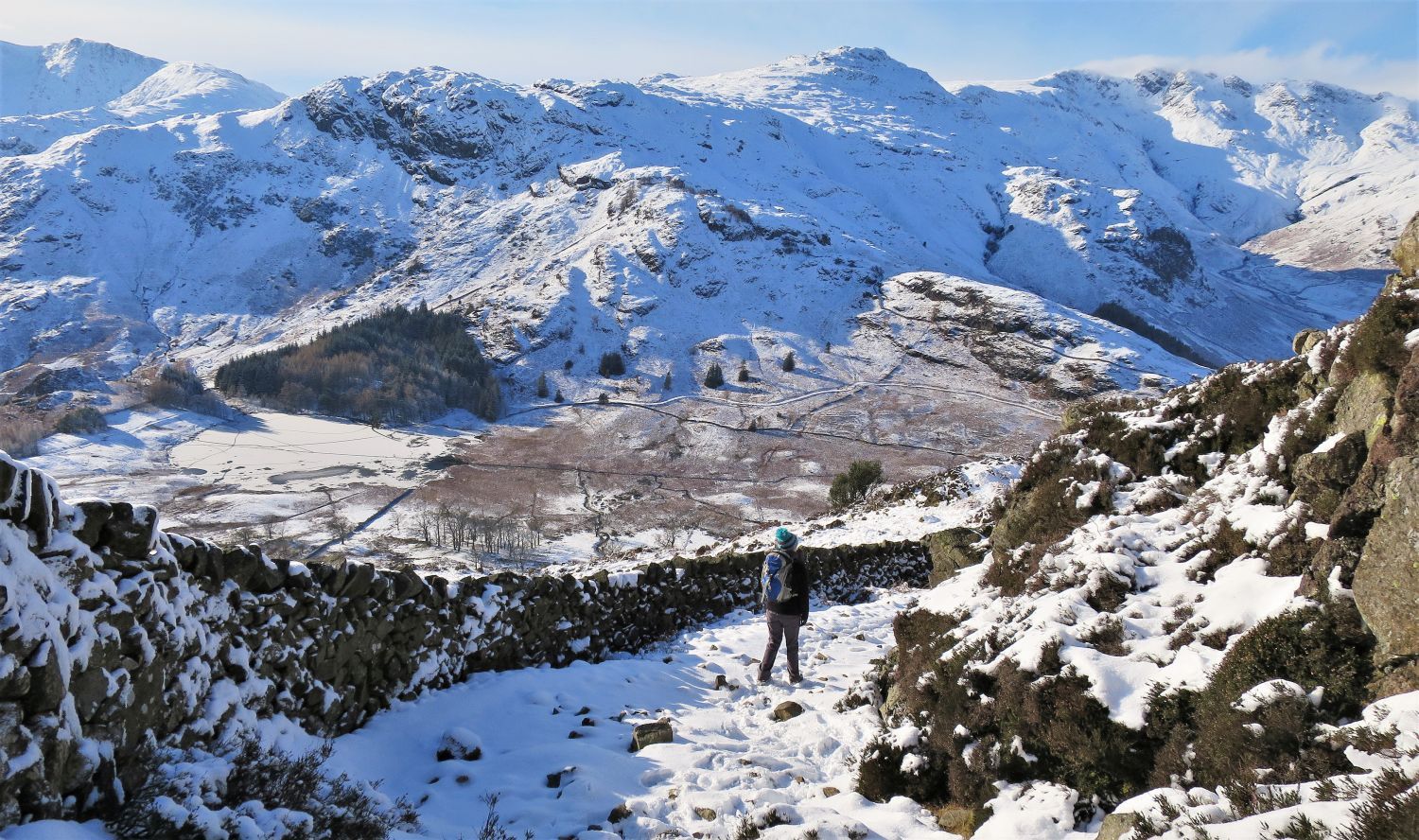 Looking down towards a frozen Blea Tarn
We now skirt around the lower subsidiary top and follow the ridge wall to Side Pike, our last top on the Lingmoor Fell ridge. Our return route appears below us that visits Blea Tarn before reaching Little Langdale.
 Side Pike from above the Bleatarn House/Oakhowe Crag col
 Pike o’ Blisco (left) from the Bleatarn House/Oakhowe Crag col
 Book Four
The Southern Fells
Lingmoor Fell 6
“Side Pike – from the ridge running up to it”
Sadly, on this occasion, I didn’t get the exact location where Wainwright stood to take his photo; I forgot to take ‘The Southern Fells’ guide with me, so I relied on memory.
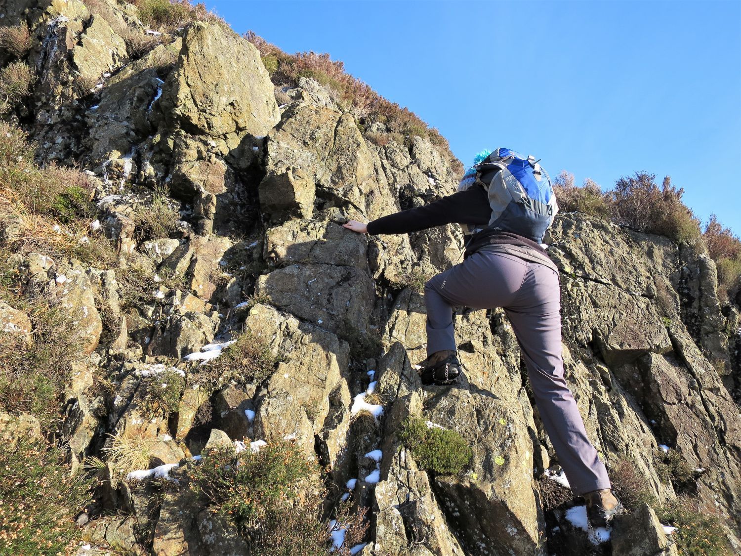
 Jaclyn on the traverse leading to the ‘squeeze’
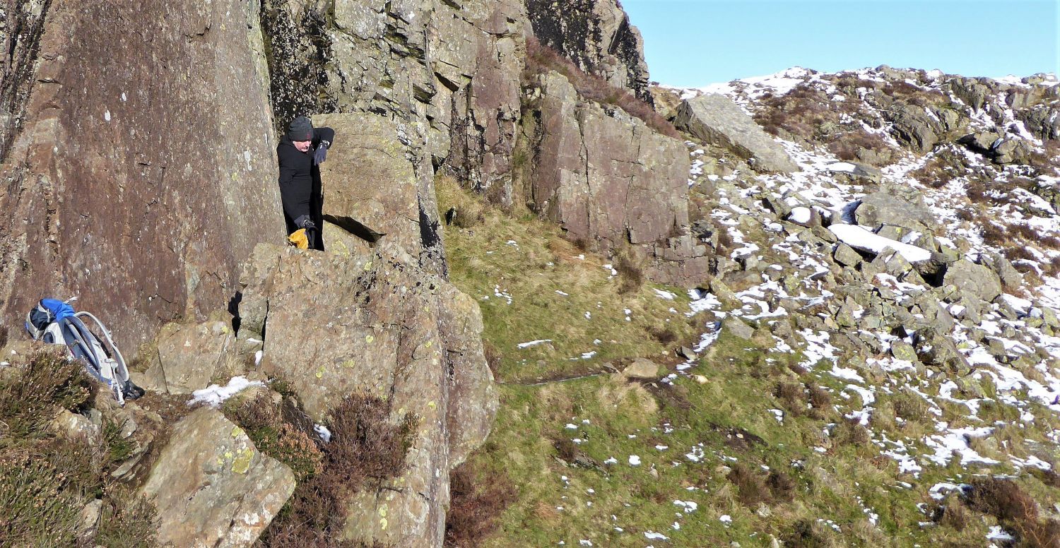 Squeezing through the ‘squeeze’
I’m so pleased to see that Clive Hutchby has included the ‘squeeze’ in the new ‘Walkers Edition’ of ‘The Southern Fells’.
“…..follow the path through a gap between a crag and boulder known as The Squeeze – rucksacks off here!” Lingmoor Fell 5
CH
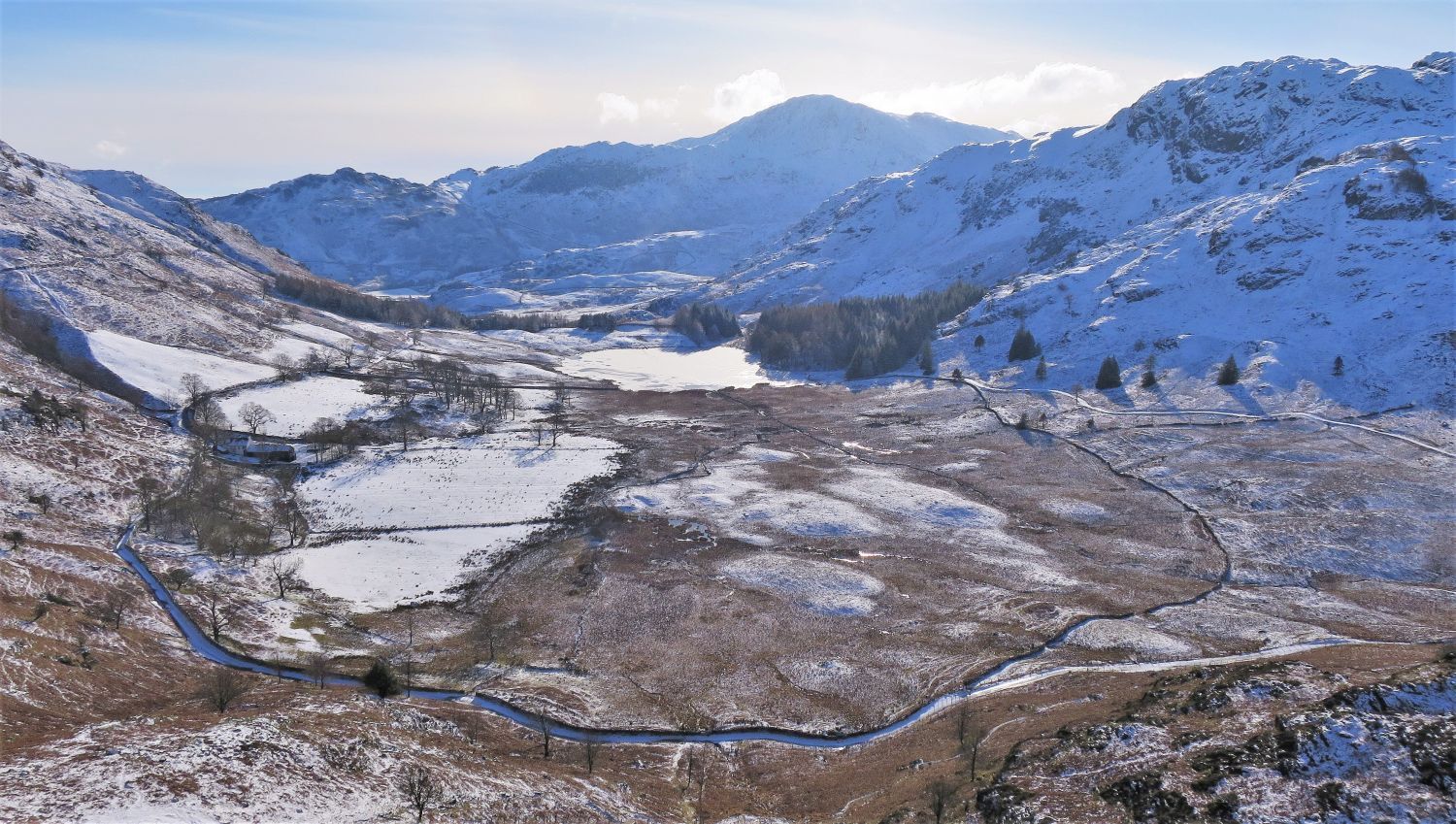 Blea Tarn and Bleatarn House from the traverse of Side Pike
The track we’ll be taking to Blea Tarn, can be seen on the right. Firstly though, we have the wonderful Side Pike to climb.
 Short traverse to the ‘split boulder’
Rather than skirting fully around Side Pike and joining the main path to the top, look out for this traverse path on your right; it’s not often used and can be easily missed.
 Scramble to the ‘split boulder’
A short easy scramble is required on the last bit of ascent; note that we had left our microspikes on.
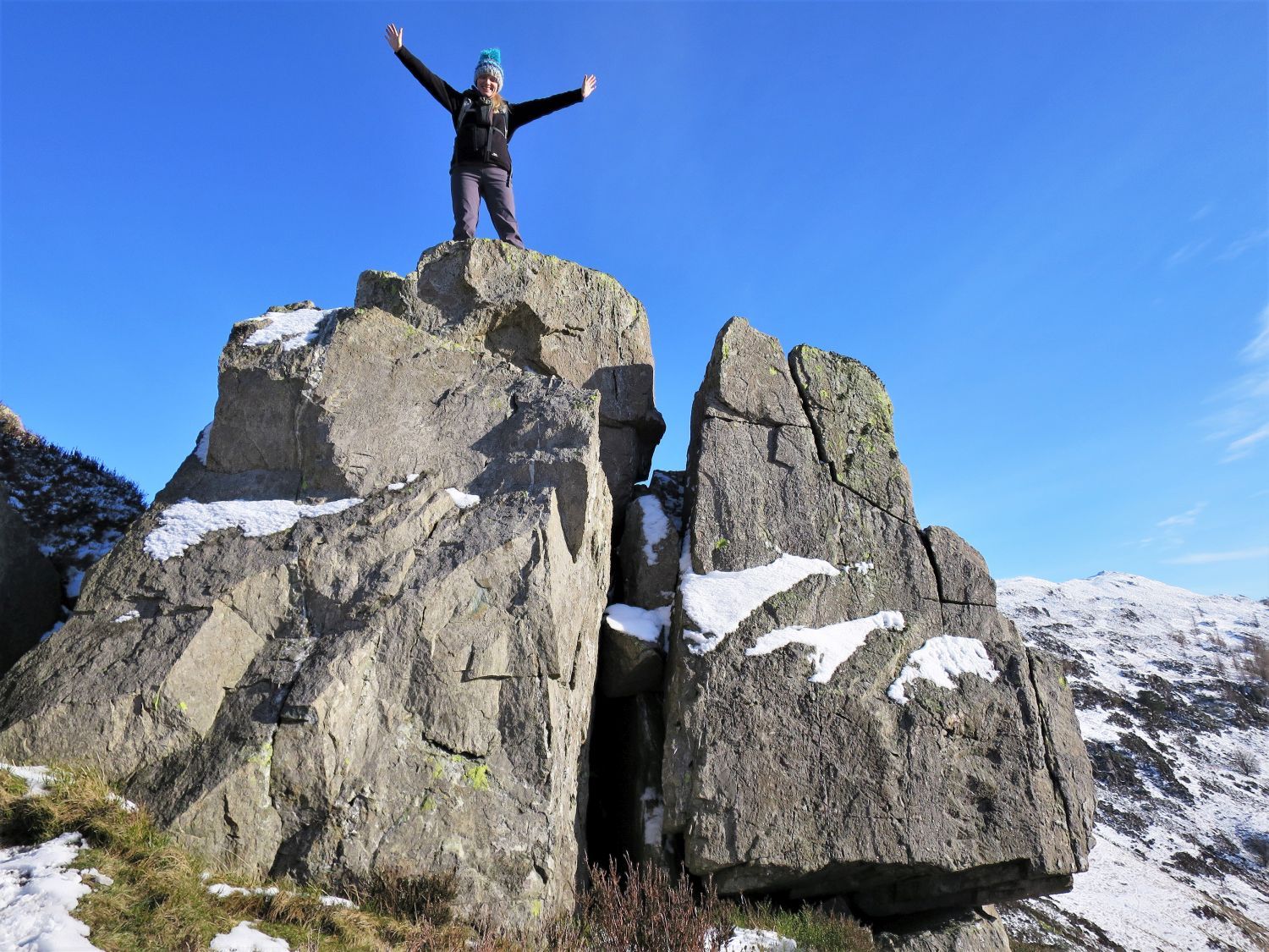 Jaclyn on the ‘split boulder’
A fantastic rock feature awaits any exploring fellwalker, and well worth the detour. The ‘split boulder’ is not distinguishable from the summit of Side Pike, which is probably the reason why it doesn’t get many visitors.
 Pike o’ Blisco, Crinkle Crags and Bowfell from the summit of Side Pike
Like from the upper and lower subsidiary tops, although much closer, the view from the summit of Side Pike is superb.
 Mickleden and the Langdale Pikes from the summit of Side Pike
“The rocky Side Pike (NY293054) is one of the most impressive of Lakeland’s subsidiary summits, and at 1188′ is not an insignificant height. More visitors to its summit than not would agree this is one of the finest viewpoints of the head of Great Langdale.” Lingmoor Fell 2
CH
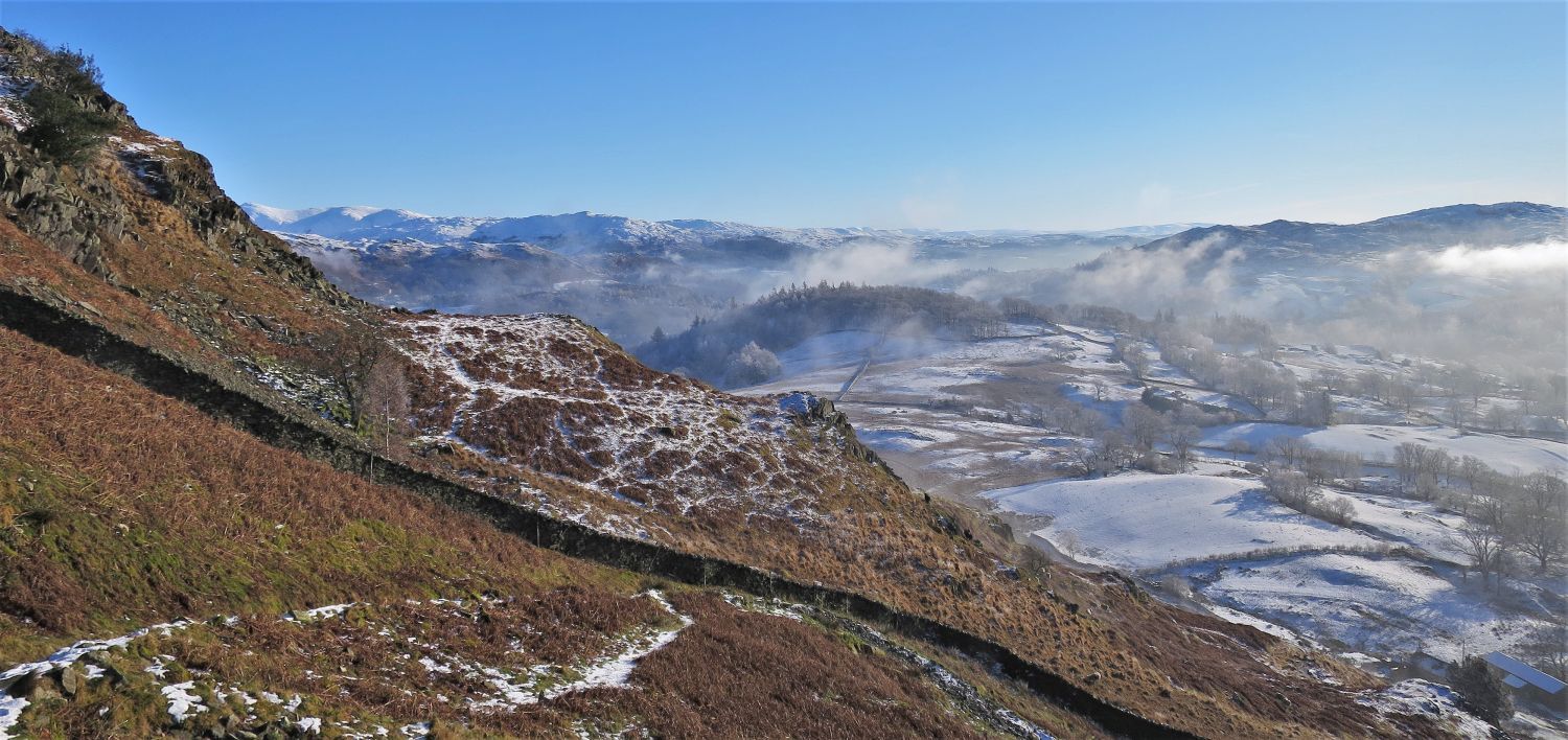
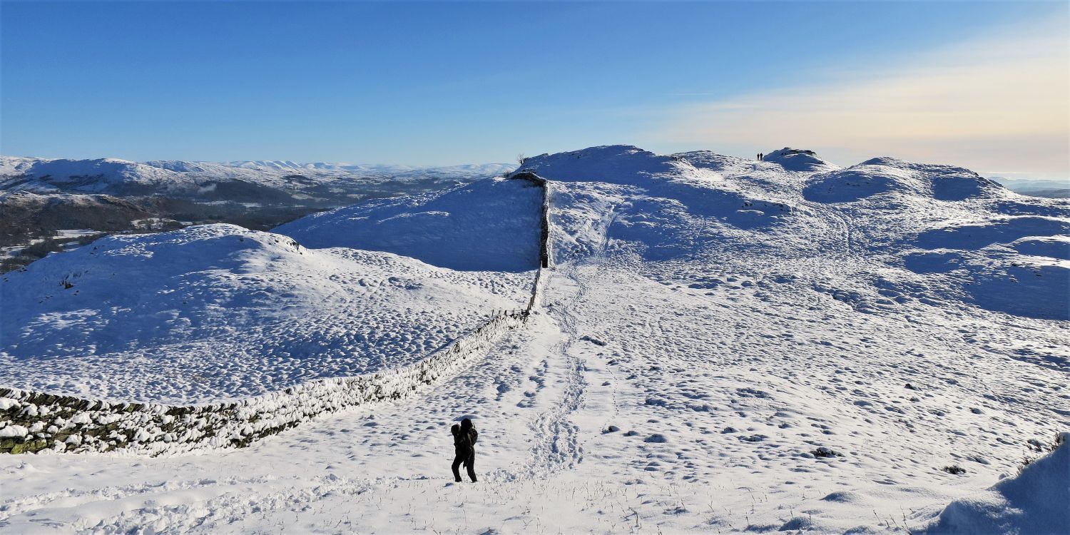
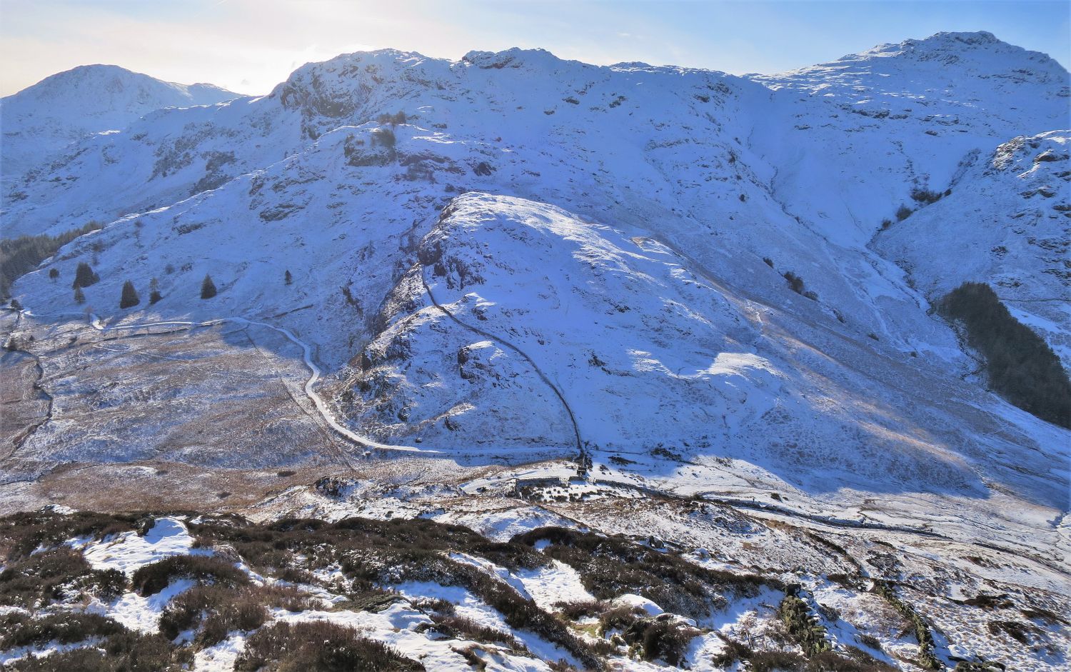
 Looking back towards Side Pike and the north-west ridge of Lingmoor Fell
This view looking back towards Side Pike shows the ‘split boulder’ on its southern face. The lower subsidiary top, which I personally regard as the best view point in Lakeland, can be seen on the north-west ridge behind Side Pike.
 Looking down to Sidegates Hause
The hause below is where the Side Gate road links the heads of Little and Great Langdale. Here, a short but steep descent to the hause, is followed by a level walk along a wide track to Blea Tarn; microspikes are essential!
 Mickleden from Sidegates Hause
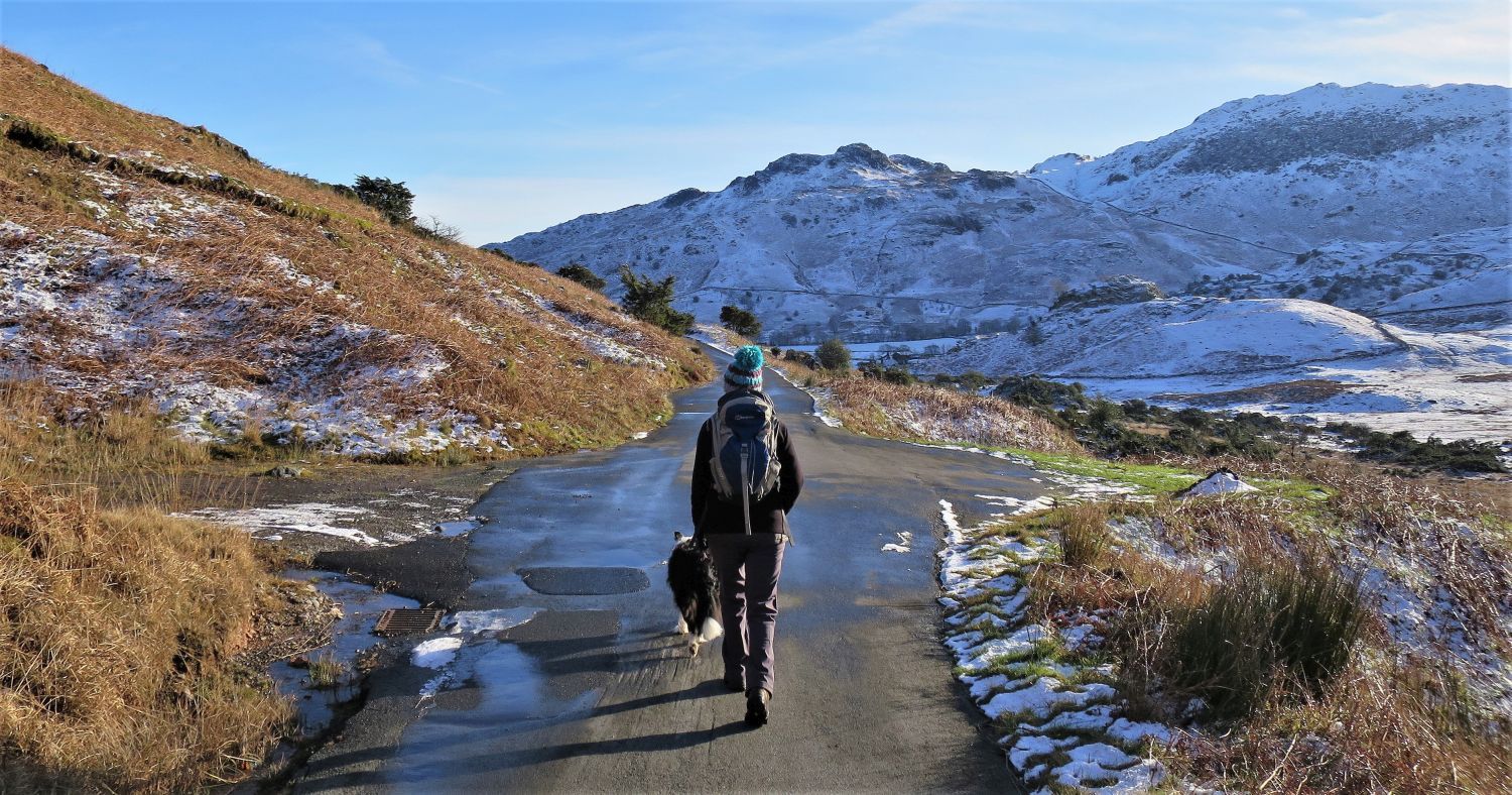
 Jaclyn and Frankie on the Blea Tarn track
 Looking back towards Side Pike
 Approaching the small plantation on the west shore of Blea Tarn
“Blea Tarn’s once well-wooded western shore is now denuded of many of its trees, although a fringe has been left by the water’s edge (including the pines that have graced many a thousand photographs). Once rhododendrons were rampant in this area, but now most of them have been cut down, leaving only the stumps. Larches and spruces are more recent additions to the scene.” Pike o’ Blisco 4
AW (updated by CJ)
 Footbridge over Bleamoss Beck
 The Langdale Pikes and Side Pike from Blea Tarn
One of the most photographed scenes in Lakeland.
 Following Side Gates road to Fell Foot
This short section of the Side Gates road skirts the western flank of Lingmoor Fell, so this time of year it can be very icy; please take care!
 Looking back to Fell Foot over the head of Little Langdale
“Fell Foot was once an inn, provided for the benefit of people crossing the passes of Wrynose and Hardknott. In 1958 it was acquired by the National Trust. Behind the house is a viking ‘thing mount’ or ‘ting mound’ where open air meetings took place more than a thousand years ago.” Pike o’ Blisco 4
CJ
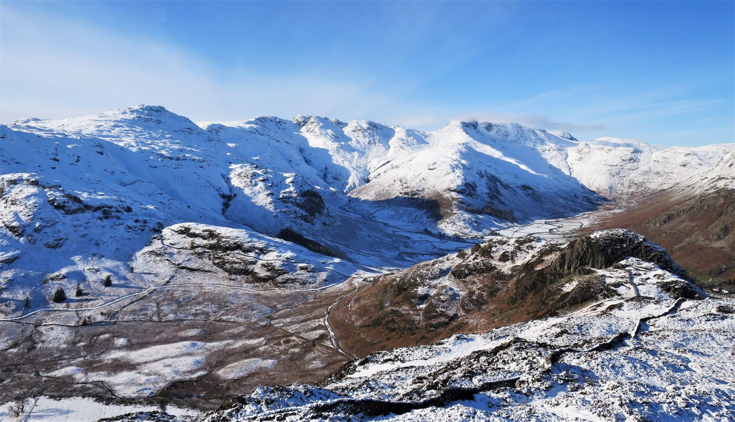
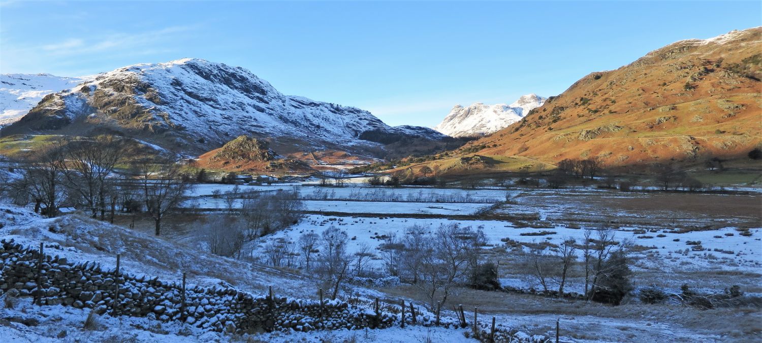
 The east ridge of Lingmoor Fell over Little Langdale Tarn
 Looking back towards Wrynose Pass from the Greenburn road
 Lingmoor Fell and Slater Bridge
Look, no people; I got lucky!
It’s impossible not to like this scene, and that’s why photographers from all over perch their tripods and wait patiently for the right light.
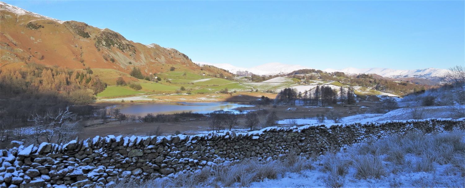
 Lingmoor Fell from Birk Howe
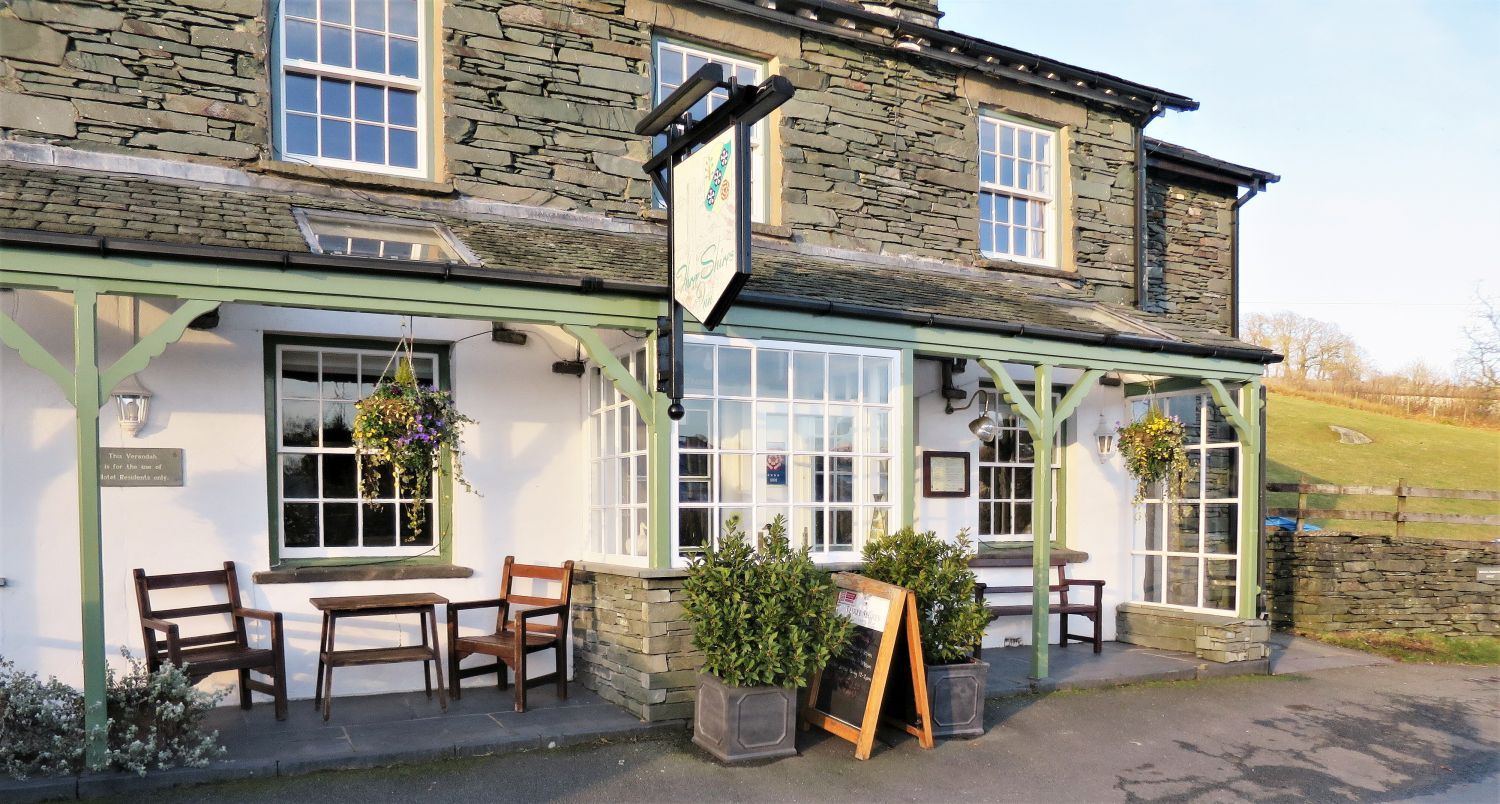 Three Shires Inn in the village of Little Langdale
Refreshment time!
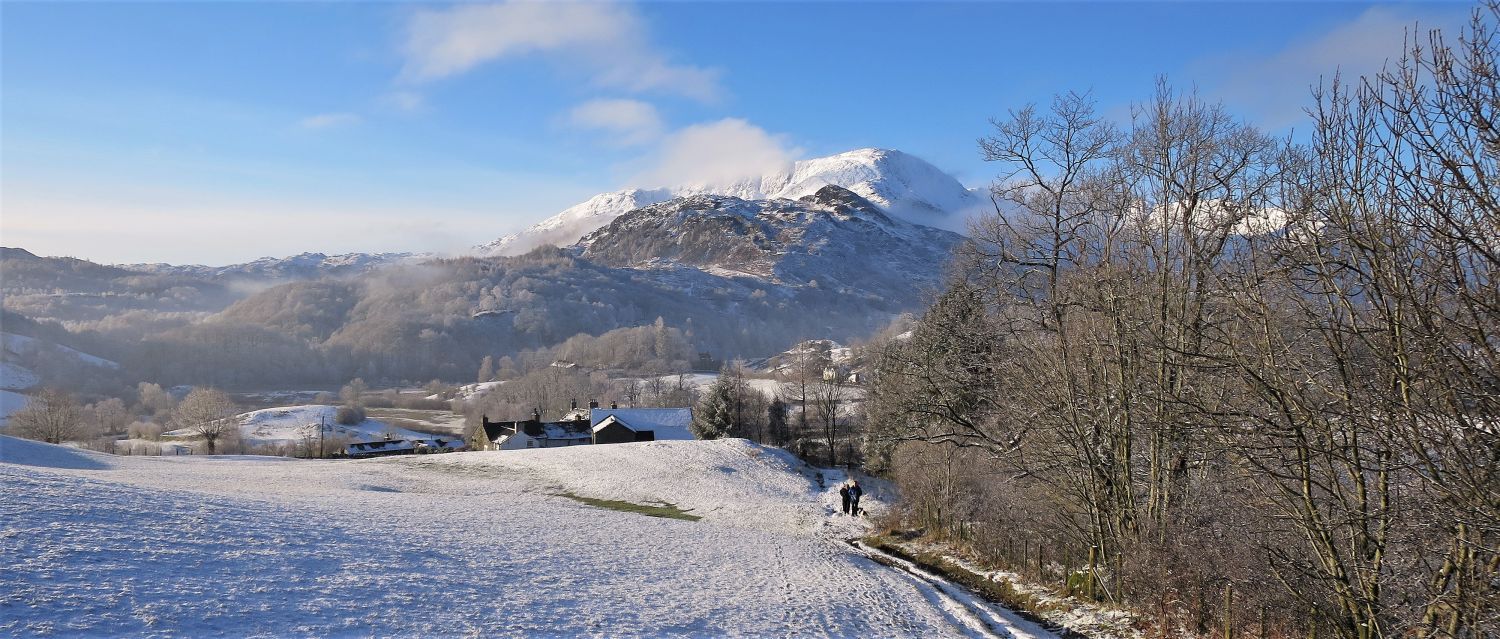
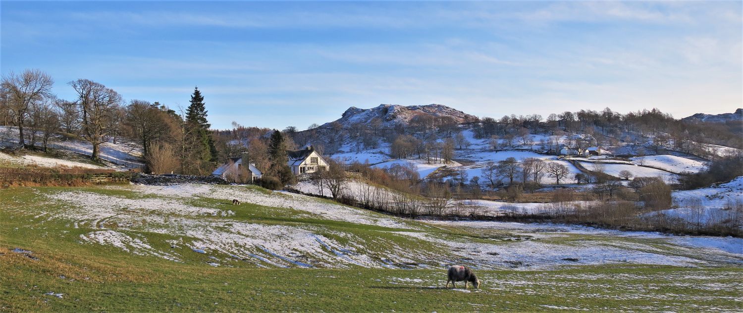 Great How from the approach to Greenbank
Thank you for visiting.
Richard Jennings