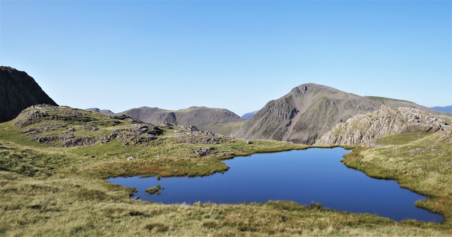
Alfred Wainwright describes Kirk Fell as “plain and unattractive”, and its crown “a rather disappointing ornamentation”, however, there are interesting features that warrant the inclusion of this fell in any Lakeland expedition. From the north, the grand buttresses of Kirkfell Crags do provide passage to the summit plateau, and the views all around from Kirk Fell’s twin tops are very rewarding. Lingmell’s grandest possession is the deep ravine of Piers Gill, but also, like Kirk Fell, both provide magnificent views of Great Gable. Linking these two fells is achieved by following two of the finest traverses in Lakeland: Great Gable’s south traverse, which is part of the Gable Girdle path, and the Corridor Route traversing below Great End and Broad Crag. Route 27 is an epic mountain walk, and there is interest throughout.
GPX Route: Download
PDF Maps: Download

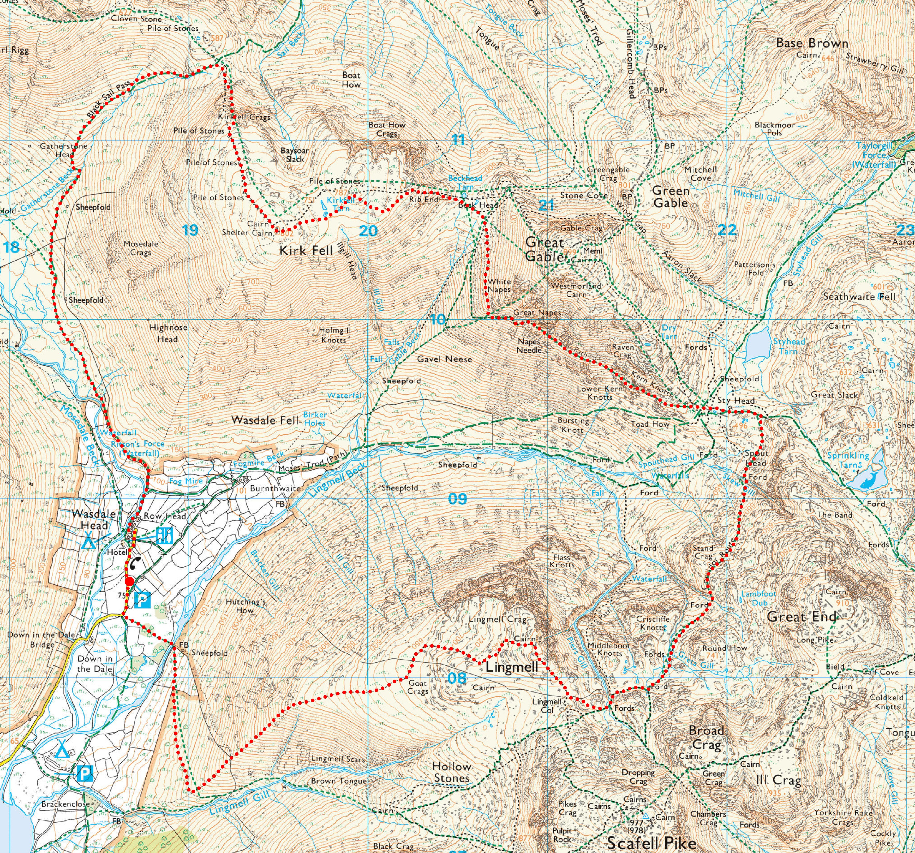
Wasdale Head > Mosedale > Gatherstone Head > Black Sail Pass > Kirkfell Crags > Kirk Fell > Rib End > Beck Head > Gable Girdle > Sty Head > Corridor Route > Lingmell > Wasdale Head
 The foot of Mosedale and Kirk Fell from Wasdale Head
Free parking is provided at the village green at Wasdale Head. There is also a National Trust pay-and-display car park at Lake Head. Postcode for Wasdale Head is: CA20 1EX.
As well as littering, grass verge parking is becoming one of the biggest problems here in Lakeland. The narrow roads, villages and car parks simply cannot cope with the rising numbers of visitors each year, and no more so than here in Wasdale. I have observed at times people parking along the verges when there are spaces at the nearby National Trust car park; at the time of writing, the cost of a National Trust membership is only £6.50 each month. This act is having an effect on the day-to-day lives of farmers and villagers, and of course access for emergency services. So please be prepared to arrive early to avoid disappointment, and if the car parks are full on arrival, it is maybe wise to have a plan B; an alternative walk that starts outside of the valley.
 The rise into Mosedale
A short climb over this rise is required to enter the valley of Mosedale. This tongue is part of Kirk Fell’s south shoulder, or ‘Nose’.
 Black Crag, Pillar and Pillar’s east ridge over Mosedale
The scenery in Mosedale is delightful, but also the valley is surprisingly very quiet; the hustle and bustle of people arriving at Wasdale Head to climb England’s highest mountain is soon forgotten once the rise into the valley is complete. It is no ‘hidden valley’, but few witness this peaceful beauty, whereas many trample the stony tracks of Scafell Pike.
“There are several Mosedales, and the best-known of them, and the best, is the one branching from Wasdale Head.” Red Pike 1
AW
 Looking back to the foot of Mosedale
Scafell just peaking over Lingmell’s west shoulder.
 Stirrup Crag, Dorehead Screes and Red Pike
 Black Crag, Pillar and Murl Rigg over Mosedale
 Looking across to Yewbarrow’s Stirrup Crag and Dorehead Screes
“At one time, Dore Head had the reputation of providing the best scree-run in the district on its northern side, descending to Mosedale, but generations of booted scree-runners have scraped the passage clean in places and left it dangerously slippery.” Yewbarrow 2
AW
 Looking across to Red Pike, Blackem Head and Black Crag
 The Black Sail path leading to Gatherstone Head
The knoll ahead provides a grand view of Yewbarrow and Mosedale.
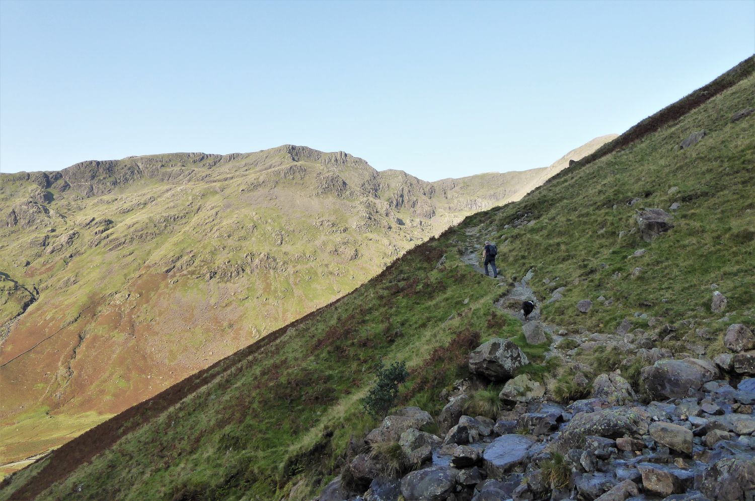 Red Pike from the crossing of Gatherstone Beck
 Looking back to Yewbarrow over Mosedale from the knoll
 Looking back to Yewbarrow and Red Pike from the Black Sail path
 Close the gate!
This old rusty gate was part of the 20 mile long parish boundary ‘Ennerdale Fence’, which once enclosed the valley of Ennerdale down both lengths and around its head.
 Looking back to Red Pike from the summit of Black Sail Pass
 Kirkfell Crags from the summit of Black Sail Pass
On the western end of the escarpment of Kirkfell Crags, three buttresses of dark intimidating rock are divided by two narrow gullies. The gully you see just left of centre, is our route of ascent, which includes some grade 1 scrambling. Please note that the usual and easier route, to ascend Kirk Fell from Black Sail Pass, is by following the line of old fence posts direct up and over the first crag; a cairn at the base of this crag marks this line of ascent.
 Jaclyn looking up towards the gully
After traversing around the base of the first buttress, follow this scree path up its left flank towards the intended gully. From here, the route ahead is clear.
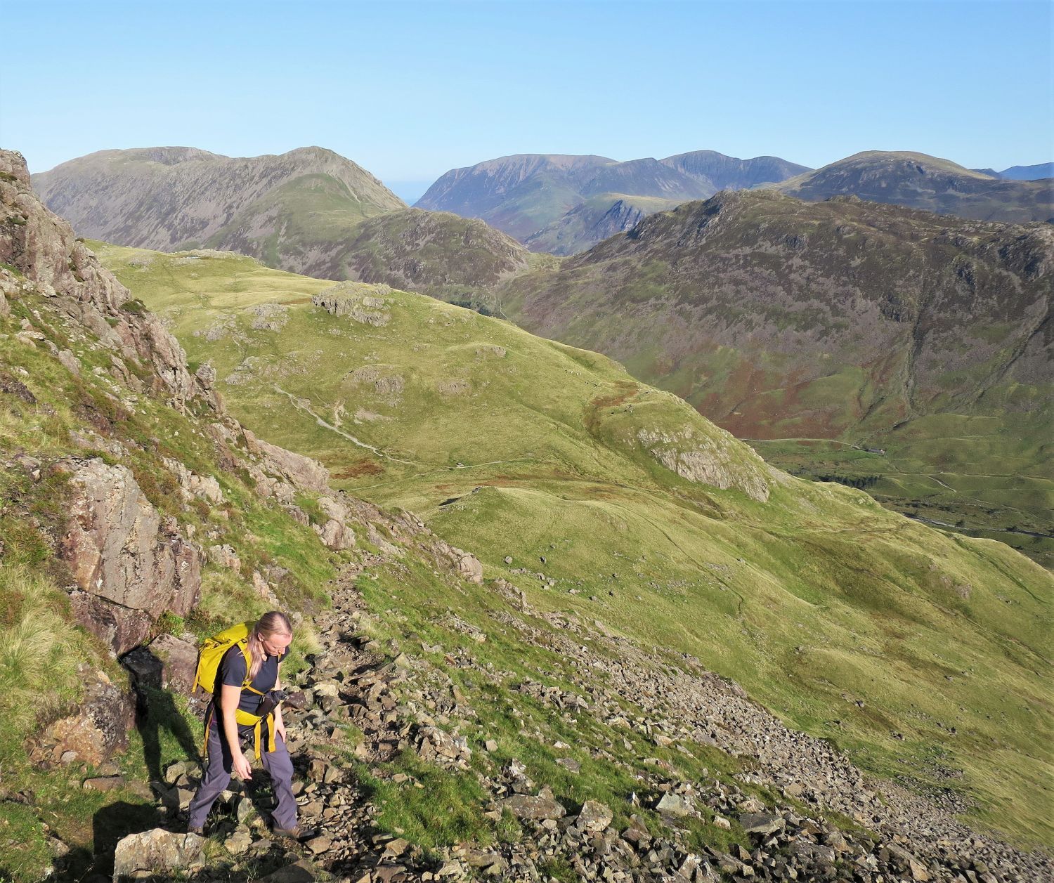 Looking down to Black Sail Pass from Kirkfell Crags
Further up the side of the buttress a path becomes more apparent.
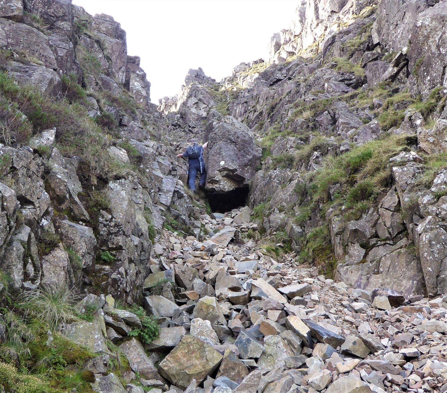 The chockstone in the gully
Once in the gully, a very large boulder can be seen blocking the way, however, there are two options to climb around it: to the left of the boulder, a steep narrow gap requires long legs and good knees, while on the right a series of rocky grass ledges provide a slightly easier route to negotiate the obstacle. The scree in the gully, above and below the chockstone, is steep and very unstable, so care is needed.
 Looking back to Haystacks over the River Liza in Ennerdale, from above the chockstone
The Ennerdale side of Haystacks dominates the view out of the gully. In the distance, the North Western Fells appear on the left, and far back Skiddaw is seen to the left of Fleetwith Pike and Hindscarth.
“Bland the southern aspect may be, but the dark north face is very different. Here, shadowed cliffs seam the upper slopes in a long escarpment, a playground for climbers, above rough declivities that go down to the Liza in Ennerdale.” Kirk Fell 2
AW
 The groove in the gully
Seen here on the right, the gully continues and becomes narrow, and another line of scree has to be negotiated before reaching the top. However, on the left, a steep narrow groove provides another but more adventurous route to the summit plateau. Please note that this route is a grade 1 scramble, and should only be climbed in dry conditions. The following climb is in three sections….
 Looking back to the gully from above the groove
The first section up the groove is complete, and now Jaclyn is on the mid section, a broad slope of rock and grass. The initial gully can be seen behind Jaclyn.
 Looking Stead from the head of the climb
Near the top, the last section requires a scramble up a narrow gully. Thankfully we have Frankie to keep an eye on our progress.
 High Stile, High Crag, Seat and Haystacks from above the climb
I think Jaclyn enjoyed that route!
 Red Pike, Scoat Fell, Black Crag and Pillar from the Ennerdale Fence
Any path leading towards the main summit is very sketchy, so just follow the old fence posts to its highest point.
 Book Seven
The Western Fells
Kirk Fell 6
“The Summit”
Scafell Pike and Scafell over Lingmell, from the summit of Kirk Fell.
“The Scafells look magnificent, and the path up to the Pike from Lingmell col is clearly seen.” Kirk Fell 7
AW
 Red Pike, Scoat Fell, Black Crag and Pillar from the summit of Kirk Fell
“Kirk Fell has two separate tops, the higher being at the head of the Wasdale slope in an area of stones. Here is the main cairn, which takes the form of a wind shelter,….”
 The High Stile Range and the North Western Fells from the summit of Kirk Fell
“….and there is a second wind shelter 30 yards further north.” Kirk Fell 6
AW (Revised by CH)
 The north-east summit over Kirk Fell Tarn, with Green Gable and Great Gable on the right
A small outcrop mounted with a cairn, 150 yards east of the main summit, provides this splendid view of the Gables.
 The north-east summit and Kirk Fell Tarn
Alfred Wainwright described the two tarns (named as one, Kirk Fell Tarn) as “unattractive”, however, William Heaton Cooper described them as “two small and lovely tarns among the mountain grasses.”
 Book Seven
The Western Fells
Kirk Fell 6
“The north east summit”
Pillar from the north-east summit of Kirk Fell.
 Book Seven
The Western Fells
Great Gable 3
“from the west”
Take a slight detour to join the escarpment path (see map), to witness this grand aspect of Great Gable’s west face. On the left is Gable Crag on the north face, and on the right is the Napes. Crossing below is the West Traverse, which we’ll be following from Beck Head.
“From the east and west the slender tapering of the summit as seen from the south is not in evidence, the top appearing as a massive square-cut dome.” Great Gable 3
AW
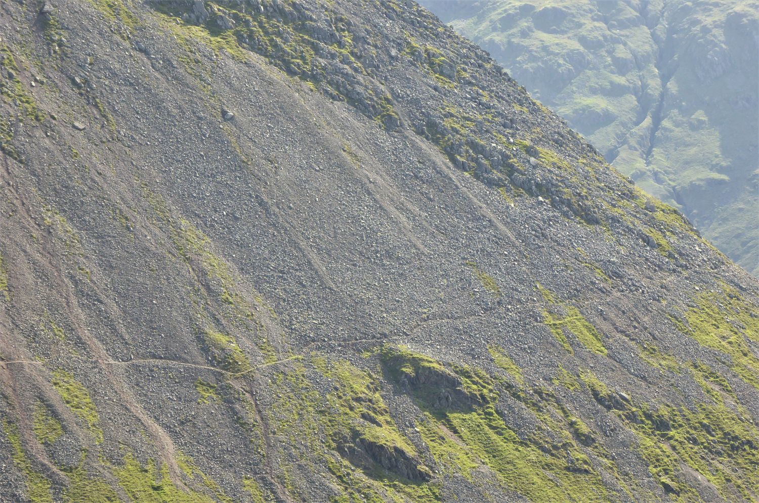 Great Gable’s West Traverse from Kirk Fell (zoomed in)
 Green Gable and Gable Crag from the descent of Rib End to Beck Head
 Looking back to Kirk Fell’s Rib End from Beck Head
 Wasdale from Great Gable’s West Traverse
Initially the West Traverse is a little tricky to locate from Beck Head, however, look ahead towards the scree slope and a route materializes.
“This is the finest mountain walk in the district that does not aim to reach a summit.” Great Gable 9
AW
 Looking back to Kirk Fell and Beck Head from the West Traverse
It was on a day during my early days of a fellwalker that I was walking along the West Traverse. I noticed a section of the route, about halfway along, the path became sketchy amongst large boulders and the route ahead was less obvious. I took the responsibility of constructing a large cairn on a boulder, in a location where it seemed obvious to have one. At the time I wasn’t 100% certain I was the right person to be going round constructing cairns, but I was certain it would benefit those venturing this way in bad weather. The cairn lasted for a decade or more, and could even be seen from Kirk Fell. It was sad however, to see that the cairn had now vanished; it seems I need to work more on my cairn-building skills! It was to my surprise, and only noticing this recently, that Wainwright had mentioned a “cairn on a boulder” on page Great Gable 10, in the first edition of Book Seven (c.1965), however, it wasn’t mentioned in Chris Jesty’s second edition (c.2008). So, it seems I may have picked the right location after all, and had accidently replaced a much older cairn that Wainwright had mentioned.
While on this expedition, because of limited time, Jaclyn and I could only build this small cairn to replace it, however, we plan to go back one day to build a sturdier one.
 Turning a corner
Jaclyn here is turning at a right angle around Gavel Neese (Gable Nose), and starts the long South Traverse. The scenery hereon is some of the finest in Lakeland.
“There are rough places to negotiate and nasty scree to cross and climb, but no dangers or difficulties. It is a doddle compared with, say, Jack’s Rake or even Lord’s Rake.” Great Gable 9
AW
 Great Napes over Little Hell Gate
Above are Eagle’s Nest Ridge and Needle Ridge appearing over the long rising Sphinx Ridge. Once the scree of Little Hell Gate is crossed, the South Traverse divides temporarily into two; in book seven of the Wainwright guides, Chris Jesty had appropriately illustrated this diversion (branch-path) on page ‘Great Gable 11’.
“Great Gable is a desert of stones. Vegetation is scanty, feeding few sheep. Petrified rivers of scree scar the southern slopes, from which stand out the bony ribs of the Napes ridges; the whole fell on this side is a sterile wilderness, dry and arid and dusty.” Great Gable 4
AW
 Looking up Little Hell Gate with the ‘rock island’ at the top
 Looking back to Kirk Fell from Little Hell Gate
 Wasdale and Yewbarrow from Little Hell Gate
 Great Napes from the lower south traverse on Sphinx Ridge
From left to right: Arrowhead Gully, Arrowhead Ridge, Eagle’s Nest Gully, Eagle’s Nest Ridge (centre), Needle Gully and Needle Ridge.
“Rock climbers have played a much greater part than walkers in the selection of identifying names for natural features. All the names of the Great Napes are attributable to those who carried out the first exploration of the crags. Fortunately their choice was always appropriate, descriptive, and often inspired.” Great Gable 11
AW
Napes Needle is difficult to spot against the complex rock structures of Great Napes; it is on the right, below the aptly named Needle Ridge. We are now on the lower path of the South Traverse; a walker can be seen on the upper South Traverse below Eagle’s Nest Ridge. The paths meet again below Napes Needle.
“The intervening ground is steep and rocky, especially in the vicinity of the Needle, and its exploration calls for care. The Needle is in full view from the Traverse but does not seem its usual self (as usually seen in illustrations) and on a dull day is not easily distinguished from its background of rock.” Great Gable 12
AW
 Looking back to Cat Rock on Sphinx Ridge
 Looking up to Eagle’s Nest Ridge, Needle Gully and Needle Ridge
A walker can be seen on the upper south traverse below Eagle’s Nest Ridge.
 Wasdale from below Napes Needle
 Looking back to Napes Needle
 Great End from the approach to Great Hell Gate
Walkers can be seen approaching the scree of Great Hell Gate, who’ve followed the south traverse from Sty Head.
 Looking up Great Hell Gate
Left of centre, Hell Gate Pillar peers around the buttress of Tophet Bastion.
 Great End, Ill Crag, Broad Crag, Scafell Pike and Lingmell from the south traverse
“This aspect of the Scafell range (well seen from Great Gable) is, in the author’s opinion, the finest mountain scene in Lakeland.” Scafell Pike 5
AW
 Book Seven
The Western Fells
Great Gable 13
“The Great Napes – Tophet Bastion”
Looking back to Tophet Bastion over Great Hell Gate. We’ve now passed the walkers who now continue their journey towards Great Napes.
 Great End from the approach to Kern Knotts
After leaving Great Napes another scree slope must be crossed to reach the crags of Kern Knotts. It is easy to go astray here, so keep looking ahead with Skew Gill in line with the base of first large ‘knott’.
 Book Seven
The Western Fells
Great Gable 10
“The water-hole”
Just around the corner of the first crag, the ‘water-hole’ is easily missed. There is enough room inside for two people, and there’s no better place in Lakeland to taste mountain water. A small trickle from the upper cavities, even during the driest of months, is enough to replenish the water bottles. It’s remarkable, with the exception of Styhead Tarn and Arron Slack, that the three miles of the Gable Girdle path has no other water source.
 Looking out of the ‘water-hole’
 Great End and Skew Gill from Kern Knotts
“Huge boulders to be negotiated along the base of the crag. A simpler variation passes below these boulders (good shelter here)….” Great Gable 10
AW
 The Mountain Rescue stretcher box at Sty Head
“Once upon a time Sty Head was a simple pass between Wasdale and Borrowdale, providing also a link with Great Langdale; the two routes served the dalesmen sufficiently and no others were needed in the vicinity to carry them about their business. Then, a century ago, came the first walkers, in occasional twos and threes, hesitant to venture into this wild place; and later, in greater numbers, with growing confidence and much more often – for Sty Head became known as a convenient springboard for excursions into the surrounding mountains.” Great End 5
AW
 Looking back to Green Gable and Base Brown over Styhead Tarn
 Looking back to Great Gable and Green Gable from the Corridor Route
 Lingmell Crag over Piers Gill and Greta Gill, from the Corridor Route
There’s no denying that this view is one the most dramatic scenes of Lakeland.
 The Corridor Route from the ‘bad step’
Top right, the Corridor Route rises slightly as it traverses below Round How.
 Looking back to Kirk Fell and Great Gable from the ‘bad step’
Many who walk the Corridor Route will recognise this scramble above Stand Crag. If returning back to Sty Head in mist, it is easy to go astray here; the cairn above is not seen, and many tired walkers head down towards Wasdale by mistake. Arrows have been scratched onto the rocks to point the way.
 Yewbarrow, Red Pike, Scoat Fell and Kirk Fell from Greta Gill
 Jaclyn and Frankie approaching Greta Gill
 Kirk Fell and Great Gable from Middleboot Knotts Tarn
A most wonderful Lakeland Tarn.
 Book Four
The Southern Fells
Lingmell 9
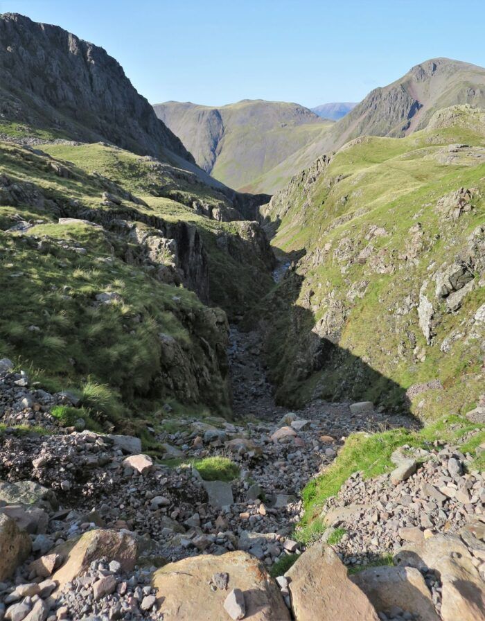
“Piers Gill”
Lingmell Crag, Kirk Fell and Great Gable from Piers Gill.
 Lingmell Col and Lingmell
From the crossing of Piers Gill, leave the Corridor Route and take this shortcut towards the ‘old wall’ and Lingmell Col.
“Eastwards, a high saddle connects the fell with Scafell Pike, but on other sides steep slopes descend abruptly from the wide top.” Lingmell 2
AW
 Looking back to Broad Crag, Broad Crag Col and Dropping Crag
 Book Four
The Southern Fells
Lingmell 2
“summit arete”
Looking down to Piers Gill, with Styhead Tarn above.
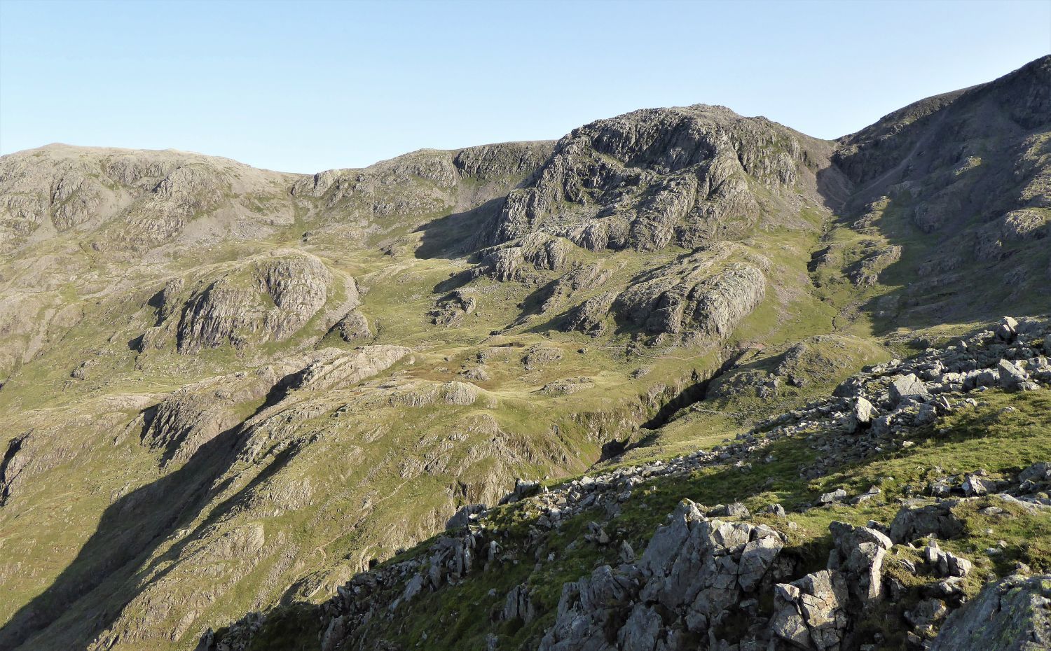 Looking back to Great End and Broad Crag
The head of Piers Gill seen on the right.
 Great Gable from above Lingmell Crag
“The summit area is stony, but not too stony to hamper progress unduly, and a short exploration along the top of the cliff northwards earns a reward of magnificent views.” Lingmell 7
AW
 Book Four
The Southern Fells
Lingmell 7
“The Summit”
“Summit cairns are welcome sights, but they are seldom objects of beauty or admiration. Here, however, on the highest point of Lingmell, was one of singular elegance, a graceful ten-foot spire that quite put to shame the squat and inartistic edifice crowning the neighbouring very superior Scafell Pike. The cairn illustrated has been replaced by one much broader, but just as well built,….” Lingmell 7
AW (Revised by CJ)
 Kirk Fell, Beck Head and Great Gable from Lingmell
We now leave the summit and head down to Wasdale via Lingmell’s west shoulder. It is very steep, and tired knees will hurt.
“The shoulder route is a quick and easy way down, with excellent views….”
 Mosedale and Wasdale Head from Lingmell’s west shoulder
“right….”
 Scafell Pike, Mickledore and Scafell from Lingmell’s west shoulder
“left….”
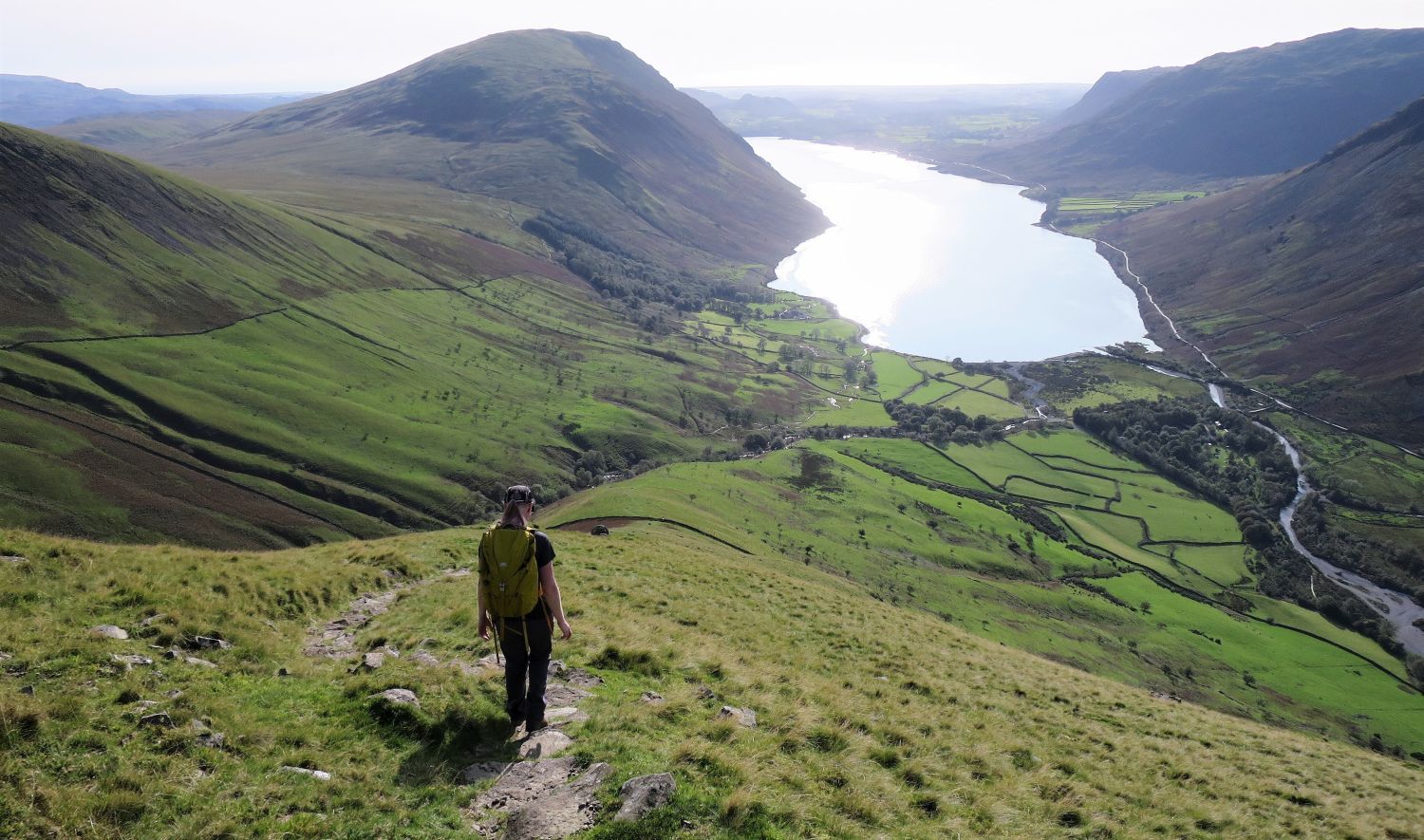 Illgill Head and Wast Water
“and centre, and much better than the longer alternative via Lingmell Col and the Brown Tongue path.” Lingmell 7
AW
 Pillar and Kirk Fell from the approach to Wasdale Head
Thank you for visiting.
Richard
<<>>
Thanks, sources and further reading:
‘Book Four – The Southern Fells’ by Alfred Wainwright
‘Book Seven – The Western Fells’ by Alfred Wainwright
‘The Tarns of Lakeland’ by William Heaton Cooper

