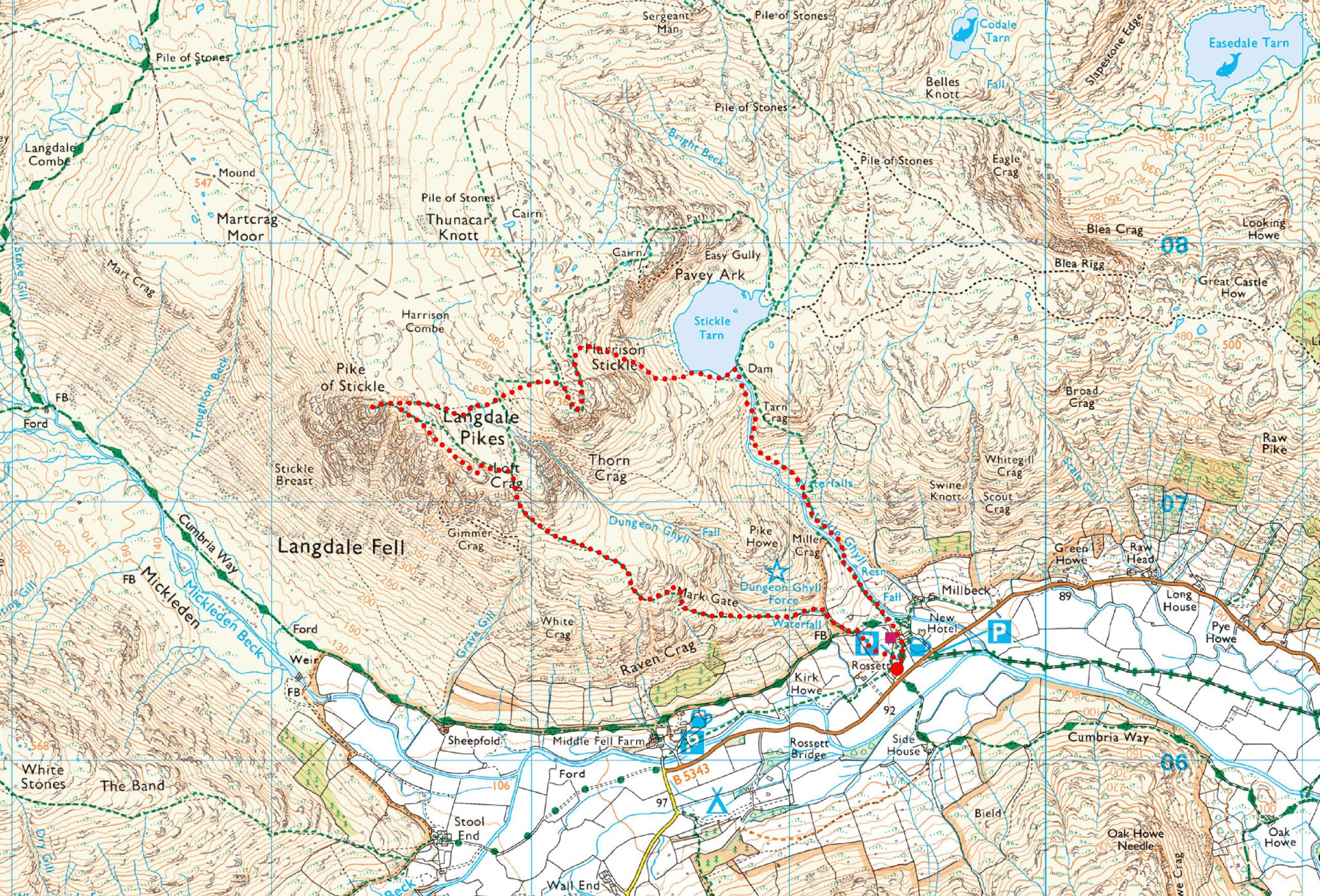
A classic Langdale walk that features three Wainwrights, spectacular views, and wonderful waterfalls. If anyone asks me, either in person or on social media, which is the best walk in the Langdale area that isn’t too long but is very rewarding in scenery, then this route is the one I would recommend. It can, however, be extended to include Pavey Ark and Thunacar Knott, or even Sergeant Man, but let’s save that for another day. After all, Great Langdale deserves more than one visit from any explorer of the Lakeland Fells.
Although this walk includes a mountain camp, the route itself is designed as a day walk.
Richard
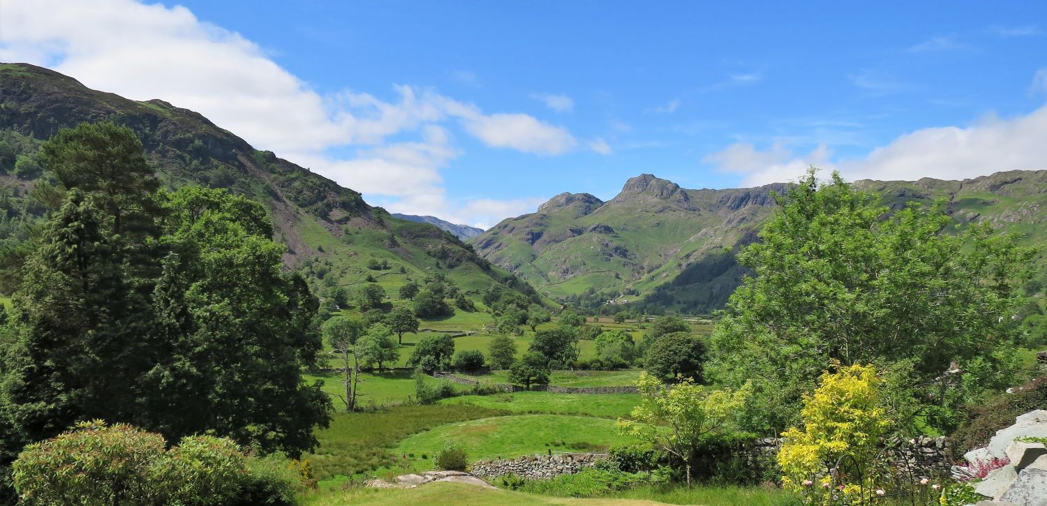
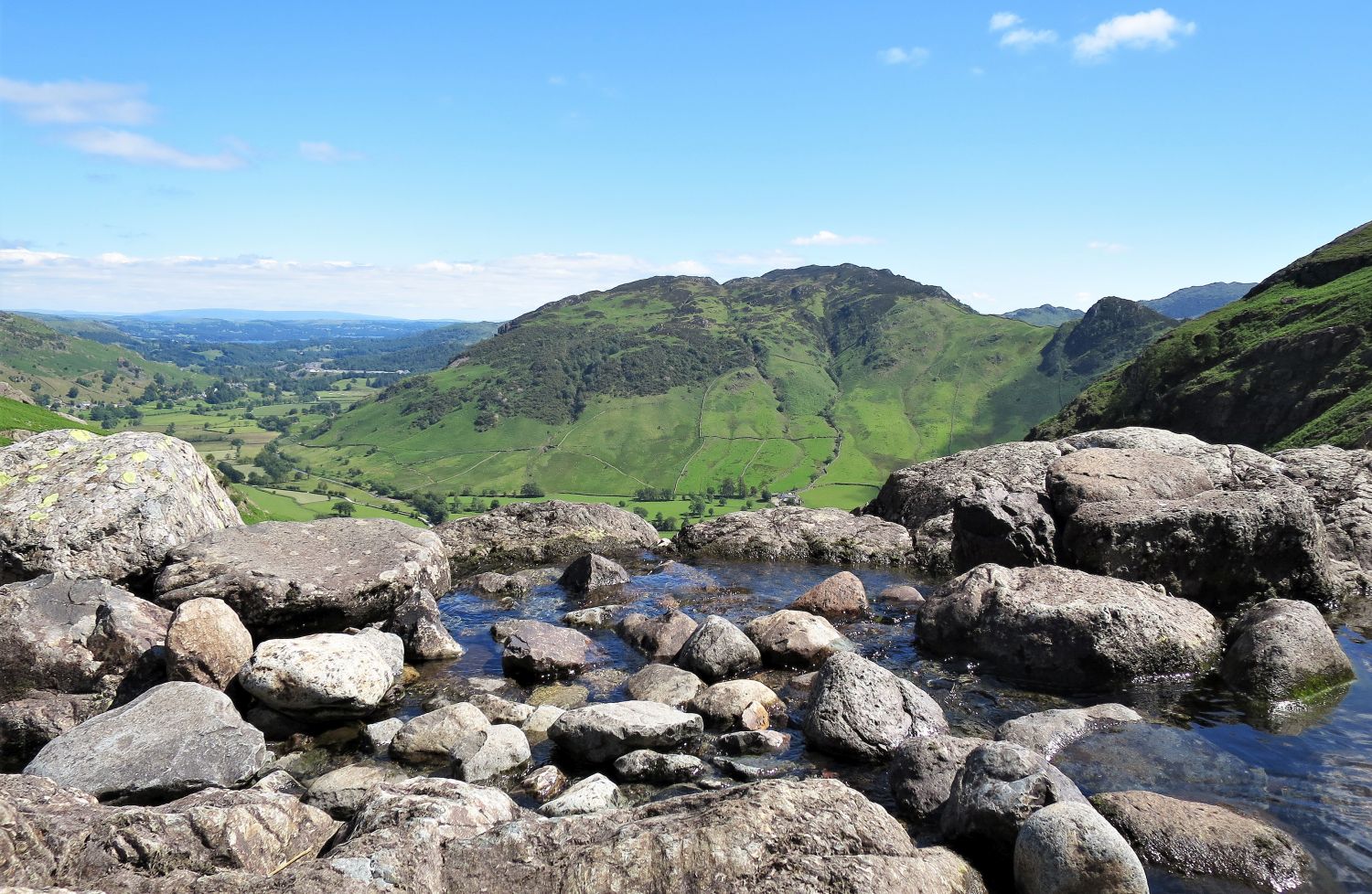
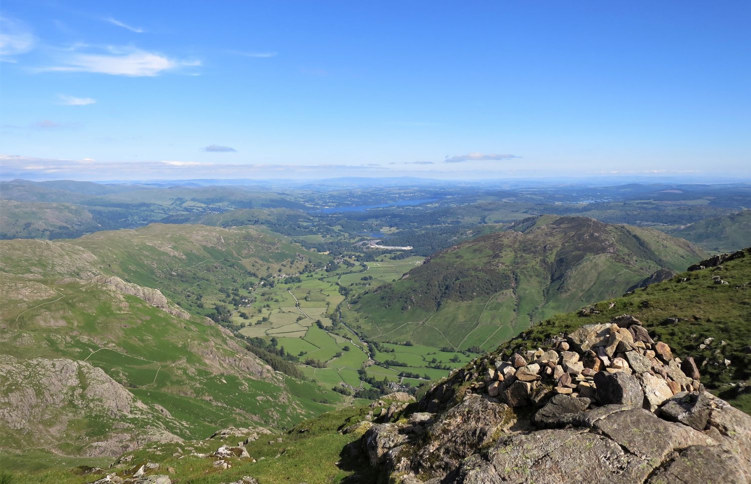
When driving along the Langdale road from Ambleside, the towering peaks of the Langdale Pikes dominate the backdrop. It is a lovely approach, leaving a long-lasting memory of the valley.
“No mountain profile in Lakeland arrests and excites the attention more than that of the Langdale Pikes, and no mountain group better illustrates the dramatic appeal of a sudden rising of the vertical from the horizontal; the full height from valley to summit is revealed at a glance in one simple abrupt upsurge to all travellers on the distant shore of Windermere and, more intimately, on the beautiful approach along Great Langdale.” Harrison Stickle 2
AW
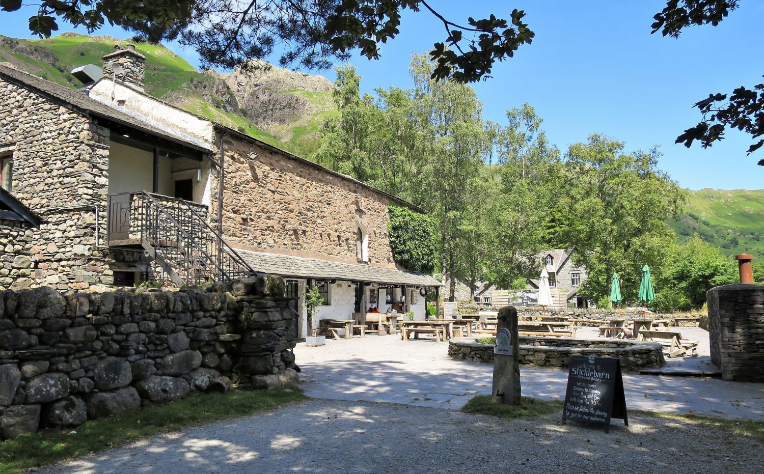
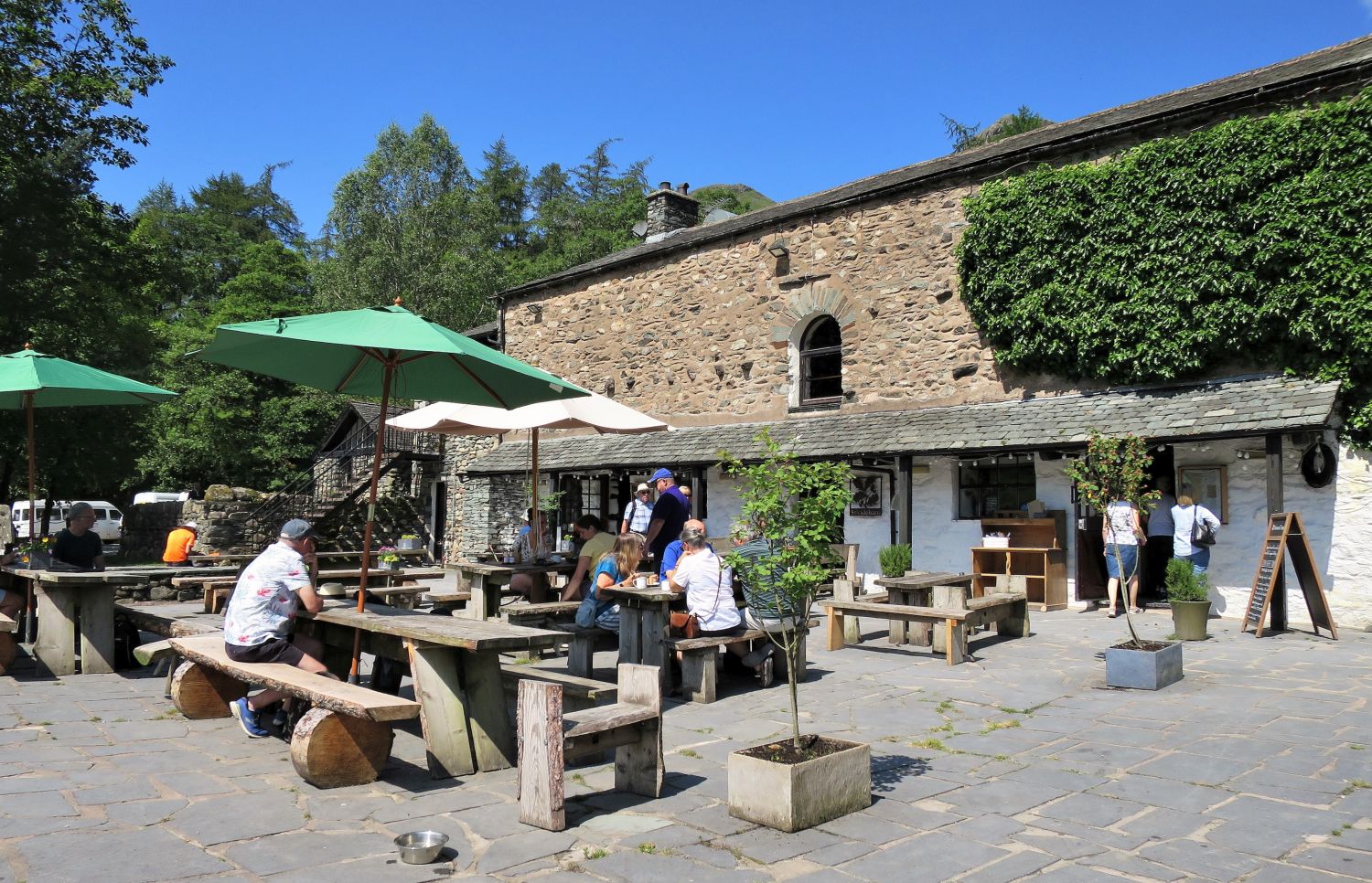
Once part of the complex of buildings connected with Millbeck Farm, Stickle Barn is now a popular base for the Langdale Pikes. Nearby are two car parks: the National Trust car park, which also owns Stickle Barn, and the LDNP car park across the road. Please note: if you wish to do a mountain camp up on the fells, you can pay to leave your car overnight at the NT car park. There is also a great bus service (516) from Ambleside — the bus stop is located near the New Dungeon Ghyll Hotel.
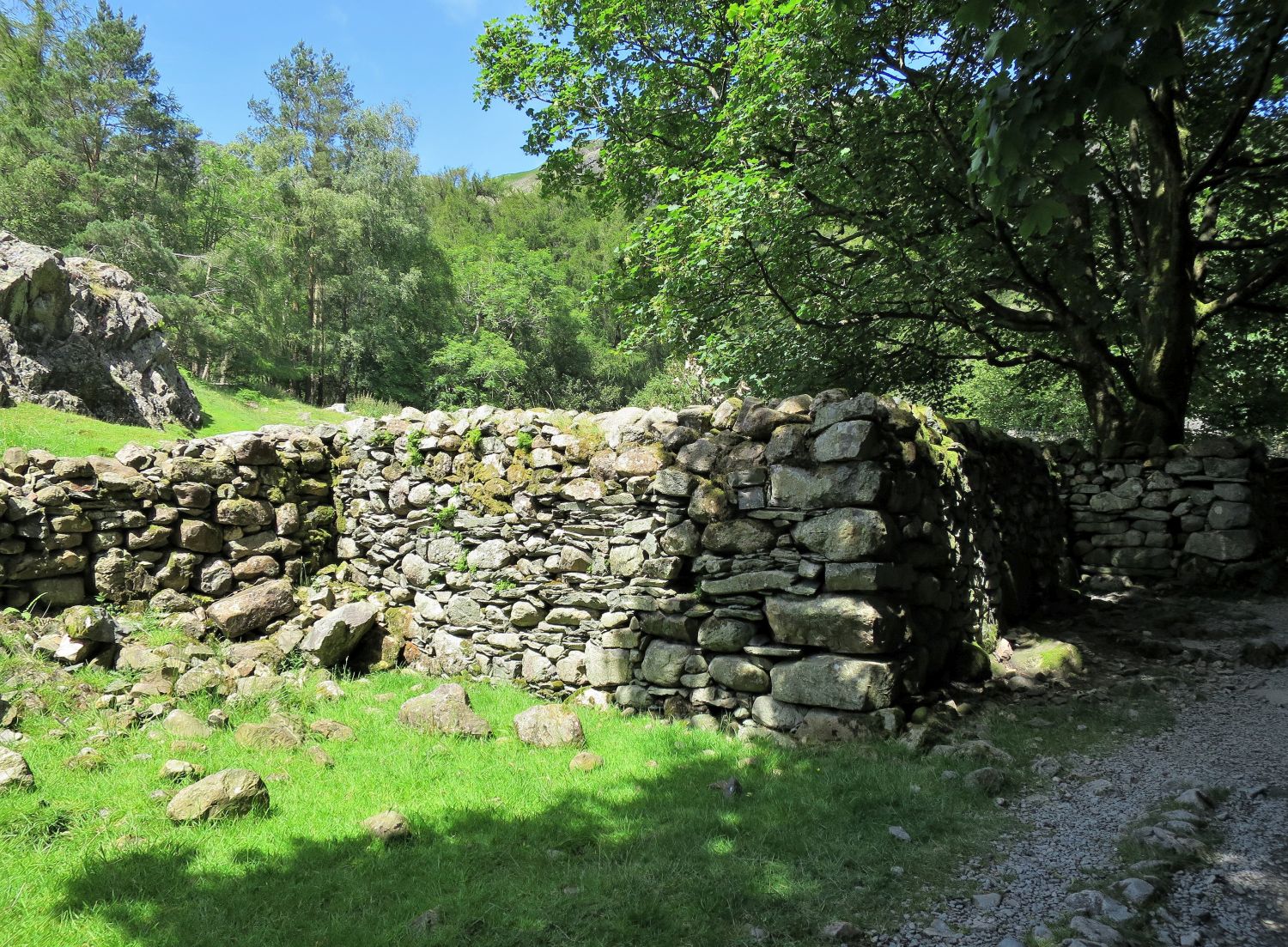
Just after leaving Stickle Barn, through the gate on the Stickle Ghyll path, note what looks to be the remains and foundations of a barn. In fact, it was once a fulling mill, built here in 1453 to clean and felt wool, and was formerly part of the Millbeck Farm complex; hence the name “Mill Beck”. The mill was powered by a water wheel, using water diverted from Mill Gill (now Stickle Ghyll). A well-defined rock-cut and channels can still be seen to the left of the Stickle Ghyll path. It is also believed that there was a corn mill located at what remains of Millbeck Farm today.
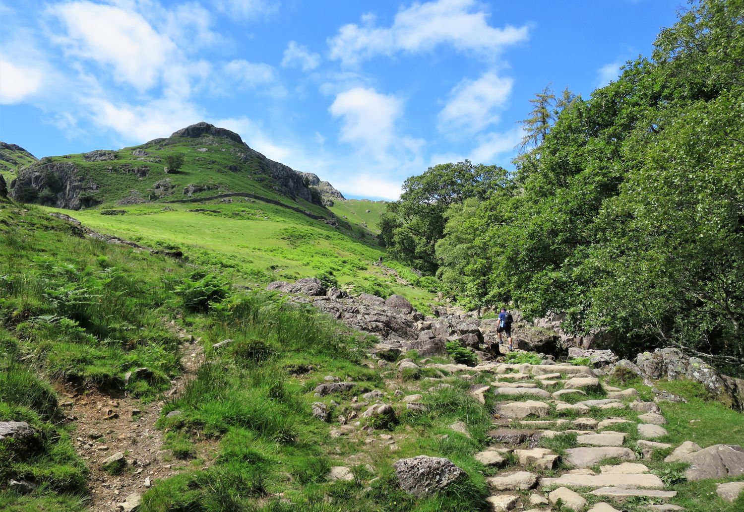
The name “Mill Gill” was eventually replaced by Stickle Ghyll, probably around the early 1800s, but the former is still preferred by some people. “Miller Crag”, however, still survives on the maps of today and reminds us of the connection with the mills and the history of this area in Great Langdale. On a personal note, I find it quite sad and confusing as a result of the name changes; for example, where does this walk start from? Stickle Barn or New Dungeon Ghyll Hotel? Neither seems appropriate, do they? The whole area at the foot of the gill was called “Millbeck”, but sadly this name is lost to time.
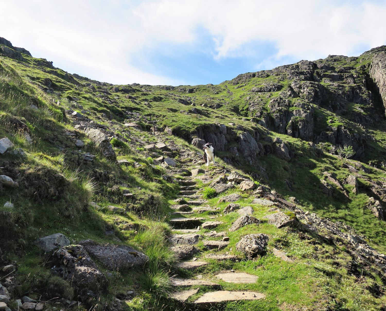
An enormous amount of work has been carried out over the years repairing the Stickle Ghyll path, with the majority of the route constructed by stone pitching…
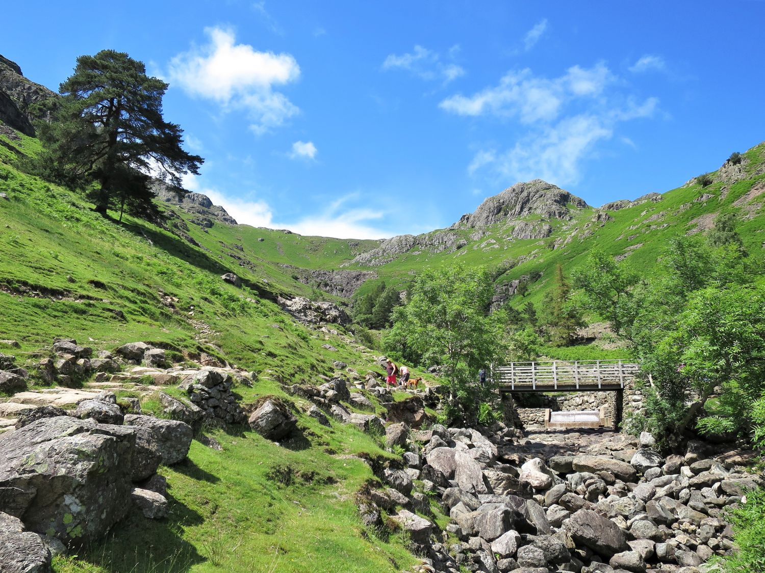
…At the footbridge, you will see the Stickle Ghyll hydro-electric scheme, which is part of the National Trust’s plan to become a greener organisation.
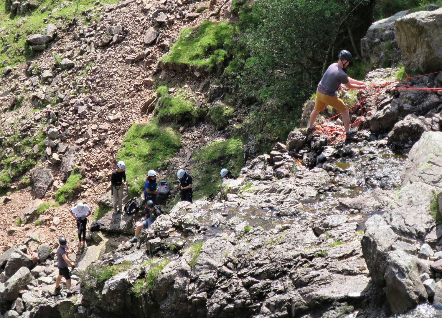
Stickle Ghyll is a very popular destination for gill scrambling, roped waterfall climbs, and deep pool jumping. Groups of schoolchildren are often seen being guided along the many obstacles and delights in this wonderful ravine.
A great place to stop and sit for some lunch, isn’t it? It’s worth noting that the whole length of the ravine is a notorious suntrap, and as a result, progress can be slow in the summer months, especially when carrying a heavy pack like I am on this visit.
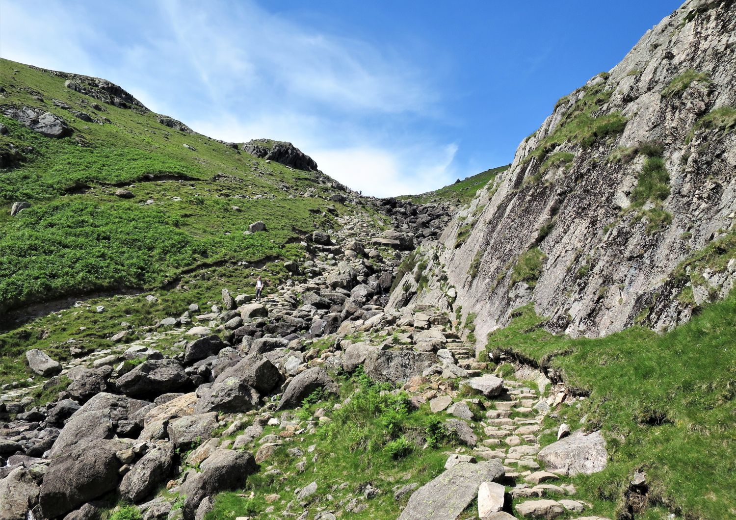
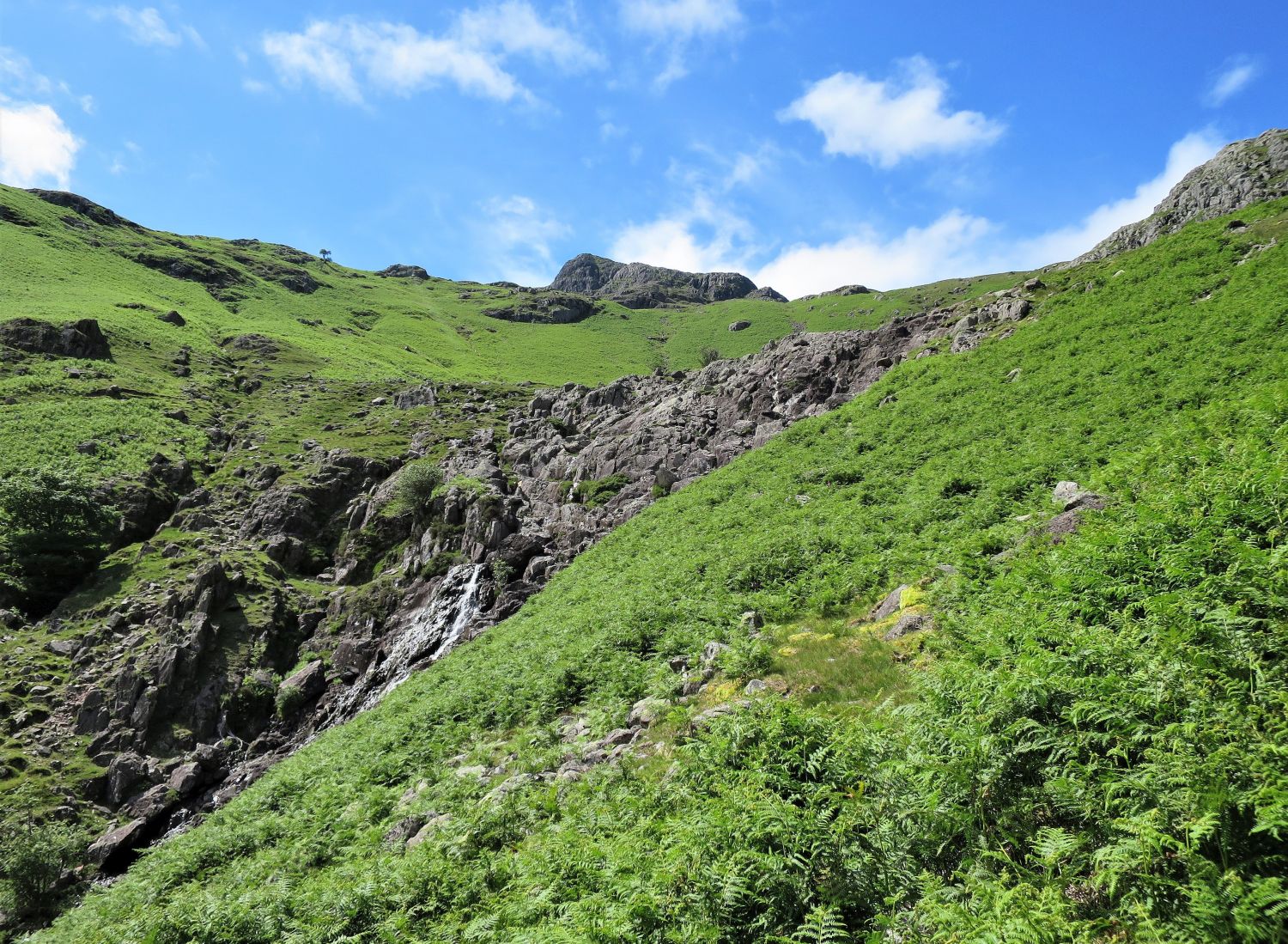
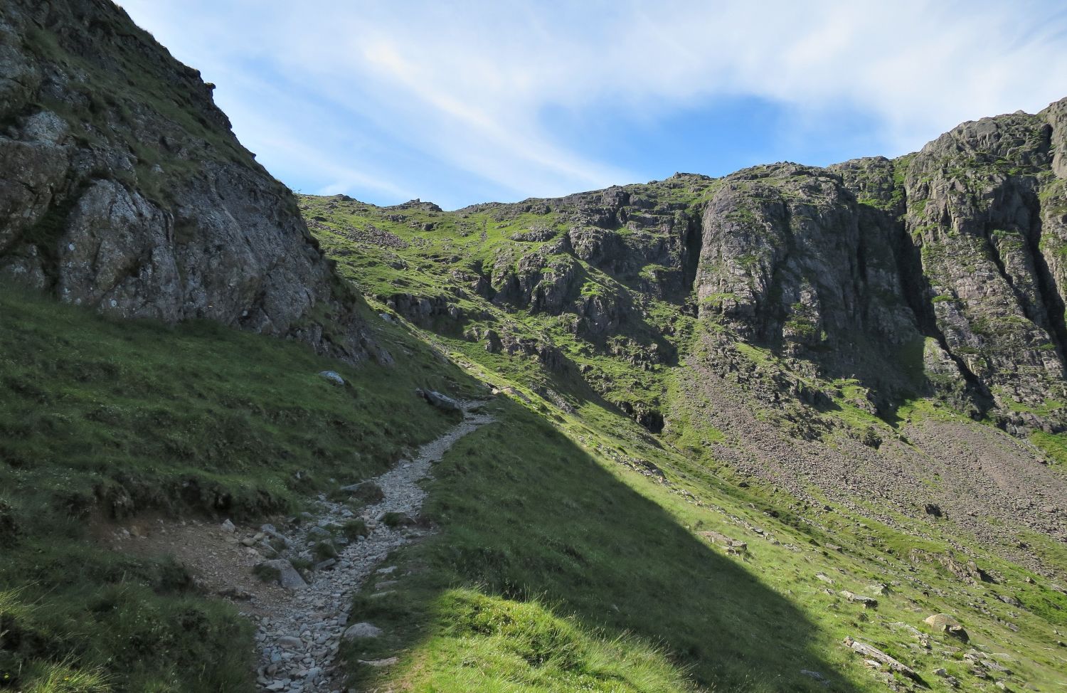
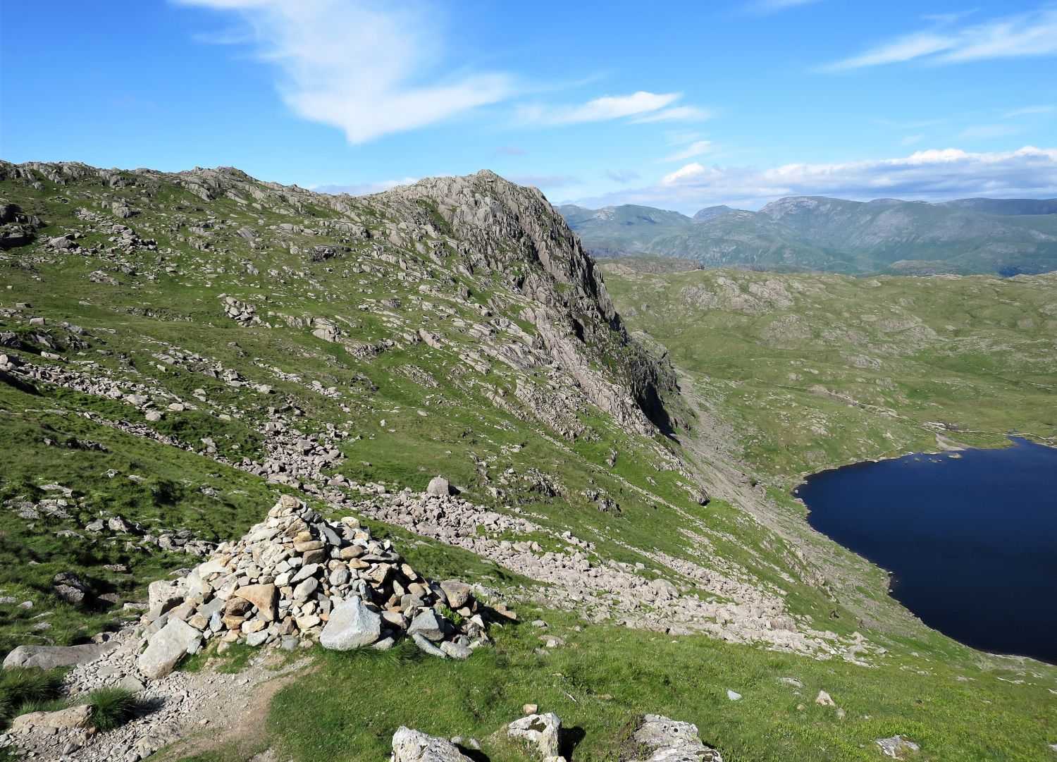
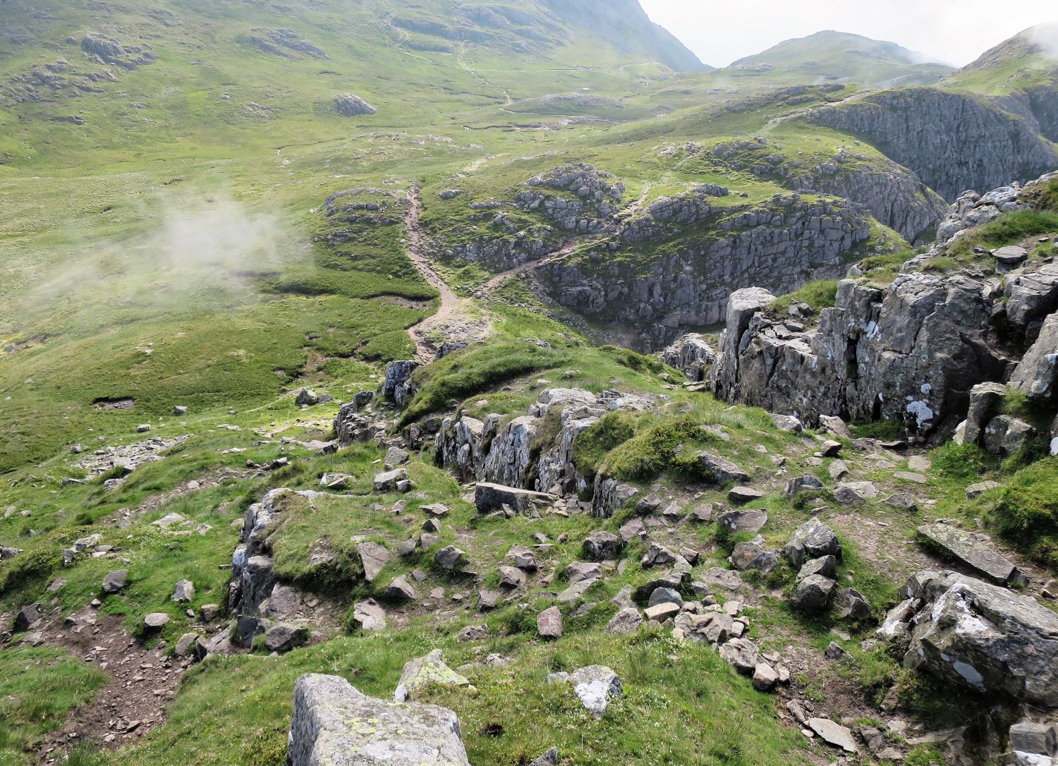
We’ve now arrived at the base of Tarn Crag, and where we cross to the western side of the ravine. Light scrambling is required on the last section before reaching Stickle Tarn.
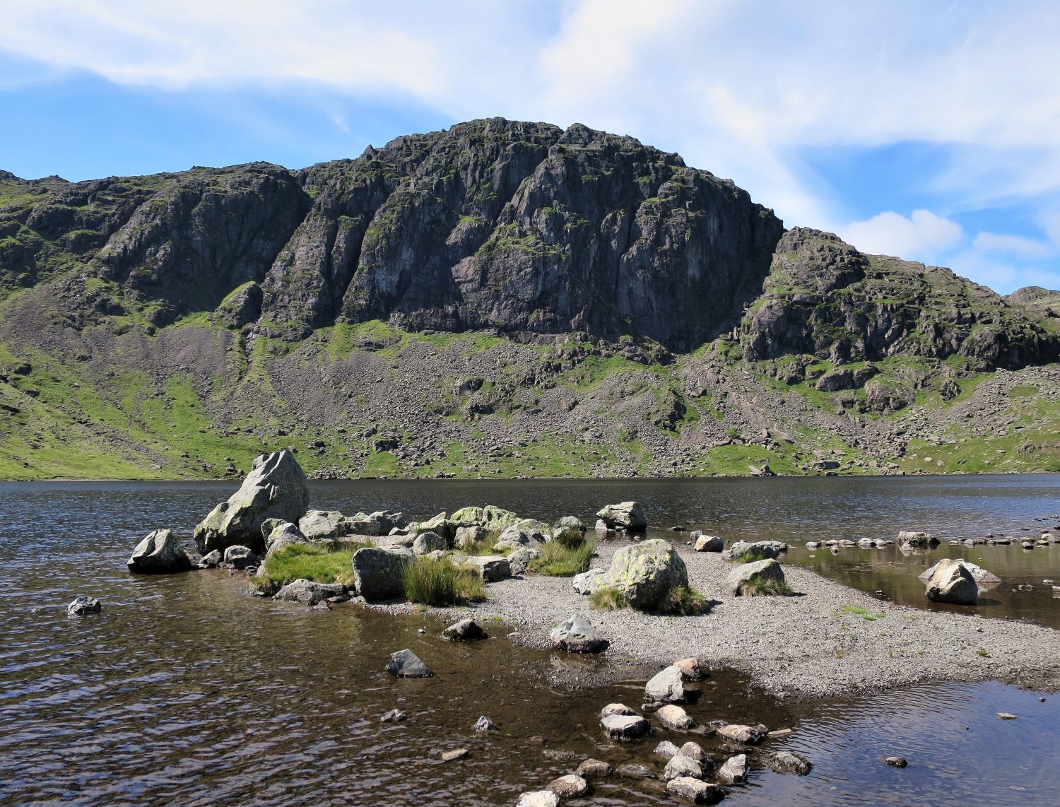
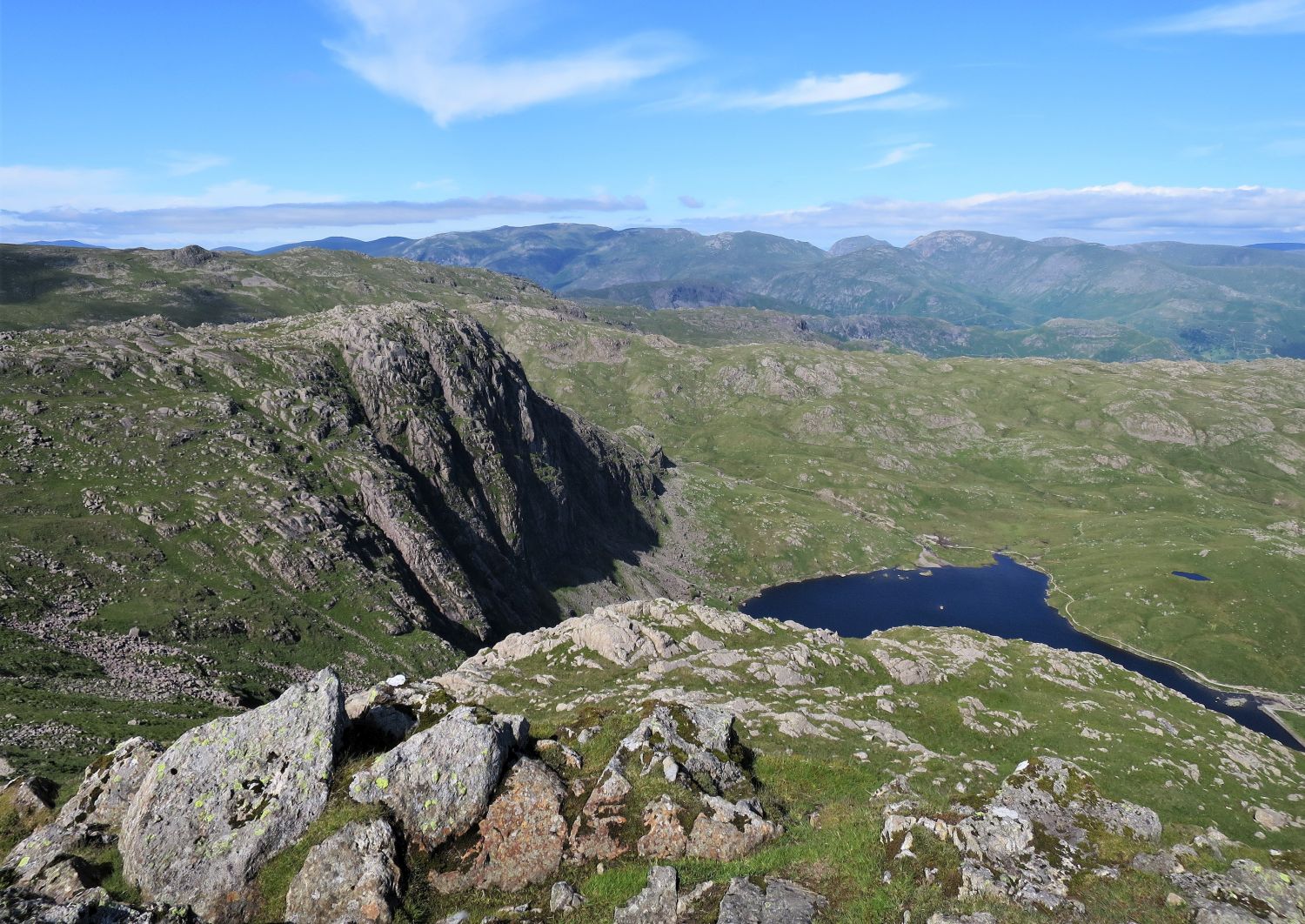
The mighty cliff and gullies of Pavey Ark dominate the scene on arrival at Stickle Tarn.
“The highlight of this route is the impressive view of Pavey Ark, one of the finest scenes in Lakeland” Harrison Stickle 10
AW
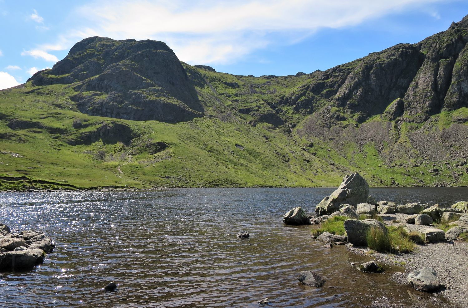
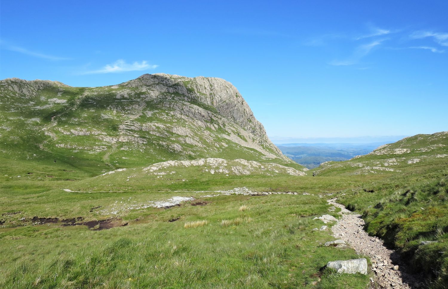
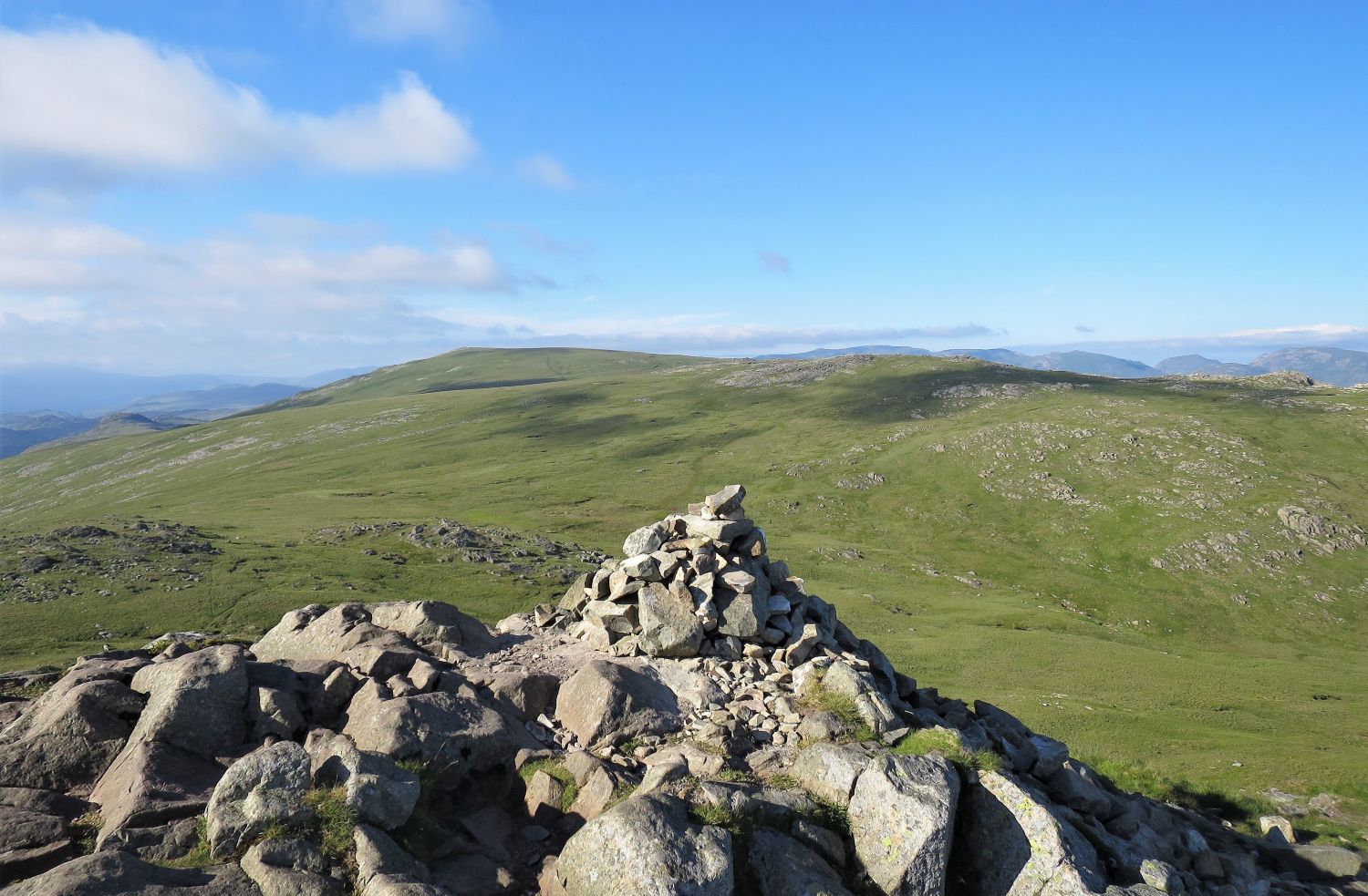
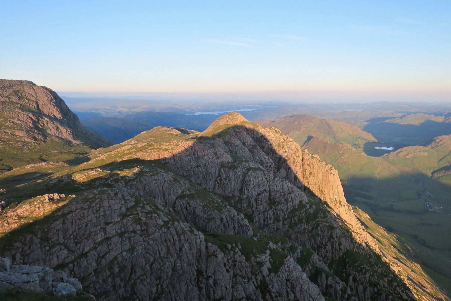
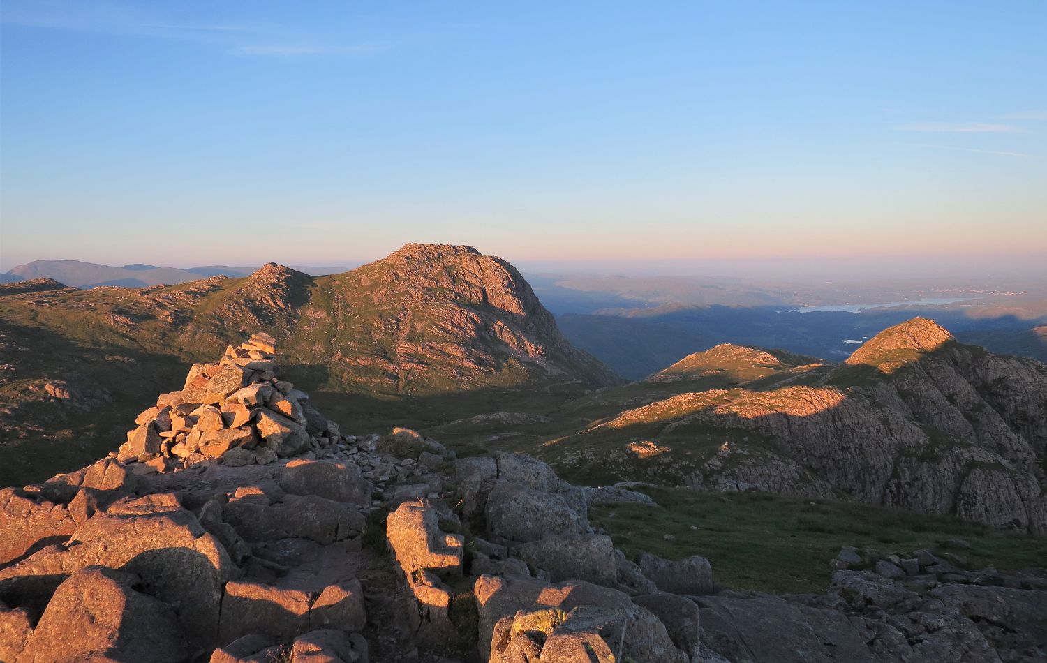
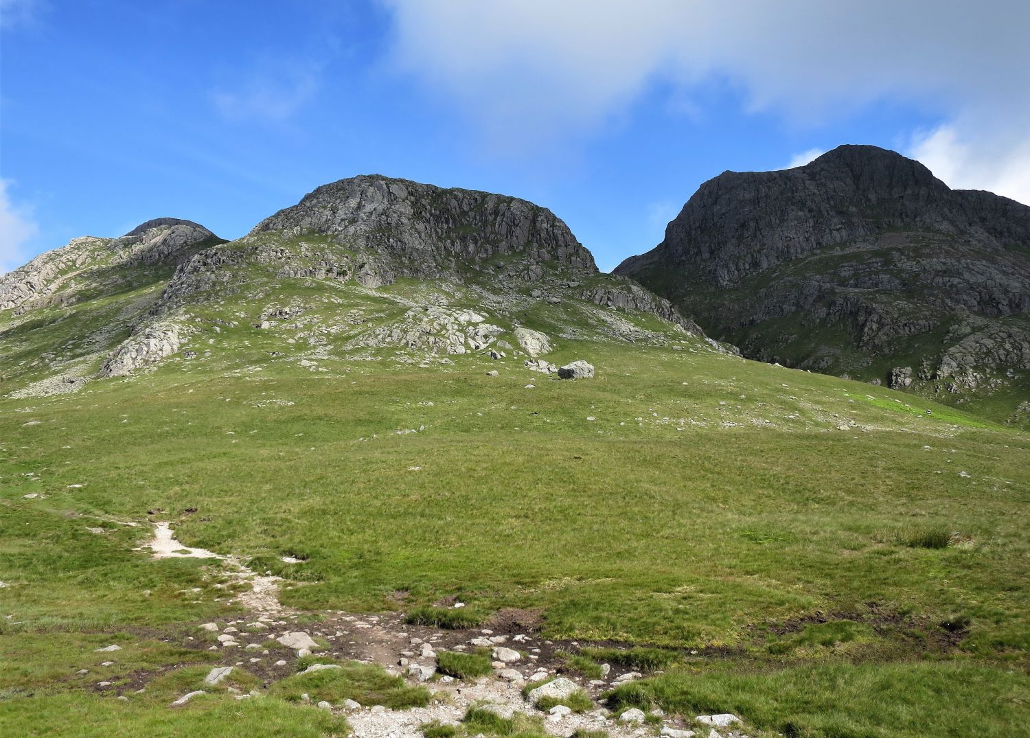
The connecting col between Harrison Stickle and Pavey Ark, seen here in the centre, is our next objective. On the left, you can see the beginning of the path below Harrison Stickle, which then traverses the base of its eastern shoulder.
“The ridged summit is liberally buttressed by crags, as is a curious shoulder running down to the hanging valley occupied by Stickle Tarn, a considerable sheet of water no less attractive for being partly artificial.” Harrison Stickle 3
AW
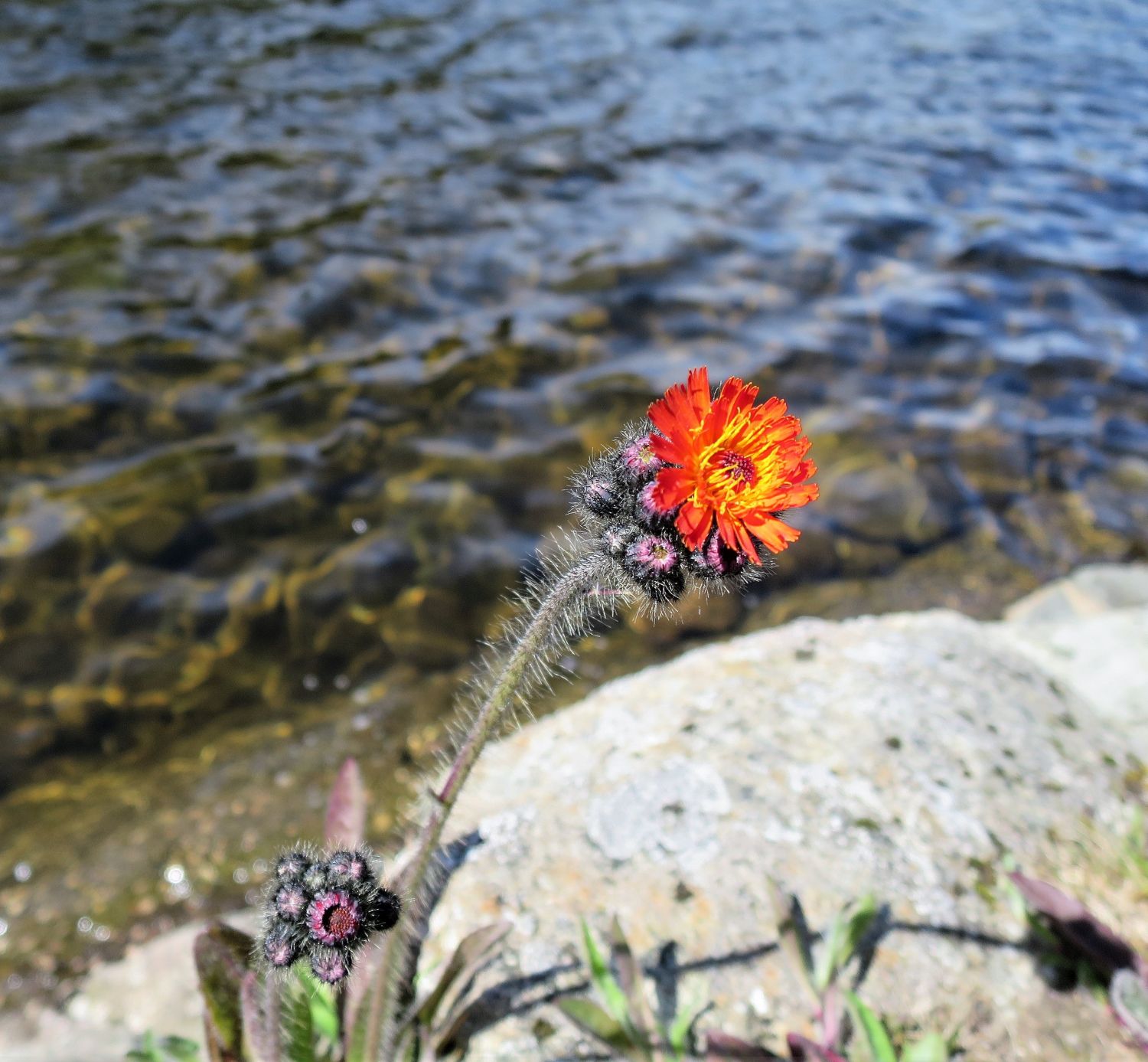
(fox-and-cubs, orange hawkweed, devil’s paintbrush, grim-the-collier)
Orange hawkweed is a hardy perennial herb which was first brought over to Britain from Europe in the 17th century. It is commonly seen invading neglected lawns throughout the British Isles, so it’s nice to see this one at home in an alpine setting.
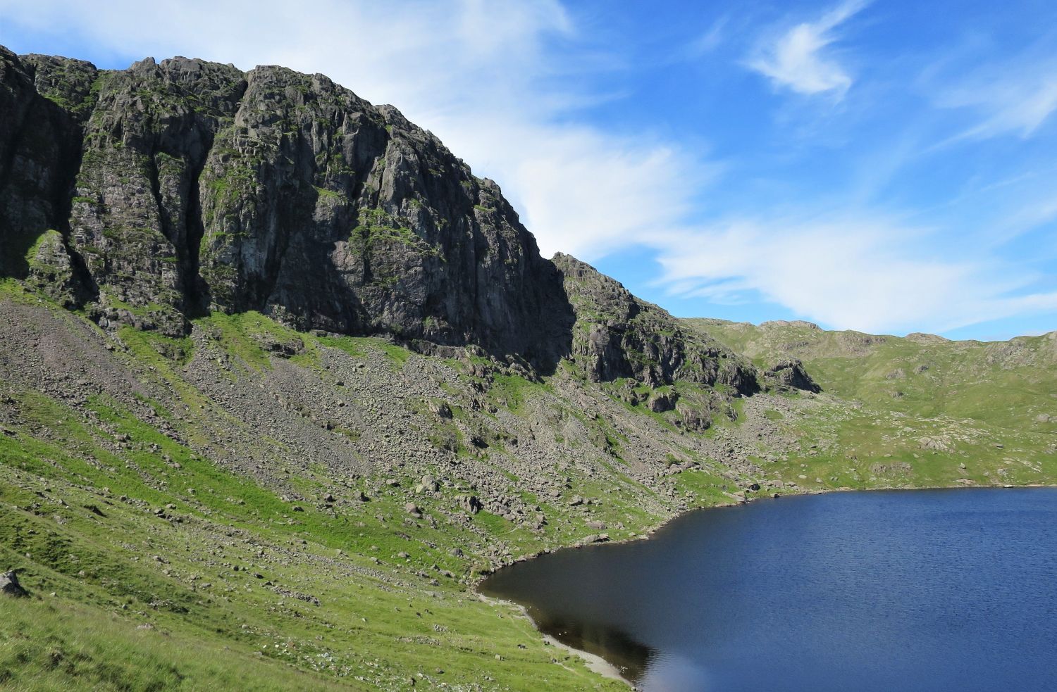
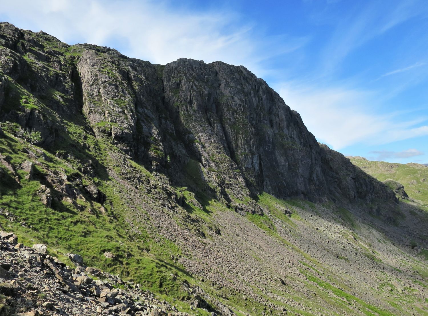
“Pavey Ark is Langdale’s biggest cliff. In an area where crags and precipices abound, here is the giant of them all, and, scenically, it is the best.” Pavey Ark 2
AW
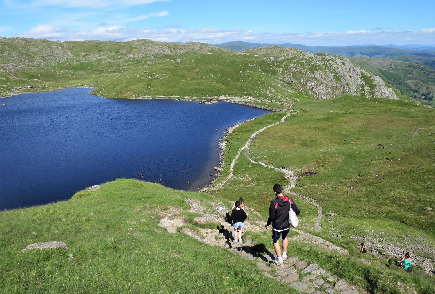
Stickle Tarn is a very popular destination for bathers and campers, especially in the summer months.
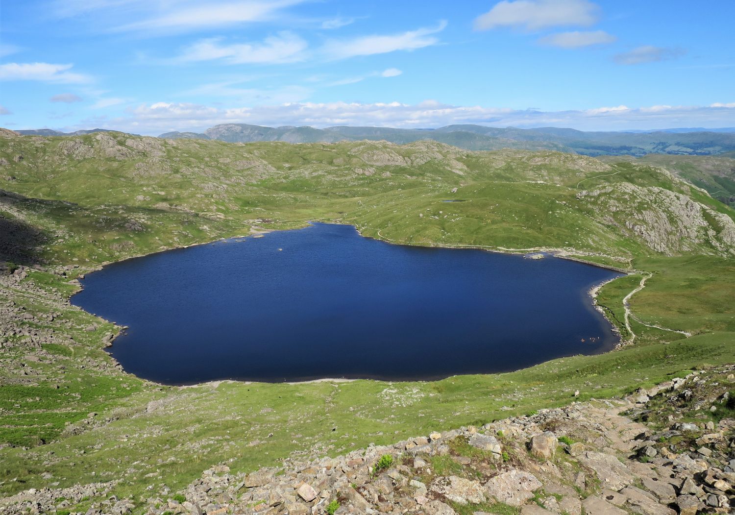
“Stickle Tarn was converted into a reservoir for the former gunpowder works at Elterwater.” Harrison Stickle 10
AW
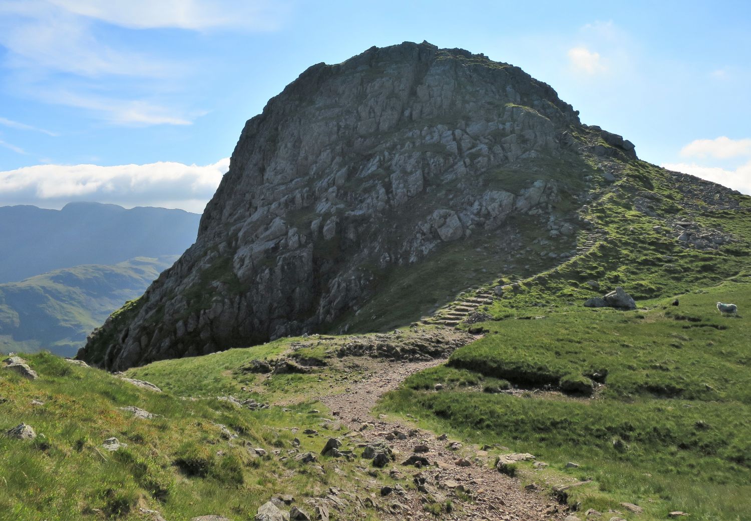
Before the top of the col is reached, a large cairn marks where the path divides…
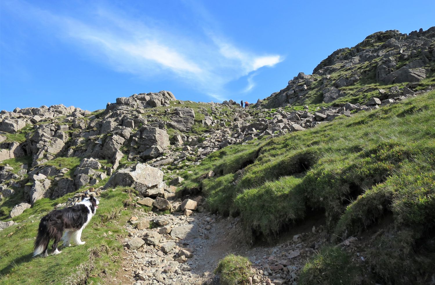
…Here we turn left and head more directly towards the summit crag of Harrison Stickle.
“The uninitiated climber who scales Harrison Stickle from Langdale expecting to find the northerly slopes descending as steeply as those he has just ascended will be surprised to see, on reaching the main cairn, that higher ground continues beyond a very shallow depression. The Pikes are, in fact, no more than the abrupt termination of a wide ridge coming down from High Raise, and on this side their aspect, in contrast, is one of almost comical insignificance.” Harrison Stickle 3
AW
“To Pike o’ Stickle…..An easy walk, ending with an enjoyable scramble. The objective is clearly in view and its distinctive outline is unmistakable.” Harrison Stickle 17
AW
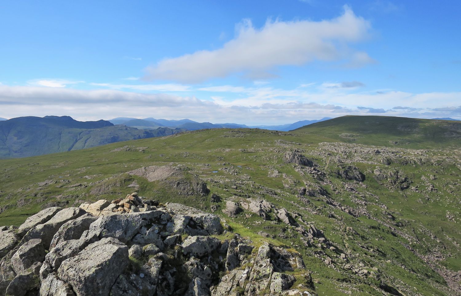
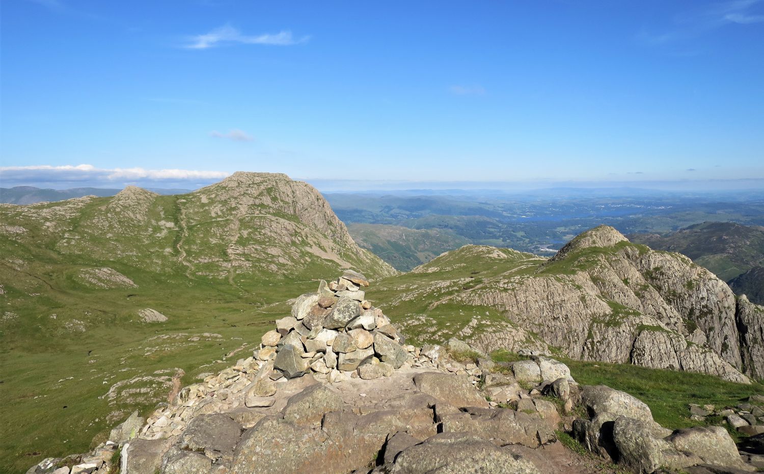
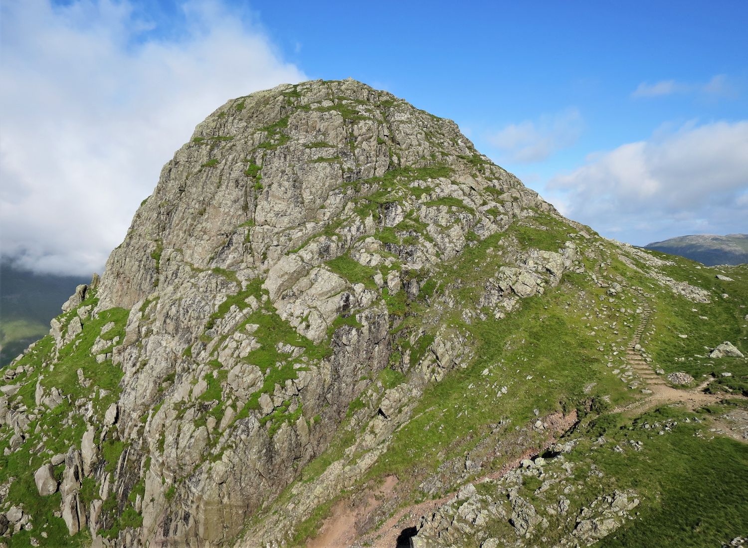
There are two paths leaving the summit of Harrison Stickle to connect with Loft Crag or Pike o’ Stickle. The easiest is to first head north from the summit to a small grassy depression, and then turn west and follow a stony path down to the hanging valley of Harrison Combe. The other path is followed south over much of the craggy summit, and then west and more steeply down rock steps to the marshy basin.
The two paths mentioned previously that leave the summit can be clearly seen on the left.
“Access to the cairn is gained by an easy scramble on the more broken northern slope, this being the only side ‘open’ to walkers.” Pike o’ Stickle 7
AW
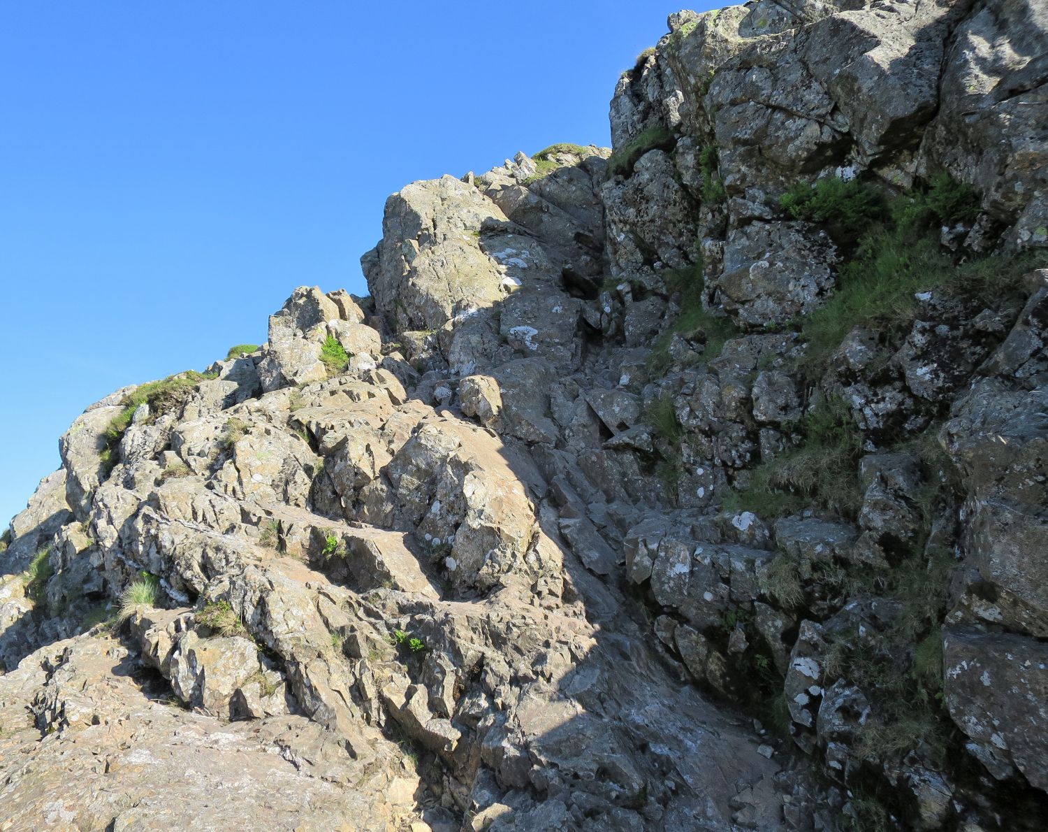
A couple of options are available to reach the top from the northern side; however, in wet conditions, or with a heavy pack like mine on this day, care is needed.
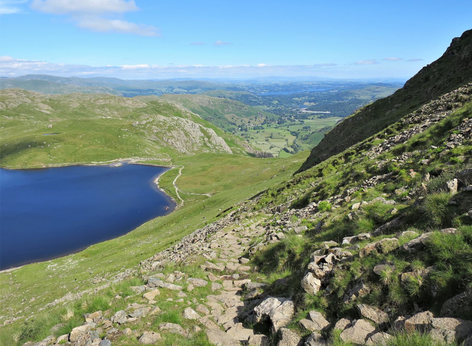
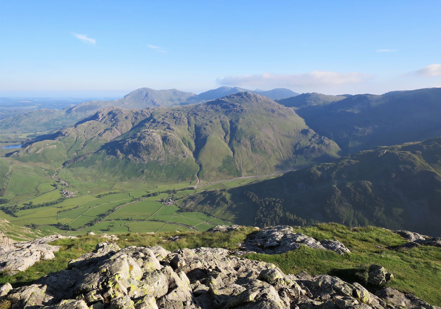
Blea Tarn is seen nestled in the hollow between Lingmoor Fell and Wrynose Fell.
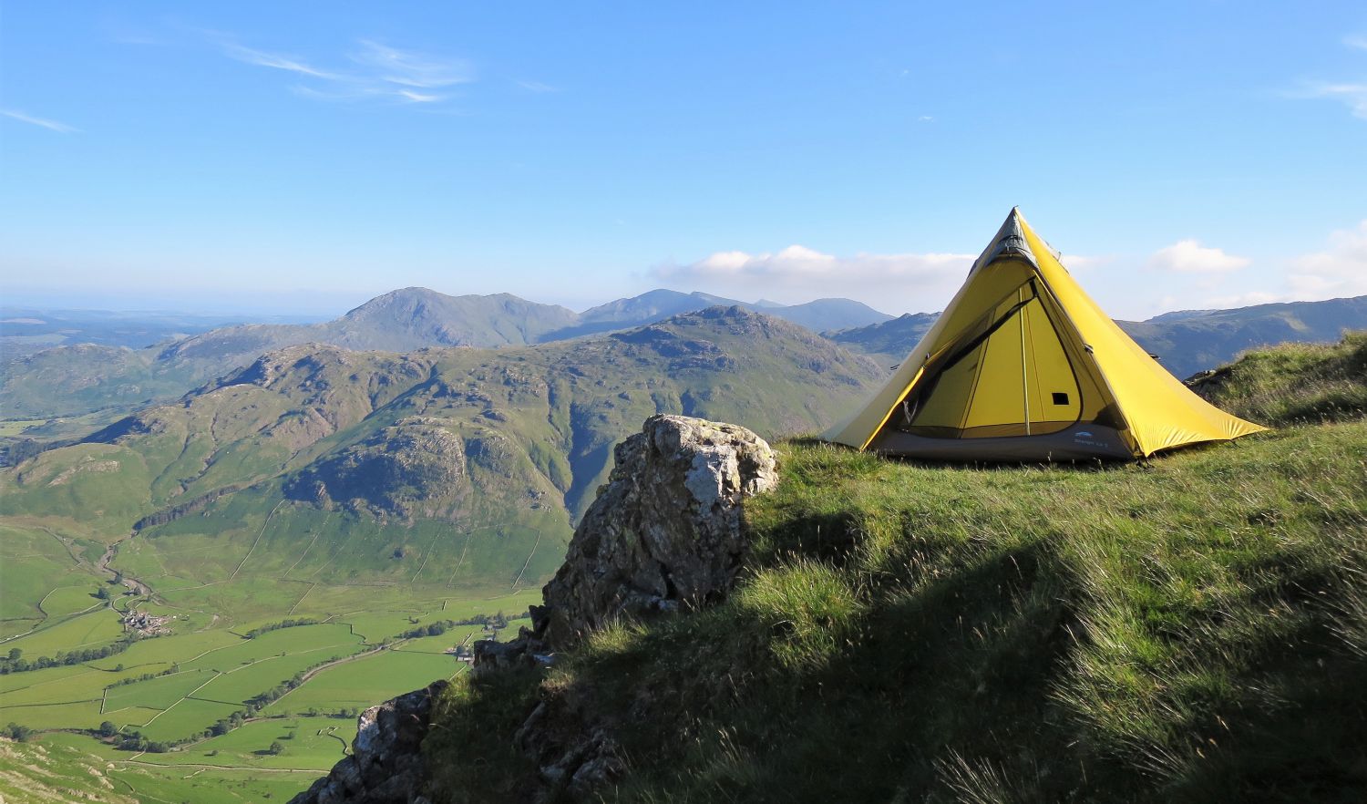
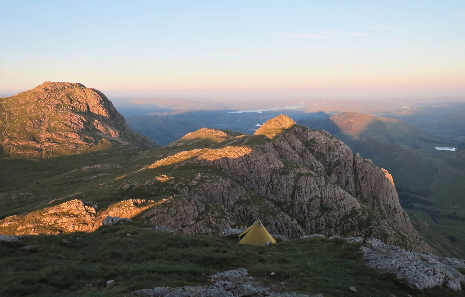
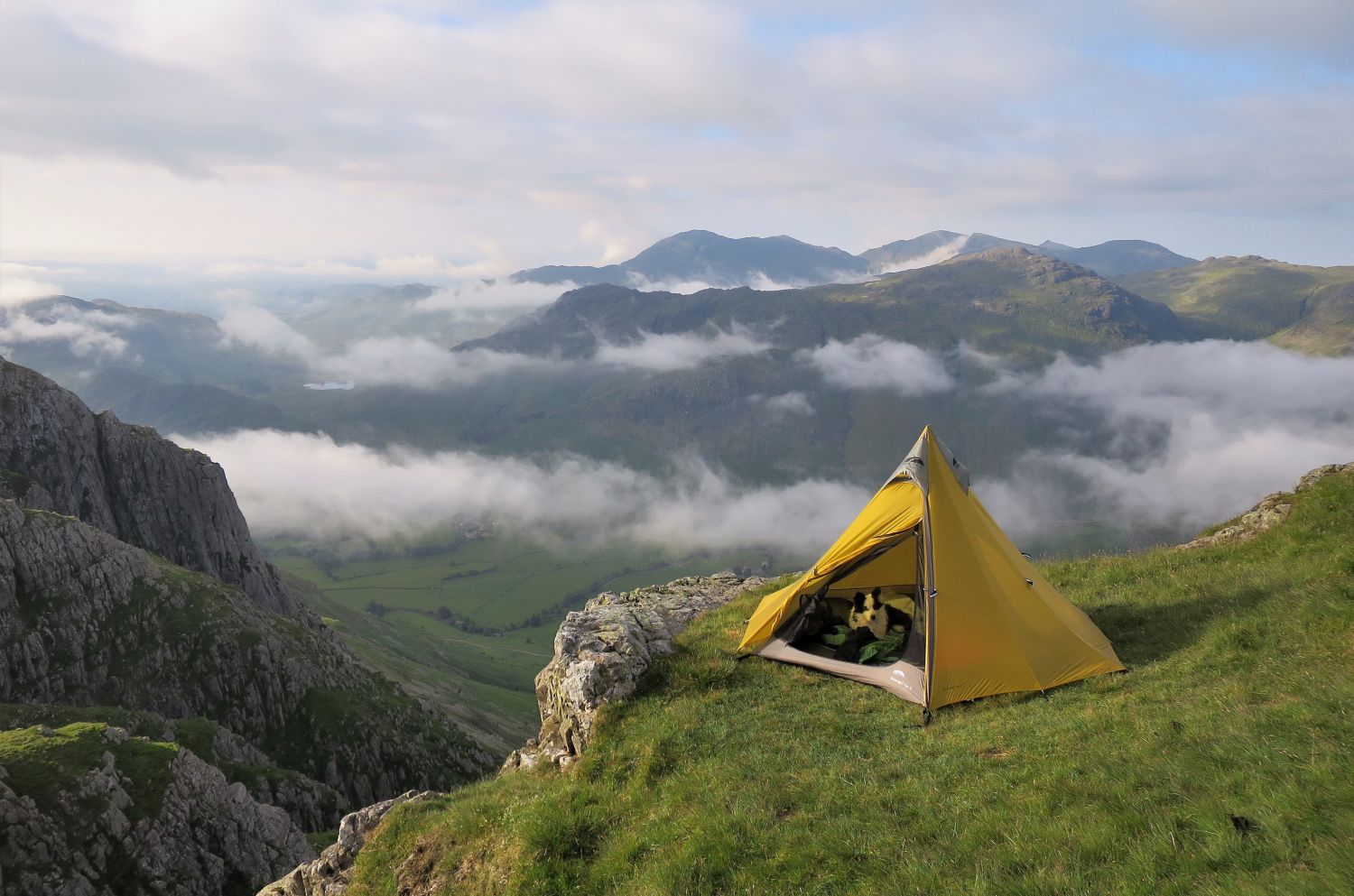
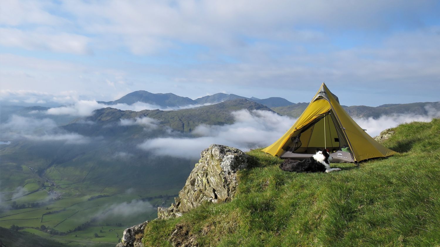
While Frankie was relaxing, I pitched at my usual location, just below the summit and above the ‘south gully’. There’s only room for one tent, and sleepwalking isn’t an option!
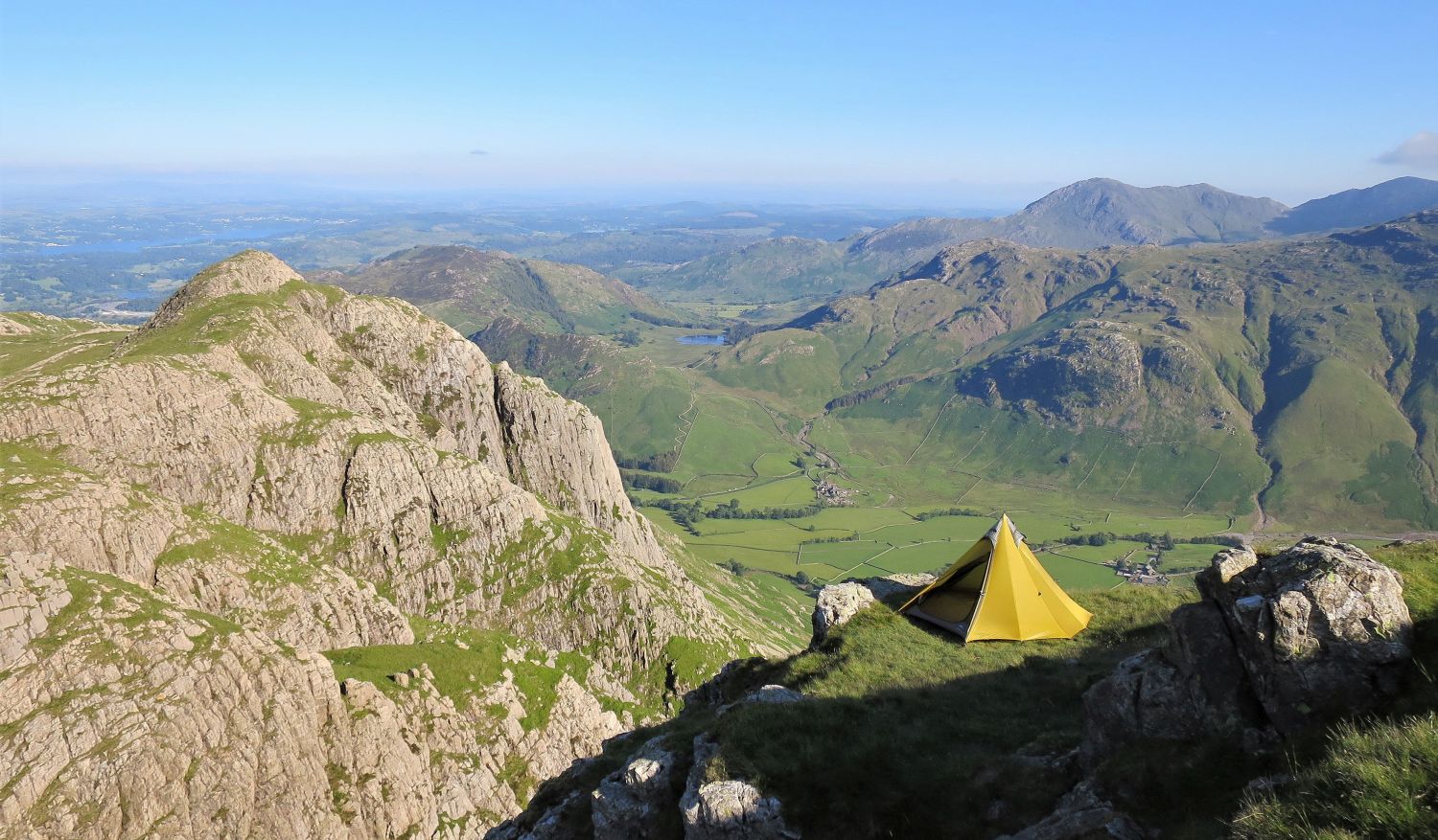
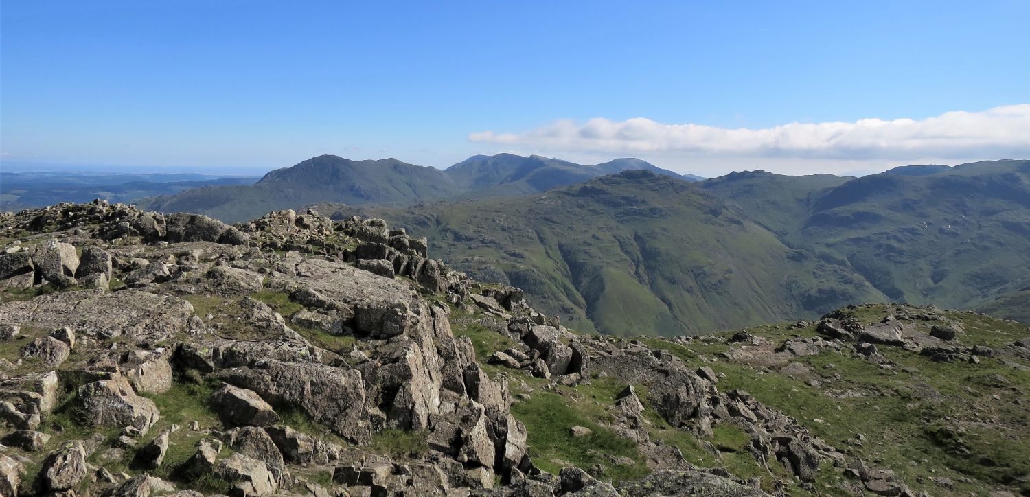
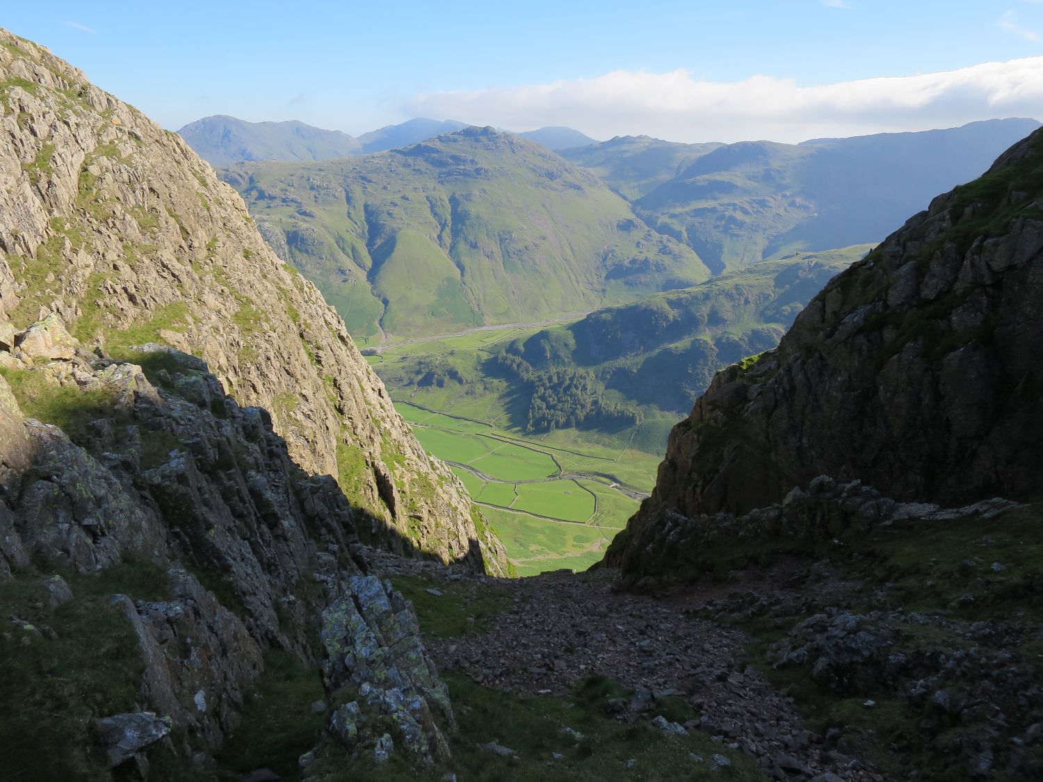
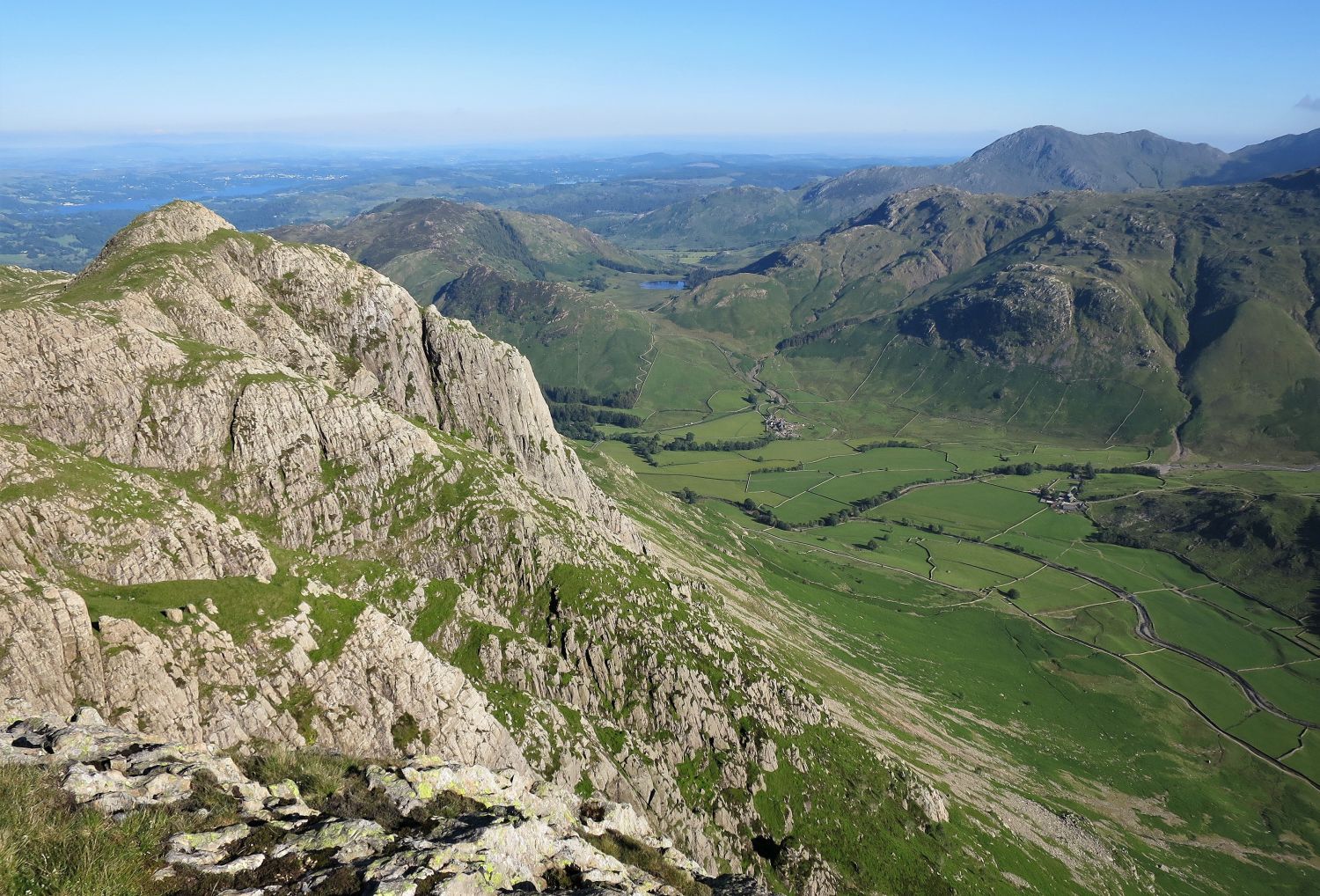
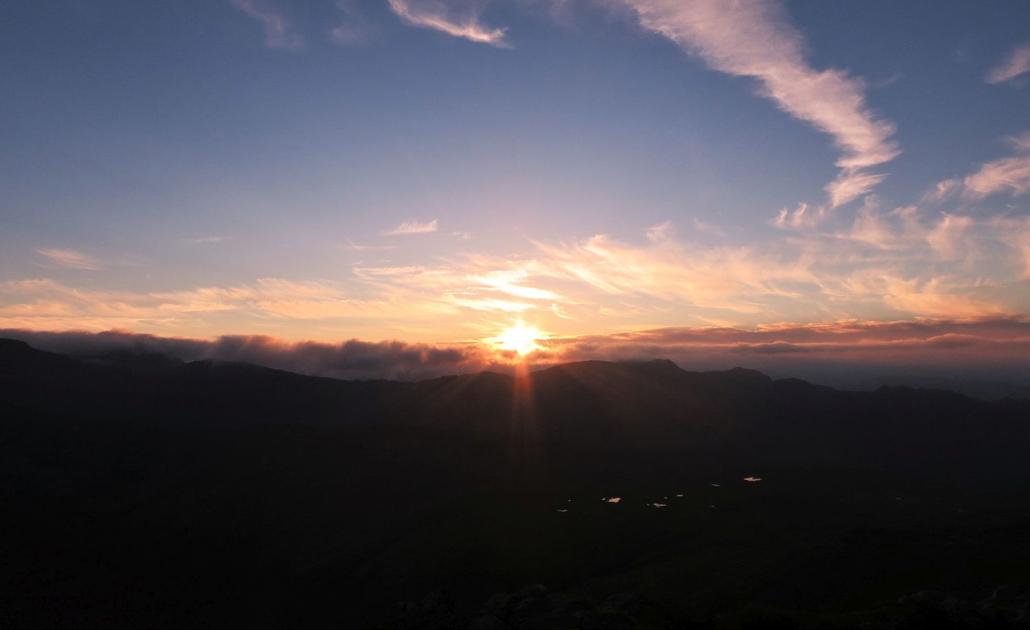
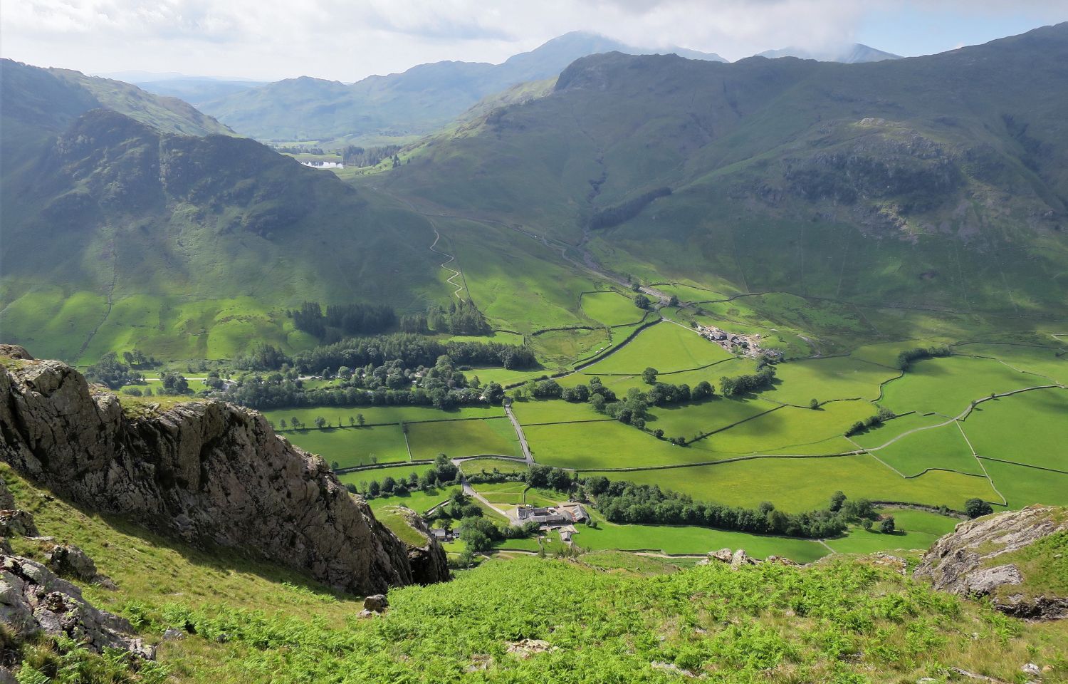
The grandest views from Pike o’ Stickle are not just of the distant fells, but also down in the valleys of upper Great Langdale and Mickleden. These views are even more rewarding in the evening.
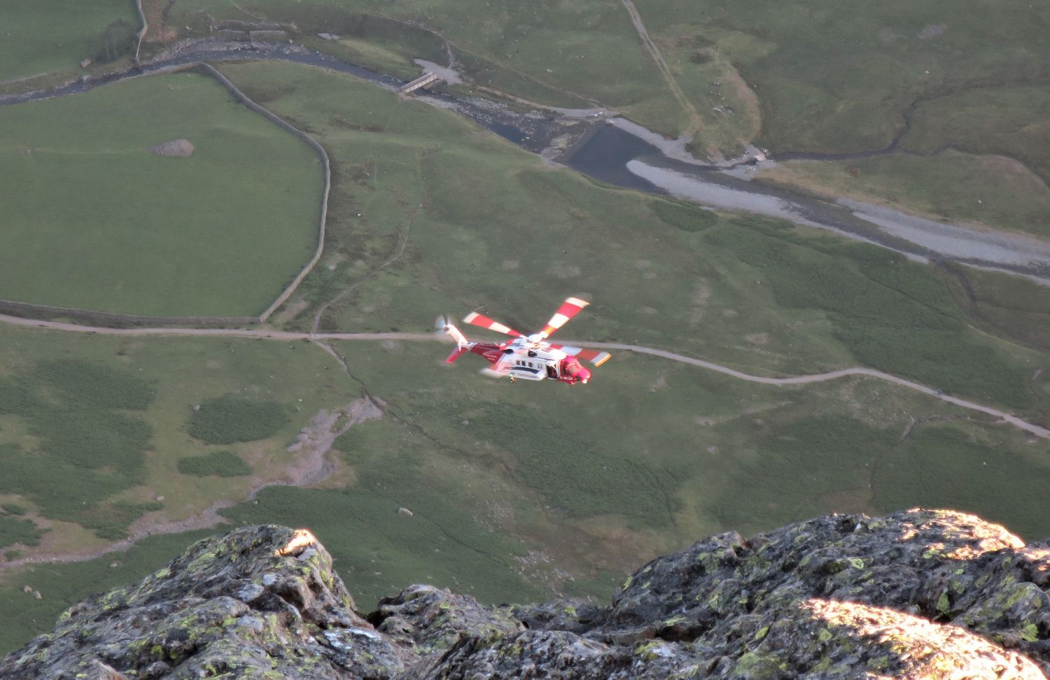
While relaxing and getting ready to settle down for the night, we witnessed a spectacular rescue over the valley. The casualty was halfway down The Band, this given away by flares set off by rescuers who were on foot. Initially, the Air Ambulance tried for around 20 minutes to land on the ridge, but had no success and then landed in a field at Stool End Farm. Shortly after, an HM Coastguard helicopter came, and the team were able to rescue the casualty, who was then transferred to the Air Ambulance on the ground at the farm. After chatting with team members at a later date, I was informed that the rescue was a “success”, and that it began at 17:30 that evening and continued for five hours until sunset.
Langdale/Ambleside Mountain Rescue Team
Incident Report #44 2022
Wednesday, 22 June 2022 – 17:29
“A man was unable to continue his walk complaining of hip and knee pain. Examination also revealed a concerning cardiac issue so he was evacuated by air ambulance.”
Man hours: 15 team members for five hours
Incident type: Fellwalking
Location: The Band
OS Grid Reference: NY263058
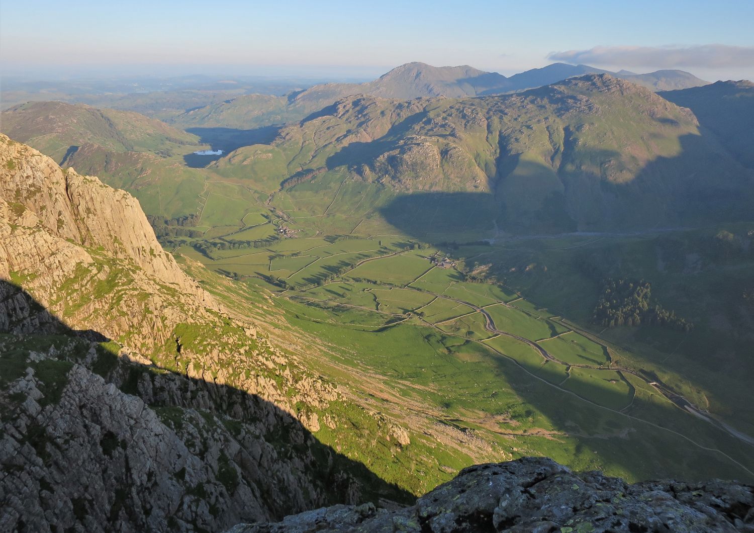
Amazingly, the shadow matches the outline of Loft Crag perfectly.
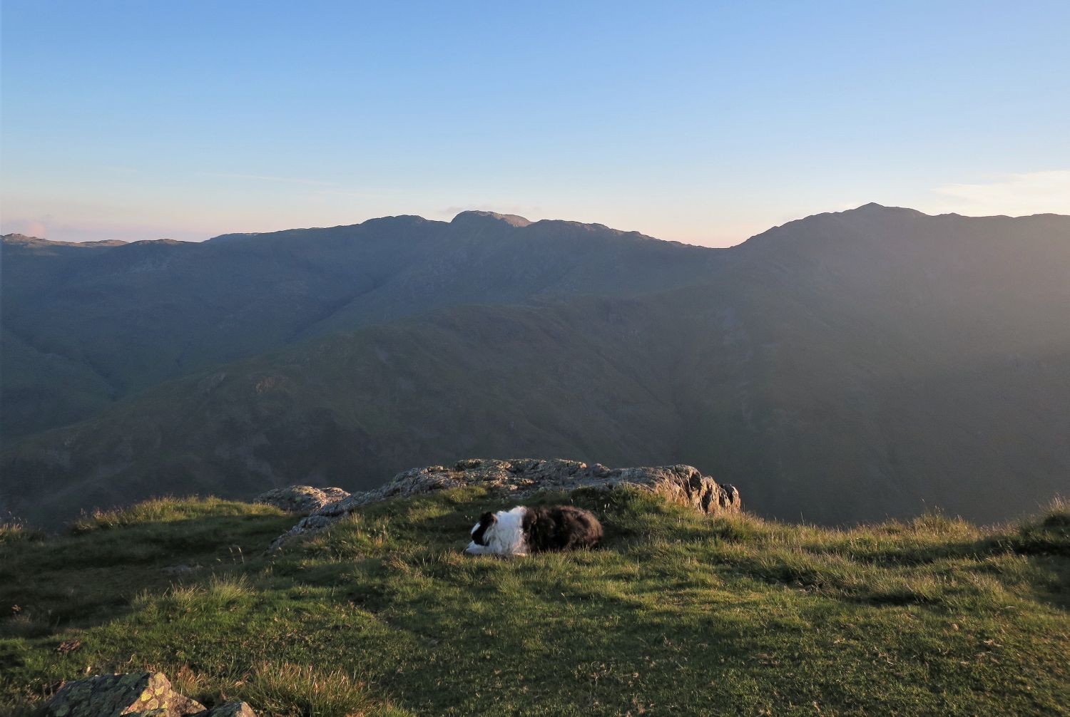
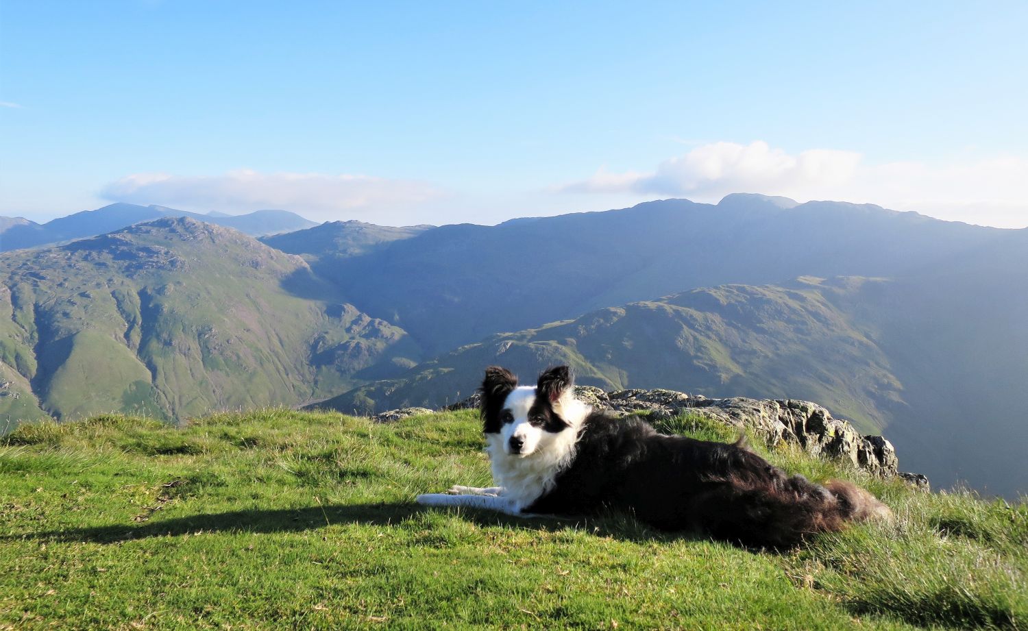
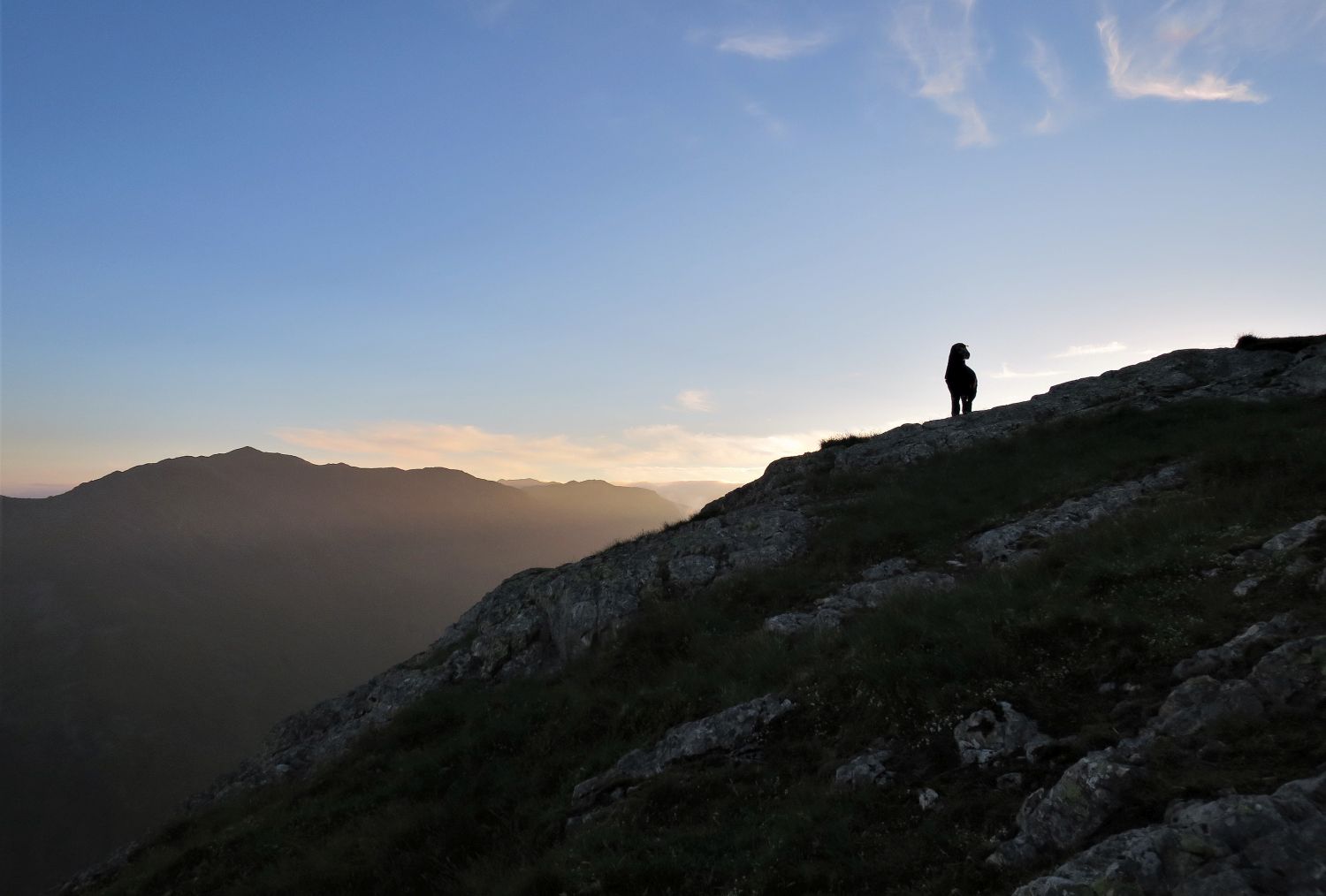
Frankie is looking very tired this evening.
Frankie wanting a lie-in!
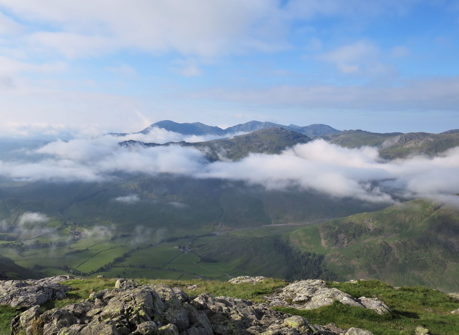
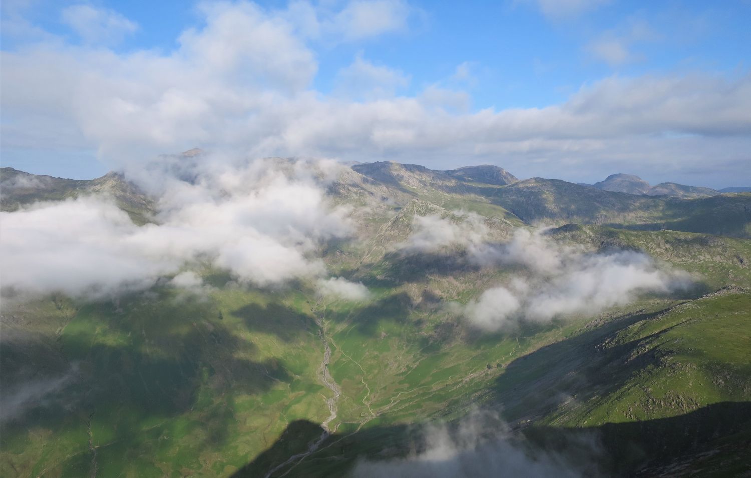
Wonderful clusters of rising valley fog dominate the morning views.
Joking aside, sadly Frankie is showing signs of ‘slowing down’. He’s now eleven years old, but I truly hope there are a few more mountain years left in him yet. He is the best walking buddy anyone could ever wish for, but it’s sad to see him like this.
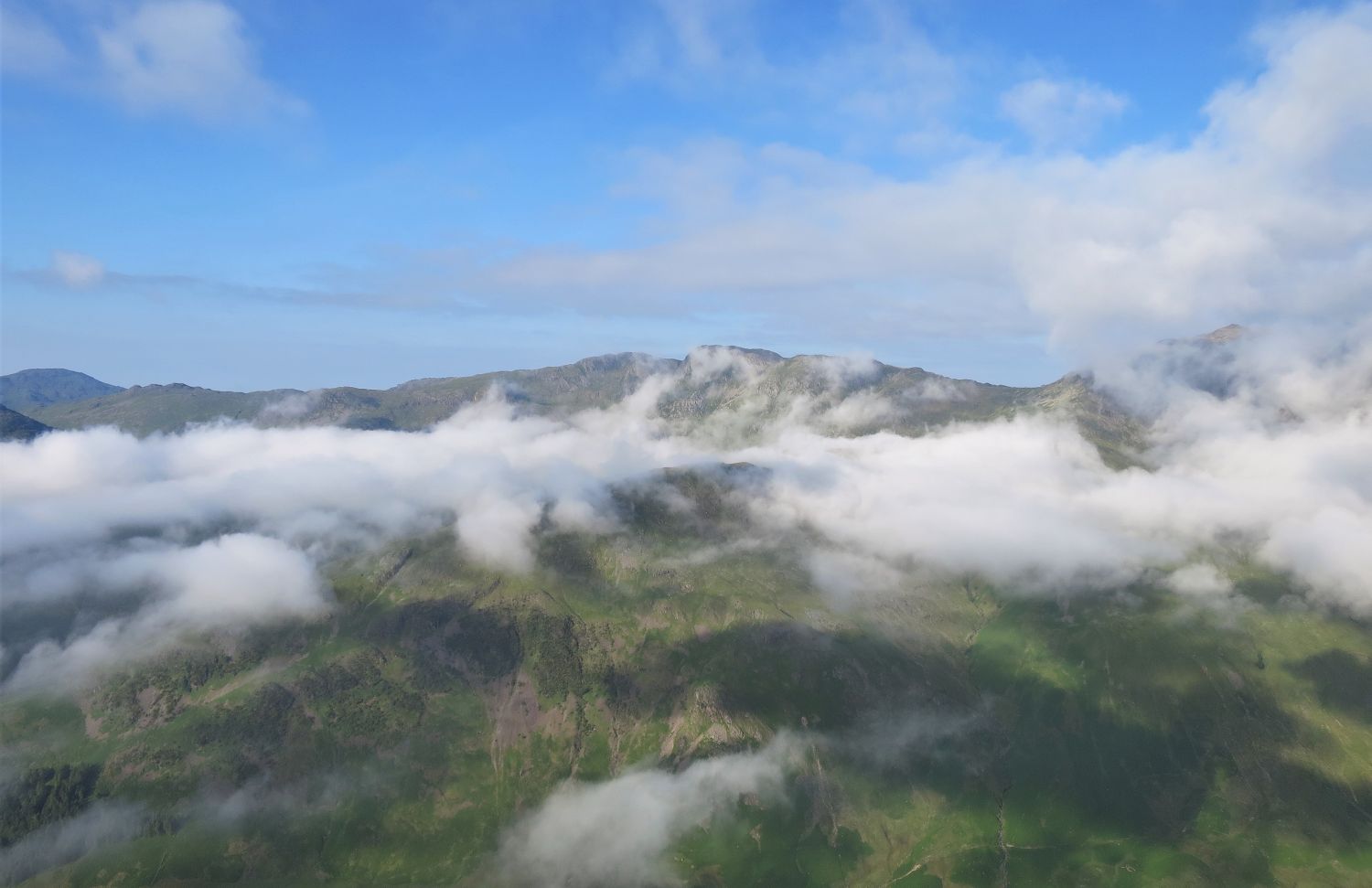
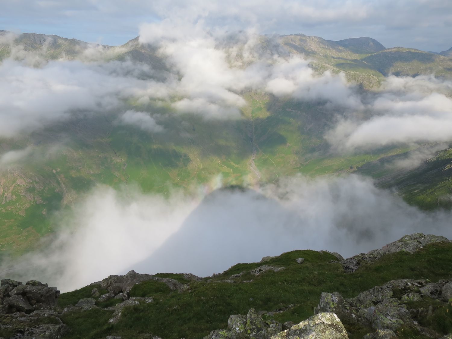
Pike o’ Stickle can be the perfect location for witnessing Brocken spectres, fog bows, or temperature inversions. The conditions have to be right, of course, and sadly on this occasion, this was my best attempt at a Brocken spectre. As soon as the cold air below meets the thin layer of warm air above, the rising fog burns away.
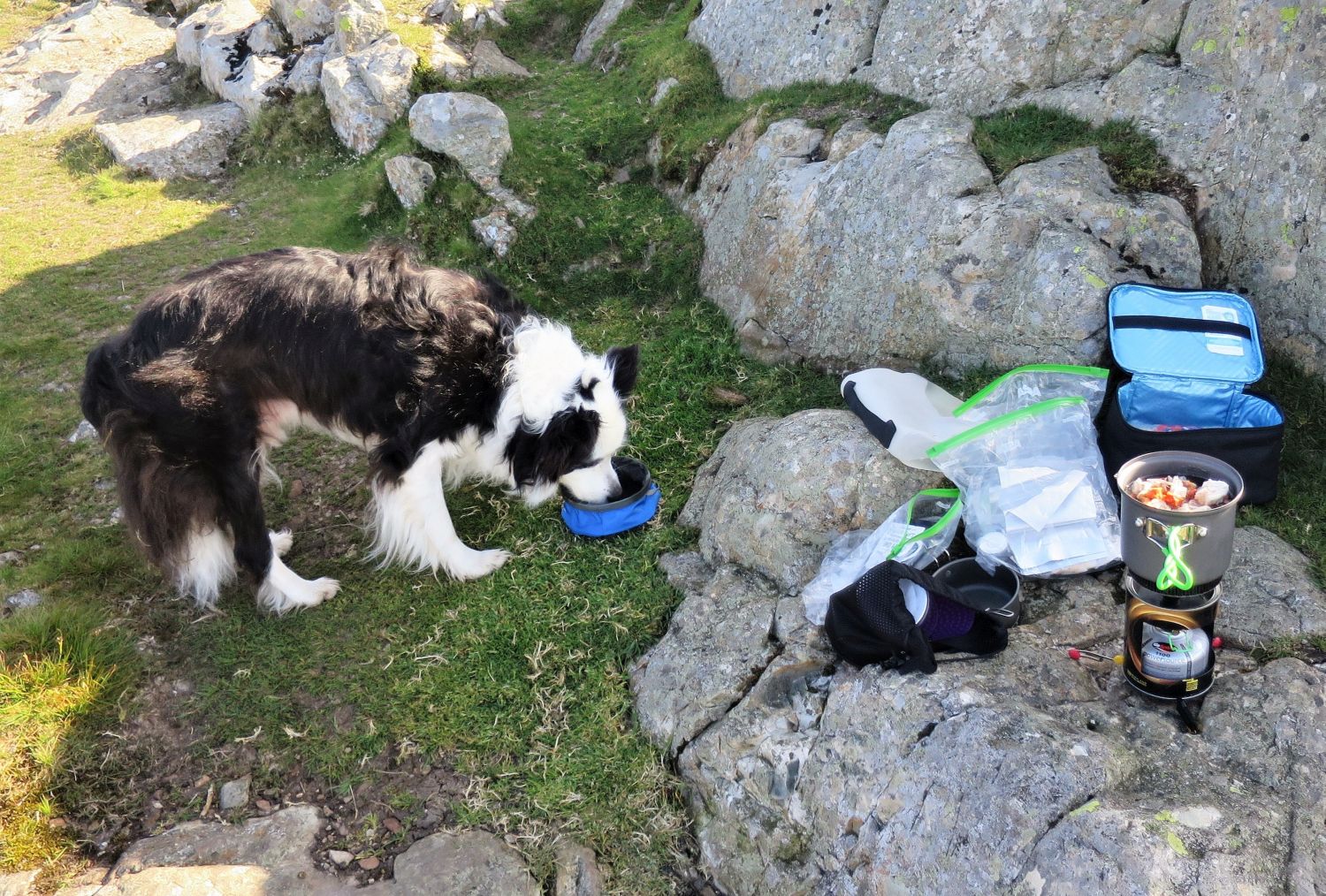
This morning’s menu is chicken, chorizo, and pasta served in chicken and leek soup.
Now that our bellies are full and everything is packed away, it’s time to head back to Stickle Barn in Great Langdale — we strictly follow the wild camping ‘code of conduct’ by leaving early and leaving no trace.
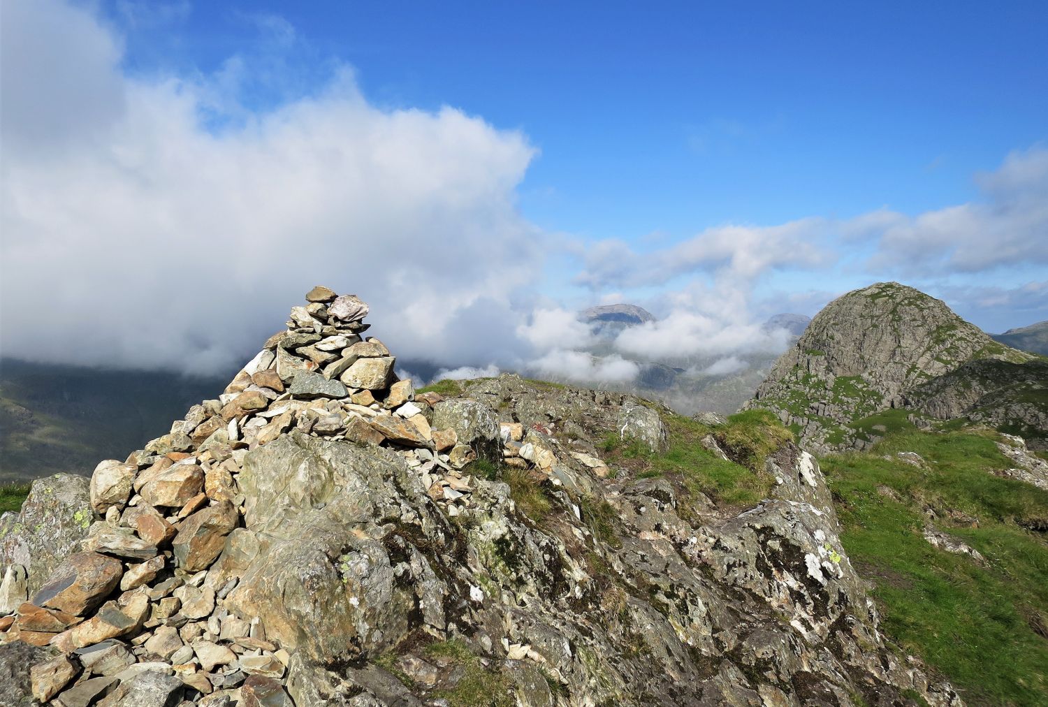
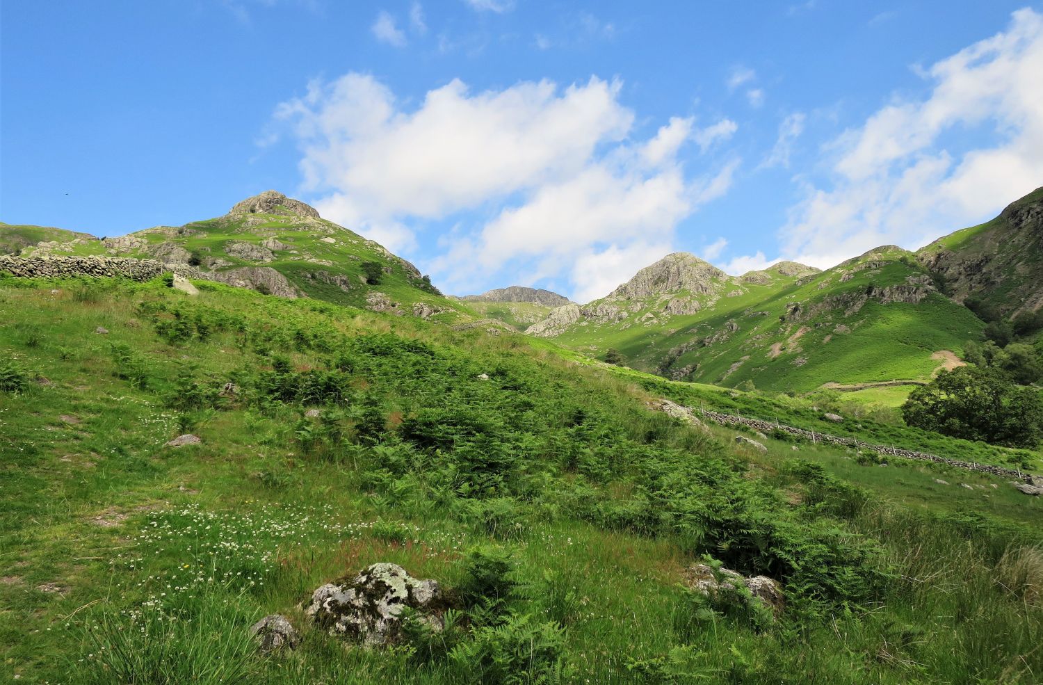
You can see ahead, just beyond the top of ‘south gully’, that the path divides. We are going to follow the ridge path that veers right and continues to Loft Crag.
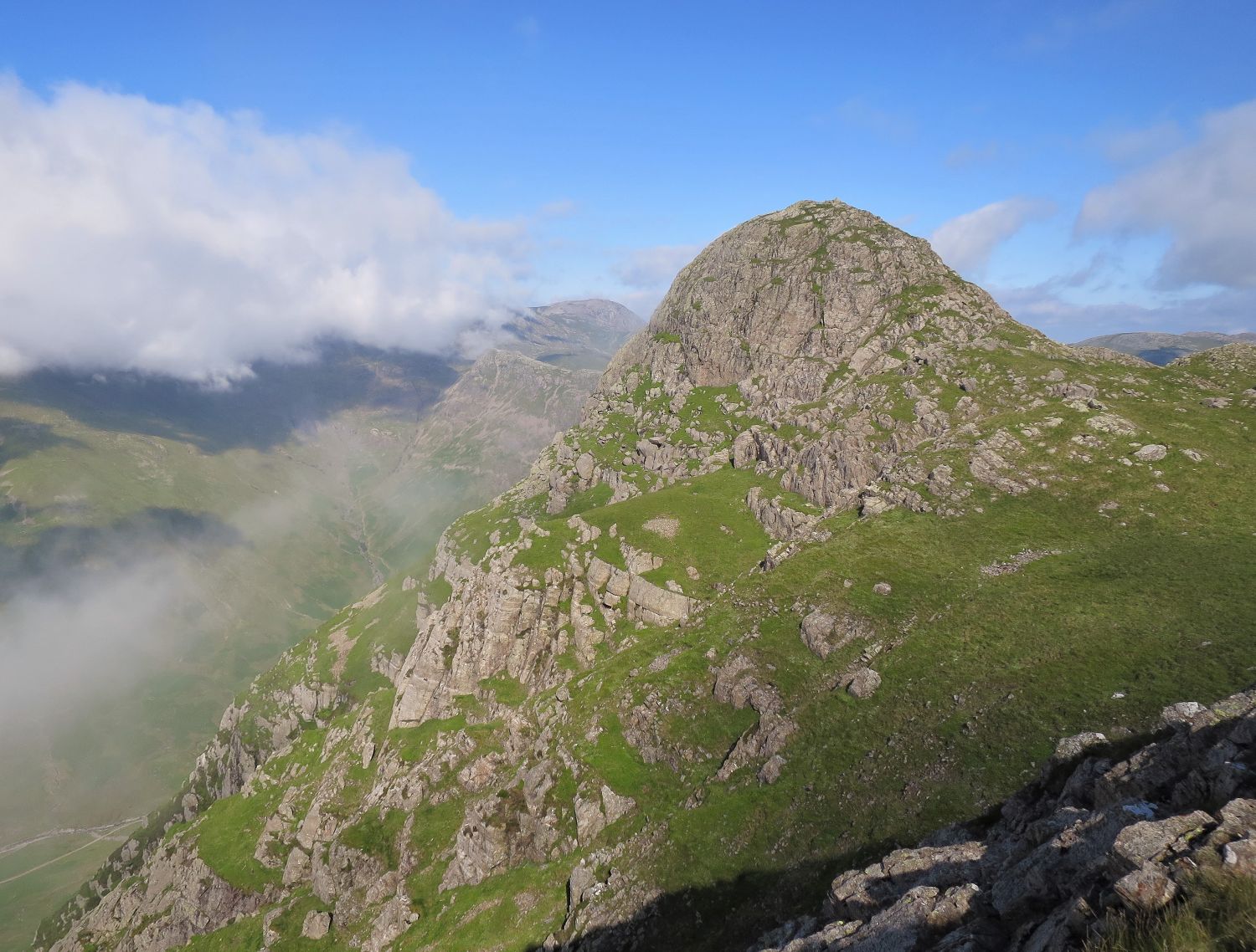
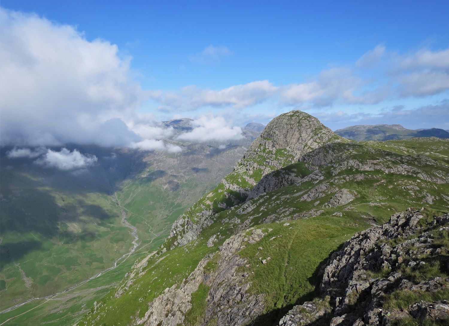
I make no apology for the number of photos of Pike o’ Stickle. The constant turning around to view this marvel of Langdale makes progress slow, but very worthwhile — not to do so would be criminal!
“Simple lines are often the most affective, and the smoothly-soaring pyramid of Pike o’ Stickle, rising to a tapering thimble of rock without interruption or halt between valley and summit, is an imposing and impressive feature that contributes much to the grandeur of the head of Great Langdale.” Pike o’ Stickle 2
AW
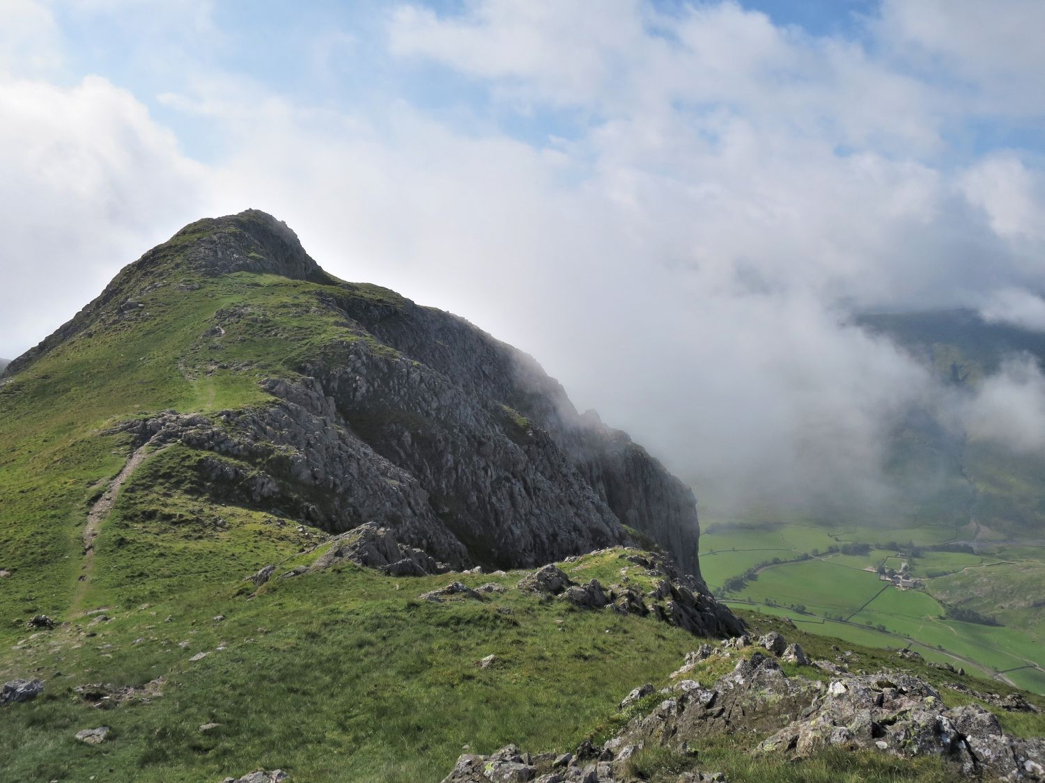
“Care is needed in getting off the east end of Loft Crag; at the first depression use a little scree-run on the left.” Loft Crag 8
AW
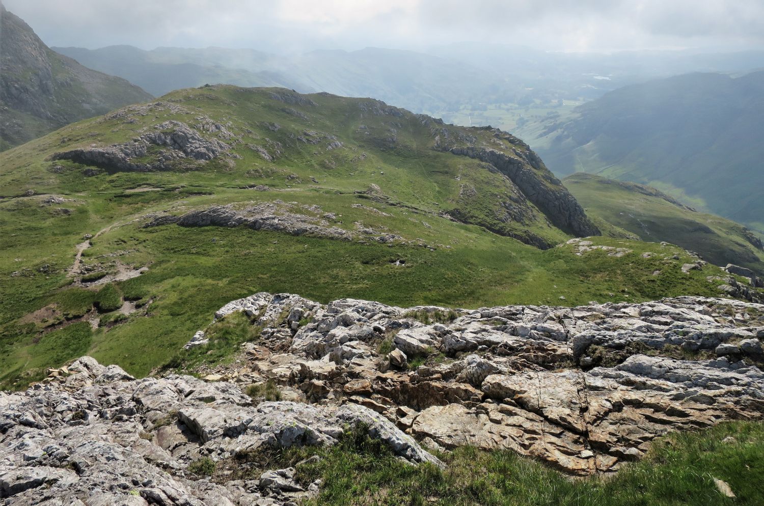
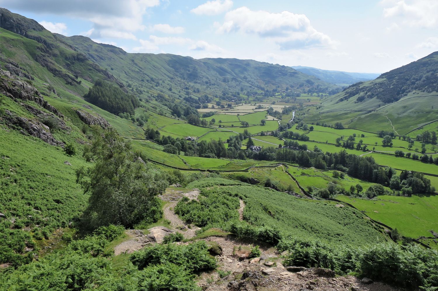
On this occasion, rather than following the main path down a small scree run, we continued east to the very end of the ridge where light scrambling is required. This way is not recommended in wet conditions. Our next objective is the path heading right that leaves the Thorn Crag col, which is our route down into Great Langdale.
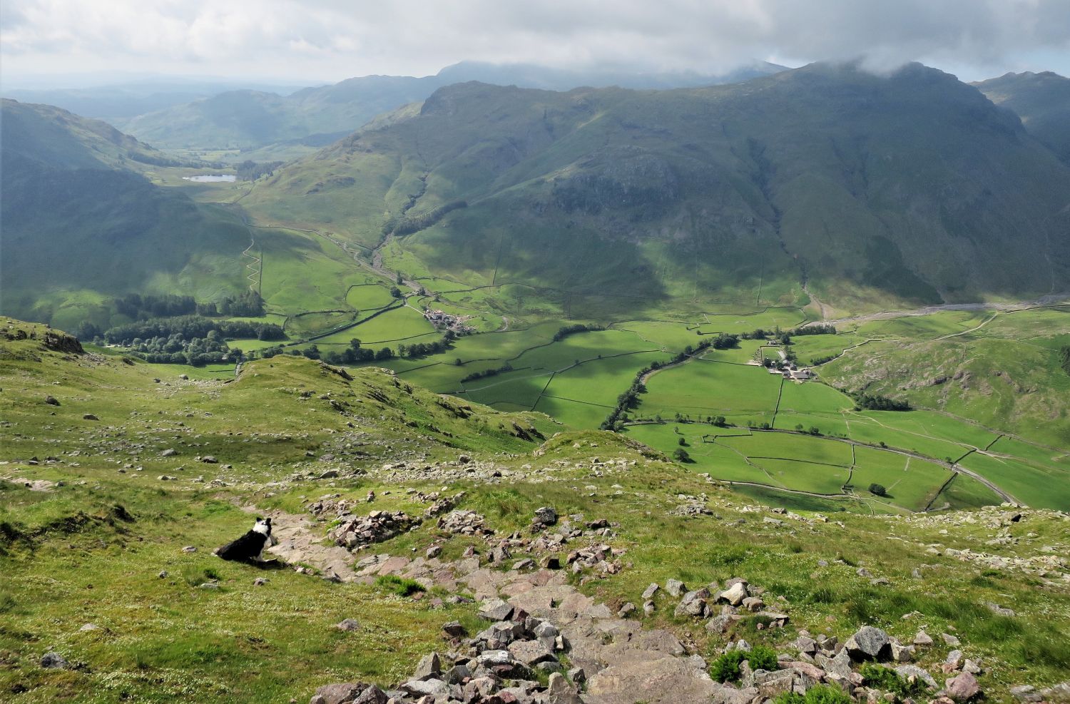
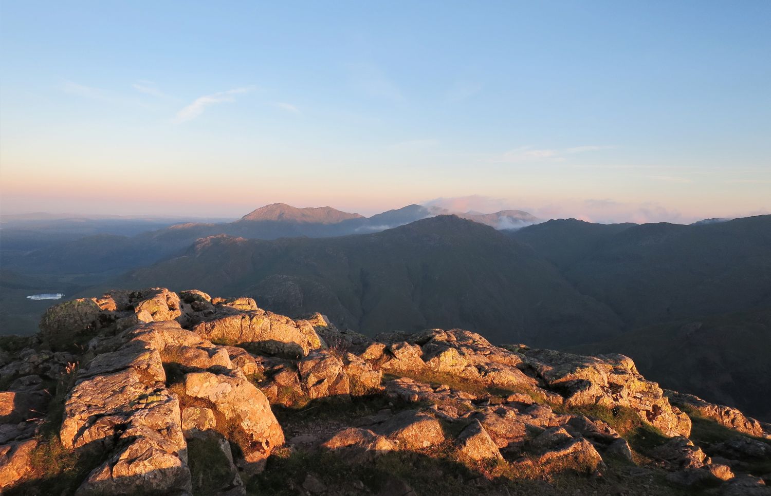
A grand view is witnessed when turning around at the ‘grassy plateau’. It never disappoints.
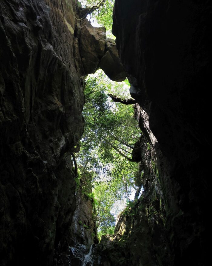
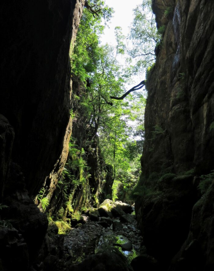
Our next objective is a visit to Dungeon Ghyll Force. It’s worth noting that in descent this iconic waterfall can be a little tricky to find, especially in the summer months when bracken covers the path that leads to the entrance. The main waterfall is at a section where trees are growing out of the ravine, but these birch trees lead you to a false promise. The entrance is, in fact, at a corner of the intake wall, much further down the Mark Gate ridge.
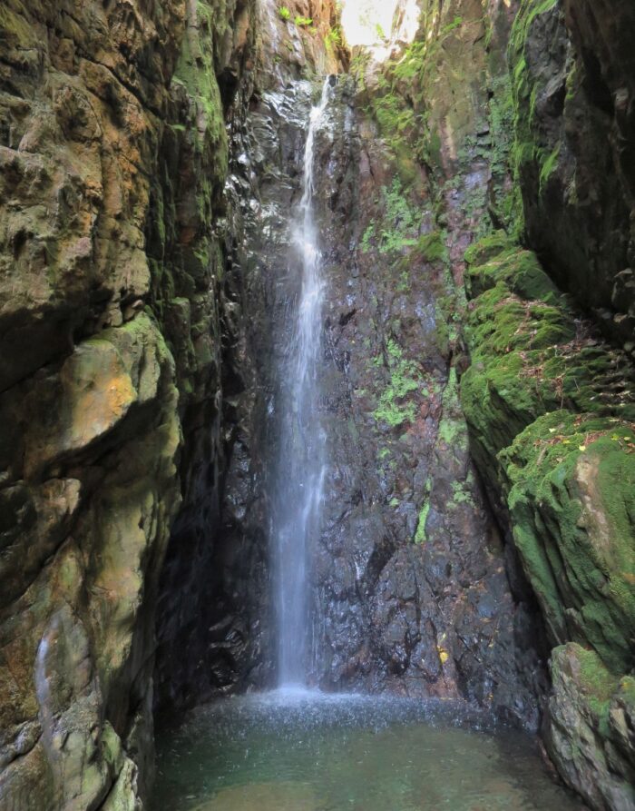
To reach the base of the waterfall requires scrambling over large, slimy boulders and getting your feet wet. Please take care.
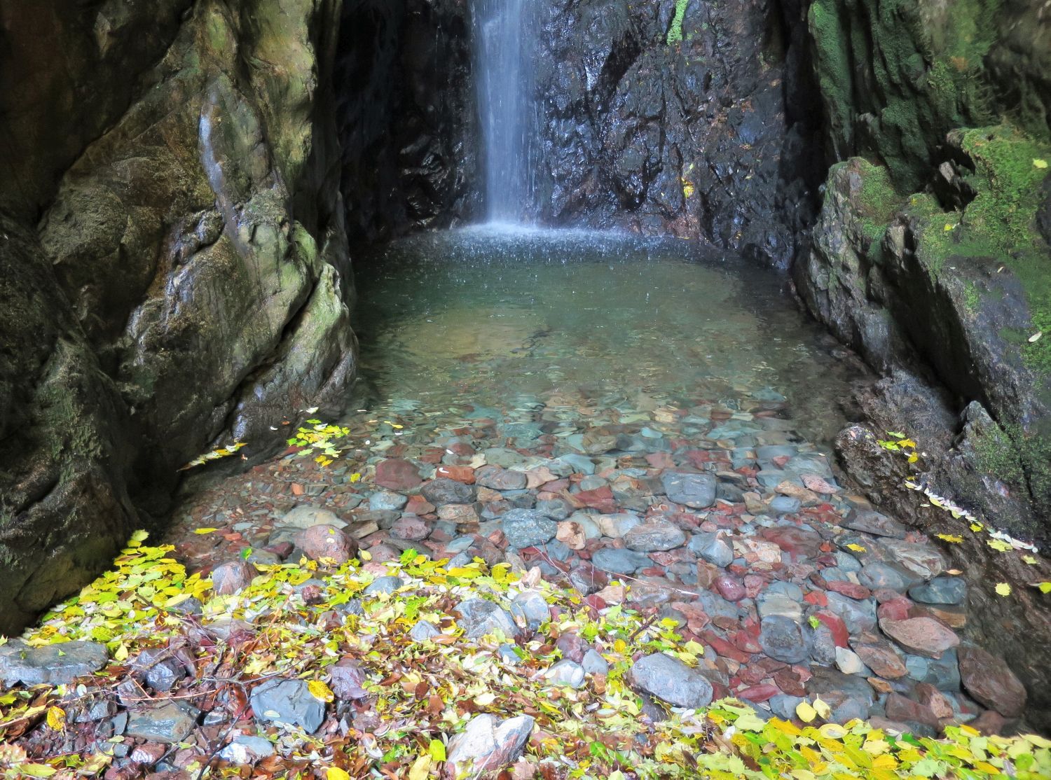
This waterfall is always worth a visit during the autumn months, when the ravine is full of leaves providing a fine, colourful display.
A nice pint of lemonade to finish a grand adventure.
<<>>
Thanks, sources, and further reading:
‘Book Three – The Central Fells’ by Alfred Wainwright
Langdale/Ambleside Mountain Rescue Team
National Library of Scotland
National Trust