This route is a great example of a simple, direct and rewarding climb of a Lakeland fell. It is an ideal walk for a short day when daylight is limited or when the weather is extreme. For example, on this occasion, we had plenty of summer daylight hours, but the weather conditions were very hot and humid, and much of the route was walked at a slow pace. Because of these conditions, the plan was to descend and return back to the car by midday, so to avoid any prolonged exposure to the afternoon summer sun.
A five-mile walk with a Lakeland tarn, a Wainwright and an extra Birkett; it is fell-walking at its simplest.
“This is an excellent expedition, richly rewarding in intimate scenes of Harter Fell’s grand northern cliffs and in the views of Haweswater from its summit, yet short in distance and needing much less effort in execution than its formidable appearance suggests.” Harter Fell 8
AW
GPX Route: Download
PDF Map: Download
Mardale Head > Small Water Gill > Small Water Tarn > Nan Bield Pass > Nan Bield > Harter Fell > Little Harter Fell > Adam Seat > Gate Scarth > Gatescarth Pass > Mardale Head
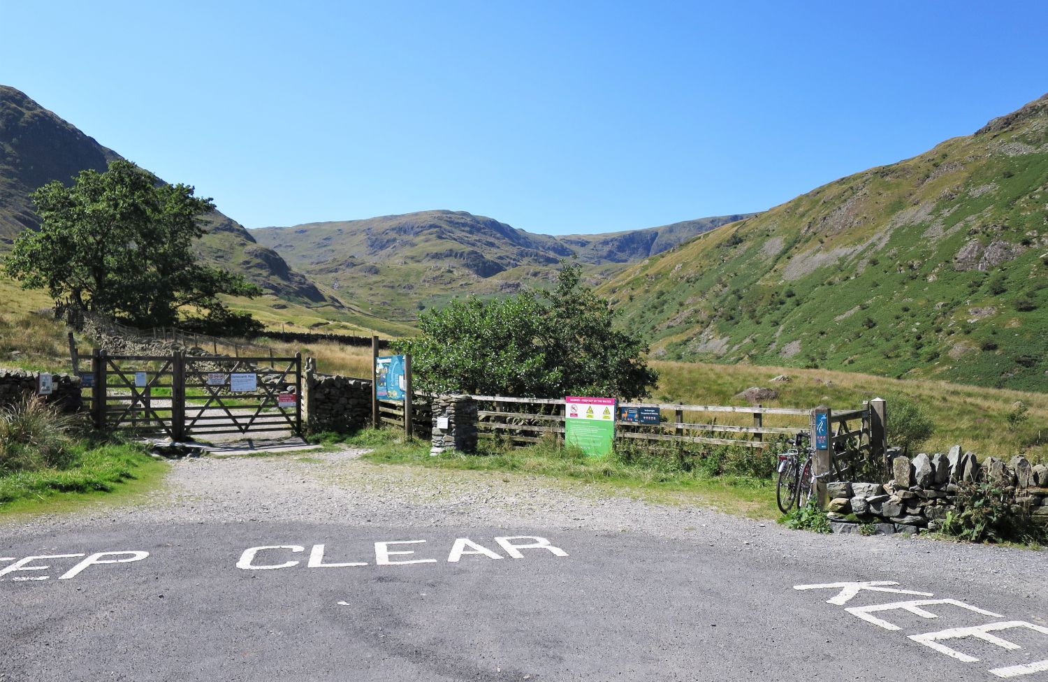 Mardale Ill Bell from the parking area at Mardale Head
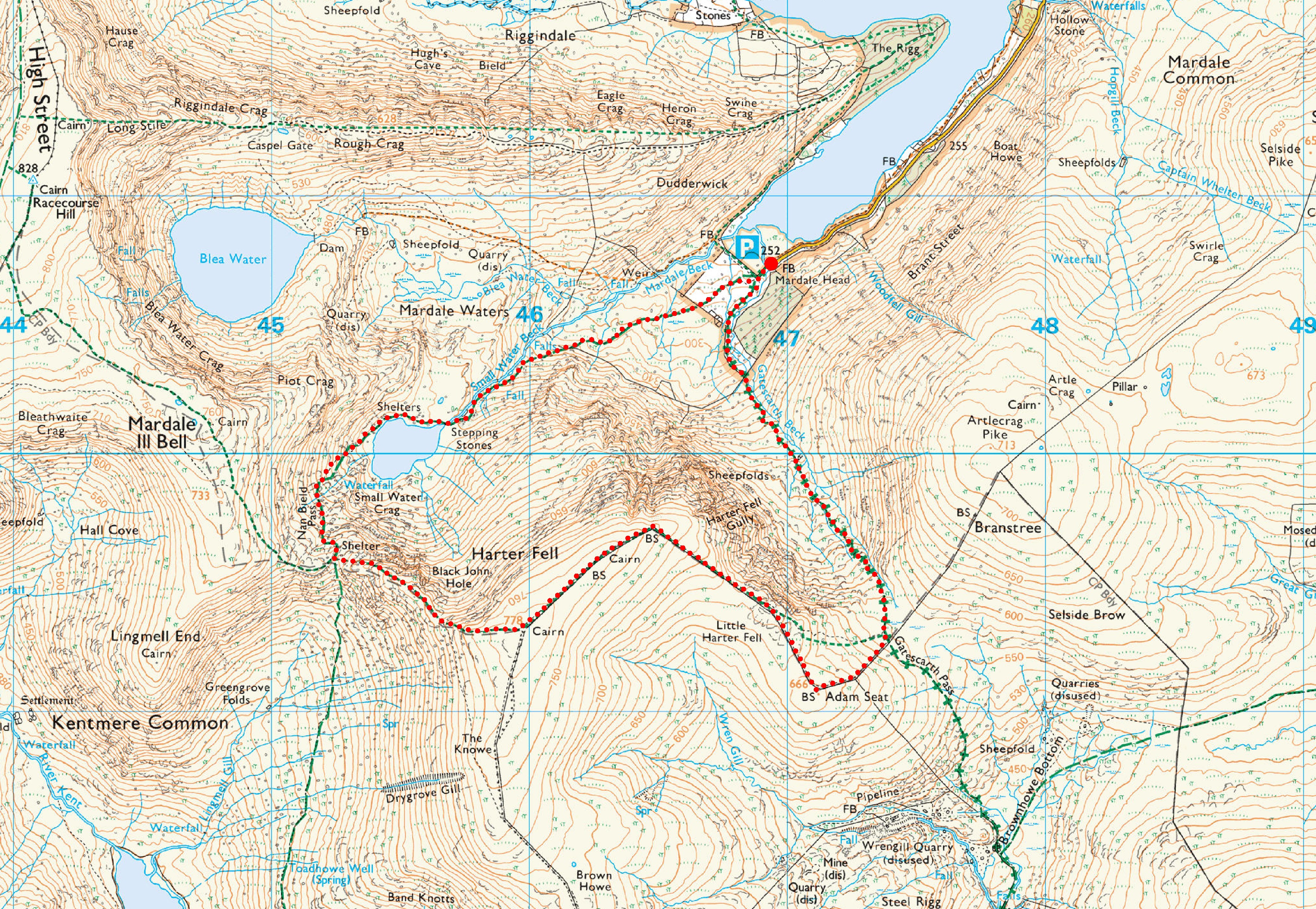
It is recommended to arrive early to secure a parking spot at Mardale Head, especially in the summer season.
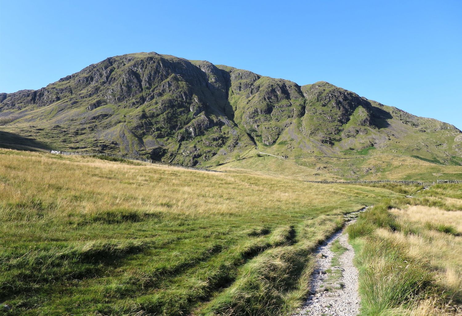
 Harter Fell and Mardale Ill Bell from Mardale Head
Just a few yards from the car park the path divides into three: to the left the path heads into the valley of Gate Scarth and beyond to the pass of the same name, to our right, the path leads to Blea Water or alternatively to the northern shore-path of Haweswater Reservoir, and straight on, this is our route to Nan Bield and then onto Harter Fell via its western ridge.
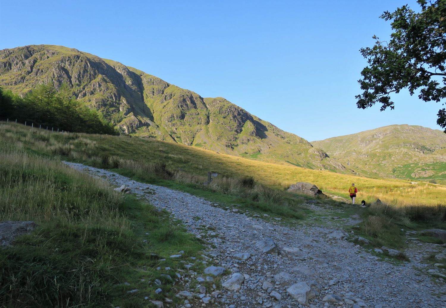
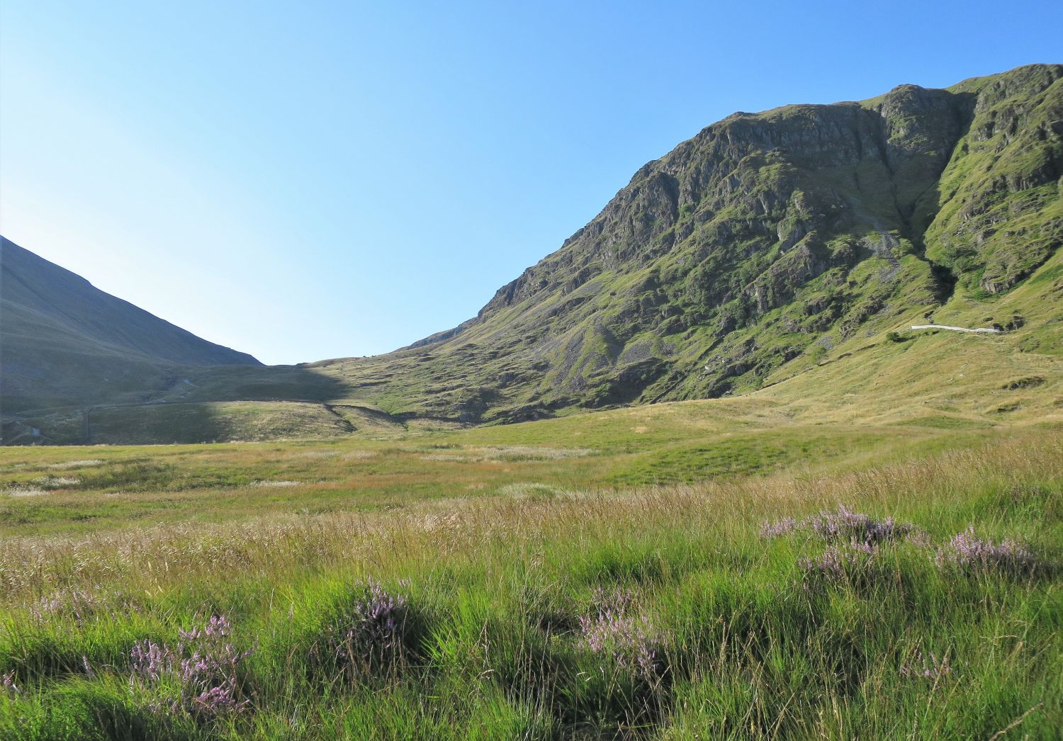
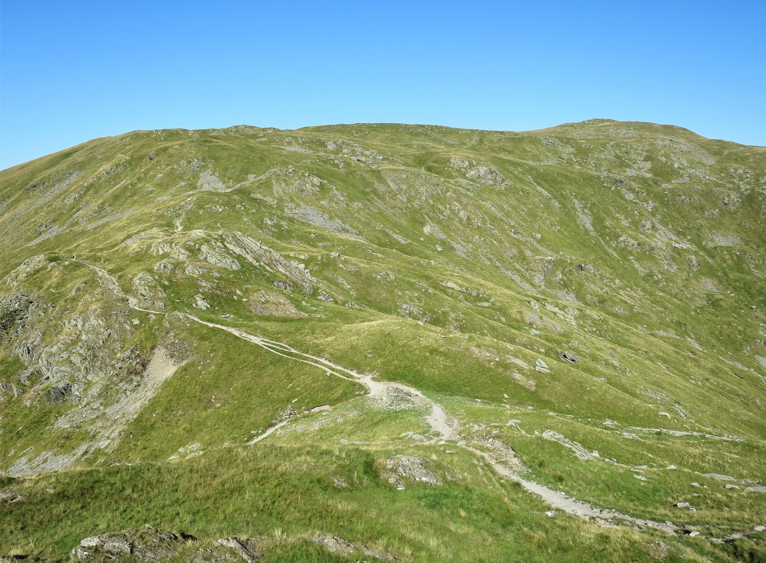
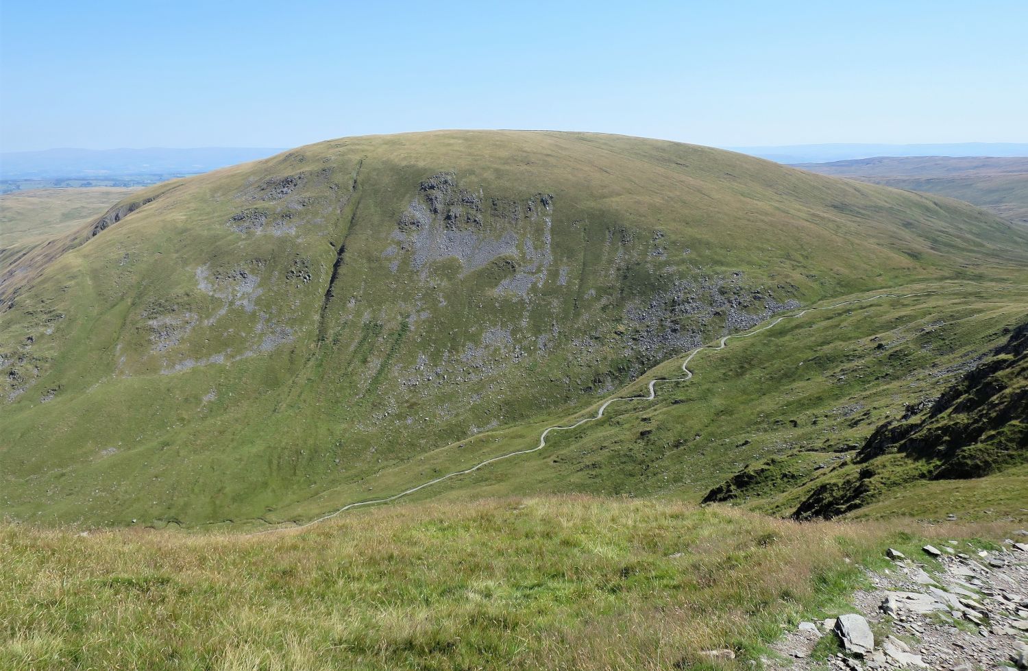
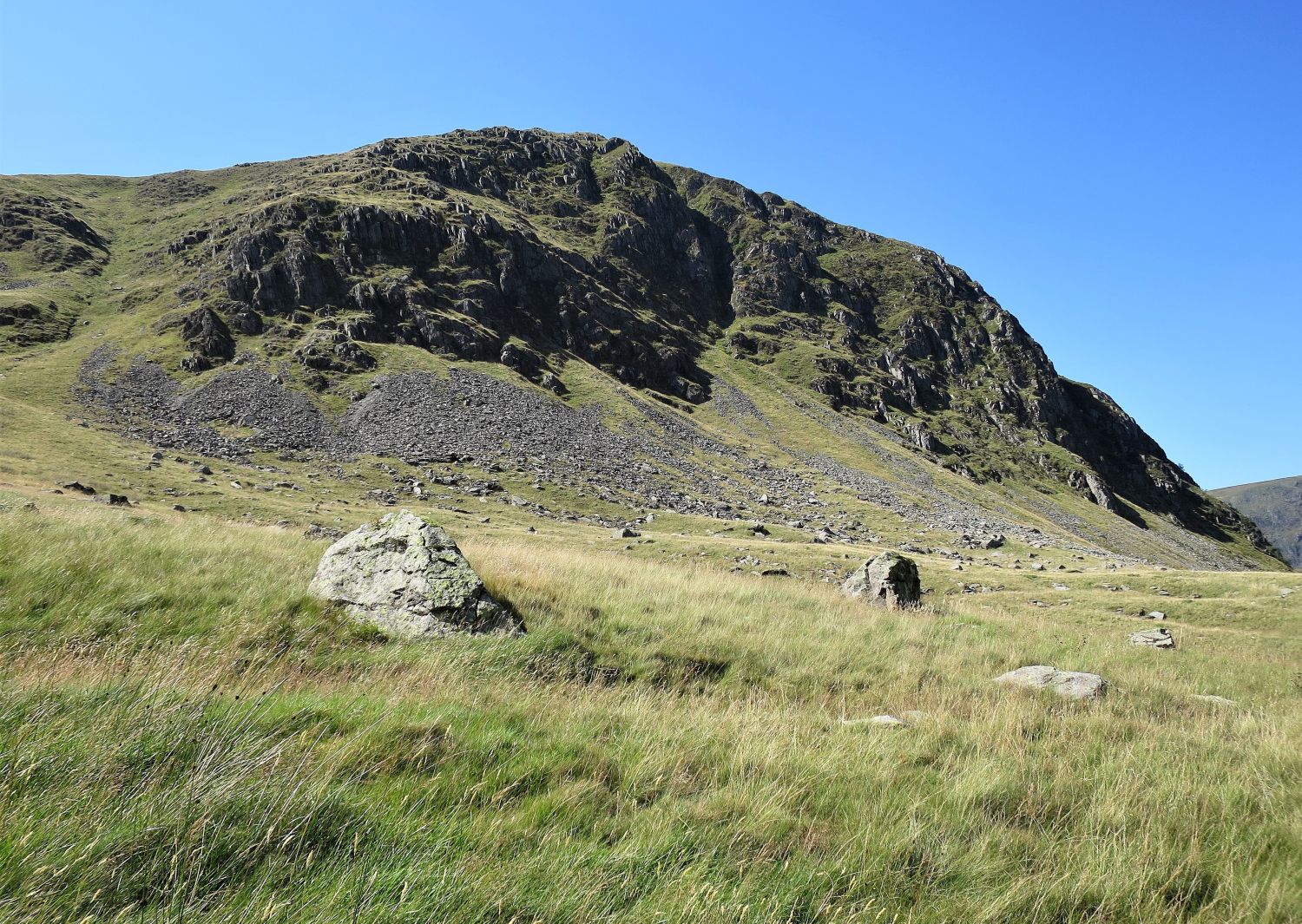
 The northern face of Harter Fell
“….having very gradually attained its maximum height on Harter Fell, the ground suddenly collapses in a tremendous wall of crags, falling swiftly to the head of Mardale amongst wild and romantic surroundings – one of the noblest mountain scenes in the district.” Harter Fell 2
AW
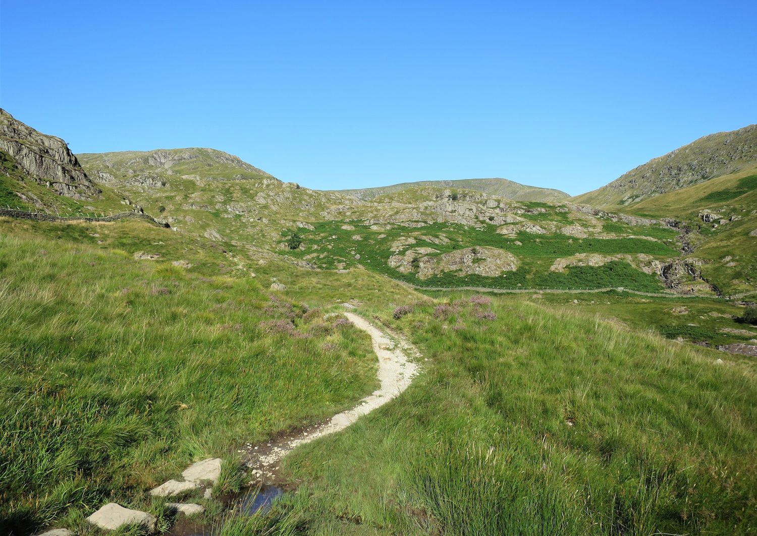
 Looking across to Gate Scarth and Harter Crag
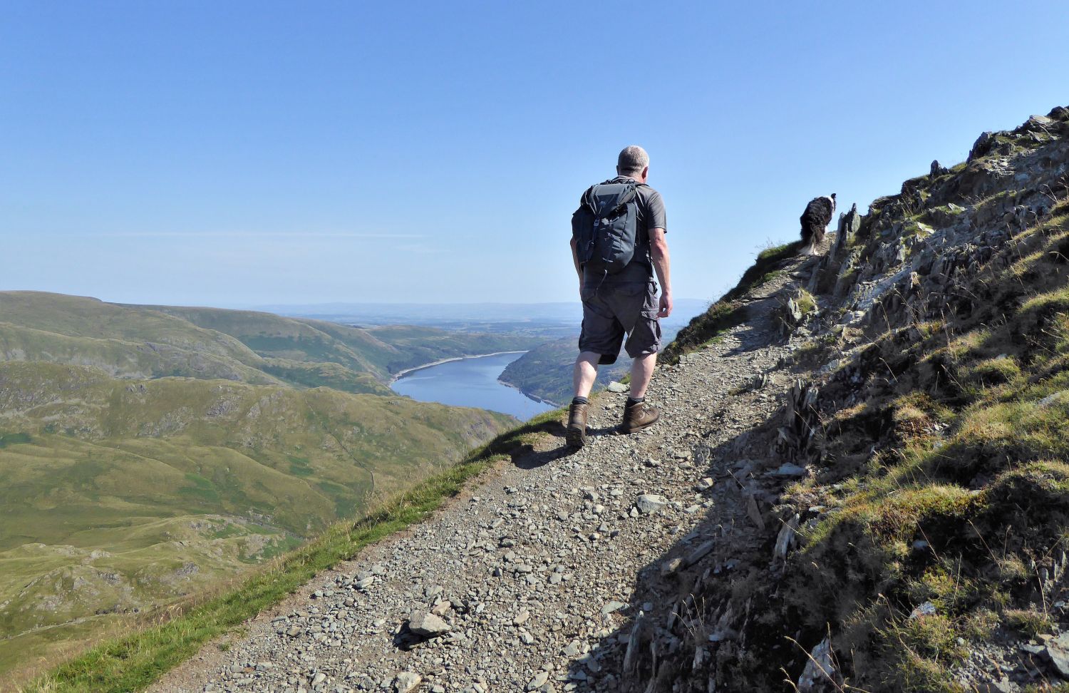
Gatescarth Pass will be our descent route back to Mardale Head, having climbed Harter Fell in a anti-clockwise direction. Wainwright, however, recommended the “round journey” by ascending Gatescarth Pass and returning by Nan Bield and Small Water. Personally, I prefer to climb the fell via its western ridge from Nan Bield, which provides a more rewarding ascent.
 Mardale Ill Bell and High Street appear over rough ground at Mardale Waters
Over on the right are the cascades of Blea Water Beck.
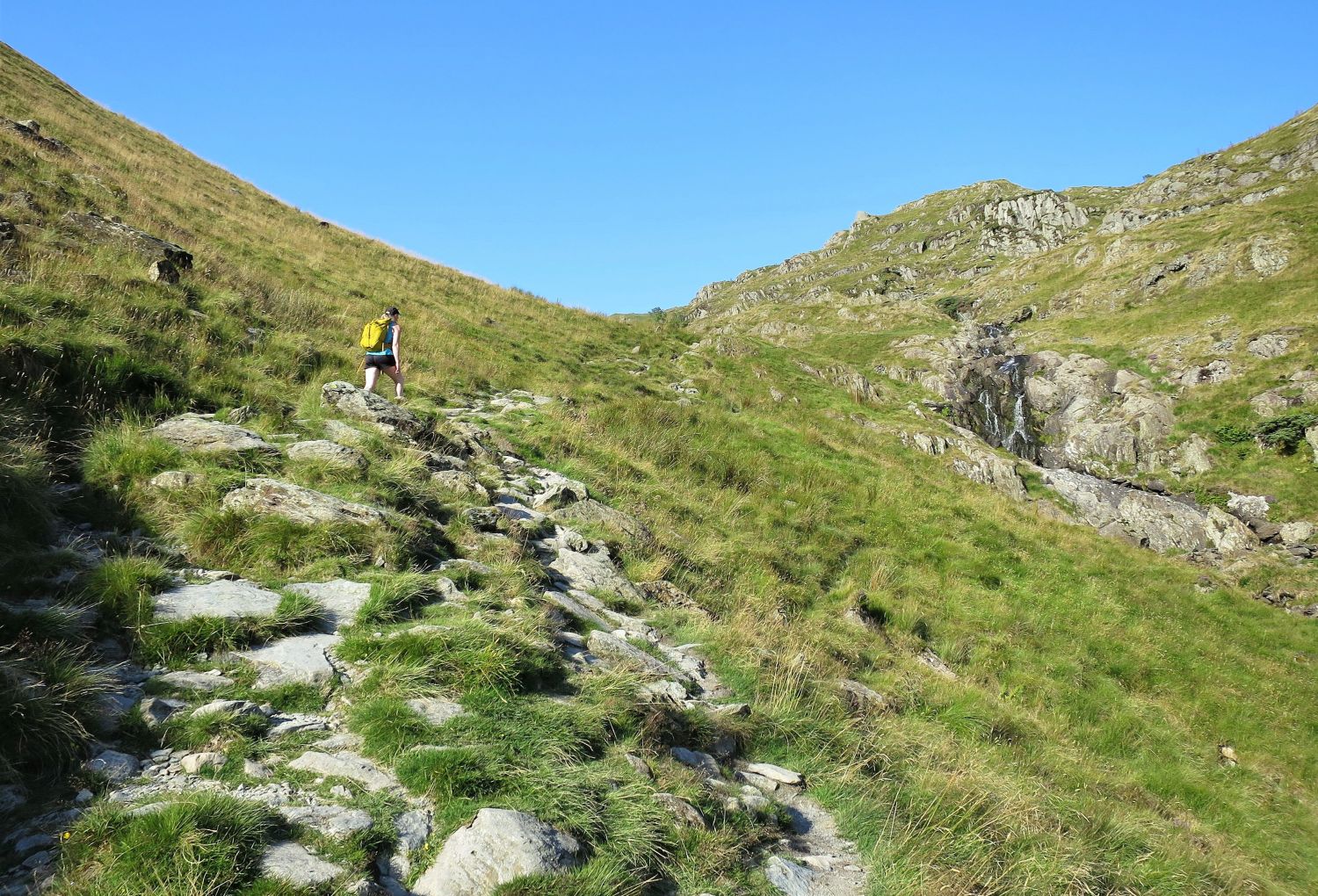
 Following the Nan Bield path to Small Water
 Looking back to Mardale Head
Once Small Water Beck is reached, the path becomes steeper in a series of rocky zig-zags. On a very hot day progress can be slow, so there’s no excuse for not turning around and admiring the view.
 Waterfall in Small Water Gill
Just a splash and a tickle of a waterfall after a long spell of dry weather.
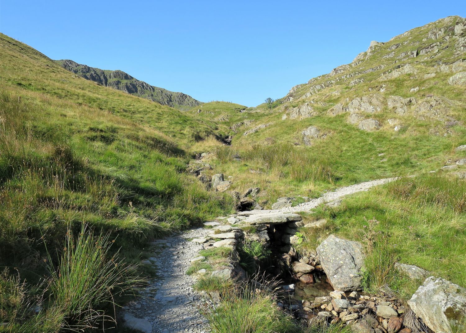 Clapper bridge over an infant Small Water Beck
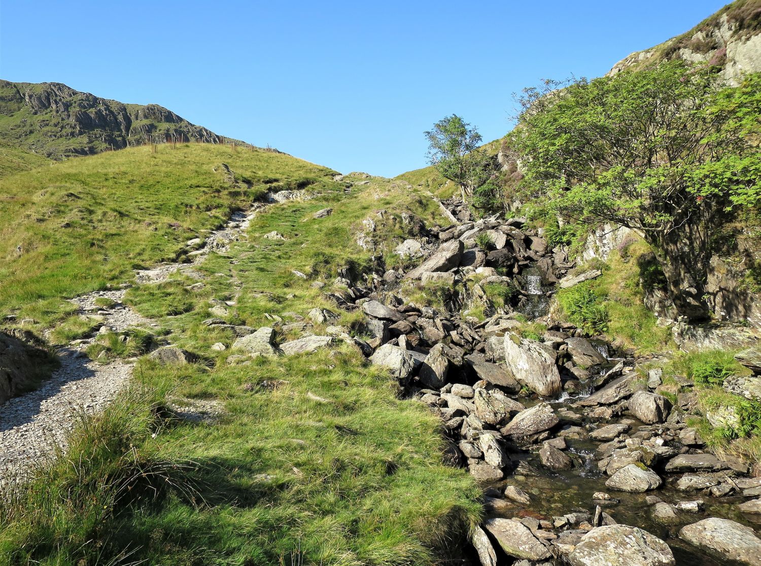 More cascades on the final approach to Small Water
 Book Two
The Far Eastern Fells
Harter Fell 14
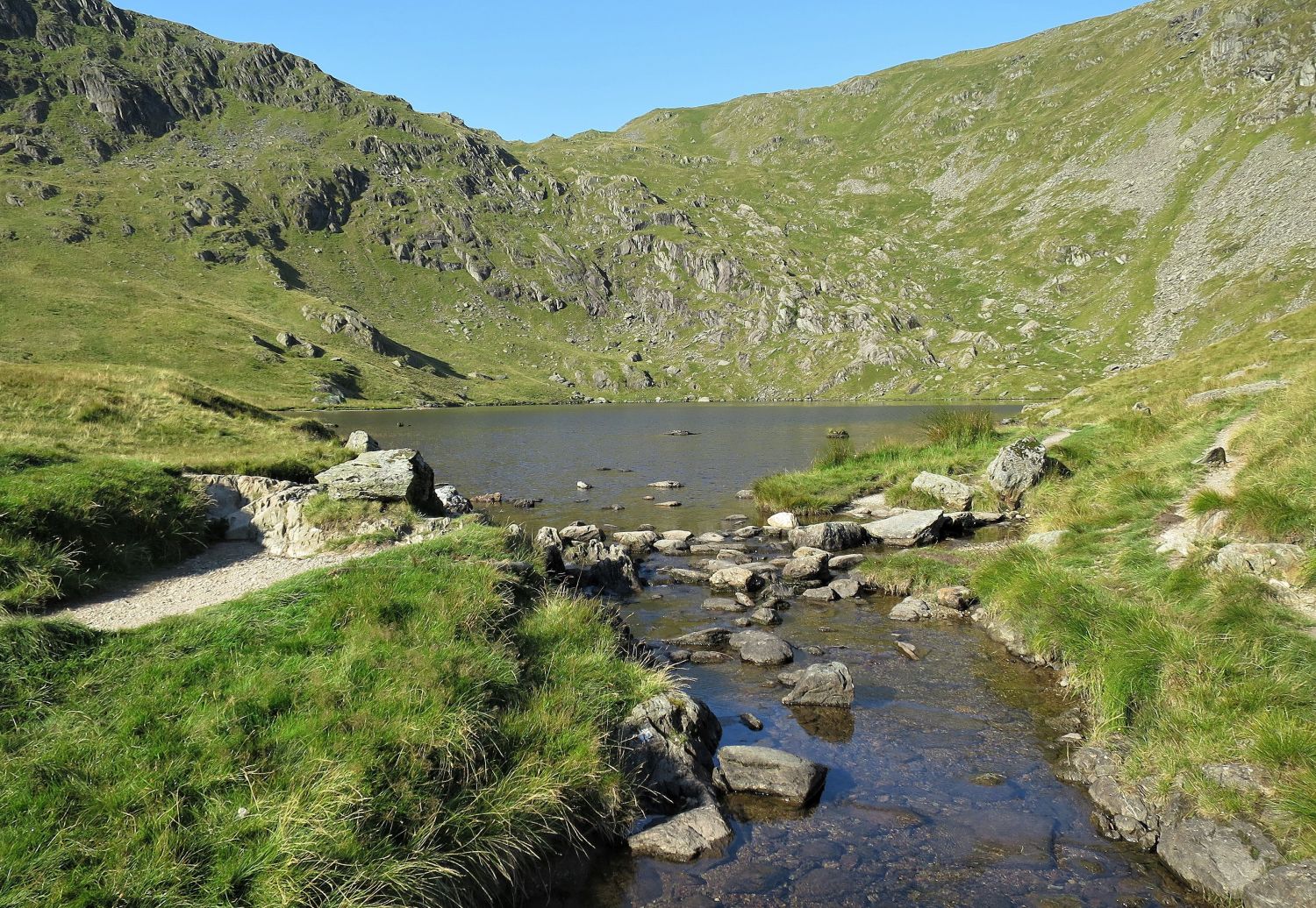
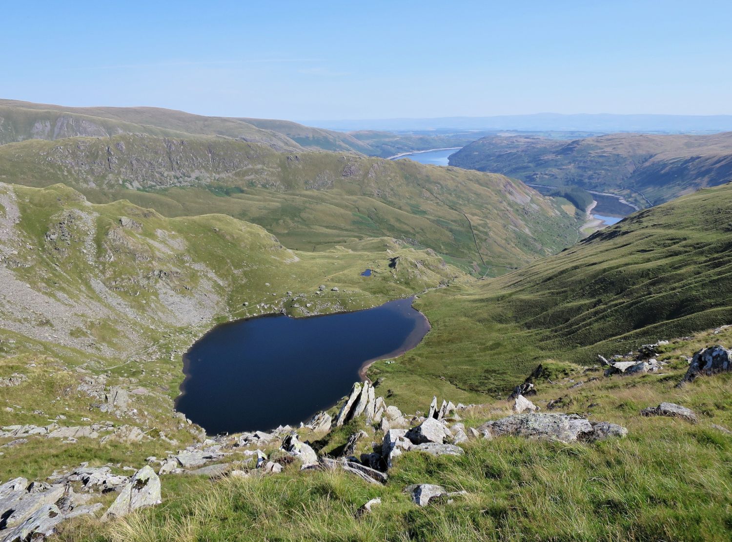
“Small Water”
“….the rugged surroundings on this side are greatly enhanced in impressiveness by the two splendid tarns of Blea Water (below High Street) and Small Water (below Harter Fell), each of them occupying a volcanic crater and deeply inurned amongst crags. These tarns, with their streams, are collectively known as Mardale Waters, and greatly contribute to the fine scenic quality of this typical Lakeland landscape.” Mardale Ill Bell 2
AW
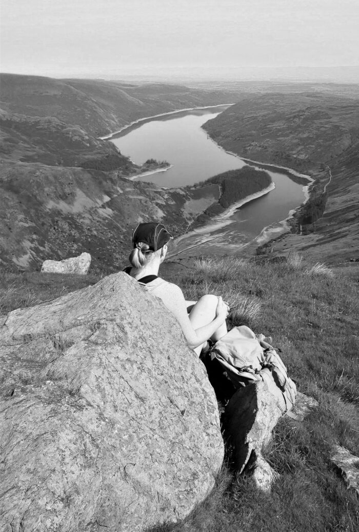
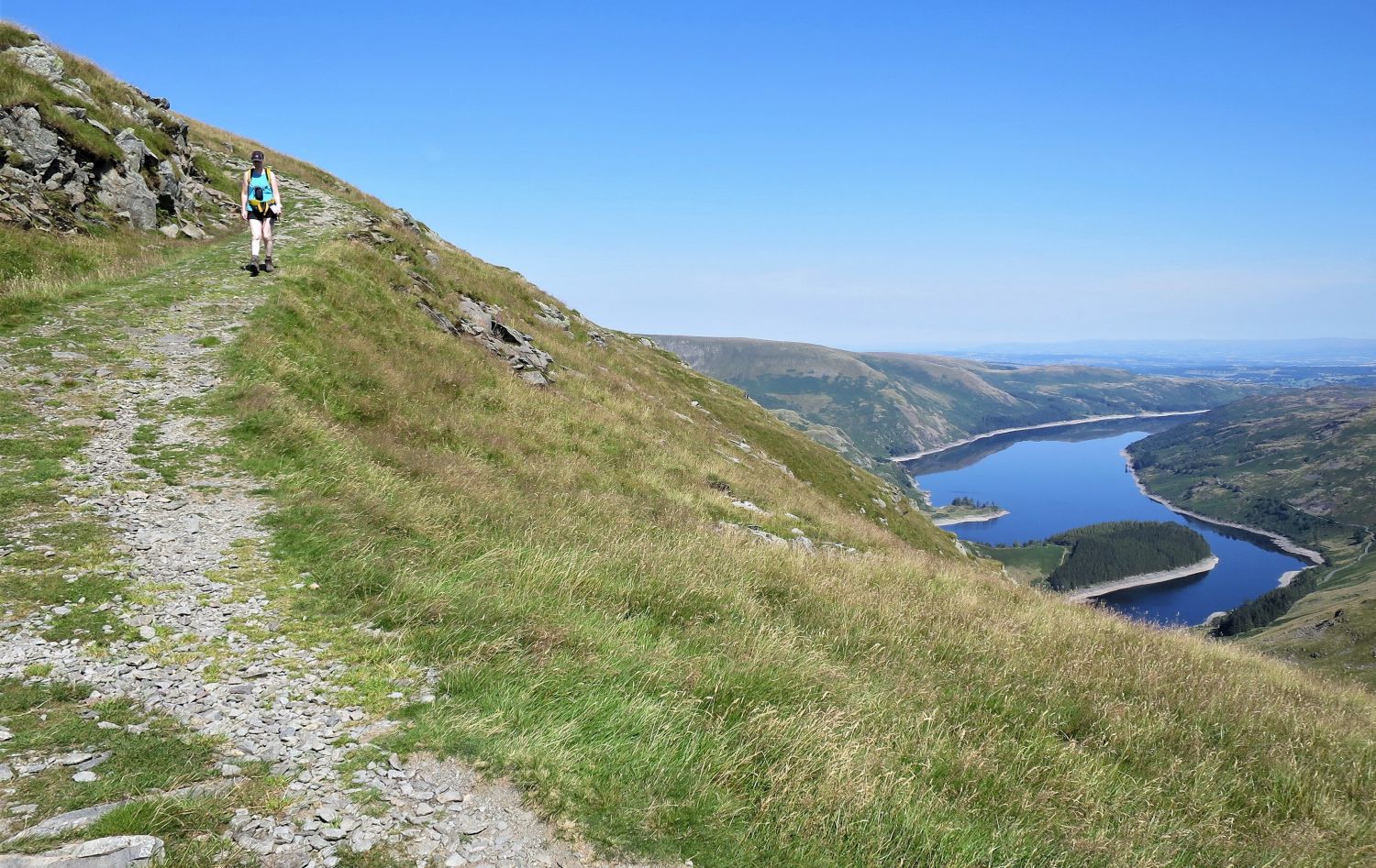
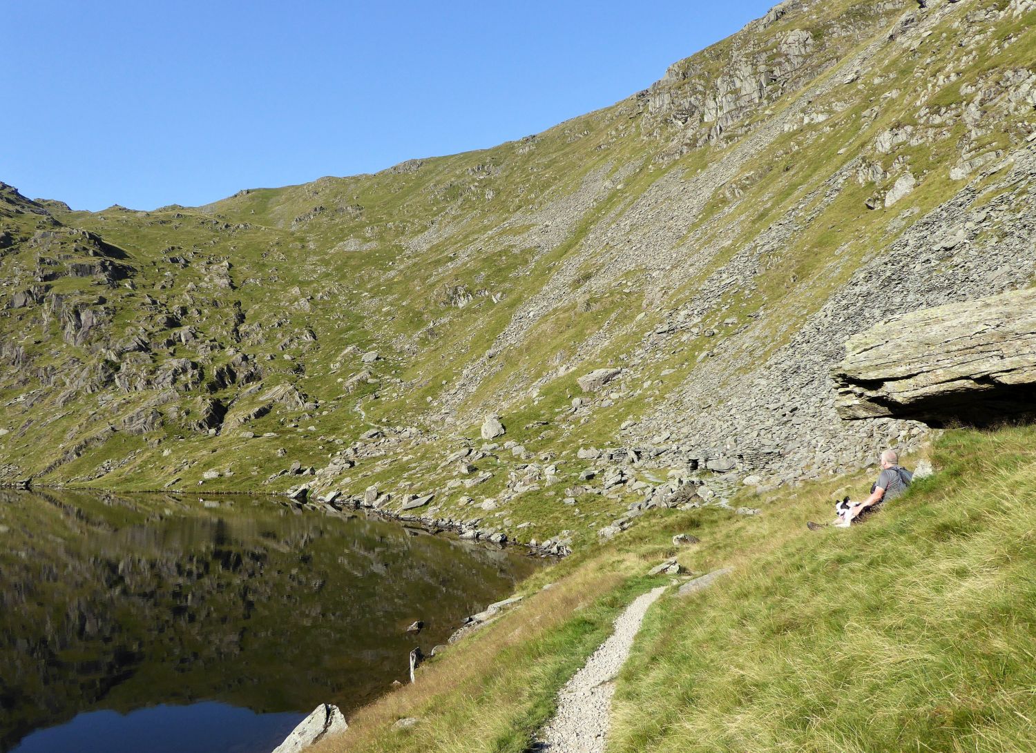 Lunch stop with a grand view towards the summit of Nan Bield Pass.
From here the walk is very rewarding; the approach to Nan Bield via a rock staircase is splendid, and the views looking back are memorable.
 Book Two
The Far Eastern Fells
Mardale Ill Bell 7
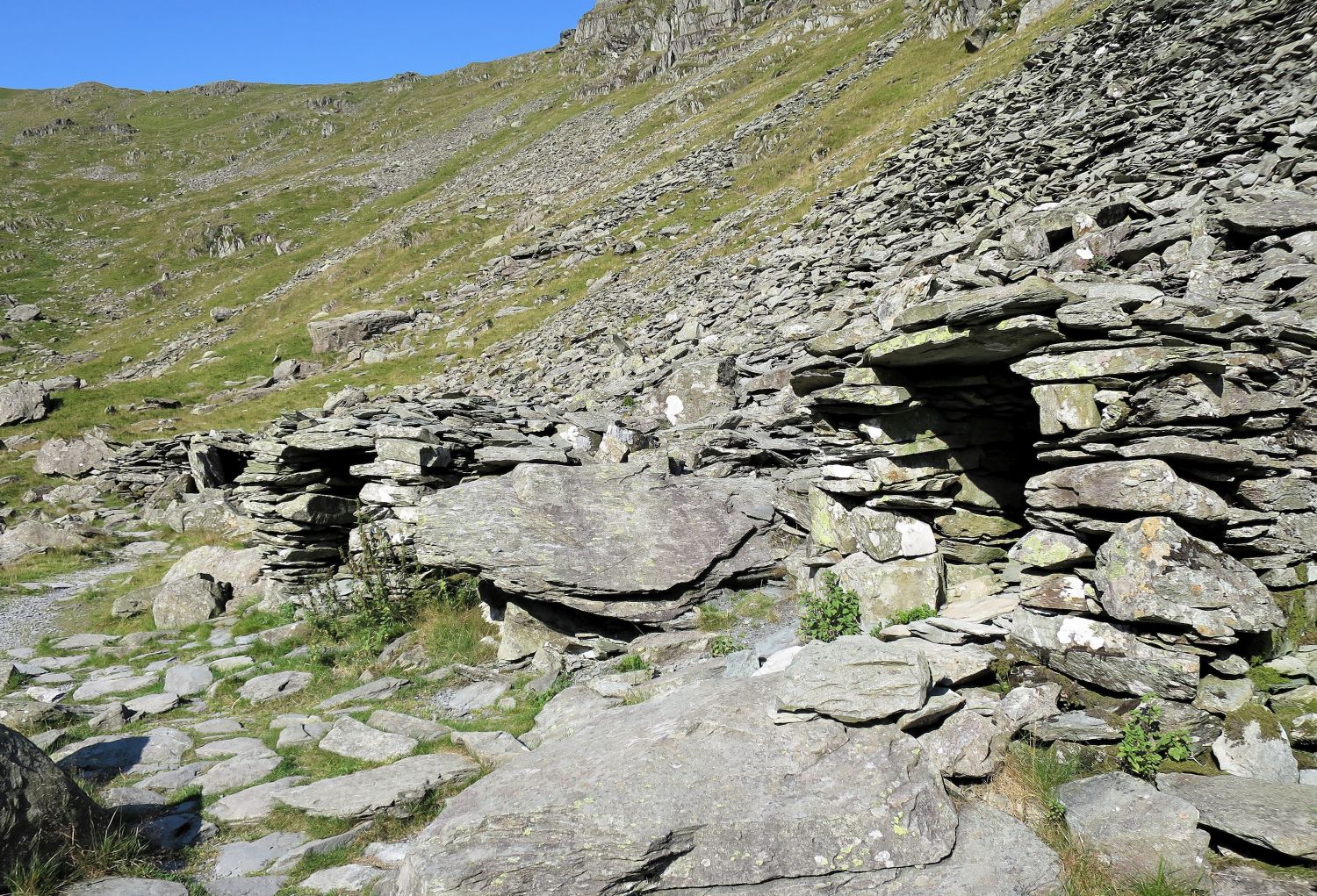
“The stone shelters at Small Water”
“Testimony to the former importance of Nan Bield Pass as a route for travellers and trade are the three shelters alongside the track where it crosses the bouldery shore of Small Water – erected for wayfarers overtaken by bad weather or darkness. These shelters are roughly but soundly built and roofed, but they are low and can be entered only by crawling. Once the body is insinuated snugly in their spider-infested recesses, however, the weather may be defied.” Mardale Ill Bell 8
AW
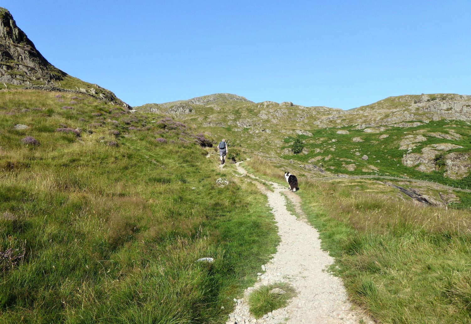
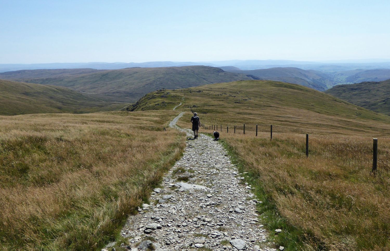
 The path to Nan Bield
More sunscreen, more fluids and more steps,….
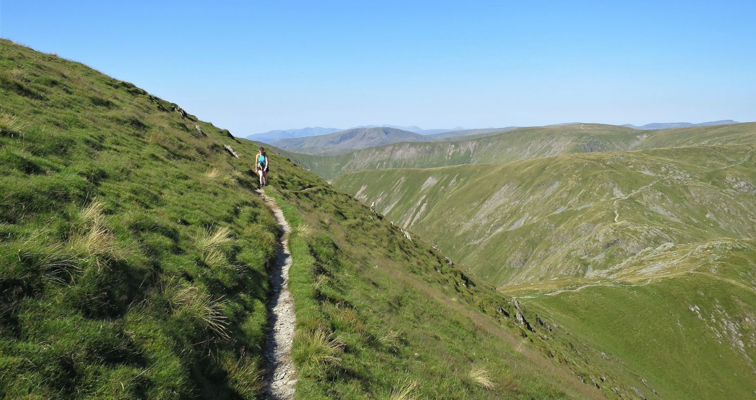
 Looking back to Small Water and Mardale Head in the distance
….however, the route is a delight, and the view is very rewarding. Remarkably, you can still see the car park at Mardale Head, even though the route has followed many twists and turns.
 The summit shelter at Nan Bield
The Nan Bield Pass has to be one of the finest passes of Lakeland. When stood at its summit and looking north and then south, its historic importance becomes obvious; this ancient route was vital for trading, not only between the valleys of Kentmere and Mardale, but also the towns of Kendal and Penrith.
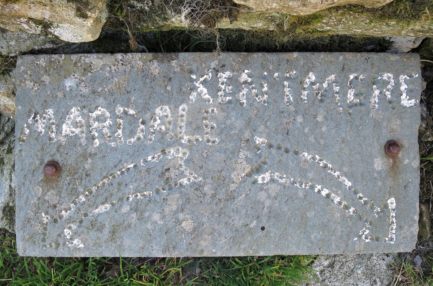 Waymarker on the summit shelter
Imagine the benefit of this simple waymarker in thick mist!
 Looking down into Kentmere from Nan Bield
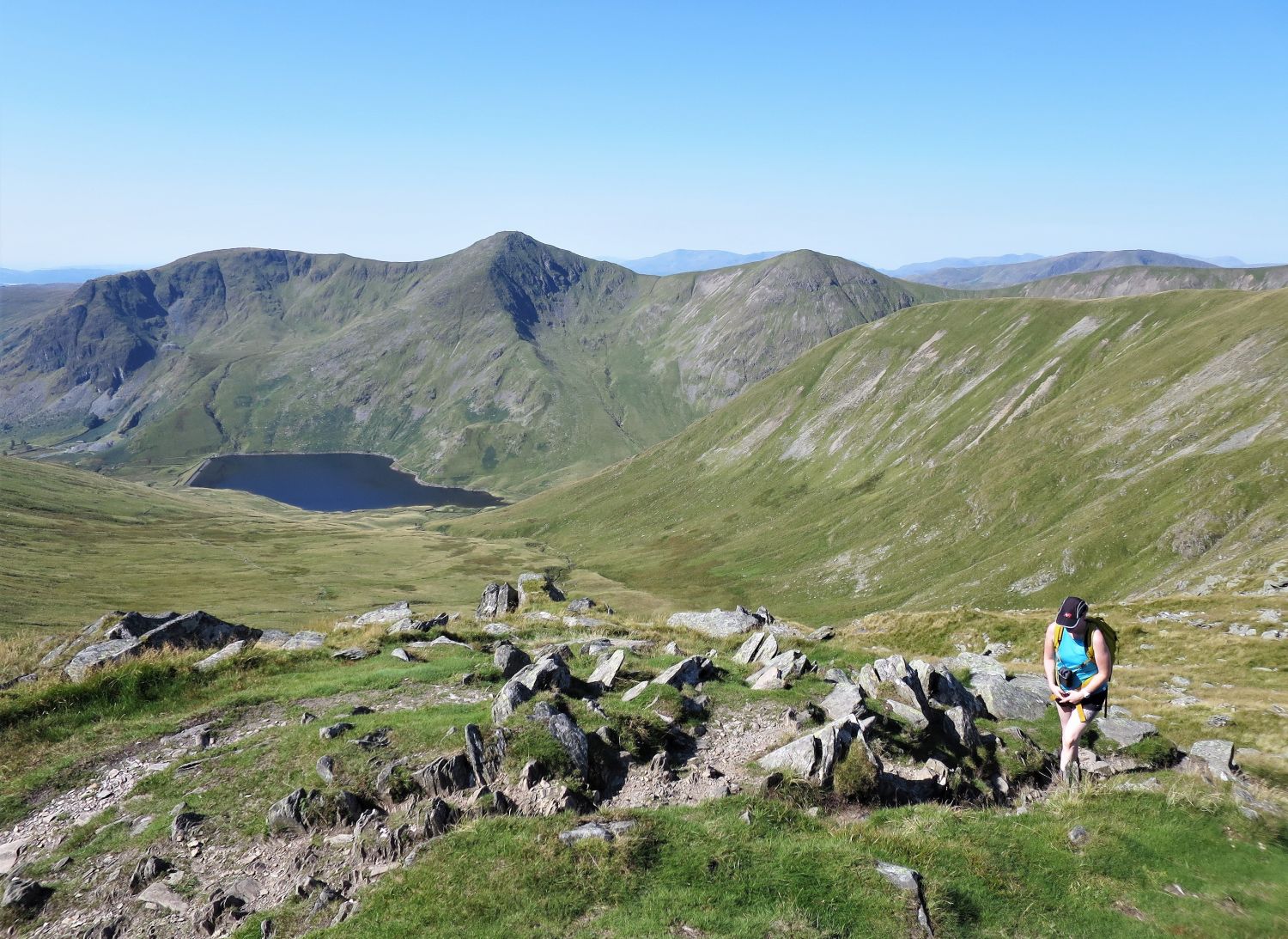
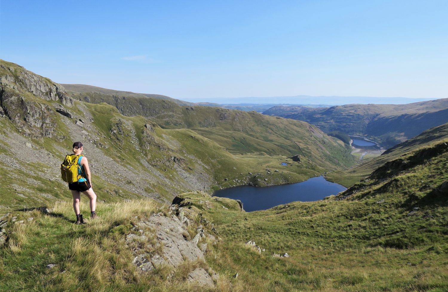 Mardale Head and Small Water seen from above Nan Bield
A nice place to contemplate and add more sun cream before our final climb to Harter Fell.
 Looking back to Mardale Ill Bell over Nan Bield
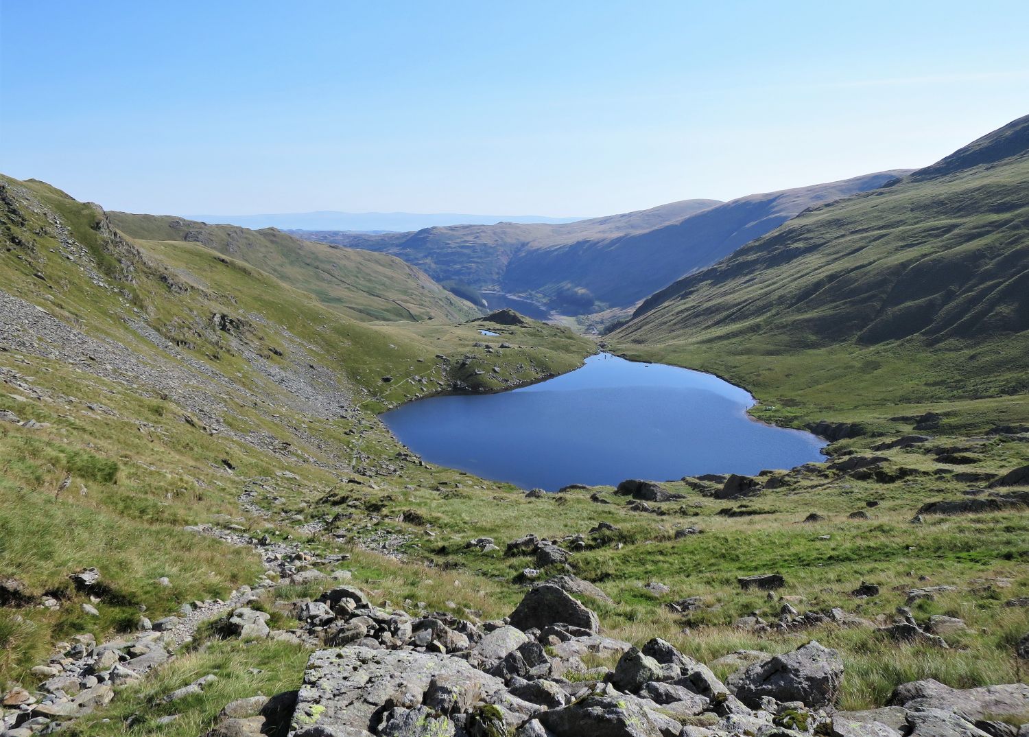
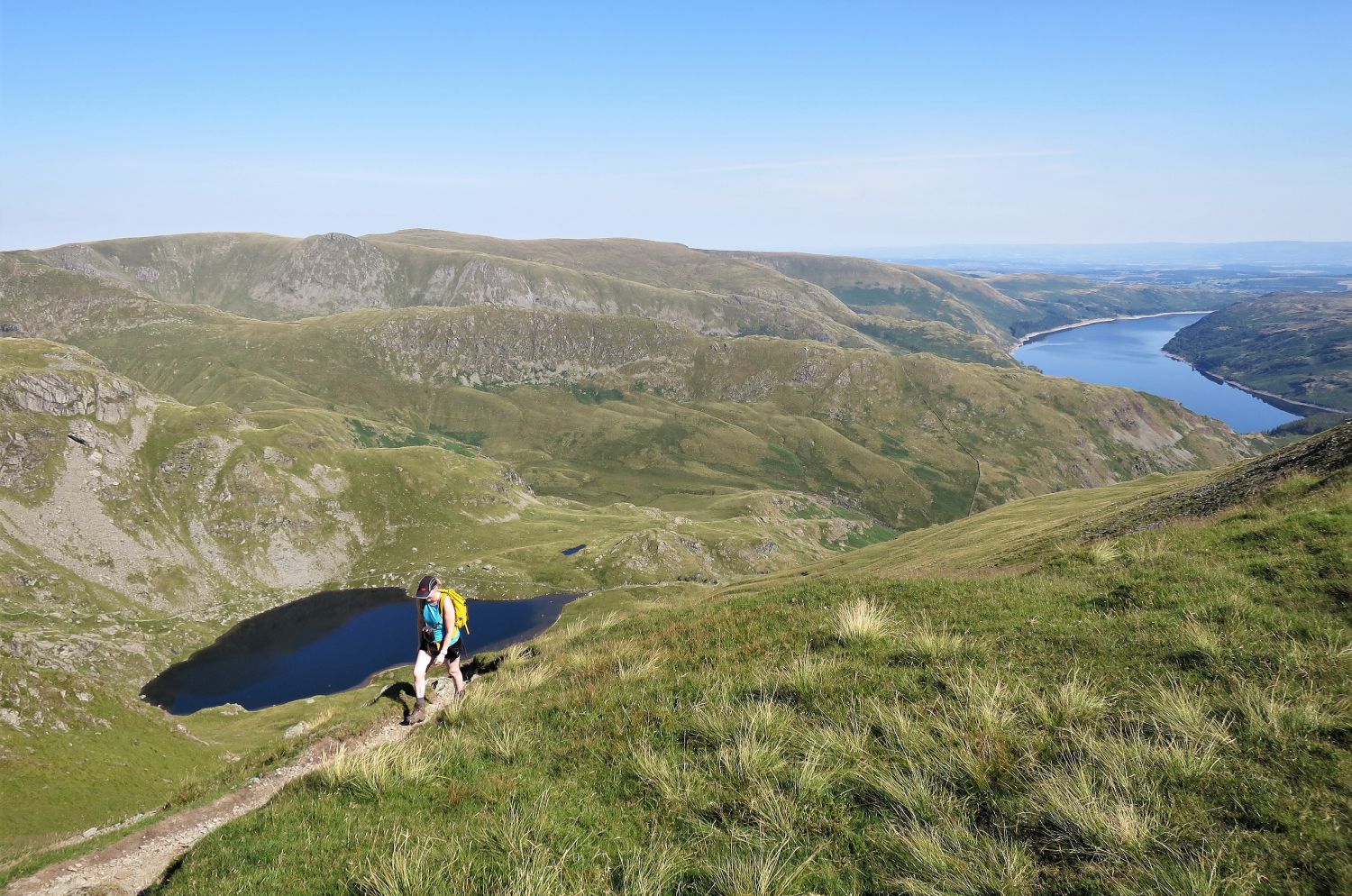
 Small Water from the ascent of Harter Fell
 The author and Frankie ascending Harter Fell
 Jaclyn and Frankie on the rocky sections
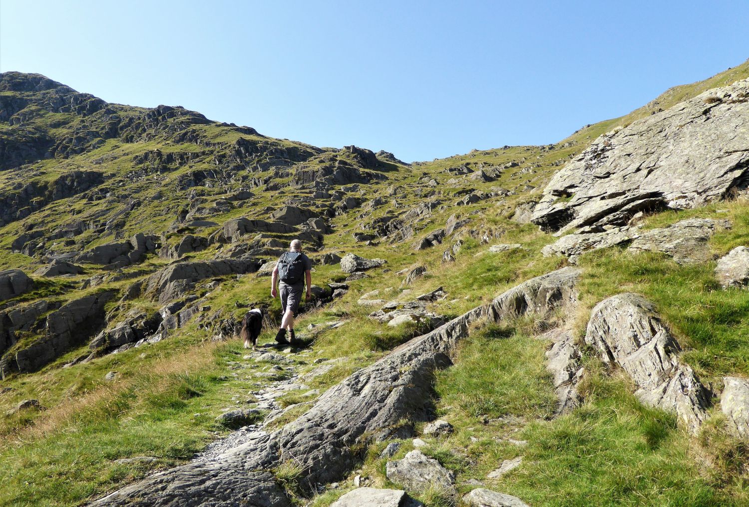
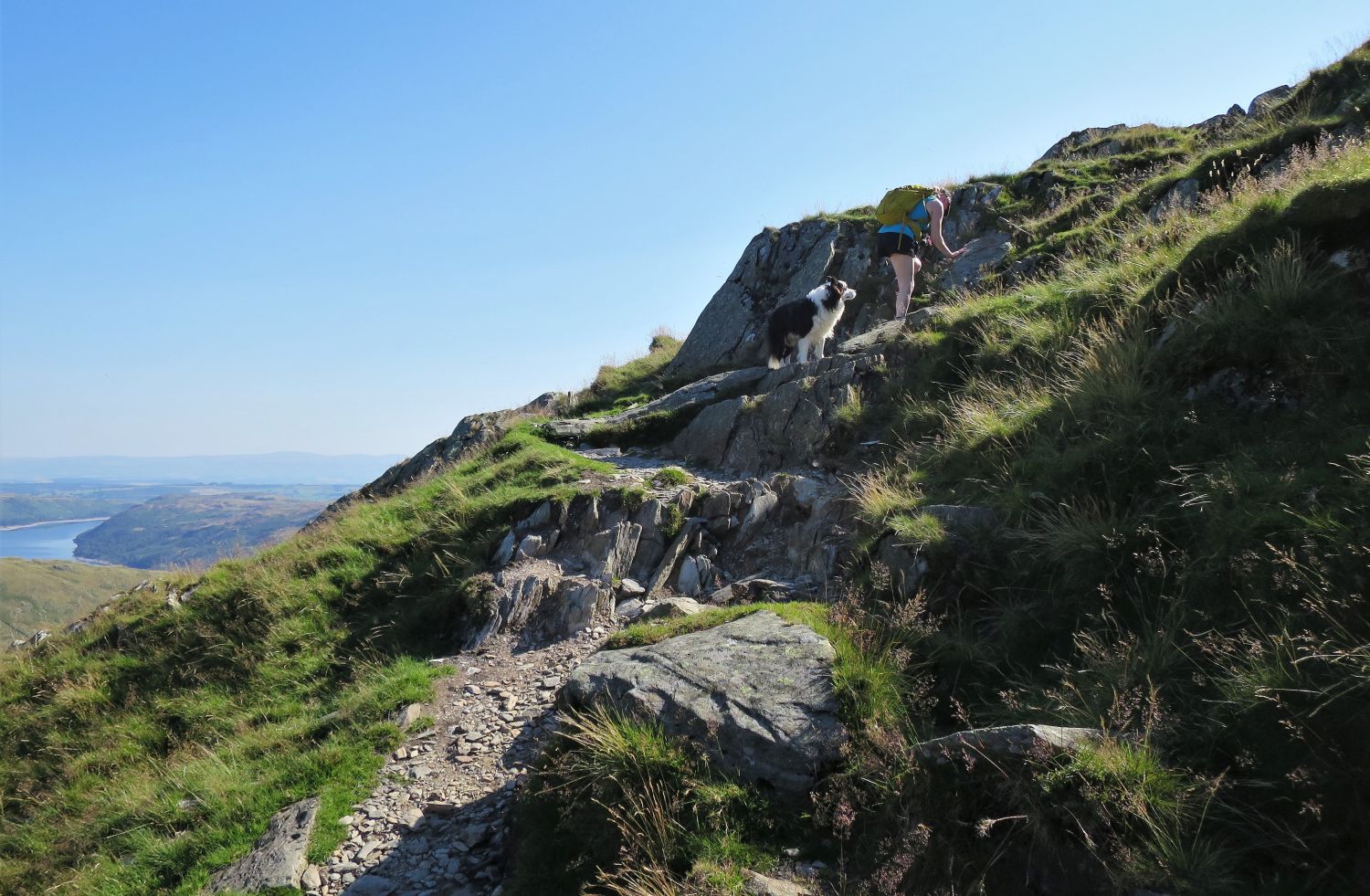
Initially, the climb from Nan Bield is a series of rock sections, which require a little bit of simple scrambling. It is a joy in dry conditions.
 Jaclyn looking over to the peaks of Ill Bell and Froswick
 Harter Fell and The Knowe
The ascent suddenly becomes much gentler, and then it’s another steep but simple climb to the summit plateau.
 Looking back to Yoke, Ill Bell and Froswick over Kentmere Reservoir
 Jaclyn on the north-west flank
You can choose to continue following the western ridge to take a direct line to the summit plateau, but we prefer to follow the narrow path that zig-zags its way up the north-west flank.
 Small Water and Haweswater Reservoir from the ascent of Harter Fell
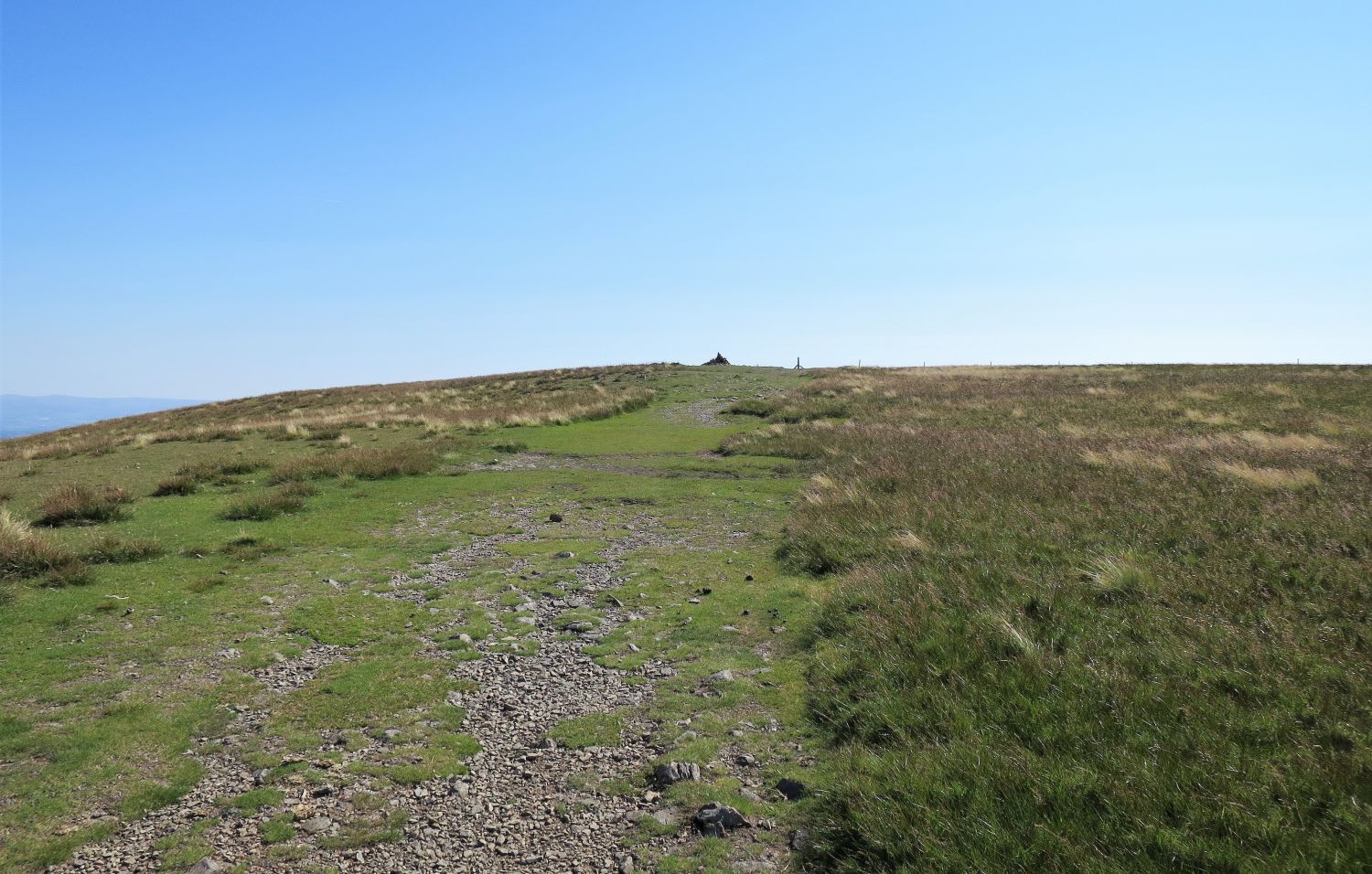 Approaching the summit of Harter Fell
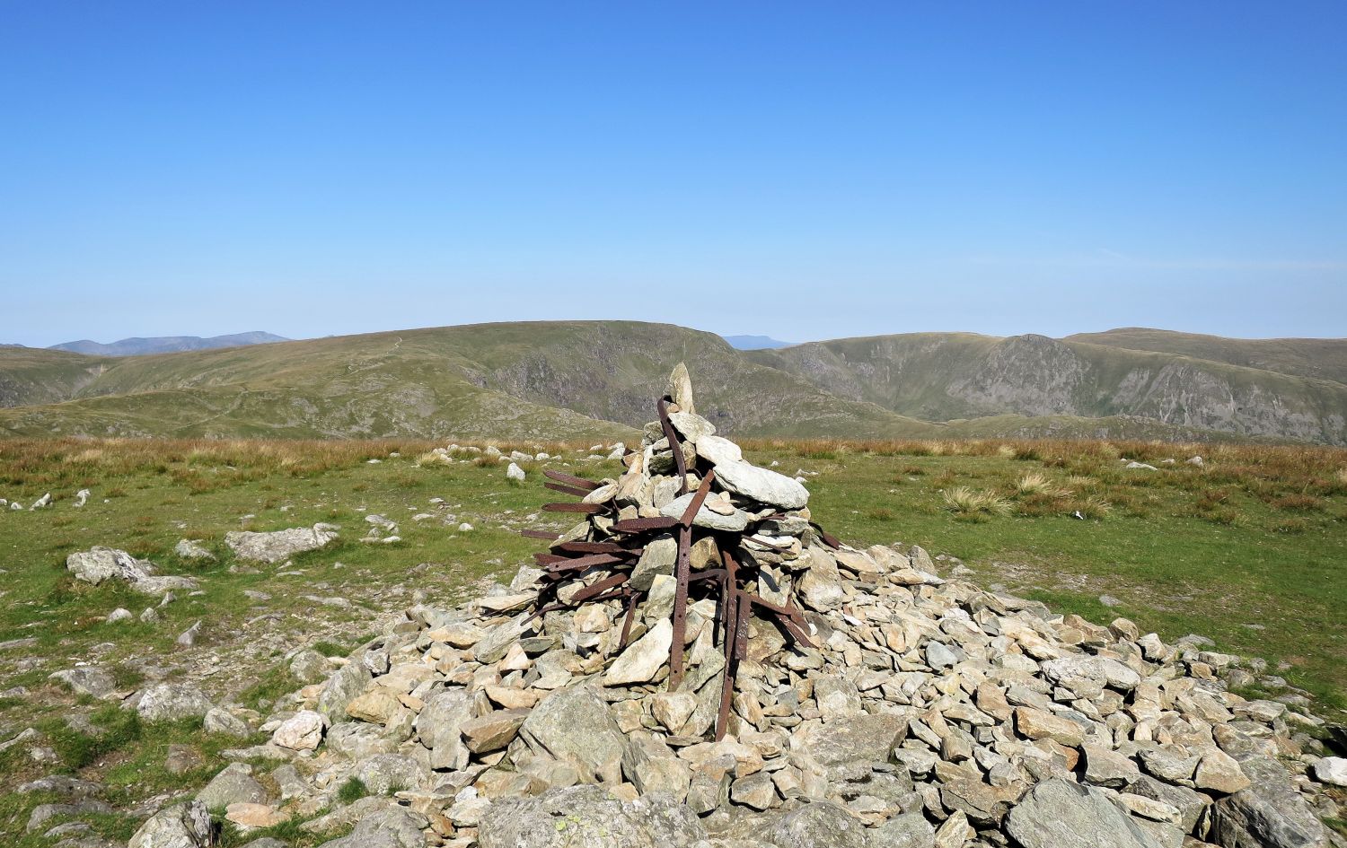
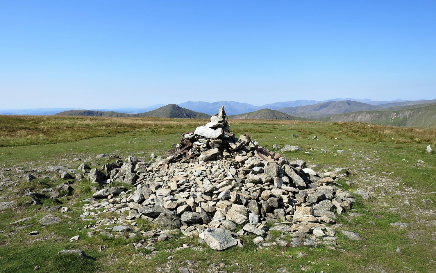
“A mild shock awaits anyone reaching the top of the fell on a first visit, especially in mist, for there is a spectral weirdness about the two highest cairns….”
 Book Two
The Far Eastern Fells
Harter Fell 9
“The Summit”
“….The stones support an elaborate superstructure of iron fence-posts and railings, which, having served their original mission, now act as an adornment that has a nightmarish quality. The summit cairn, illustrated above, now has a higher proportion of stones to metal” Harter Fell 9
AW (revised by CH)
 The distant Coniston fells seen between Ill Bell and Froswick
Over on the right in the very far distance, the Scafells and Great Gable are easily recognisable. The dominant looking fell on the right is Red Screes.
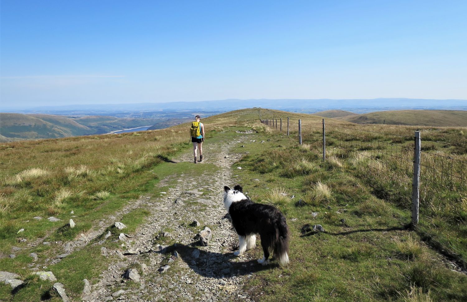 Following the ridge to the north-east cairn(s)
“The pedestrian route across the top follows a wire fence. The paths are clear on hard ground, in places ten yards wide or more.” Harter Fell 9
AW (revised by CH)
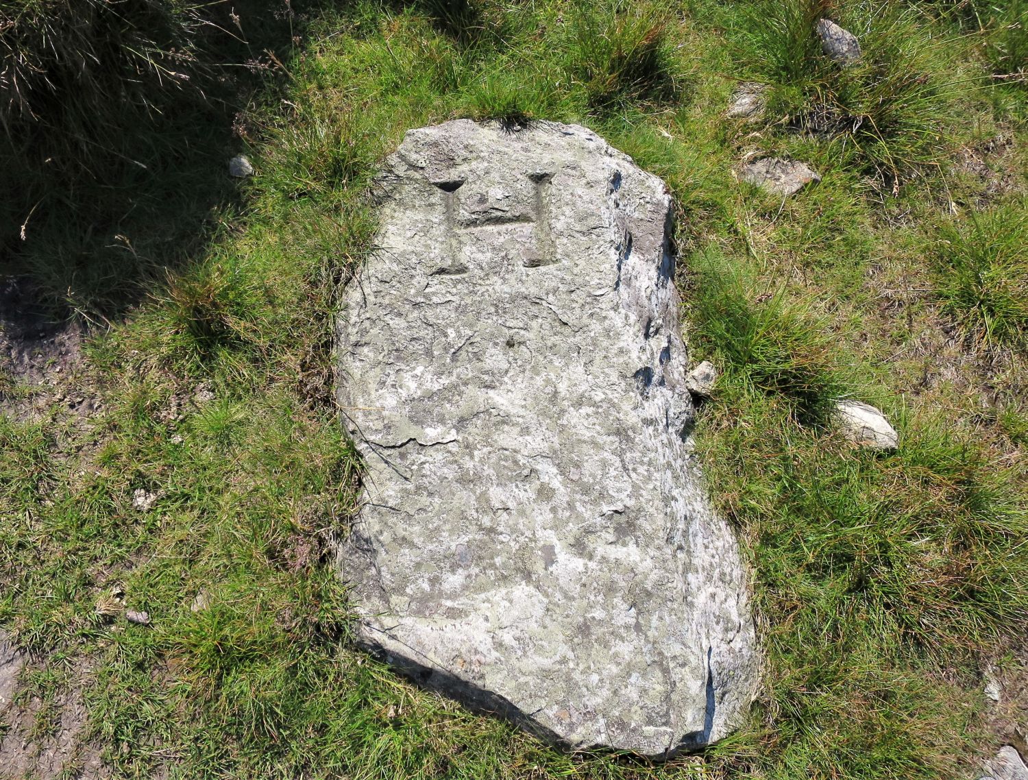
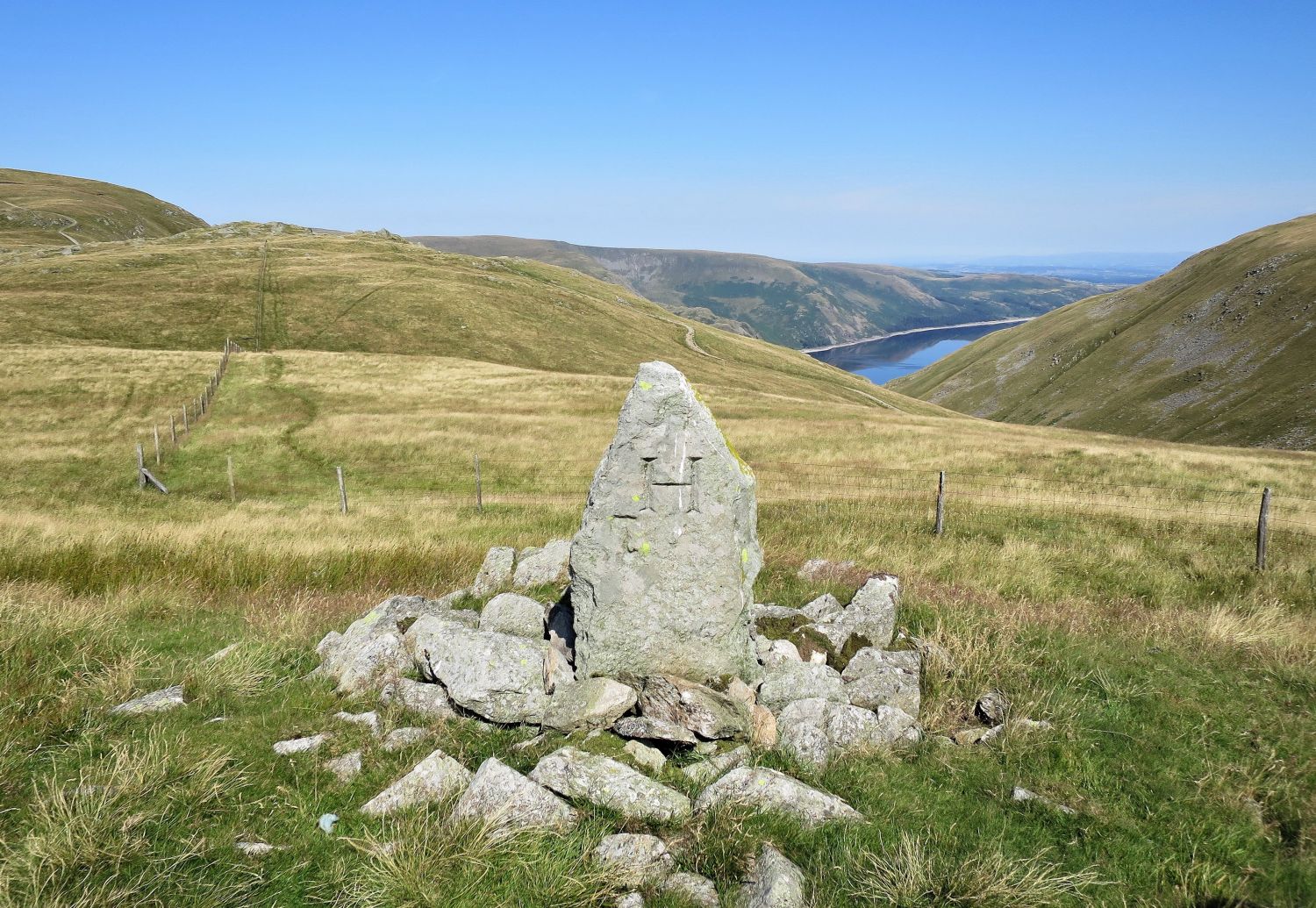
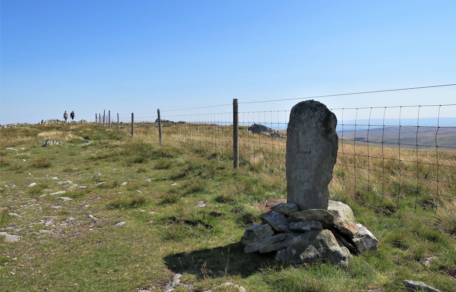 The old boundary stone on Harter Fell
This large stone, engraved “L” on one side, and “H” on the other, once marked the boundary between the land around Mardale (owned by the Lonsdale Estate) and Longsleddale (owned by the Harrison Estate). My wife and I decided to place it back in an upright position, as it had been laying flat down in the grass for many decades. Although it is no longer required, we simply didn’t see the point of leaving it there out of view. Sadly we didn’t have enough time on this day to build a more substantial cairn around it, but we hope over time more stones will be added so it can stay in position and continue to battle the elements on Harter Fell.
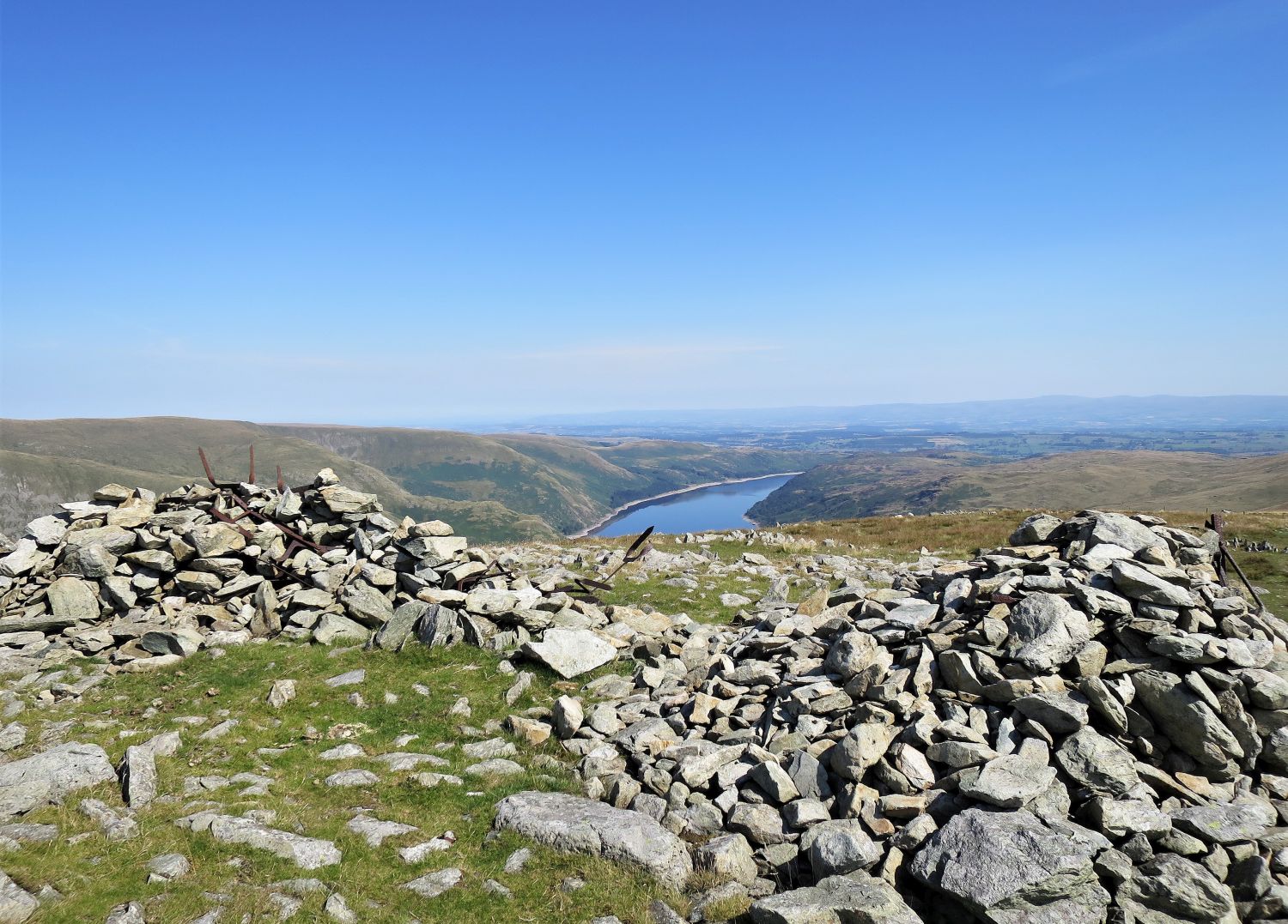 Haweswater Reservoir seen from Harter Fell’s north-east cairn(s)
Not sure why, but there are two large cairns at this location. Was there an attempt to build a wind shelter many years ago?
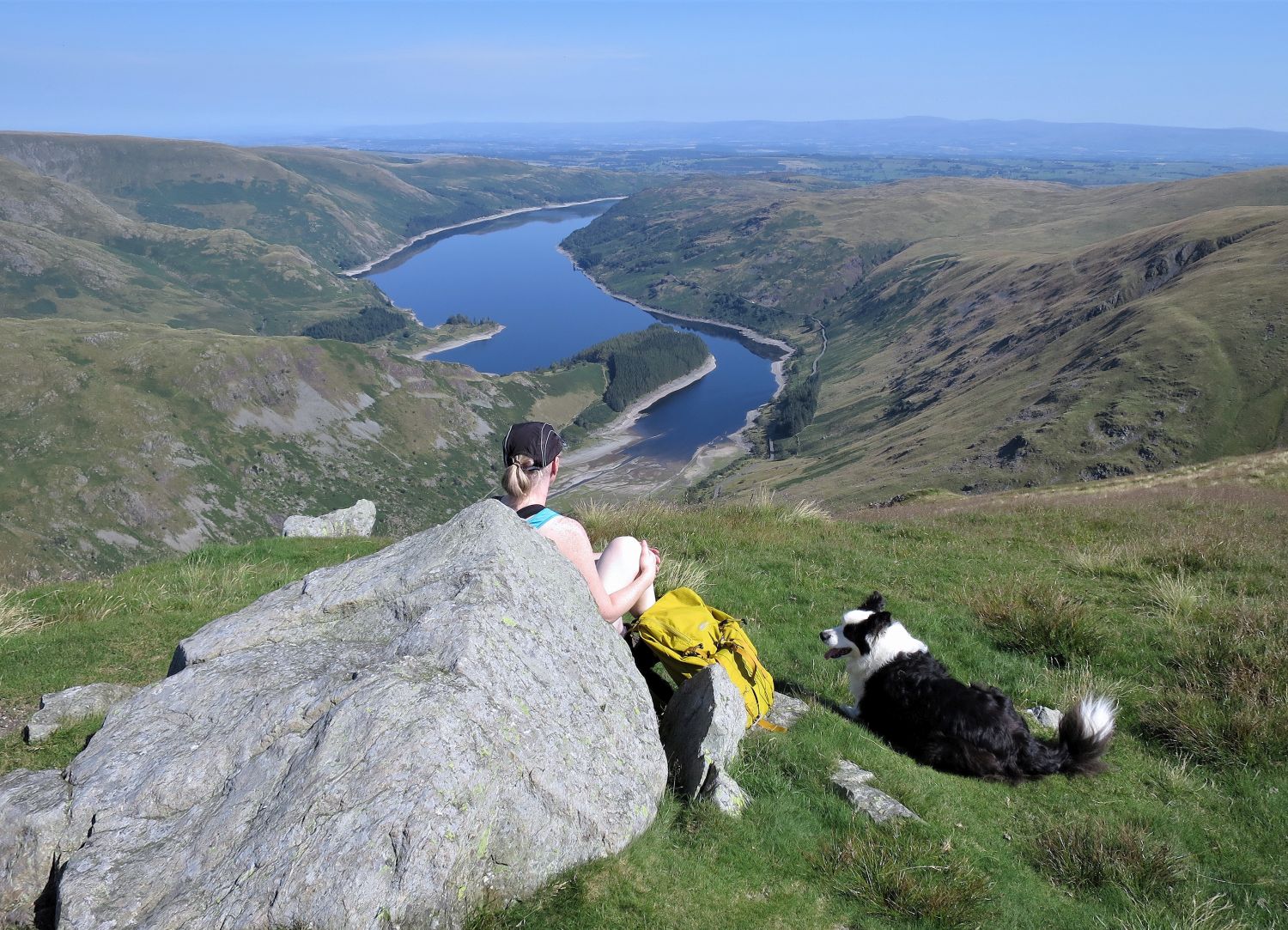 Jaclyn and Frankie at the “fence corner”
A very popular place to sit where Alfred Wainwright once sat to admire the view down the valley of Mardale.
 Book Two
The Far Eastern Fells
Harter Fell 10
“Haweswater from the fence corner”
“The fence corner is the setting for the illustration opposite, which was used to introduce the author’s television programmes in the 1980s.” Harter Fell 9
CJ
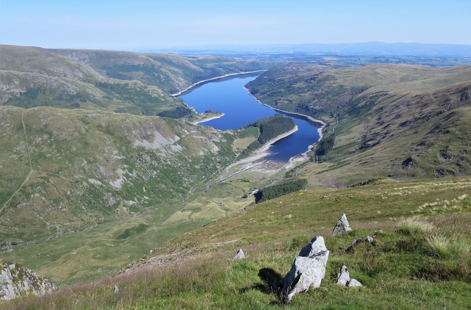 Mardale from Harter Fell
Walk a little bit further to the edge and you are rewarded with an even more impressive view.
 The second boundary stone at the “fence corner”
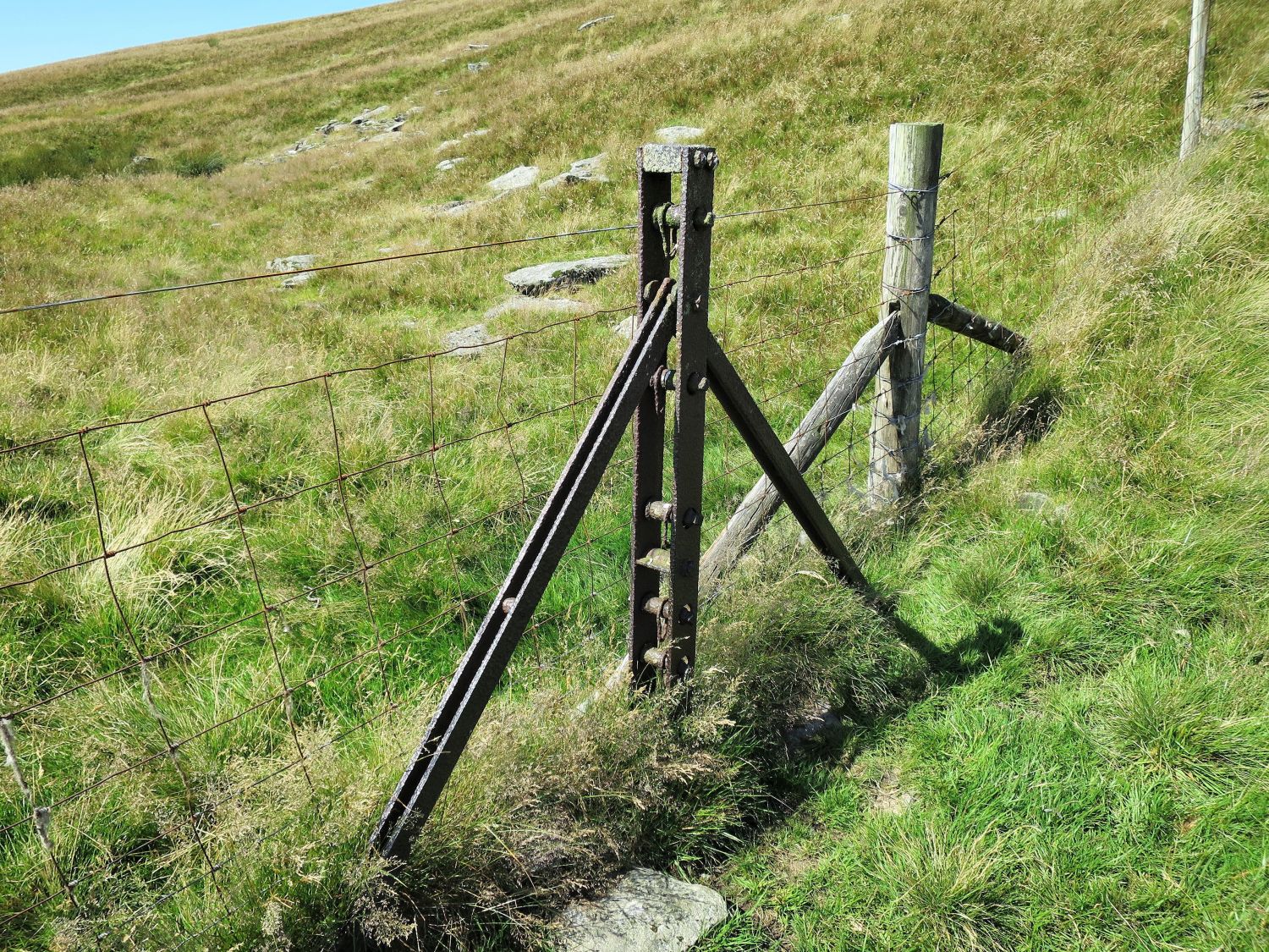 Old boundary fence tensioner post
“The route around the top of the fell follows the ruins of a wire fence….Traces of the fence are continuous between The Knowe and Adam Seat.” Harter Fell 7
AW
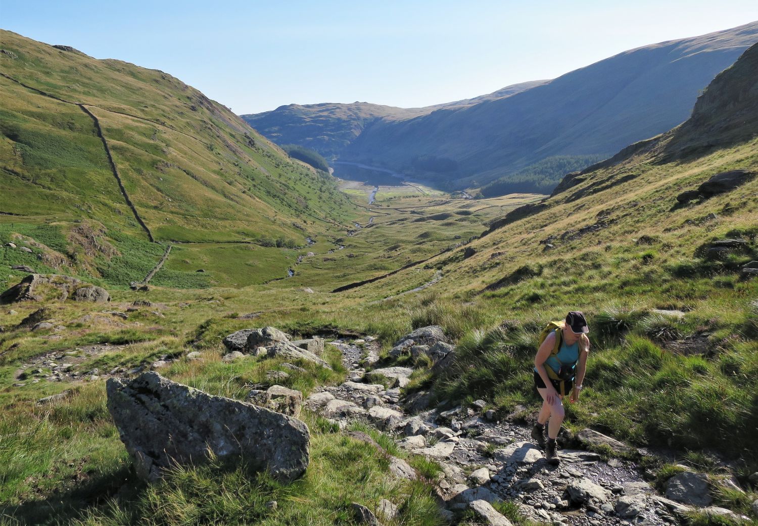
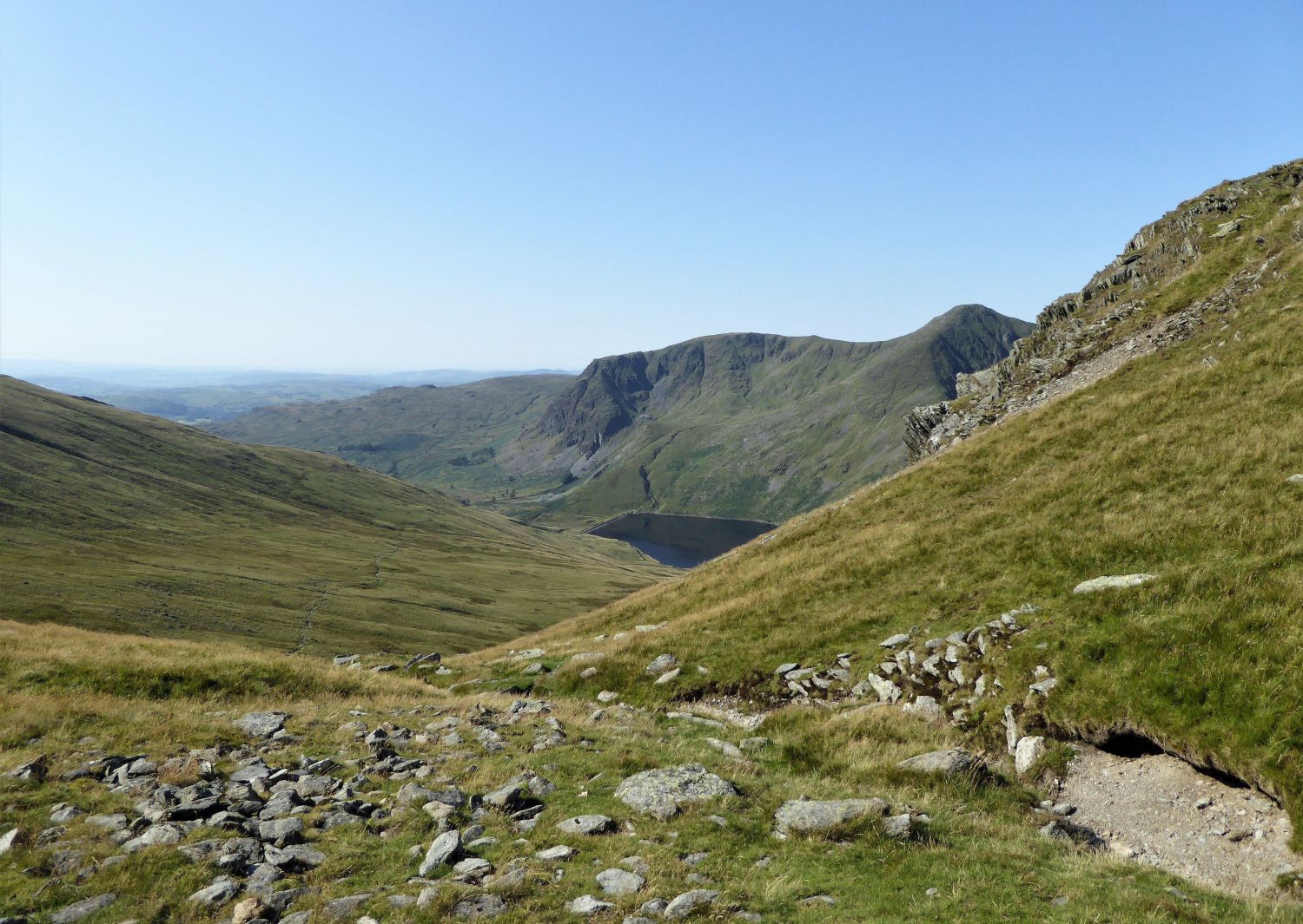
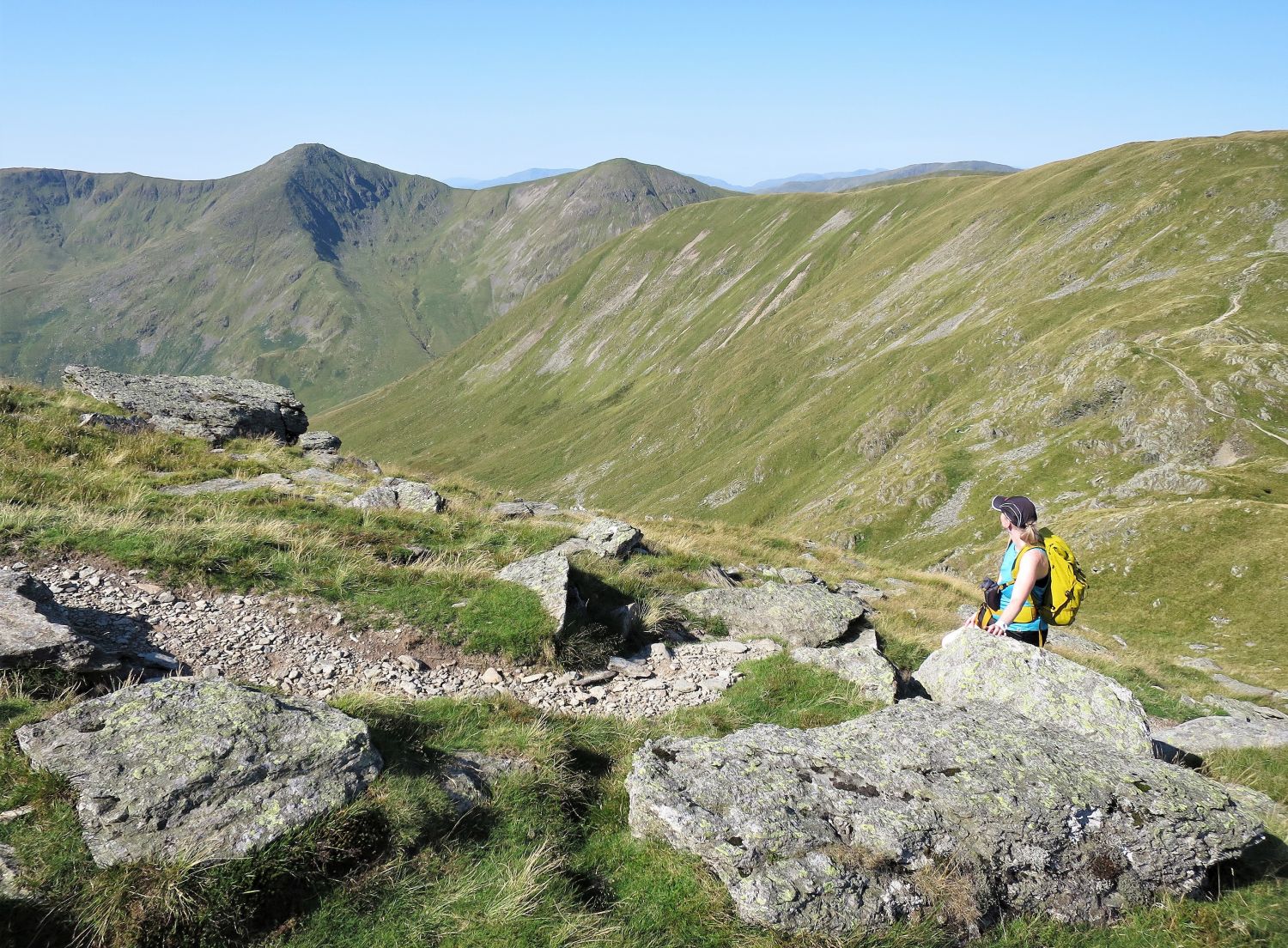
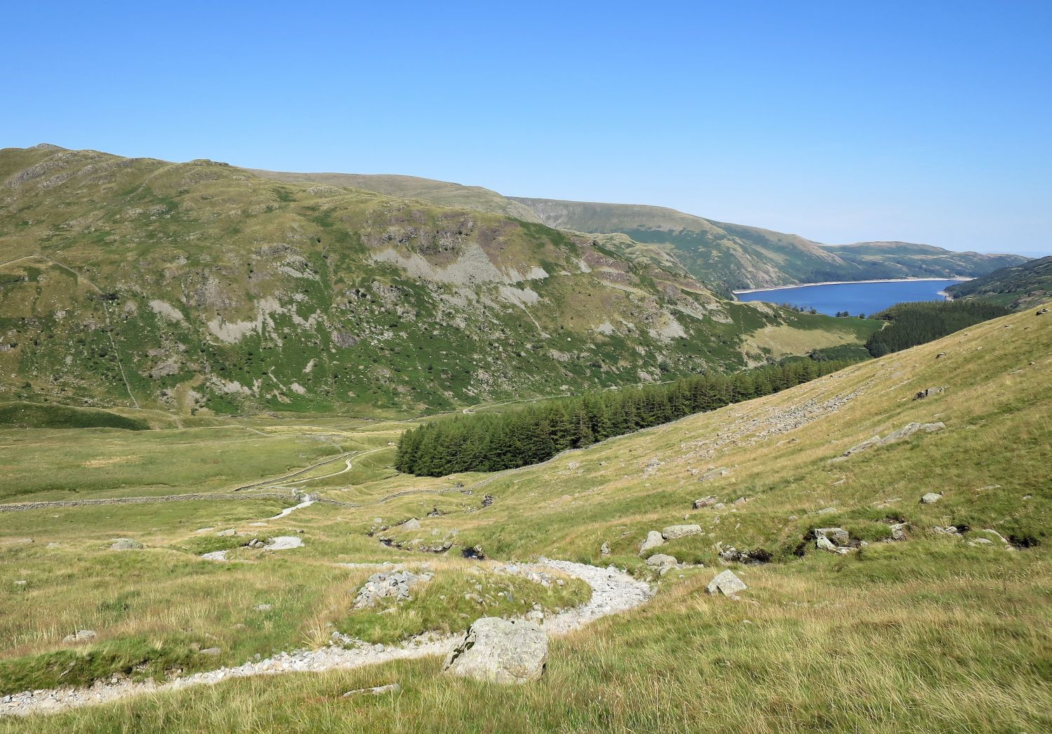
 Branstree over Gatescarth Pass, from the approach to Little Harter Fell
Our route back to Mardale is in plain sight below us, as we descend to Little Harter Fell.
 Jaclyn on the descent from Harter Fell, with Haweswater Reservoir on the right
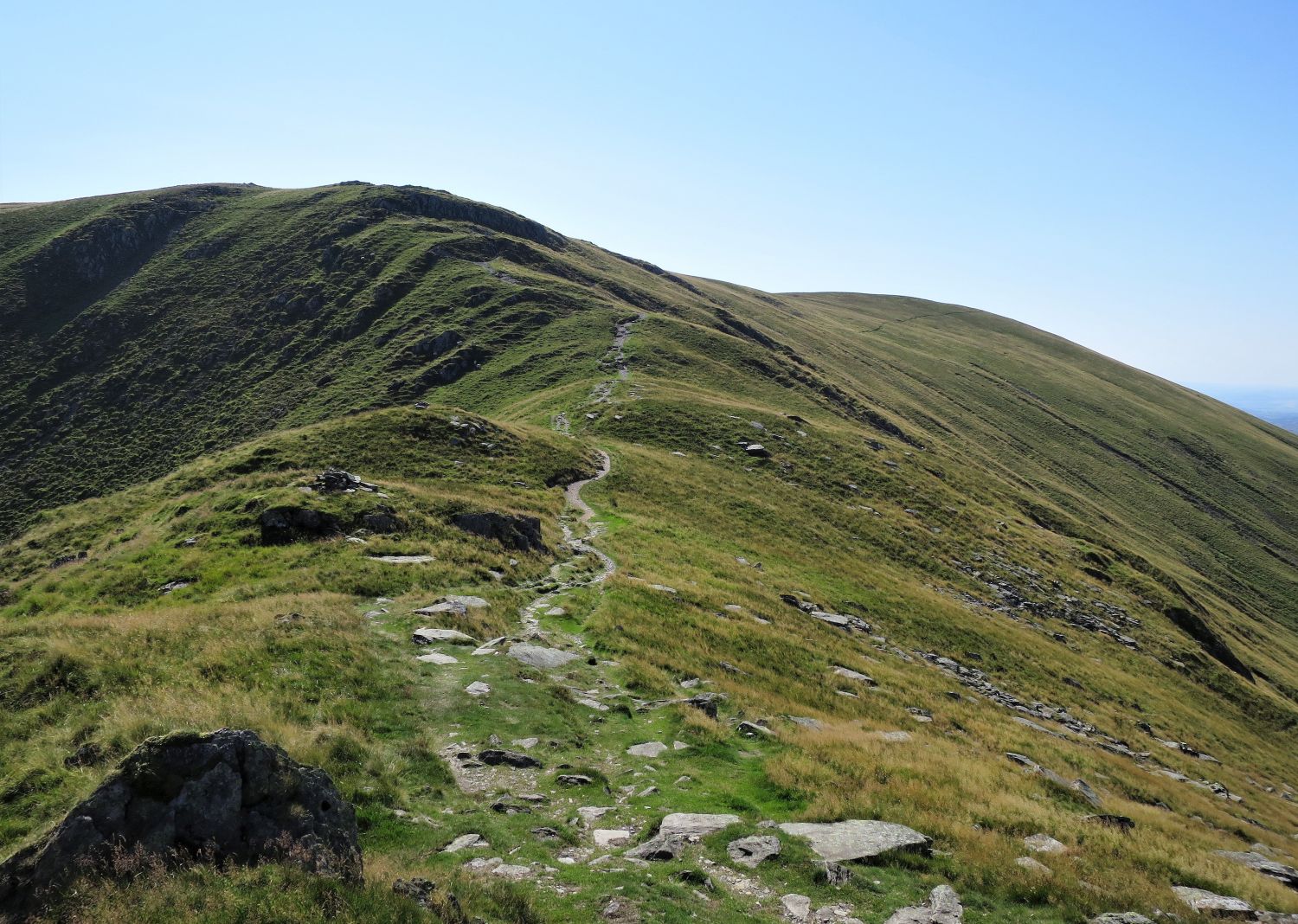
 Approaching Little Harter Fell and Adam Seat
The valley of Longsleddale can be seen over on the far right.
 Looking back to Little Harter Fell from the summit of Adam Seat
A third boundary stone can be found, still in its original position, on the summit of Adam Seat. All three stones on Harter Fell and Adam Seat are still marked as “BS” on present day OS maps; there is also a fourth stone on Branstree.
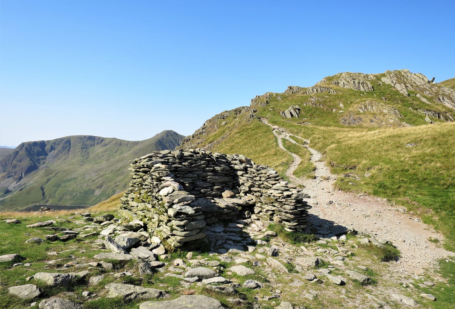
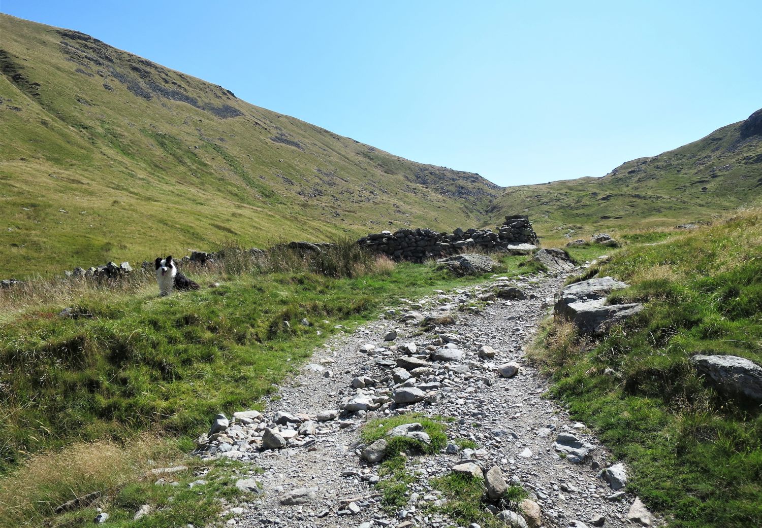
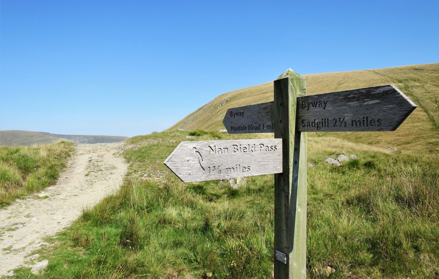 Sign post at Gate Scarth (the summit of Gatescarth Pass)
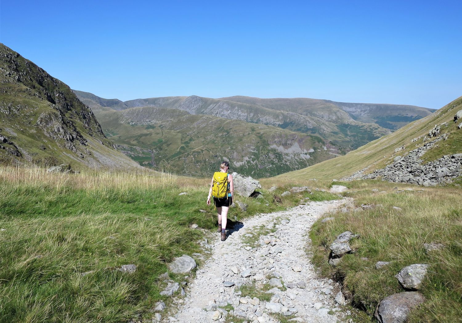 Jaclyn on the descent to Mardale from Gate Scarth
It was midday when we left the summit of Gatescarth Pass and the heat was close to being unbearable. Thankfully we hadn’t far to go to reach the car park at Mardale Head.
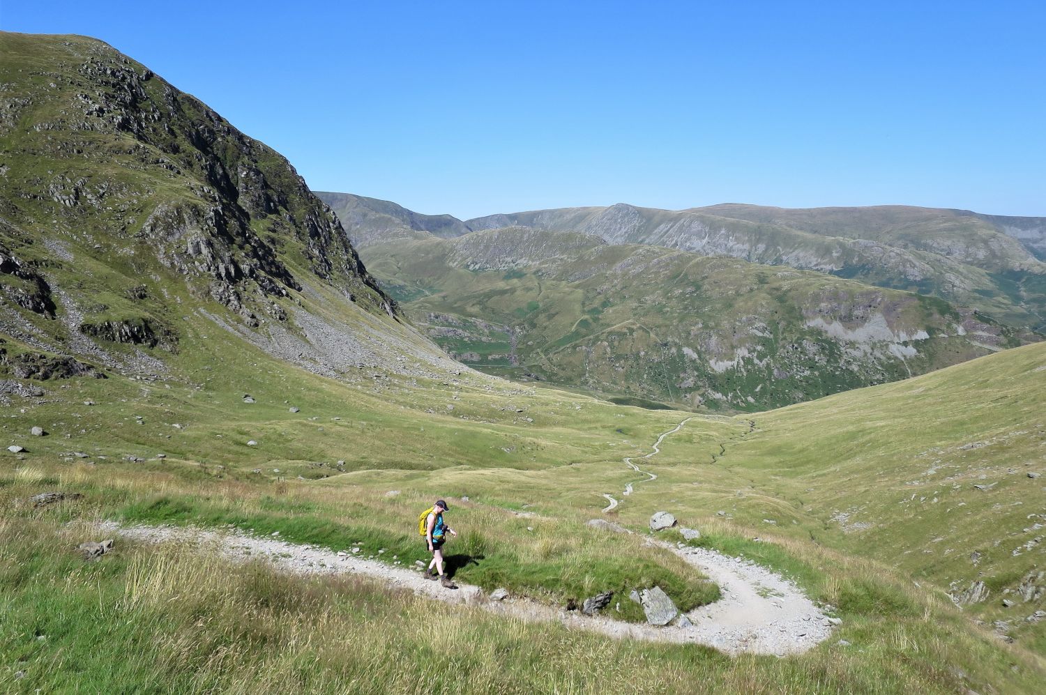 Jaclyn descending Gatescarth Pass to Mardale Head
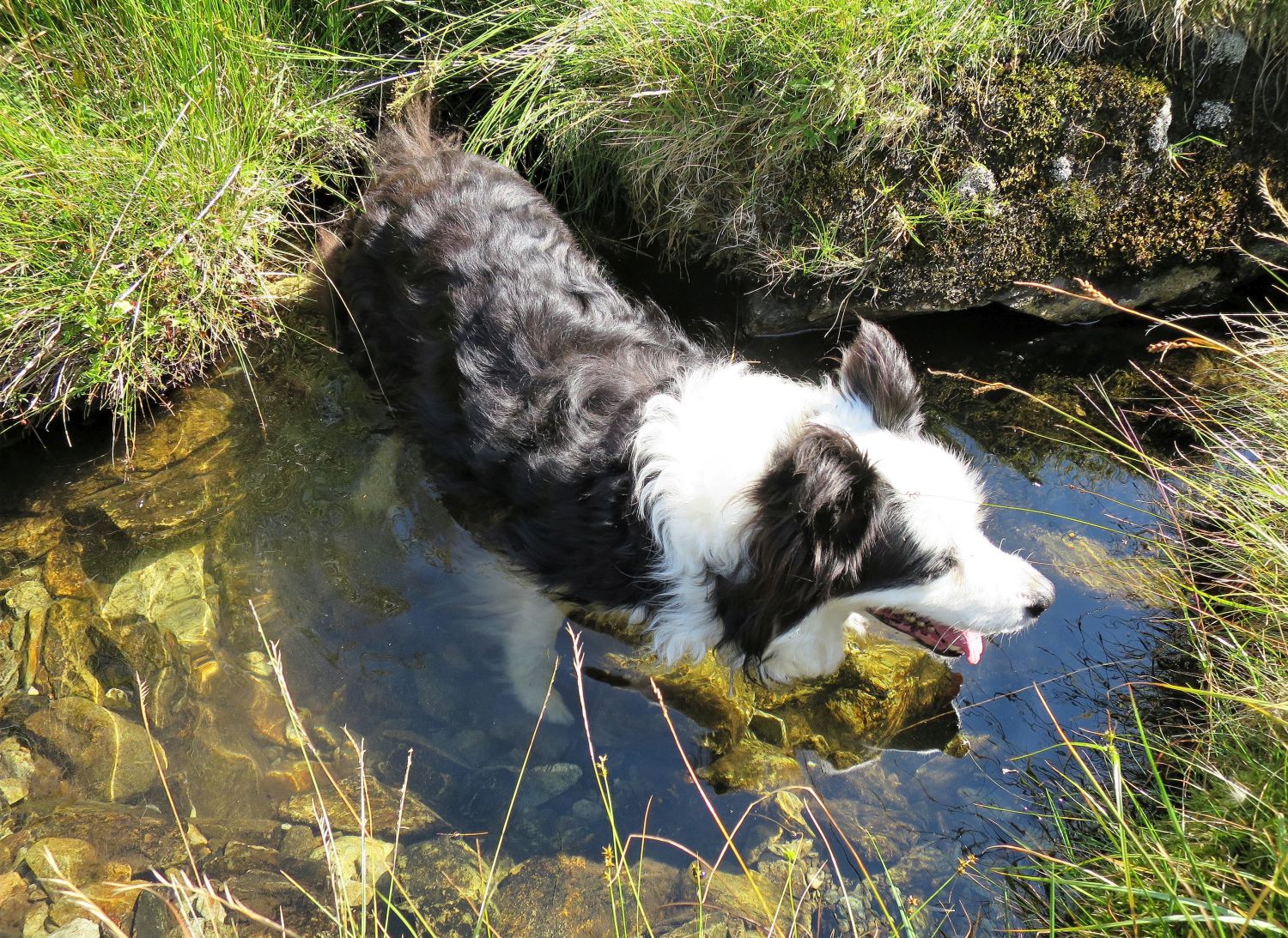 Frankie enjoying a dip in a cool Gatescarth Beck
 Harter Fell Gully seen from Gatescarth Pass
 Looking back to Gate Scarth from the sheepfold beside Gatescarth Pass
 Approaching Mardale Head
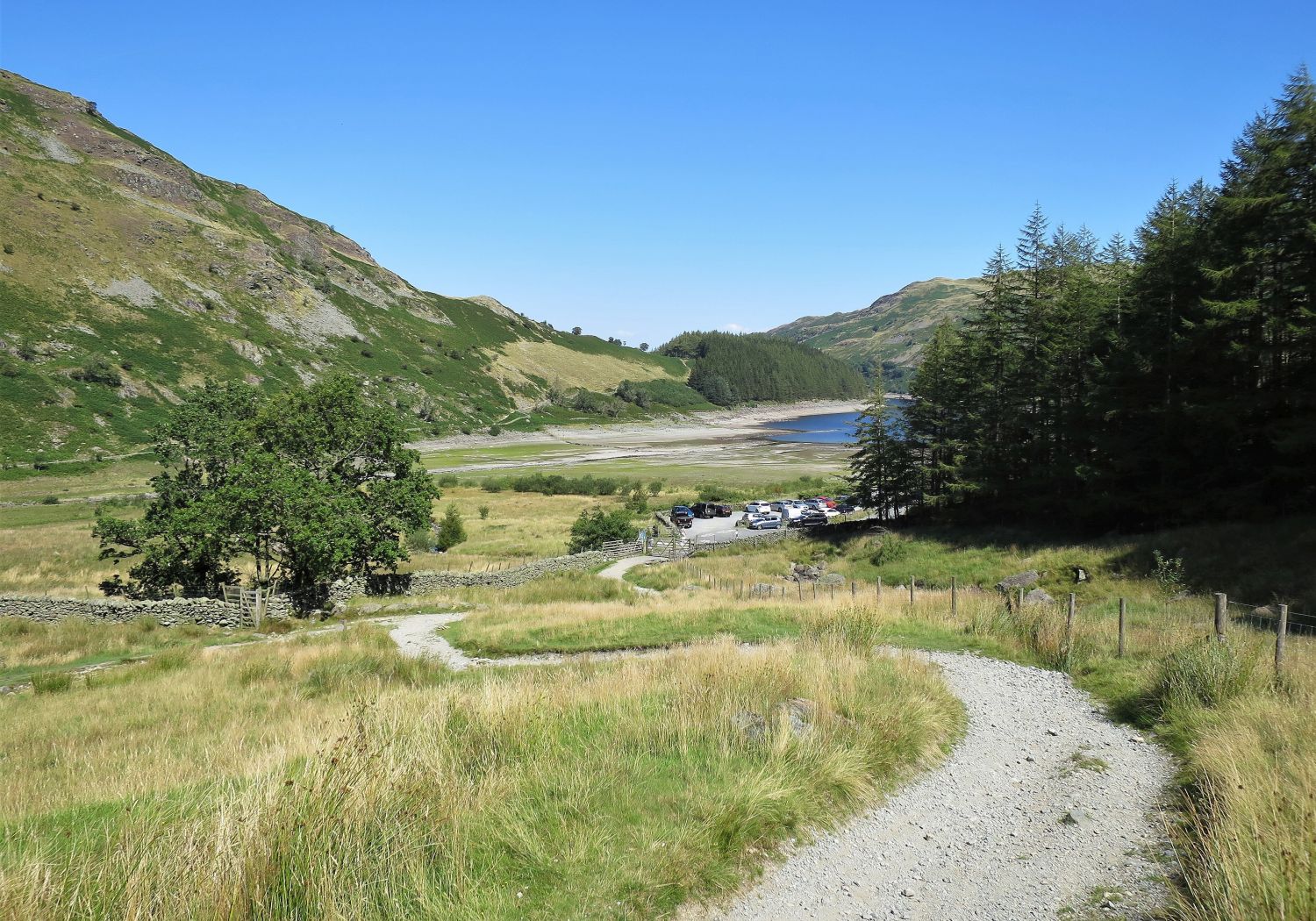 Car park at Mardale Head
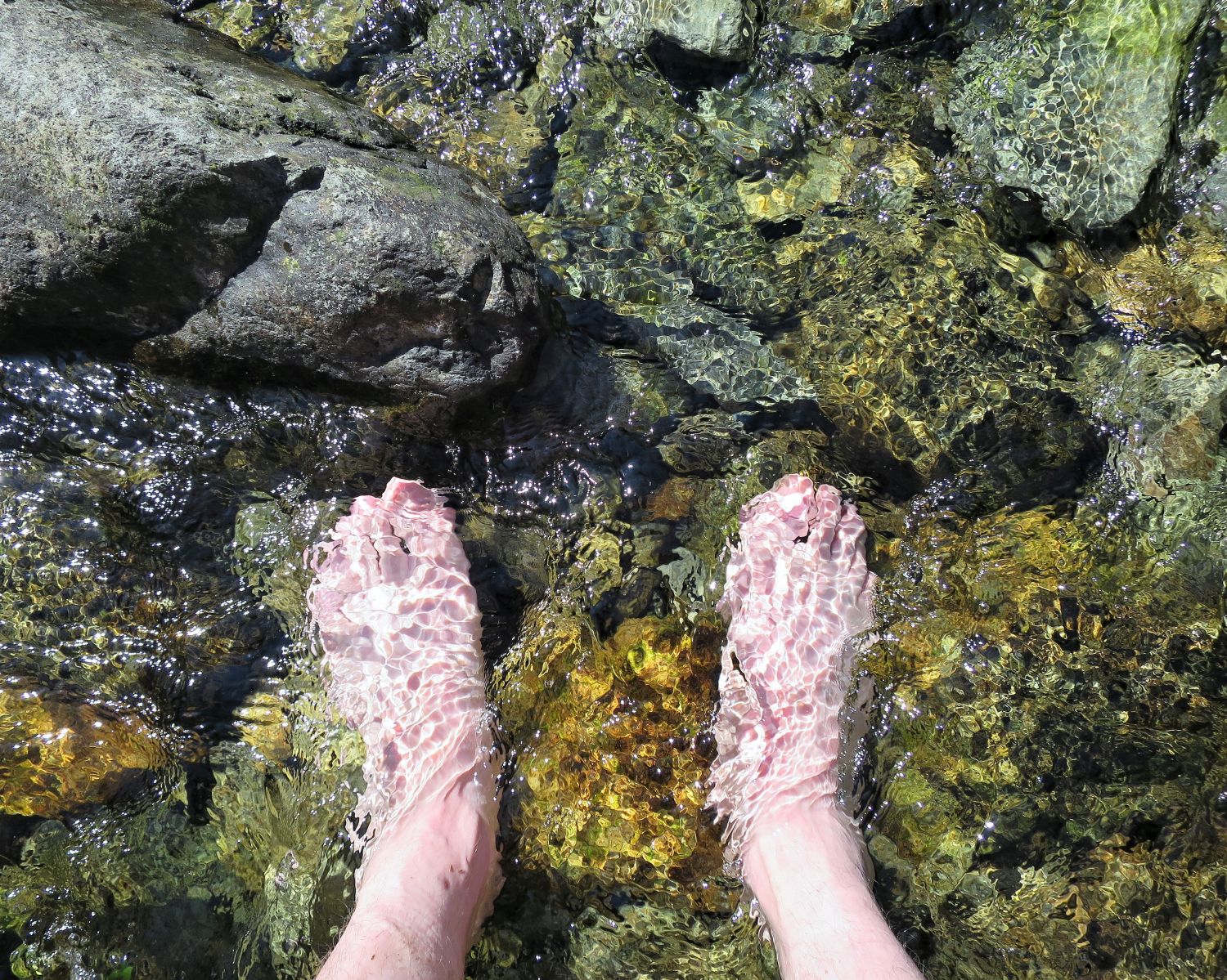 Cooling off in Gatescarth Beck
There’s no better feeling….
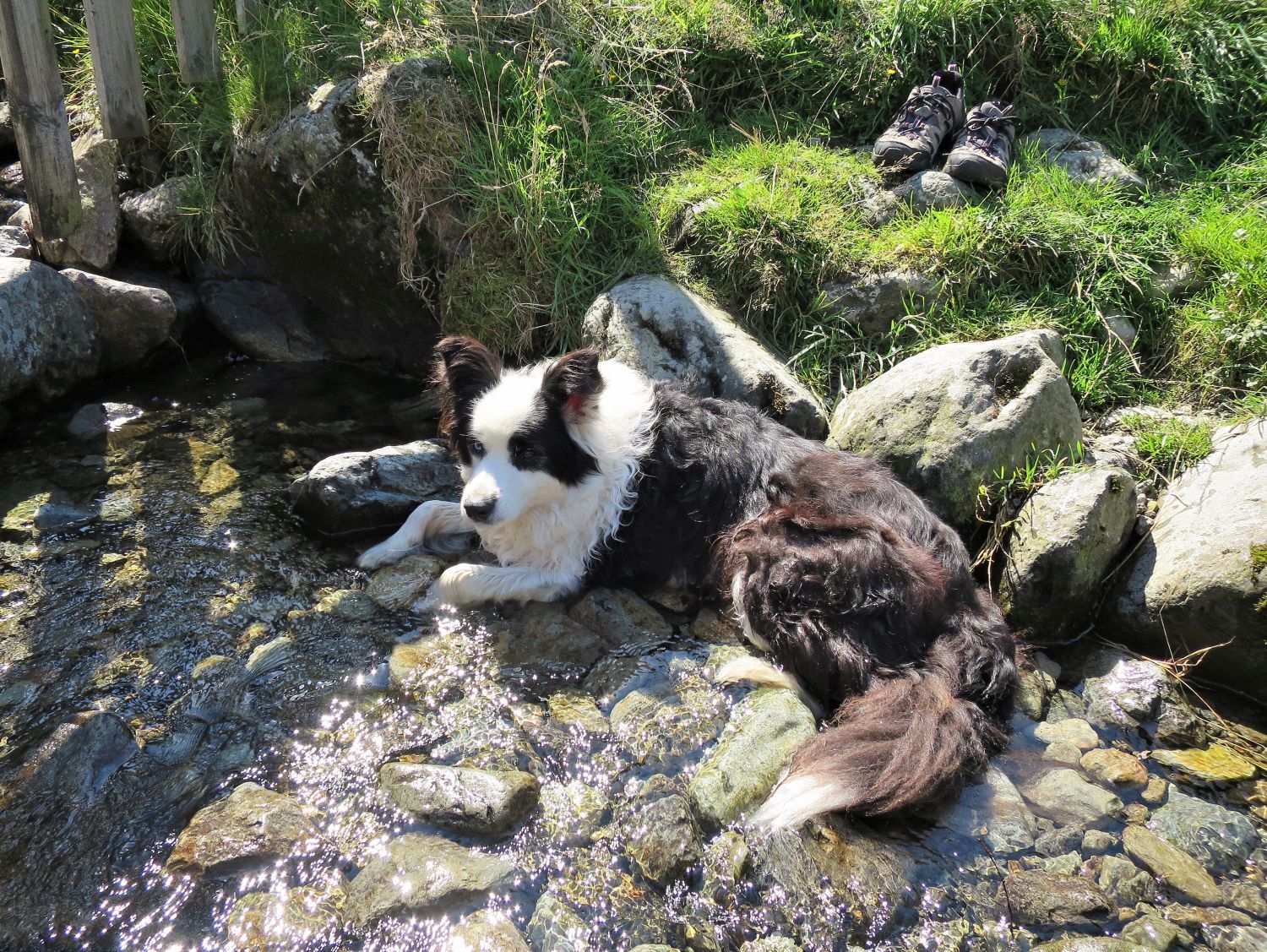 Frankie cooling off in Gatescarth Beck
….is there Frankie?
Thank you for visiting.
Richard
<<>>
Thanks, sources and further reading:
‘Book Two – The Far Eastern Fells’ by Alfred Wainwright